Walnut, California

Last updated

Walnut, California
Mt. Sac Valley Pan.jpg
View of Mt. San Antonio College and surrounding area
LA County Incorporated Areas Walnut highlighted.svg
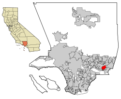
Location of Walnut in Los Angeles County, California
Usa edcp relief location map.png
Red pog.svg
Walnut, California
Location in the United States
Coordinates: 34°2′N117°52′W / 34.033°N 117.867°W / 34.033; -117.867
Country United States
State California
County Los Angeles
Incorporated (city)January 19, 1959 [1]
Named for Rancho Los Nogales
(lit.'Ranch of the Walnut Trees')
Government
  Type Council-Manager
   Mayor Allen Wu [2]
  Mayor Pro TemNancy Tragarz [2]
  Council MemberLinda Freedman [2]
  Council MemberEric Ching [2]
  Council MemberBob Pacheco [2]
Area
[3]
  Total9.00 sq mi (23.30 km2)
  Land8.99 sq mi (23.29 km2)
  Water0.00 sq mi (0.01 km2)  0.04%
Elevation
[4]
561 ft (171 m)
Population
 (2010) [5]
  Total29,172
  Estimate 
(2019) [6]
29,685
  Density3,301.27/sq mi (1,274.67/km2)
Time zone UTC-8 (PST)
  Summer (DST) UTC-7 (PDT)
ZIP Codes
91788, 91789, 91795 [7]
Area code(s) 909, 626
FIPS code 06-83332
GNIS feature IDs 1652808, 2412173
Website www.ci.walnut.ca.us

Walnut is a city in the eastern part of Los Angeles County in the U.S. state of California. [8] According to the 2010 census, the city had a population of 29,172, [9] and the population was estimated to be 29,685 in 2019. [10]

Contents

The greater Walnut Valley is located between the steep San Jose Hills to the north and the gently sloping Puente Hills to the south. Quality housing consists of master-planned single family homes ranging in size from 1,800 to 11,200 sq ft (170 to 1,040 m2). The city hosts a highly ranked public school system: the Walnut Valley Unified School District, which has been ranked by numerous sources as one of the top public school districts in Southern California, [11] as well as Mt. San Antonio College. Walnut is one of the cities with the lowest crime rates in the San Gabriel Valley. [8]

The city covers nearly 9 sq mi (23 km2) and is home to hundreds of businesses. According to the 2010 United States Census, Walnut has a median household income at one of the top-earning percentiles in the country at $101,250. [12]

The city's name is derived from the Rancho Los Nogales Mexican land grant, nogales being the Spanish word for "walnut trees"; the native California black walnut is a common tree, native to the San Jose Hills. The City of Walnut is a general law city incorporated on January 19, 1959. It is governed by a city council/city manager form of government. A five-member city council is elected by the residents, and a mayor is elected annually by the council to serve a twelve-month term. A city manager is appointed by the council to oversee the daily activities of the city.

Geography

Walnut is located on the southern slopes of the San Jose Hills, with West Covina to the northwest, Covina to the north, San Dimas to the northeast, Pomona to the east, Diamond Bar, Rowland Heights, and the City of Industry to the south, and La Puente to the west. Several small creeks (i.e. Snow Creek, Lemon Creek) run mostly to the south toward the valley of San Jose Creek, which runs west to the San Gabriel River.

Climate

Climate data for Walnut, California
MonthJanFebMarAprMayJunJulAugSepOctNovDecYear
Record high °F (°C)91
(33)
94
(34)
100
(38)
104
(40)
106
(41)
117
(47)
113
(45)
109
(43)
113
(45)
107
(42)
97
(36)
93
(34)
117
(47)
Mean daily maximum °F (°C)68
(20)
69
(21)
71
(22)
76
(24)
79
(26)
84
(29)
90
(32)
92
(33)
89
(32)
80
(27)
74
(23)
68
(20)
78
(26)
Mean daily minimum °F (°C)43
(6)
45
(7)
47
(8)
49
(9)
54
(12)
58
(14)
62
(17)
62
(17)
60
(16)
55
(13)
47
(8)
42
(6)
52
(11)
Record low °F (°C)21
(−6)
22
(−6)
27
(−3)
29
(−2)
31
(−1)
38
(3)
37
(3)
43
(6)
38
(3)
29
(−2)
25
(−4)
22
(−6)
21
(−6)
Average precipitation inches (mm)3.11
(79)
4.76
(121)
2.63
(67)
1.20
(30)
0.23
(5.8)
0.09
(2.3)
0.00
(0.00)
0.03
(0.76)
0.15
(3.8)
1.05
(27)
1.62
(41)
2.45
(62)
17.32
(440)
Source: [13]

History

Californio ranchero Ricardo Vejar owned both Rancho Los Nogales and part of Rancho San Jose, which make up modern-day Walnut. Ricardo Vejar of Rancho San Jose.jpg
Californio ranchero Ricardo Vejar owned both Rancho Los Nogales and part of Rancho San José, which make up modern-day Walnut.

The area are the traditional lands of the Tongva people. Spanish missionaries who arrived in the 18th century called the indigenes Gabrieleño, because the area where they lived was controlled by the San Gabriel Mission. The Walnut area was part of the network of outlying ranches used for the grazing of cattle and sheep by the Mission. [14]

Following secularization of the missions in the 1830s, former mission lands were divided into ranchos , and given away as land grants by the Mexican government of Alta California. In the Walnut area, the first grants were Rancho San Jose (granted to Ricardo Vejar and Ygnacio Palomares in 1837); Rancho Los Nogales (granted to Jose De La Cruz Linares in 1840); and Rancho La Puente (granted to John Rowland and William Workman in 1842). In 1868, John Rowland and William Workman divided Rancho La Puente, leaving Rowland the eastern half and Workman the western half. Rowland's land included the western portion of Walnut and the adjacent community now called Rowland Heights. The land was used mainly for raising cattle and growing wheat, grapes, and fruit trees (mostly citrus).

In 1895, the first U.S. post office was established and given the name "Lemon". In 1908, the post office name was changed to Walnut. [15] As a reminder of those early days, the U.S. Post Office is on Lemon Avenue, one of the town's main streets.

The City of Walnut's Bicentennial Commission selected the construction of Lemon Creek Park and the restoration of the William R. Rowland Adobe Redwood Ranch House as Walnut's bicentennial project. In 1872, the Lemon Creek Park area became the property of Sheriff William Rowland, who inherited the 29,000-acre (120 km2) ranch from his father, John Rowland. The modest structure built in 1883 served as the home of Mr. Meridith, ranch foreman for William Rowland. The adobe redwood ranch house is one of the few remaining original ranch style redwood and adobe structures in the area. On October 1, 1975, the State Landmark Committee placed the W.R. Rowland ranch house in the National Registry of Historical Places.

Walnut Family Festival

Walnut holds an annual Walnut Family Festival. On the day of festival, several streets in the area (such as portions of Lemon and La Puente) are closed in the morning and a parade is held in which many local clubs and groups participate. Later in the afternoon, a fair with booths, games, food, and activities is held in Suzanne Park, adjacent to Suzanne Middle School. The Walnut Family Festival usually occurs in early or mid-October.

Mt. SAC Relays

Olympic Flame and wall of honor at Hilmer Lodge Stadium Mt. SAC flame.JPG
Olympic Flame and wall of honor at Hilmer Lodge Stadium

Started in 1959, the Mt. SAC Relays are an annual track and field festival held primarily at Hilmer Lodge Stadium on the Mt. San Antonio College campus. The April festival attracts many elite athletes from around the world to the city of Walnut. This meet and other elite track meets held at the stadium, including the 1968 Olympic Trials and two editions of the USA Outdoor Track and Field Championships have emblazoned the identification of "Walnut, California" in numerous national records in athletics around the world. At various points in time, many world records were set at the Mt. SAC Relays.

The October Mt. SAC Cross Country Invitational, run in the hills surrounding the stadium, proclaims itself to be the largest Cross Country meeting in the world. Much of the same course is used as the annual CIF Southern Section championships and the western qualifier for the Foot Locker Cross Country Championships.

Economy

Shea Homes, and the United States divisions of the Filipino home video company Viva Video, Inc. and the Japanese card game company Bushiroad are based in Walnut.

According to the 2010 United States Census, Walnut had a median household income of $101,250, with 6.2% of the population living below the federal poverty line. [12]

According to the city's 2017 Comprehensive Annual Financial Report, the principal employers in the city are: [16]

Principal Employers in Walnut, CA
RankEmployer# of employees% of total employment
1 Mount San Antonio College 3,77549%
2Ninas Mexican Food, Inc.1402%
3Ronsin Photocopy Inc.1242%
4Recruiter Exchange Inc1081%
5Edro Engineering Company, Inc.841%
6 Stater Brothers Market 811%
7Sodexo, Inc.761%
8 Vons #2167731%
9 Applebee's Neighborhood Grill 671%
10 TJ Maxx #682661%

Infrastructure

The Los Angeles County Sheriff's Department (LASD) operates the Walnut/Diamond Bar Station in Walnut. [17]

The Los Angeles County Department of Health Services operates the Pomona Health Center in Pomona, serving Walnut. [18]

Government

State and federal

In the California State Legislature, Walnut is in the 30th Senate District , represented by Democrat Bob Archuleta, and in the 56th Assembly District , represented by Democrat Lisa Calderon. [19]

In the United States House of Representatives, Walnut is in California's 38th congressional district , represented by Democrat Linda Sánchez. [20]

While the Congressional, State Senate, and State Assembly districts that Walnut is located in may have tendencies to vote for Republican candidates, since the 2000 election Walnut has voted only for Democratic presidential, gubernatorial, and senatorial candidates, with the exceptions of 2003 and 2006 when they voted for Arnold Schwarzenegger. [21] Walnut voters break down by party affiliation 63.102% Democratic and 35.598% Republican. [22]

Election results from statewide races
YearOfficeResults
2022 Governor Newsom 55.5–44.5% [23]
Senator Padilla 56.7–43.3% [23]
2021 Recall No 62.0–38.0% [24]
2020 President Biden 61.5–37.0% [25]
2018 Governor Newsom 58.3–41.7% [26]
Senator Feinstein 60.0–40.0% [26]
2016 President Clinton 62.0–33.1% [27]
Senator Harris 60.8–39.2% [28]
2014 Governor Brown 57.3–42.7% [29]
2012 President Obama 57.8–40.1% [30]
Senator Feinstein 61.9–38.1% [31]
2010 Governor Brown 48.8–46.5% [32]
Senator Boxer 48.4–46.8% [33]
2008 President Obama 56.2–42.0% [34]
2006 Governor Schwarzenegger 60.3–36.1% [35]
Senator Feinstein 58.6–37.5% [ citation needed ]
2004 President Kerry 51.1–48.0% [36]
Senator Boxer 57.6–38.2% [37]
2003 Recall Yes 64.0–36.0% [38]
Schwarzenegger 60.1–24.2% [39]
2002 Governor Davis 47.5–45.9% [40]
2000 President Gore 53.4–43.6% [41]
Senator Feinstein 55.1–38.1% [42]
1998 Governor Davis 47.5–45.9% [43]
Senator Fong 51.2–45.7% [44]
1996 President Clinton 50.0–40.1% [45]
1994 Governor Wilson 57.6–38.9% [46]
Senator Huffington 50.4–40.8% [46]

Education

Primary education in Walnut is generally served by the prestigious Walnut Valley Unified School District (WVUSD), which has been ranked by numerous sources to be one of the top public school districts in all of Southern California; [11] it also serves parts of the city of Diamond Bar. Schools located in and around Walnut include:

Portions of the western side of Walnut are also served by the Rowland Unified School District.

In addition, Mt. San Antonio College, one of the California Community Colleges, is also located in Walnut near its border with Pomona.

Surrounding suburban cities

Demographics

Historical population
CensusPop.Note
1960 934
1970 5,992541.5%
1980 12,478108.2%
1990 29,105133.3%
2000 30,0043.1%
2010 29,172−2.8%
2019 (est.)29,685 [6] 1.8%
U.S. Decennial Census [49]

2010 census

According to the 2010 United States Census, Walnut had a median household income of $101,250, with 6.2% of the population living below the federal poverty line. [12]

The 2010 United States Census [50] reported that Walnut had a population of 29,172. The population density was 3,242.8 inhabitants per square mile (1,252.1/km2). The racial makeup of Walnut was 18,567 (63.6%) Asian, 6,913 (23.7%) White (12.5% Non-Hispanic White), [12] 824 (2.8%) African American, 69 (0.2%) Native American, 28 (0.1%) Pacific Islander, 1,750 (6.0%) from other races, and 1,021 (3.5%) from two or more races. Hispanic or Latino of any race were 5,575 persons (19.1%).

The Census reported that 29,138 people (99.9% of the population) lived in households, 22 (0.1%) lived in non-institutionalized group quarters, and 12 (0%) were institutionalized.

There were 8,533 households, out of which 3,492 (40.9%) had children under the age of 18 living in them, 6,298 (73.8%) were opposite-sex married couples living together, 985 (11.5%) had a female householder with no husband present, 394 (4.6%) had a male householder with no wife present. There were 163 (1.9%) unmarried opposite-sex partnerships, and 26 (0.3%) same-sex married couples or partnerships. 627 households (7.3%) were made up of individuals, and 237 (2.8%) had someone living alone who was 65 years of age or older. The average household size was 3.41. There were 7,677 families (90.0% of all households); the average family size was 3.55.

The population was spread out, with 6,088 people (20.9%) under the age of 18, 3,092 people (10.6%) aged 18 to 24, 6,089 people (20.9%) aged 25 to 44, 10,339 people (35.4%) aged 45 to 64, and 3,564 people (12.2%) who were 65 years of age or older. The median age was 43.1 years. For every 100 females, there were 96.2 males. For every 100 females age 18 and over, there were 93.6 males.

There were 8,753 housing units at an average density of 973.0 per square mile (375.7/km2), of which 7,536 (88.3%) were owner-occupied, and 997 (11.7%) were occupied by renters. The homeowner vacancy rate was 0.8%; the rental vacancy rate was 4.4%. 25,504 people (87.4% of the population) lived in owner-occupied housing units and 3,634 people (12.5%) lived in rental housing units.

2000 census

As of the census [51] of 2000, there were 8,260 households, out of which 50.6% had children under the age of 18 living with them, 77.1% were married couples living together, 9.9% had a female householder with no husband present, and 8.2% were non-families. 5.8% of all households were made up of individuals, and 1.3% had someone living alone who was 65 years of age or older. The average household size was 3.63 and the average family size was 3.74.

In the city, the population was spread out, with 27.8% under the age of 18, 9.8% from 18 to 24, 27.2% from 25 to 44, 28.4% from 45 to 64, and 6.9% who were 65 years of age or older. The median age was 37 years. For every 100 females, there were 96.7 males. For every 100 females age 18 and over, there were 93.5 males.

[52] Males had a median income of $51,944 versus $36,197 for females. The per capita income for the city was $31,196. About 5.8% of families and 6.5% of the population were below the poverty line, including 7.8% of those under age 18 and 6.3% of those age 65 or over.

The city was recognized in 1999 by CNN as a model of diversity. [53]

As of the census [51] of 2000, there were 30,004 people, 8,260 households, and 7,582 families residing in the city. The population density was 3,340.5 inhabitants per square mile (1,289.8/km2). There were 8,395 housing units at an average density of 934.6 per square mile (360.9/km2). The racial makeup of the city was 55.75% Asian, 28.37% White, 4.20% African American, 0.24% Native American, 0.08% Pacific Islander, 7.65% from other races, and 3.71% from two or more races. Hispanic or Latino of any race were 19.34% of the population.

Chinese (21.0%) and Mexican (14.6%) were the most common ancestries in the 2000 census. Taiwan (20.7%) and Philippines (17.3%) were the most common foreign places of birth in 2000. [54]

Notable people

Proposed NFL stadium

In April 2008, billionaire land developer and co-owner of the Los Angeles Lakers and Kings Edward P. Roski unveiled plans for the construction of an $800 million NFL stadium in the neighboring City of Industry. [57] In March 2009, Walnut filed a lawsuit opposing construction of the stadium, but dropped those charges in September. [58] [59]

On October 23, 2009, California governor Arnold Schwarzenegger signed a bill allowing the 75,000-seat stadium to be built in neighboring Industry in hopes of attracting an NFL team there. [60] This bill would also nullify a lawsuit filed by local residents over the project's environmental impact report.

Related Research Articles

<span class="mw-page-title-main">San Ramon, California</span> City in California, United States

San Ramon is a city in Contra Costa County, California, United States, located within the San Ramon Valley, and 34 miles (55 km) east of San Francisco. San Ramon's population was 84,605 per the 2020 census, making it the 4th largest city in Contra Costa County, behind Richmond, Concord and Antioch.

<span class="mw-page-title-main">Calexico, California</span> City in California, United States

Calexico is a city in southern Imperial County, California. Situated on the Mexican border, it is linked economically with the much larger city of Mexicali, the capital of the Mexican state of Baja California. It is about 122 miles (196 km) east of San Diego and 62 miles (100 km) west of Yuma, Arizona. Calexico, along with six other incorporated Imperial County cities, forms part of the larger populated area known as the Imperial Valley.

<span class="mw-page-title-main">Bradbury, California</span> City in California, United States

Bradbury is a city in the San Gabriel Valley region of Los Angeles County, California, United States. It is located in the foothills of the San Gabriel Mountains below Angeles National Forest. Bradbury is bordered by the city of Monrovia to the west and south, and Duarte to the south and east. The population was 1,048 at the 2010 census, up from 855 at the 2000 census. The city has three distinct areas—the Bradbury Estates, which is a gated community consisting of 5-acre (20,000 m2) minimum estates; Woodlyn Lane, which is also a gated community with minimum 2-acre (8,100 m2) lots; and the balance of the city, which is not gated, which has lots generally ranging in size from 7,500 square feet (700 m2) to 1-acre (4,000 m2). A significant portion of the properties in Bradbury Estates and Woodlyn Lane are zoned for horses, and several horse ranches still exist within these communities today.

<span class="mw-page-title-main">Diamond Bar, California</span> City in California, United States

Diamond Bar is a city in eastern Los Angeles County, California, United States. At the 2010 census it had a population of 55,544, and in 2019 the population was estimated to be 55,720. It is named after the "diamond over a bar" branding iron registered in 1918 by ranch owner Frederic E. Lewis (1884–1963). The city features a public Los Angeles County golf course.

<span class="mw-page-title-main">Lomita, California</span> City in California, United States

Lomita is a city in Los Angeles County, California, United States. The population was 20,921 at the 2020 census, up slightly from 20,256 at the 2010 census.

<span class="mw-page-title-main">Rowland Heights, California</span> Unincorporated community in the United States

Rowland Heights is an unincorporated area in and below the Puente Hills in the San Gabriel Valley, in Los Angeles County, California, United States. The population was 48,231 at the 2020 census. Rowland Heights is in the Los Angeles metropolitan area and represented by the County of Los Angeles and is the largest census designated place in Los Angeles County by area and the county's fourth largest CDP by population. The area has a high Taiwanese population and was known as “Little Taipei” in the 1980s and 1990s, when it saw an influx of wealthy immigrants from Taiwan.

<span class="mw-page-title-main">Villa Park, California</span> City in California, United States

Villa Park is a city in northern Orange County, California, United States. It was founded in 1962. At the 2010 census, the city had a population of 5,812, making it the smallest city in Orange County.

<span class="mw-page-title-main">Banning, California</span> American city in California, United States

Banning is a city in Riverside County, California, United States. Its population was 29,505 as of the 2020 census, down from 29,603 at the 2010 census. It is situated in the San Gorgonio Pass, also known as Banning Pass. It is named for Phineas Banning, stagecoach line owner and the "Father of the Port of Los Angeles."

<span class="mw-page-title-main">Beaumont, California</span> City in California, United States

Beaumont is a city in Riverside County, California, United States, located at the summit of the San Gorgonio Pass, between the San Bernardino Mountains and Mount San Gorgonio to the north, and the San Jacinto Mountains and San Jacinto Peak to the south.

<span class="mw-page-title-main">Canyon Lake, California</span> American city in California, United States

Canyon Lake is a city and gated community in Riverside County, California, United States, located on Canyon Lake reservoir. Canyon Lake began as a master-planned community developed by the Corona Land Company in 1968. The City of Canyon Lake was incorporated on December 1, 1990. Railroad Canyon Dam was built in 1927, and impounds the San Jacinto River to fill the reservoir, which covers 383 acres (1.55 km2) and has 14.9 miles (24.0 km) of shoreline.

<span class="mw-page-title-main">Indian Wells, California</span> City in California, United States

Indian Wells is a city in Riverside County, California, United States, in the Coachella Valley. Incorporated in 1967, it lies in between the cities of Palm Desert and La Quinta. As of the 2020 census, the city population was 4,757.

<span class="mw-page-title-main">Moreno Valley, California</span> City in Riverside County, California, United States

Moreno Valley is a city in Riverside County, California, United States, and is part of the Riverside–San Bernardino–Ontario metropolitan area. It is the second-largest city in Riverside County by population and one of the Inland Empire's population centers. The city's population was 208,634 at the 2020 census. Moreno Valley is also part of the larger greater Los Angeles area.

<span class="mw-page-title-main">Murrieta, California</span> City in the United States

Murrieta is a city in southwestern Riverside County, California, United States. The population of Murrieta was 110,949 as of the 2020 census. Murrieta experienced a 133.7% population increase between 2000 and 2010, making Murrieta one of the fastest-growing cities in the state during that period. Largely residential in character, Murrieta is typically characterized as a bedroom community. Murrieta is bordered by the city of Temecula to the south, the cities of Menifee and Wildomar to the north, and the unincorporated community of French Valley to the east. Murrieta is located in the center of the Los Angeles-San Diego mega-region. Murrieta is named for Juan Murrieta, a Californio ranchero who founded the town.

<span class="mw-page-title-main">Norco, California</span> City in California, United States

Norco is a city in Riverside County, California, United States. Located roughly 40 miles (64 km) inland from the Pacific Ocean, Norco is known as “Horsetown, USA” and prides itself on being a "horse community”. The area is dotted with corrals, farms, hitching posts, ranches, riding trails, and tack-and-feed supply stores; there are also city ordinances in-place requiring new construction to have a "traditional, rustic... Western flavor".

<span class="mw-page-title-main">Wildomar, California</span> City in California, United States

Wildomar is a city in southwest Riverside County, California, United States. The city was incorporated on July 1, 2008. As of the 2020 census, the population was 36,875. The community has grown quickly during the early 21st century; the population has more than doubled since the 2000 census, when the community was still an unincorporated census-designated place.

<span class="mw-page-title-main">Chino, California</span> City in California, United States

Chino is a city in the western end of San Bernardino County, California, United States, with Los Angeles County to its west and Orange County to its south in the Southern California region.

<span class="mw-page-title-main">Rancho Cucamonga, California</span> City in California, United States

Rancho Cucamonga is a city located just south of the foothills of the San Gabriel Mountains and Angeles National Forest in San Bernardino County, California, United States. About 37 mi (60 km) east of Downtown Los Angeles, Rancho Cucamonga is the 28th most populous city in California. The city's seal, which centers on a cluster of grapes, alludes to the city's agricultural history including wine-making. The city's proximity to major transportation hubs, airports, and highways has attracted the business of several large corporations, including Coca-Cola, Frito-Lay, Big Lots, Mercury Insurance Group, Southern California Edison, and Amphastar Pharmaceuticals.

<span class="mw-page-title-main">Manteca, California</span> City in California, United States

Manteca is a city in San Joaquin County, California. The city had a population of 83,498 as of the 2020 Census. It is part of the Stockton-Lodi, CA Metropolitan Statistical Area.

<span class="mw-page-title-main">Turlock, California</span> City in California, United States

Turlock is a city in Stanislaus County, California, United States. Its population was 72,740 at the 2020 United States Census, making it the second-largest city in Stanislaus County after Modesto.

<span class="mw-page-title-main">California's 38th congressional district</span> U.S. House district for California

California's 38th congressional district is a congressional district in the U.S. state of California based in suburban eastern Los Angeles County and Orange County, California. The district is currently represented by Democrat Linda Sánchez.

References

  1. "California Cities by Incorporation Date". California Association of Local Agency Formation Commissions. Archived from the original (Word) on November 3, 2014. Retrieved August 25, 2014.
  2. 1 2 3 4 5 "Walnut City Council". City of Walnut. Retrieved June 27, 2023.
  3. "2019 U.S. Gazetteer Files". United States Census Bureau. Retrieved July 1, 2020.
  4. "Walnut". Geographic Names Information System . United States Geological Survey, United States Department of the Interior . Retrieved February 23, 2015.
  5. "Walnut (city) QuickFacts". United States Census Bureau . Retrieved March 18, 2015.
  6. 1 2 "Population and Housing Unit Estimates". United States Census Bureau. May 24, 2020. Retrieved May 27, 2020.
  7. "USPS – ZIP Code Lookup – Find a ZIP+ 4 Code By City Results" . Retrieved January 18, 2007.
  8. 1 2 "About the City of Walnut". Archived from the original on June 5, 2016. Retrieved March 10, 2015.
  9. "Geographic Identifiers: 2010 Census Summary File 1 (G001), Walnut city, California". American FactFinder. U.S. Census Bureau. Archived from the original on February 13, 2020. Retrieved September 4, 2019.
  10. "Population and Housing Unit Estimates" . Retrieved May 21, 2020.
  11. 1 2 "Best School Districts for Your Buck in Southern California". June 29, 2015.
  12. 1 2 3 4 "Census data". quickfacts.census.gov.
  13. "Walnut, CA Monthly Weather". The Weather Channel . Retrieved November 25, 2020.
  14. Walnut. 2012. ISBN   9780738595474.
  15. Gudde, Erwin G. (1969). California Place Names . Berkeley: UC Press. p.  176. ISBN   978-0520015746.
  16. "City of Walnut Comprehensive Annual Financial Report for the Fiscal Year Ended June 30, 2017". Cityofwalnut. Retrieved November 13, 2018.
  17. "Walnut/Diamond Bar Station Archived January 6, 2010, at the Wayback Machine ." Los Angeles County Sheriff's Department. Retrieved on January 21, 2010.
  18. "Pomona Health Center." Los Angeles County Department of Health Services. Retrieved on March 27, 2010.
  19. "California Districts". UC Regents. Retrieved January 5, 2023.
  20. "California's 38th Congressional District - Representatives & District Map". Civic Impulse, LLC.
  21. Data compiled and calculated based on election results from "Political Districts within Counties" results for Walnut Archived August 24, 2008, at the Wayback Machine , All percentages are rounded to nearest tenth place
  22. "Walnut, California". BestPlaces.[ dead link ]
  23. 1 2 "Election data" (PDF). elections.cdn.sos.ca.gov. 2022.
  24. "Election data" (PDF). elections.cdn.sos.ca.gov. 2021.
  25. "Election data" (PDF). elections.cdn.sos.ca.gov. 2020.
  26. 1 2 "Election data" (PDF). elections.cdn.sos.ca.gov. 2018.
  27. "Election data" (XLS). elections.cdn.sos.ca.gov. 2016.
  28. "Election data" (XLS). elections.cdn.sos.ca.gov. 2016.
  29. "Election data" (XLS). elections.cdn.sos.ca.gov. 2014.
  30. "Election data" (XLS). elections.cdn.sos.ca.gov. 2012.
  31. "Election data" (XLS). elections.cdn.sos.ca.gov. 2012.
  32. "Election data" (XLS). elections.cdn.sos.ca.gov. 2010.
  33. "Election data" (XLS). elections.cdn.sos.ca.gov. 2010.
  34. "Archived copy" (PDF). Archived from the original (PDF) on June 12, 2009. Retrieved September 9, 2009.{{cite web}}: CS1 maint: archived copy as title (link)
  35. "Archived copy" (PDF). Archived from the original (PDF) on October 11, 2009. Retrieved September 9, 2009.{{cite web}}: CS1 maint: archived copy as title (link)
  36. "Election results" (PDF). Archived from the original (PDF) on June 11, 2007. Retrieved September 9, 2009.
  37. "Election results" (PDF). Archived from the original (PDF) on June 11, 2007. Retrieved September 9, 2009.
  38. "Archived copy" (PDF). Archived from the original (PDF) on October 11, 2009. Retrieved September 9, 2009.{{cite web}}: CS1 maint: archived copy as title (link)
  39. "gov ssov alpha for all a-z.xls" (PDF). Archived from the original (PDF) on October 11, 2009. Retrieved September 9, 2009.
  40. "Archived copy" (PDF). Archived from the original (PDF) on October 11, 2009. Retrieved September 9, 2009.{{cite web}}: CS1 maint: archived copy as title (link)
  41. "Archived copy" (PDF). Archived from the original (PDF) on October 11, 2009. Retrieved September 9, 2009.{{cite web}}: CS1 maint: archived copy as title (link)
  42. "Archived copy" (PDF). Archived from the original (PDF) on October 11, 2009. Retrieved September 9, 2009.{{cite web}}: CS1 maint: archived copy as title (link)
  43. "Archived copy" (PDF). Archived from the original (PDF) on August 28, 2009. Retrieved September 9, 2009.{{cite web}}: CS1 maint: archived copy as title (link)
  44. "Archived copy" (PDF). Archived from the original (PDF) on August 28, 2009. Retrieved September 9, 2009.{{cite web}}: CS1 maint: archived copy as title (link)
  45. "Archived copy" (PDF). Archived from the original (PDF) on May 20, 2011. Retrieved September 9, 2009.{{cite web}}: CS1 maint: archived copy as title (link)
  46. 1 2 "Archived copy" (PDF). Archived from the original (PDF) on December 19, 2011. Retrieved September 9, 2009.{{cite web}}: CS1 maint: archived copy as title (link)
  47. "South Pointe Middle".
  48. "Not Available..."
  49. "Census of Population and Housing". Census.gov. Retrieved June 4, 2015.
  50. "2010 Census Interactive Population Search: CA - Walnut city". U.S. Census Bureau. Archived from the original on July 15, 2014. Retrieved July 12, 2014.
  51. 1 2 "U.S. Census website". United States Census Bureau . Retrieved January 31, 2008.
  52. "American FactFinder - Community Facts". U.S. Census Bureau. Archived from the original on February 10, 2020. Retrieved December 30, 2016.
  53. Moret, Jim (December 17, 1999). "California town hailed as model of diversity". Walnut, California: CNN. Retrieved November 1, 2009.
  54. "Walnut". Mapping L.A. Retrieved February 21, 2024.
  55. "Kyle MacKinnon Hockey Stats and Profile at hockeydb.com". www.hockeydb.com. Retrieved February 21, 2024.
  56. "Darius McCrary". IMDb .
  57. "NFL stadium set for industry". Archived from the original on June 28, 2009. Retrieved August 23, 2009.
  58. "Walnut files Lawsuit over NFL Stadium". Archived from the original on March 28, 2009. Retrieved August 23, 2009.
  59. "Plan for NFL site in City of Industry clears major legal hurdle". Los Angeles Times. September 24, 2009. Retrieved September 24, 2009.
  60. "Petitions submitted for vote on Los Angeles NFL stadium" . Retrieved February 21, 2024.