La Quinta, California

Last updated

La Quinta, California
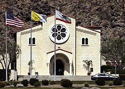
Saint Francis of Assisi Catholic Church, La Quinta, Riverside County, California, United States .jpg
St. Francis of Assisi Church
Flag of La Quinta, California.gif
Seal of La Quinta, California.png
Motto: 
The Gem of the Desert
Riverside County California Incorporated and Unincorporated areas La Quinta Highlighted 0640354.svg
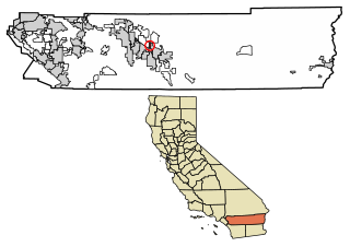
Location of La Quinta in Riverside County, California.
Usa edcp relief location map.png
Red pog.svg
La Quinta, California
Location in the United States
Coordinates: 33°40′31″N116°17′51″W / 33.67528°N 116.29750°W / 33.67528; -116.29750
CountryUnited States
State California
County Riverside
Incorporated May 1, 1982 [1]
Government
  Type Council–manager
   Mayor Linda Evans [2]
   Mayor Pro Tem John Pena
   City Council Kathleen Fitzpatrick
Deborah McGarrey
Steve Sanchez
Area
[3]
  Total35.68 sq mi (92.42 km2)
  Land35.26 sq mi (91.32 km2)
  Water0.42 sq mi (1.10 km2)  1.22%
Elevation
[4]
135 ft (41 m)
Population
 (2010) [5]
  Total38,181
  Estimate 
(2021) [6]
41,748
  Density1,184.07/sq mi (457.17/km2)
Time zone UTC-8 (Pacific)
  Summer (DST) UTC-7 (PDT)
ZIP code
92253
Area code 442/760
FIPS code 06-40354
GNIS feature IDs 1660870, 2411582
Website www.laquintaca.gov

La Quinta (a Spanish idiom meaning "the country villa") is a desert resort city in Riverside County, California, United States. Located between Indian Wells and Indio, it is one of the nine cities of the Coachella Valley. The population was 37,467 at the 2010 census, up from 23,694 at the 2000 census.

Contents

Golf courses include La Quinta Resort and Club, a resort dating to 1926, where director Frank Capra wrote the screenplay for Lost Horizon , and SilverRock Golf Resort, a host golf courses for the annual Bob Hope Chrysler Classic PGA golf tournament. [7]

History

The Cahuilla Indians were the first inhabitants of La Quinta.

In the late-19th century and early-20th century (1880–1920), agriculture developed in present-day La Quinta and "East Valley" by pre-modern (mountain water runoff or open water springs) and modern irrigation techniques. At the time, California and federal land surveyors declared the sand dunes uninhabitable, only the hard rock ground of the "Marshall Cove" held potential farming and residential development. [ citation needed ]

In 1926, Walter Morgan established the La Quinta Resort at the northern section of Marshall Cove as a type of secluded hideaway for nearby Hollywood's celebrities and socialites. The Resort was the site for the Coachella Valley's first golf course, coinciding with the construction and pavement of State Route 111 in the 1930s. Further expansion of Washington Street in the 1950s and 1960s connected La Quinta with US Highways 60 and 99 (became Interstate 10 in the 1970s). [8]

As nearby desert cities grew to capacity, La Quinta's growth rose dramatically by the mid-1980s, which led to its incorporation as a city in Riverside County in 1982. [9] In the 1980 census, La Quinta had 4,200 residents, then increased to 11,215 by 1990 in the city's early phases of residential area growth. It was predominantly a part-time community until around that time.

Geography

According to the United States Census Bureau, the city has a total area of 35.6 square miles (92 km2), of which 35.1 square miles (91 km2) is land and 0.4 square miles (1.0 km2) (1.22%) is water. The city's elevation is 56 feet (20 m) above sea level.

La Quinta is located on the floor of the Coachella Valley, and is surrounded on three sides by the Santa Rosa Mountains. As the floor of the valley sank, it was covered by the Pacific Ocean. Silt deposits from the flow of the Colorado River into the Gulf of California caused the basin to be cut off from the ocean. Five hundred years ago, the Colorado River changed its course and the eastern Coachella Valley flooded, leading to the creation of Lake Cahuilla, which was fresh water. [10]

Climate

The climate of the Coachella Valley is influenced by the surrounding geography. High mountain ranges on three sides contribute to its unique and year-round warm climate, with some of the warmest winters west of the Rocky Mountains. La Quinta has a warm winter/hot summer climate: Its average annual high temperature is 89.5 °F (31.9 °C) and average annual low is 62.1 °F (16.7 °C) but summer highs above 108 °F (42 °C) are common and sometimes exceed 120 °F (49 °C), while summer night lows often stay above 82 °F (28 °C). Winters are warm with daytime highs often between 68 and 86 °F (20 and 30 °C). Under 4 inches (100 mm) of annual precipitation are average, with over 348 days of sunshine per year. The hottest temperature ever recorded there was 125 °F (52 °C) on July 6, 1905. [11] The mean annual temperature is 75.8 °F (24.3 °C). [12]

Climate data for La Quinta, California, elev. 10 feet (3.0 m) (1981–2010)
MonthJanFebMarAprMayJunJulAugSepOctNovDecYear
Record high °F (°C)97
(36)
100
(38)
103
(39)
109
(43)
117
(47)
123
(51)
125
(52)
121
(49)
122
(50)
115
(46)
101
(38)
93
(34)
125
(52)
Mean daily maximum °F (°C)72.0
(22.2)
75.3
(24.1)
81.3
(27.4)
87.5
(30.8)
95.7
(35.4)
103.1
(39.5)
107.3
(41.8)
106.6
(41.4)
102.0
(38.9)
91.9
(33.3)
79.6
(26.4)
71.0
(21.7)
89.5
(31.9)
Daily mean °F (°C)58.3
(14.6)
61.6
(16.4)
68.1
(20.1)
74.1
(23.4)
81.7
(27.6)
88.6
(31.4)
93.8
(34.3)
93.4
(34.1)
88.0
(31.1)
77.8
(25.4)
65.7
(18.7)
57.6
(14.2)
75.8
(24.3)
Mean daily minimum °F (°C)44.6
(7.0)
48.0
(8.9)
54.8
(12.7)
60.7
(15.9)
67.7
(19.8)
74.2
(23.4)
80.3
(26.8)
80.3
(26.8)
74.0
(23.3)
63.7
(17.6)
51.8
(11.0)
44.2
(6.8)
62.1
(16.7)
Record low °F (°C)13
(−11)
20
(−7)
25
(−4)
33
(1)
38
(3)
45
(7)
59
(15)
56
(13)
46
(8)
31
(−1)
23
(−5)
19
(−7)
13
(−11)
Average precipitation inches (mm)0.56
(14)
0.64
(16)
0.43
(11)
0.05
(1.3)
0.07
(1.8)
0.01
(0.25)
0.04
(1.0)
0.54
(14)
0.04
(1.0)
0.26
(6.6)
0.18
(4.6)
0.62
(16)
3.44
(87)
Source: www.ncdc.noaa.gov [13]

Demographics

Historical population
CensusPop.Note
1980 3,328
1990 11,215237.0%
2000 23,694111.3%
2010 37,46758.1%
2019 (est.)41,748 [6] 11.4%
U.S. Decennial Census [14]

2020

In the 2020 U.S. decennial census, La Quinta's official population was 37,558. [15]

2012

As of January 1, 2012, the California Department of Finance Demographic Research Unit estimated the City of La Quinta's population to be 38,075. [16]

2010

The 2010 United States Census [17] reported that La Quinta had a population of 37,467. The population density was 1,053.9 inhabitants per square mile (406.9/km2). The racial makeup of La Quinta was 29,489 (78.7%) White (63.1% Non-Hispanic White), [18] 713 (1.9%) African American, 230 (0.6%) Native American, 1,176 (3.1%) Asian, 41 (0.1%) Pacific Islander, 4,595 (12.3%) from other races, and 1,223 (3.3%) from two or more races. Hispanic or Latino of any race were 11,339 persons (30.3%).

The Census reported that 37,410 people (99.8% of the population) lived in households, 50 (0.1%) lived in non-institutionalized group quarters, and 7 (0%) were institutionalized.

There were 14,820 households, out of which 4,329 (29.2%) had children under the age of 18 living in them, 8,672 (58.5%) were opposite-sex married couples living together, 1,442 (9.7%) had a female householder with no husband present, 595 (4.0%) had a male householder with no wife present. There were 787 (5.3%) unmarried opposite-sex partnerships, and 182 (1.2%) same-sex married couples or partnerships. 3,164 households (21.3%) were made up of individuals, and 1,522 (10.3%) had someone living alone who was 65 years of age or older. The average household size was 2.52. There were 10,709 families (72.3% of all households); the average family size was 2.93.

The population was spread out, with 8,208 people (21.9%) under the age of 18, 2,509 people (6.7%) aged 18 to 24, 7,696 people (20.5%) aged 25 to 44, 11,238 people (30.0%) aged 45 to 64, and 7,816 people (20.9%) who were 65 years of age or older. The median age was 45.6 years. For every 100 females, there were 93.5 males. For every 100 females age 18 and over, there were 91.3 males.

There were 23,489 housing units at an average density of 660.7 per square mile (255.1/km2), of which 11,152 (75.2%) were owner-occupied, and 3,668 (24.8%) were occupied by renters. The homeowner vacancy rate was 6.5%; the rental vacancy rate was 16.5%. 27,386 people (73.1% of the population) lived in owner-occupied housing units and 10,024 people (26.8%) lived in rental housing units.

According to the 2010 United States Census, La Quinta had a median household income of $72,099, with 8.0% of the population living below the federal poverty line. [18]

2000

As of the census [19] of 2000, there were 23,694 people, 8,445 households, and 6,553 families residing in the city. The population density was 746.2 inhabitants per square mile (288.1/km2). There were 11,812 housing units at an average density of 372.0 per square mile (143.6/km2). The racial makeup of the city was 78.5% White, 1.4% African American, 0.7% Native American, 1.9% Asian, 0.1% Pacific Islander, 13.9% from other races, and 3.5% from two or more races. Hispanic or Latino of any race were 32.0% of the population.

There were 8,445 households, out of which 38.1% had children under the age of 18 living with them, 64.6% were married couples living together, 9.2% had a female householder with no husband present, and 22.4% were non-families. 17.0% of all households were made up of individuals, and 6.6% had someone living alone who was 65 years of age or older. The average household size was 2.8 and the average family size was 3.2, above national average of 2.4 according to the 2000 United States Census.

In the city, the population was spread out, with 29.1% under the age of 18, 6.0% from 18 to 24, 29.0% from 25 to 44, 22.4% from 45 to 64, and 13.4% who were 65 years of age or older. The median age was 36 years. For every 100 females, there were 96.2 males. For every 100 females age 18 and over, there were 93.1 males.

The median income for a household in the city was $54,552, and the median income for a family was $56,848 (these figures had risen to $72,452 and $82,168 respectively as of a 2007 estimate [20] ). Males had a median income of $40,553 versus $31,627 for females. The per capita income for the city was $27,284. About 5.0% of families and 7.8% of the population were below the poverty line, including 11.1% of those under age 18 and 4.8% of those age 65 or over.

Other demographic data

La Quinta has developed a culturally diverse community, as large ancestry groups include Mexicans (the largest) and Mexican Americans who frequently came to the Palm Springs area/Coachella Valley to find available employment in the 1990s and 2000s. Others, in alphabetical order, include: Armenians, Bosnians, British, French, Germans, Italians, Poles and Jews of multiple nationalities. [21]

Temporary population known as "snowbird" from Coastal California urban areas, the Pacific Northwest and/or Canada increase the local population by 50–90% in the winter months from November to April. A large percentage of seasonal residents are senior citizens and RV or mobile home parks are scattered throughout "East Valley" – the eastern half of the Coachella Valley.

Like the rest of the "East Valley" including nearby communities of Indio, Coachella, and unincorporated communities of Bermuda Dunes and Vista Santa Rosa, there is a burgeoning Latino (especially Mexican-American and Central American nationalities) as well an enlargened African American and Asian American (i.e. east Asians) population belonging to the middle and upper-middle class.

According to the United States Hispanic Chamber of Commerce, estimates placed Latinos at half (about 50% to 60%) of the local population, Blacks at near or over 10% and Asians at 10–15% of the city population as of the year 2010. Most of the minorities are recently moved-in families sought starter homes and/or relocated from urban centers of Southern California during the 1990s and 2000s, and from families of two or more races (to represent multiracial identity).

Economy

La Quinta Country Club La Quinta Country Club.jpg
La Quinta Country Club

Service industries

La Quinta is the site of the first Wal-Mart Supercenter in California. Many residents work for the tourist industries in hotels, resorts, golf courses, and nearby casinos. Service industry jobs relate to the construction, hotel, landscaping, and retail industries. La Quinta has sought to attract professional businesses, and has benefited from neighboring cities' growth. [22] The city's downtown commercial district is officially known as The Village. [23] The Village District includes private commercial developments such as Old Town and Plaza Calle Tampico, and contain professional offices, the city museum, small tourist-oriented shops and boutiques, and restaurants. [24] Old Town La Quinta is a commercial real estate development [25] [26] of 30 cafes, shops, boutiques, salons, services, and offices. [27]

Top employers

According to La Quinta's 2020 Comprehensive Annual Financial Report, [28] the top employers in the city were:

#Employer# of Employees
1 Desert Sands Unified School District 2,852
2 La Quinta Resort & Club/PGA West 1,412
3 Walmart Supercenter300
4 Costco Wholesale 290
5 The Home Depot 212
6 Target 180
7 Lowe's 150
8Imperial Irrigation District134
9Traditions Golf Club120
10 In-N-Out Burger 84

Arts and culture

Old Town La Quinta Old town la quinta.jpg
Old Town La Quinta

The city opened a public library that commenced operations in 2005. La Quinta annually plays host to a four-day event known as the "La Quinta Art Celebration" at the scenic La Quinta Civic Center Park. A certified local farmers market is hosted at Old Town La Quinta. Old Town also hosts "Art on Main Street".

Parks and recreation

La Quinta has 20 parks. [29] Lake Cahuilla Regional Park is a Riverside County park.

Government

In the California State Legislature, La Quinta is in the 28th Senate District , represented by Democrat Lola Smallwood-Cuevas, and in the 42nd Assembly District , represented by Democrat Jacqui Irwin. [30]

In the United States House of Representatives, La Quinta is in California's 41st congressional district , represented by Republican Ken Calvert. [31]

Education

The Desert Sands Unified School District serves the western half of La Quinta, while the Coachella Valley Unified School District serves the eastern half. [32]

Schools include:

STEM schools

Alternative schools

Infrastructure

Public safety

Police services are provided under contract with the Riverside County Sheriff's Department through the Thermal Station, which also serves the city of Coachella and unincorporated areas of the eastern Coachella Valley.

The city of La Quinta contracts for fire and paramedic services with the Riverside County Fire Department through a cooperative agreement with CAL FIRE. [37]

American Medical Response provides ambulance services to La Quinta.

Transportation

California State Route 111 passes through La Quinta.

The city is part of the SunBus line, which serves the Coachella Valley. [38]

Notable people

The city has been home to a number of celebrity residents, including the late Merv Griffin. Griffin was the driving force behind the annual La Quinta Arts Festival, one of the country's leading plein air art shows, and was instrumental in the development of Griffin Ranch, La Quinta's first equestrian-oriented resort residential neighborhood. [39]

Additionally, the musician/actor Tyler Hilton, professional golfer Anthony Kim, [40] and singer/dancer Aubrey O'Day of Danity Kane were also former residents of La Quinta, and all three attended La Quinta High School. [41]

Tommy John, longtime MLB left-handed pitcher, is a permanent resident.

Scott Burcham, a baseball player in the Colorado Rockies' organization, was born and grew up in La Quinta. [42]

The band Yawning Man formed here.

Singer and TV personality Andy Williams resided in La Quinta with his second wife Debbie in addition to owning a house in Branson, Missouri, where his Moon River theatre was located. [43]

Olympic ice figure skater Dorothy Hamill lived in La Quinta.

Scientology founder L. Ron Hubbard lived in secret on a ranch in La Quinta from 1978 to the early 1980s. [44]

The singer Jack Jones lives in La Quinta.

Related Research Articles

<span class="mw-page-title-main">Salton City, California</span> Census designated place in California, United States

Salton City is a census-designated place (CDP) in Imperial County, California. It is the largest Imperial County development on the Salton Sea coast. It is part of the El Centro, California Metropolitan Statistical Area. The population was 3,763 at the 2010 census, up from 978 in 2000. The reported population for 2020 was 5,155.
<span class="mw-page-title-main">La Cañada Flintridge, California</span> City in Los Angeles County, California, United States

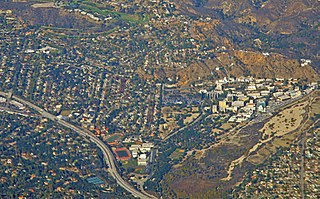
La Cañada Flintridge, commonly known as just La Cañada, is a city in the foothills of the Verdugo Mountains in Los Angeles County, California, United States. Located in the Crescenta Valley, in the western edge of the San Gabriel Valley, it is the location of NASA's Jet Propulsion Laboratory.

<span class="mw-page-title-main">Bermuda Dunes, California</span> Census-designated place in California, United States

Bermuda Dunes is a census-designated place (CDP) in Riverside County, California. The population was 7,282 at the 2010 census. Bermuda Dunes is located near Indio and 19 miles (31 km) east of Palm Springs.
<span class="mw-page-title-main">Cathedral City, California</span> City in California, United States

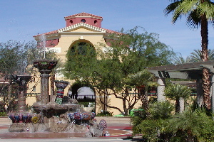
Cathedral City, colloquially known as "Cat City", is a desert resort city in Riverside County, California, United States, within the Colorado Desert's Coachella Valley. Situated between Palm Springs and Rancho Mirage, the city has the second largest population, after Indio, of the nine cities in the Coachella Valley. Its population was 51,493 at the 2020 census, a slight increase from 51,200 at the 2010 census.

<span class="mw-page-title-main">Coachella, California</span> City in California, United States

Coachella is a city in Riverside County, California, United States. It is the namesake and easternmost city of the Coachella Valley, in Southern California's Colorado Desert. Originally a railroad town, Coachella is a prominent hub for agriculture and shipping across Southern California and the Western United States.

<span class="mw-page-title-main">Desert Hot Springs, California</span> City in California, United States

Desert Hot Springs is a city in Riverside County, California, United States. The city is located within the Coachella Valley geographic region. The population was 32,512 as of the 2020 census, up from 25,938 at the 2010 census. The city has experienced rapid growth since the 1970s when there were 2,700 residents.

<span class="mw-page-title-main">Indian Wells, California</span> City in California, United States

Indian Wells is a city in Riverside County, California, United States, in the Coachella Valley. Incorporated in 1967, it lies in between the cities of Palm Desert and La Quinta. As of the 2020 census, the city population was 4,757.

<span class="mw-page-title-main">Indio, California</span> City in California, United States

Indio is a city in Riverside County, California, United States, in the Coachella Valley of Southern California's Colorado Desert region. It lies 23 miles (37 km) east of Palm Springs, 75 miles (121 km) east of Riverside, 127 miles (204 km) east of Los Angeles, 148 miles (238 km) northeast of San Diego, 250 miles (400 km) west of Phoenix, and 102 miles (164 km) north of Mexicali, Mexico.
<span class="mw-page-title-main">Palm Desert, California</span> City in California, United States

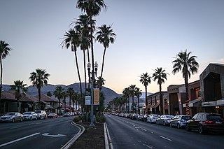
Palm Desert is a city in Riverside County, California, United States, in the Coachella Valley, approximately 14 miles (23 km) east of Palm Springs, 121 miles (195 km) northeast of San Diego and 122 miles (196 km) east of Los Angeles. The population was 51,163 at the 2020 census. The city has been one of the state's fastest growing since 1980, when its population was 11,801.
<span class="mw-page-title-main">Rancho Mirage, California</span> City in California, United States

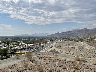
Rancho Mirage is a city in Riverside County, California, United States. The city is a low-density desert-resort community with resorts, golf courses, and country clubs within the Colorado Desert section of the Sonoran Desert. Nestled along the foothills of the Santa Rosa Mountains in the south, it is located several minutes east of Palm Springs. The city is adjacent to Cathedral City, Palm Desert, and unincorporated Thousand Palms. The population was 16,999 at the 2020 census, down from 17,218 at the 2010 census, though the seasonal population can exceed 20,000. Incorporated in 1973, Rancho Mirage is one of the nine cities of the Coachella Valley.

<span class="mw-page-title-main">Thousand Palms, California</span> Census-designated place in California, United States

Thousand Palms is a census-designated place (CDP) in the Coachella Valley of Riverside County, California, United States. The population was 7,715 at the 2010 census, up from 5,120 at the 2000 census.

<span class="mw-page-title-main">Yucca Valley, California</span> City in California, United States

Yucca Valley is an incorporated town in San Bernardino County, California, United States. The population was 21,738 as of the 2020 census. Yucca Valley lies 20 miles (32 km) north of Palm Springs, and 103 miles (166 km) east of Los Angeles. Bordered to the south by the Joshua Tree National Park and to the west by the San Bernardino Mountains, the town of Yucca Valley is located in the Mojave Desert at roughly 3,300 feet (1,000 m) above sea level.

<span class="mw-page-title-main">Salton Sea Beach, California</span> Census-designated place in California, United States

Salton Sea Beach is a census-designated place (CDP) in Imperial County, California, located 2.5 miles (4 km) southeast of Desert Shores. The population was 508 at the 2020 census, up from 422 at the 2010 census, up from 392 at the 2000 census. It is part of the El Centro, California Metropolitan Statistical Area. It was the location of the Naval Auxiliary Air Station Salton Sea.

<span class="mw-page-title-main">Twentynine Palms, California</span> City in California, United States

Twentynine Palms is a city in San Bernardino County, California. It serves as one of the entry points to Joshua Tree National Park.

<span class="mw-page-title-main">Coachella Valley</span> Valley in Southern California

The Coachella Valley is an arid rift valley in the Colorado Desert of Southern California in Riverside County. The valley has been referred to as Greater Palm Springs and occasionally the Palm Springs Area due to the historic prominence of the city of Palm Springs. The valley extends approximately 45 mi (72 km) southeast from the San Gorgonio Pass to the northern shore of the Salton Sea and the neighboring Imperial Valley, and is approximately 15 mi (24 km) wide along most of its length. It is bounded on the northeast by the San Bernardino and Little San Bernardino Mountains, and on the southwest by the San Jacinto and Santa Rosa Mountains.

The Desert Sands Unified School District (DSUSD) is a public school district with main offices located in La Quinta, California. The district was founded in 1964, after the California Department of Education consolidated all Indio public schools. As of 2017, DSUSD serves 28,958 students in Indio, La Quinta, Palm Desert, Indian Wells, Bermuda Dunes, and parts of Rancho Mirage and Coachella.

<span class="mw-page-title-main">Thermal, California</span> Resort community in Riverside County, southern California, United States

Thermal is an unincorporated community within the Coachella Valley in Riverside County, California, United States, located approximately 25 miles (40 km) southeast of Palm Springs and about 9.5 miles (15.3 km) north of the Salton Sea. The community's elevation is 138 feet (42 m) below mean sea level. It is served by area codes 760 and 442 and is in ZIP Code 92274. The population was 2,865 at the 2010 census. For statistical purposes, the United States Census Bureau has defined Thermal a census-designated place (CDP), which does not precisely correspond to the historical community.

<span class="mw-page-title-main">Palm Springs, California</span> City in Riverside County

Palm Springs is a desert resort city in Riverside County, California, United States, within the Colorado Desert's Coachella Valley. The city covers approximately 94 square miles (240 km2), making it the largest city in Riverside County by land area. With multiple plots in checkerboard pattern, more than 10% of the city is part of the Agua Caliente Band of Cahuilla Indians reservation land and is the administrative capital of the most populated reservation in California.

<span class="mw-page-title-main">Riverside County, California</span> County in California, United States

Riverside County is a county located in the southern portion of the U.S. state of California. As of the 2020 census, the population was 2,418,185, making it the fourth-most populous county in California and the 10th-most populous in the United States. The name was derived from the city of Riverside, which is the county seat.
<span class="mw-page-title-main">Desert Palms, California</span> Census-designated place in California, United States

Desert Palms is a census-designated place in the Coachella Valley of eastern Riverside County, southern California.
References

  1. "California Cities by Incorporation Date". California Association of Local Agency Formation Commissions. Archived from the original (Word) on November 3, 2014. Retrieved August 25, 2014.
  2. "Council Member Profiles". La Quinta, CA. Archived from the original on February 7, 2015. Retrieved February 11, 2015.
  3. "2019 U.S. Gazetteer Files". United States Census Bureau. Retrieved July 1, 2020.
  4. "La Quinta". Geographic Names Information System . United States Geological Survey, United States Department of the Interior . Retrieved April 16, 2015.
  5. "La Quinta (town) QuickFacts". United States Census Bureau. Archived from the original on September 5, 2015. Retrieved February 11, 2015.
  6. 1 2 "Population and Housing Unit Estimates". United States Census Bureau. May 24, 2020. Retrieved May 27, 2020.
  7. "New SilverRock Resort to Host Bob Hope Desert Classic". Cybergolf.com. Retrieved December 23, 2010.
  8. "Palm Desert Resort – Luxury Resort Palm Springs – La Quinta Resort". laquintaresort.com. Retrieved January 17, 2017.
  9. "Government – City of La Quinta". La-quinta.org. May 1, 1982. Archived from the original on December 17, 2010. Retrieved December 23, 2010.
  10. "History of La Quinta | La Quinta, CA". Laquintaca.gov. Retrieved February 1, 2019.
  11. "Indio Fire Station, California – Climate Summary". dri.edu. Retrieved January 17, 2017.
  12. "Station Name: CA INDIO FIRE STN : GHCN Daily ID: USC00044259" (TXT). 1.ncdc.noaa.gov. Retrieved July 19, 2019.
  13. NOAA. "1981–2010 Monthly Normals for Indio, CA". NOAA. Retrieved July 19, 2011.[ permanent dead link ]
  14. "Census of Population and Housing". Census.gov. Retrieved June 4, 2015.
  15. "2020 Census Results".
  16. "State of California, Department of Finance, "New Report: California Added More Than a Quarter-Million in 2011". Sacramento, California, May 2012" (PDF). Archived from the original (PDF) on February 20, 2014.
  17. "2010 Census Interactive Population Search: CA – La Quinta city". U.S. Census Bureau. Archived from the original on July 15, 2014. Retrieved July 12, 2014.
  18. 1 2 "La Quinta (City) QuickFacts from the US Census Bureau". Archived from the original on January 17, 2014. Retrieved January 26, 2014.
  19. "U.S. Census website". United States Census Bureau . Retrieved January 31, 2008.
  20. "La Quinta city, California – Fact Sheet". Factfinder.census.gov. Archived from the original on February 11, 2020. Retrieved December 23, 2010.
  21. American FactFinder, United States Census Bureau. "American Factfinder". Factfinder.census.gov. Archived from the original on February 12, 2020. Retrieved December 23, 2010.
  22. Desjardins, Doug. Wal-Mart opens 1st CA supercenter: milestone store both pivotal and contentious Archived February 22, 2006, at the Wayback Machine . DSN Retailing Today, March 22, 2004. Retrieved April 10, 2007.
  23. "City of La Quinta : Related Links and Information". La-quinta.org. Archived from the original on December 17, 2010. Retrieved December 23, 2010.
  24. "laquinta_map". Playinlaquinta.com. Archived from the original on September 3, 2010. Retrieved December 23, 2010.
  25. "Man With the Plan by JANICE KLEINSCHMIDT". Palm Springs Life. January 5, 2006. Retrieved April 3, 2022.
  26. "Old Town La Quinta". Greater Coachella Valley Chamber. Retrieved April 3, 2022.
  27. "Shared office space increasing in popularity as businesses move toward more hybrid work options". Desert Sun. July 17, 2021. Retrieved April 3, 2022.
  28. "2019/20 Comprehensive Annual Financial Report — Fiscal Year Ended June 30, 2020". www.laquintaca.gov. Retrieved August 2, 2021.
  29. "City of la Quinta : Parks and Trails". Archived from the original on December 17, 2010. Retrieved October 1, 2013.
  30. "Statewide Database". Regents of the University of California. Archived from the original on February 1, 2015. Retrieved April 6, 2015.
  31. "California's 41st Congressional District - Representatives & District Map". Civic Impulse, LLC.
  32. "The Demographic Statistical Atlas of the United States - Statistical Atlas".
  33. California Distinguished School Benjamin Franklin Elementary School of International Studies
  34. "La Quinta High School". City-data.com. Retrieved December 23, 2010.
  35. Hwang, Kristen (November 18, 2015). "DSUSD moves forward with Adams Elementary closing". The Desert Sun . Retrieved March 5, 2016.
  36. "Washington George Carver Elementary School - La Quinta, California - Public School | Facebook". Facebook.com.
  37. "Service Area". rvcfire.org. Retrieved January 17, 2017.
  38. "Book-web" (PDF). Archived from the original (PDF) on July 18, 2011. Retrieved December 23, 2010.
  39. "Griffin Ranch, Country Club lifestyle in La Quinta, CA". Griffinranchlaquinta.com. Retrieved December 23, 2010.
  40. Bonk, Thomas. "Bonk: True To His Roots, Anthony Kim : Golf Digest". GolfDigest.com. Golf Digest. Retrieved July 17, 2014.
  41. "Tyler Hilton". IMDB. Retrieved December 23, 2010.
  42. "Scott Burcham Stats, Highlights, Bio". milb.com. MiLB.com Stats – The Official Site of Minor League Baseball. Retrieved January 17, 2017.
  43. Munson, Kyle (December 25, 2009). "Iowa's own Andy Williams is "Mr. Christmas" to the nation". Des Moines Register. reprinted in Register blog September 26, 2012. Retrieved September 26, 2012.[ dead link ]
  44. Reitman, Janet (2011). Inside Scientology: The Story of America's Most Secretive Religion. Houghton Mifflin Harcourt. p. 112. ISBN   9780618883028. OL   24881847M.

Further reading