Related Research Articles

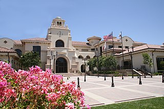
Murrieta is a city in southwestern Riverside County, California, United States. The population of Murrieta was 110,949 as of the 2020 census. Murrieta experienced a 133.7% population increase between 2000 and 2010, making Murrieta one of the fastest-growing cities in the state during that period. Largely residential in character, Murrieta is typically characterized as a bedroom community. Murrieta is bordered by the city of Temecula to the south, the cities of Menifee and Wildomar to the north, and the unincorporated community of French Valley to the east. Murrieta is located in the center of the Los Angeles-San Diego mega-region. Murrieta is named for Juan Murrieta, a Californio ranchero who founded the town.
Temecula is a city in southwestern Riverside County, California, United States. The city had a population of 110,003 as of the 2020 census and was incorporated on December 1, 1989. The city is a tourist and resort destination, with the Temecula Valley Wine Country, Old Town Temecula, the Temecula Valley Balloon & Wine Festival, the Temecula Valley International Film Festival, championship golf courses, and resort accommodations contributing to the city's economic profile.

Wildomar is a city in southwest Riverside County, California, United States. The city was incorporated on July 1, 2008. As of the 2020 census, the population was 36,875. The community has grown quickly during the early 21st century; the population has more than doubled since the 2000 census, when the community was still an unincorporated census-designated place.

The Santa Margarita River which with the addition of what is now Temecula Creek, was formerly known as the Temecula River, is a short intermittent river on the Pacific coast of southern California in the United States, approximately 30.9 miles (49.7 km) long. One of the last free-flowing rivers in southern California, it drains an arid region at the southern end of the Santa Ana Mountains, in the Peninsular Ranges between Los Angeles and San Diego.

State Route 79 (SR 79) is an approximately 106-mile (171 km) north-south state highway in the U.S. state of California. The highway's southern terminus is at Interstate 8 (I-8) at the Descanso Junction in San Diego County. Its northern terminus is at Interstate 10 (I-10) in the city of Beaumont in Riverside County. In San Diego County, SR 79 connects with Lake Cuyamaca and Cuyamaca Rancho State Park, the communities of Julian and Warner Springs. In Riverside County, the highway runs through the cities of Temecula, Murrieta, Hemet, and San Jacinto before reaching Beaumont.
California's 48th congressional district is a congressional district in the U.S. state of California based in San Diego County in Southern California as well as Murrieta and Temecula in southwestern Riverside County. It is currently represented by Republican Darrell Issa.

The Santa Rosa Plateau is an upland plateau and southeastern extension of the Santa Ana Mountains in Riverside County, southern California. It is bounded by the rapidly urbanizing Inland Empire cities of Murrieta and Temecula to the northeast and southeast, respectively.
Temecula Creek, formerly known as the Temecula River, runs 32.6 miles (52.5 km) through southern Riverside County, California, United States, past the rural communities of Radec and Aguanga, and ending 0.5 miles (0.80 km) southeast of the original city center of Temecula. The creek is filled with boulders and is typically dry and sandy. It is a relatively undeveloped coastal-draining watershed. Until the 1920s, water flowed in Temecula Creek year-round.
The Southern California Association of Governments (SCAG) is the Metropolitan Planning Organization (MPO) of six of the ten counties in Southern California, serving Imperial County, Los Angeles County, Orange County, Riverside County, San Bernardino County, and Ventura County. San Diego County's MPO is the San Diego Association of Governments, which is an unrelated agency.
French Valley is a region located in southwestern Riverside County, near the cities and communities of Hemet, Winchester, Murrieta, and Temecula in the state of California, United States. It is part of the Plains of Leon, contiguous with the Perris Plain, that drains into the Temecula Basin by means of tributaries of the Santa Margarita River.
Rancho Santa Rosa was a 47,815-acre (193.50 km2) Mexican land grant in present day Riverside County, California given in 1846 by Governor Pio Pico to Juan Moreno. At the time of the US patent, Rancho Santa Rosa was a part of San Diego County. Riverside County was created by the California Legislature in 1893 by taking land from both San Bernardino and San Diego Counties. The site is now registered as a California Historical Landmark.
Rancho La Laguna was a 13,339-acre (53.98 km2) Mexican land grant in present-day Riverside County, California given in 1844 by Governor Manuel Micheltorena to Julian Manriquez. The rancho lands are included in the present day city of Lake Elsinore and Wildomar. At the time of the US Patent, Rancho Laguna was a part of San Diego County. The County of Riverside was created by the California Legislature in 1893 by taking land from both San Bernardino and San Diego Counties.

De Luz is an unincorporated community in San Diego County, California. De Luz is 6 miles (9.7 km) northwest of Fallbrook and due west of Temecula. The region is approximately 12 miles (19 km) east of the Pacific Ocean and lies at the southern end of the Santa Ana Mountains.
Rancho Little Temecula was a 2,233-acre (9.04 km2) Mexican land grant in present-day Riverside County, California given in 1845 by Governor Pío Pico to Pablo Apis. The grant was one of the few held by indigenous people. The grant is south of present-day Temecula and is bordered on the north by Temecula Creek. At the time of the US patent, Rancho Little Temecula was a part of San Diego County. Riverside County was created by the California Legislature in 1893 by taking land from both San Bernardino and San Diego Counties.
Rancho Temecula was a 26,609-acre (107.68 km2) Mexican land grant in present-day Riverside County, California given on December 14, 1844 by Governor Manuel Micheltorena to Feliz Valdez. The grant extended south along the east bank Murrieta Creek to Temecula Creek and encompassed present-day Temecula, Murrieta and Murrieta Hot Springs. At the time of the US patent, Rancho Temecula was a part of San Diego County. Riverside County was created by the California Legislature in 1893 by taking land from both San Bernardino and San Diego Counties.
Rancho Pauba was a 26,598-acre (107.64 km2) Mexican land grant in present-day Riverside County, California given in 1844 by Governor Manuel Micheltorena to Vicente Moraga and Luis Arenas. The grant was just east of present-day Temecula. At the time of the US patent, Rancho Pauba was a part of San Diego County. Riverside County was created by the California Legislature in 1893 by taking land from both San Bernardino and San Diego Counties.

Riverside County is a county located in the southern portion of the U.S. state of California. As of the 2020 census, the population was 2,418,185, making it the fourth-most populous county in California and the 10th-most populous in the United States. The name was derived from the city of Riverside, which is the county seat.

La Cresta is an unincorporated community in the Santa Rosa Plateau region in Riverside County, California, United States. It is situated west of Murrieta, north of Temecula and the San Diego County Border, and east of Orange County. It is centrally located approximately 55 miles from Downtown San Diego, 65 miles from Downtown Los Angeles, and 15 miles from the Pacific Ocean. The population of La Cresta is approximately 2,860.
Willow Springs Station was a changing station at Alamos or Willow Springs along the Second Division route of the Butterfield Overland Mail, in what is now Murrieta, in Riverside County, California. It was also known as Alamos, Clines's or Kline's, or Willows, was one of the later Butterfield Overland Mail stations, placed in 1859, between some of the original stations for changing teams and providing water between stops in hot dry areas. Willow Springs, also originally known as Alamos Springs, was located west of the hills that line the east side of the Temecula Valley, on land of the Rancho Temecula, near Santa Gertrudis Creek on the low flood plain of Murrieta Creek, between Santa Gertrudis and Warm Springs Creek.

Murrieta Creek runs 13 miles (21 km) southeasterly through southwestern Riverside County, California, United States, through the cities of Wildomar, Murrieta, and Temecula, ending 0.5 miles (0.80 km) southeast of the city center of Temecula, where it has its confluence with Temecula Creek and forms the head of the Santa Margarita River.
References
- ↑ U.S. Geological Survey Geographic Names Information System: Linda Rose
- ↑ Gannett, Henry (1905). The Origin of Certain Place Names in the United States. U.S. Government Printing Office. p. 187.
- 1 2 Temecula at the Crossroads of History, page 69; ISBN 1-886483-14-0
- ↑ Along the Old Roads, A History of the Portion of Southern California that became Riverside County 1772 – 1893; ISBN 0983750025
- 1 2 Murrieta, Images of America by Marvin Curran, Loretta Barnett, Rebecca Farnbach, Murrieta, p.39,76; ISBN 978-0-7385-4669-8
- ↑ San Diego. Canning Company — San Diego Union, June 21: "The much talked-of fruit-canning company is now ready for business. Yesterday articles of incorporation were filed with the County Clerk. The name of the corporation is the New York and Linda Rosa Fruit Canning and Preserving Company, and the capital stock is $200,000 divided into 2000 shares of the value of $100 each. The purposes of the corporation, as set forth are the raising of fruit and vegetables and canning and preserving the same for sale; the acquiring by purchase or otherwise any patent or other rights affecting said industry; the buying, selling and exchange of lands and other property necessary or desirable for the successful prosecution and development of the business of the corporation; the purchase, manufacture, sale and general dealing with machinery and tools in any way connected with the industry. The principal place of business is designated as Linda Rosa, in this county. The capital stock has all been subscribed by the following gentlemen, constituting the directory of the company: W. C. Jacubs, Linda Rosa, $190,000; J. E. Dean, Murrieta, $500; A. J. Chapel, Los Angeles, $500; James Tobin, Boston, $2500; H. T. Mason, Murrieta, $500." Pacific Rural Press, Volume 35, Number 26, 30 June 1888, p.565.
- ↑ Frickstad, Walter N., A Century of California Post Offices 1848-1954, Philatelic Research Society, Oakland, CA. 1955, pp. 147-158.
- ↑ Charles A. Higgins, New guide to the Pacific coast, Santa Fé route: California, New Mexico, Colorado, Kansas, Missouri, Iowa, and Illinois, Rand, McNally, and Company, Chicago and New York, 1894, p.224.
