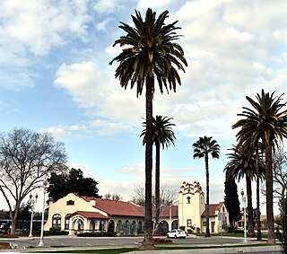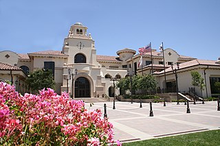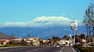
Moreno Valley is a city in Riverside County, California and is part of the Riverside-San Bernardino-Ontario Metropolitan Area. It is the second-largest city in Riverside County by population and one of the Inland Empire's population centers. As of the 2020 census, the city's population was 208,634. Moreno Valley is also part of the larger Greater Los Angeles area.

Perris is a city in Riverside County, California, United States, located 71 miles (114 km) east-southeast of Los Angeles, California, and 81 miles (130 km) north of San Diego, California. It is known for Lake Perris, which hosts a variety of flora and fauna. The city is most widely recognized for having many choices involving aerial activities, such as skydiving and hot-air ballooning. Perris is within the Inland Empire metropolitan area of Southern California. Perris had a population of 80,067 as of the 2020 census.

Temecula is a city in southwestern Riverside County, California, United States. The city is a tourist and resort destination, with the Temecula Valley Wine Country, Old Town Temecula, the Temecula Valley Balloon & Wine Festival, the Temecula Valley International Film Festival, championship golf courses, and resort accommodations for tourists which contribute to the city's economic profile. Although Temecula is geographically closer to downtown San Diego than downtown Los Angeles, it is considered part of the Greater Los Angeles area.
Interstate 215 (I-215) is a 54.5-mile-long (87.7 km) north–south auxiliary Interstate Highway in the Inland Empire region of the San Bernardino–Riverside urban area in Southern California. It has portions designated as the Barstow, Escondido, and Armed Forces Freeways. I-215 is a bypass auxiliary route of I-15, running from Murrieta to northern San Bernardino. While I-215 connects the city centers of both Riverside and San Bernardino, its parent I-15 runs to the west through Corona and Ontario.

Riverside City College (RCC) is a public community college in Riverside, California. The college is part of the Riverside Community College District, as well as the larger California Community Colleges System.

State Route 74, part of which forms the Palms to Pines Scenic Byway or Pines to Palms Highway, and the Ortega Highway, is a state highway in the U.S. state of California. It runs from Interstate 5 in San Juan Capistrano in Orange County to the city limits of Palm Desert in Riverside County. Stretching about 111 miles (179 km), it passes through several parks and National Forests between the Pacific coast and the Coachella Valley.

State Route 60 is an east-west state highway in the U.S. state of California. It serves the cities and communities on the eastern side of the Los Angeles metropolitan area and runs along the south side of the San Gabriel Valley. It functions as a bypass route of Interstate 10 (I-10) through the area between the East Los Angeles Interchange in Los Angeles and Beaumont. SR 60 provides a route across several spurs of the Peninsular Ranges, linking the Los Angeles Basin with the Pomona Valley and San Gabriel Valley. The highway also overlaps at State Route 57 and Interstate 215. Portions of SR 60 are designated as either the Pomona Freeway or the Moreno Valley Freeway.
Box Springs Mountain is the highest peak in the Box Springs Mountains range, standing 3,083 ft (940 m) tall. The mountain is in northwestern Riverside County, Southern California.

Menifee is a city in Riverside County, California, United States, and part of the Los Angeles Combined Statistical Area. The city is centrally located in the heart of Southern California, in the Menifee Valley. It is almost 15 miles (24 km) north of Temecula and just north of Murrieta. Menifee is roughly 46 square miles (100 km2) in size and has an elevation of 1,424 feet (434 m). The incorporated City of Menifee includes the communities of Sun City, Quail Valley, Paloma Valley, and Romoland.

Paul Joseph Cook is an American politician serving as a San Bernardino County Supervisor since 2020. A member of the Republican Party, he was previously elected to the Yucca Valley Town Council from 1998 to 2006, California State Assembly for the 65th district until 2012, and the U.S. representative for California's 8th congressional district from 2013 to 2020.

The Riverside Transit Agency (RTA) is the main transit agency for western Riverside County, California, United States. RTA provides both local and regional services throughout the region with 39 fixed-routes, 9 CommuterLink routes, and Dial-A-Ride services using a fleet of 339 vehicles. In the cities of Corona, Beaumont and Banning, RTA coordinates regional services with municipal transit systems. In Riverside, RTA coordinates with the city's Riverside Special Services, which provides ADA complementary service to RTA's fixed-route services.
Moreno Valley Unified School District is the third-largest district in Riverside County, the 23rd largest in California, educating more than 34,000 students in grades TK-12 at 40 schools. It is the fourth-largest employer in Moreno Valley.

The Moreno Valley Mall at Towngate is a shopping mall located on the former site of the Riverside International Raceway in Moreno Valley, California.

The Box Spring is a spring in Riverside County, California, around which grew the town of Box Springs. It is in the Moreno Valley, five miles (8.0 km) east-southeast of downtown Riverside on Interstate 215/State Route 60. Box Springs is named on the 7.5 quadrangle map, Riverside East (1967).

Riverside, California, was founded in 1870, and named for its location beside the Santa Ana River. It became the county seat when Riverside County, California, was established in 1893.
Del Rosa is a neighborhood community in the city of San Bernardino, California.

Riverside County is a county located in the southern portion of the U.S. state of California. As of the 2020 census, the population was 2,418,185, making it the fourth-most populous county in California and the 10th-most populous in the United States. The name was derived from the city of Riverside, which is the county seat.

Dewey is an unincorporated community near the southwest corner of Custer County, South Dakota, United States, less than one mile from the Wyoming border in a prairie region of the Black Hills. There are approximately five or six homes in town. Dewey has a volunteer fire department in the Edgemont city district.

The Inland Empire (IE) is a metropolitan area and region in Southern California, inland of and adjacent to coastal California, centering around the cities of San Bernardino and Riverside, and borders Los Angeles County to the west. It includes the cities of western Riverside County and southwestern San Bernardino County, and is considered to include the desert communities of the Coachella and Victor Valleys, respectively on the other sides of the San Gorgonio Pass and San Bernardino Mountains from the Santa Ana River watershed that forms the bulk of the Inland Empire; a much broader definition includes all of Riverside and San Bernardino counties. The combined land area of the counties of the Inland Empire is larger than ten U.S. states – West Virginia, Maryland, Hawaii, Massachusetts, Vermont, New Hampshire, New Jersey, Connecticut, Delaware and Rhode Island – and is slightly smaller than the combined area of the last five.


