Home Gardens, California

Last updated
Home Gardens
Riverside County California Incorporated and Unincorporated areas Home Gardens Highlighted.svg
Location in Riverside County and the state of California
Usa edcp location map.svg
Red pog.svg
Home Gardens
Location in the United States
Coordinates: 33°52′46″N117°30′43″W / 33.87944°N 117.51194°W / 33.87944; -117.51194 Coordinates: 33°52′46″N117°30′43″W / 33.87944°N 117.51194°W / 33.87944; -117.51194
Country United States
State California
County Riverside
Area
[1]
  Total1.556 sq mi (4.030 km2)
  Land1.556 sq mi (4.030 km2)
  Water0 sq mi (0 km2)  0%
Elevation
[2]
669 ft (204 m)
Population
 (2010)
  Total11,570
  Density7,400/sq mi (2,900/km2)
Time zone UTC-8 (PST)
  Summer (DST) UTC-7 (PDT)
ZIP code
92879
Area code(s) 951
FIPS code 06-34302
GNIS feature ID 1656541

Home Gardens is a census-designated place (CDP) in Riverside County, California, United States. It is within the City of Corona's sphere of influence. The population was 11,203 at the 2020 census, down from 11,507 at the 2010 census.

Contents

Geography

Home Gardens is located at 33°52′46″N117°30′43″W / 33.87944°N 117.51194°W / 33.87944; -117.51194 (33.879450, -117.511951). [3]

According to the United States Census Bureau, the CDP has a total area of 1.6 square miles (4.1 km2), all of it land.

Demographics

Historical population
CensusPop.
2000 9,461
2010 11,57022.3%
U.S. Decennial Census [4]

2010

At the 2010 census Home Gardens had a population of 11,570. The population density was 7,435.7 inhabitants per square mile (2,870.9/km2). The racial makeup of Home Gardens was 5,275 (45.6%) White, 364 (3.1%) African American, 126 (1.1%) Native American, 667 (5.8%) Asian, 51 (0.4%) Pacific Islander, 4,500 (38.9%) from other races, and 587 (5.1%) from two or more races. Hispanic or Latino of any race were 8,524 persons (73.7%). [5]

The census reported that 11,562 people (99.9% of the population) lived in households, 8 (0.1%) lived in non-institutionalized group quarters, and no one was institutionalized.

There were 2,760 households, 1,553 (56.3%) had children under the age of 18 living in them, 1,687 (61.1%) were opposite-sex married couples living together, 434 (15.7%) had a female householder with no husband present, 215 (7.8%) had a male householder with no wife present. There were 172 (6.2%) unmarried opposite-sex partnerships, and 17 (0.6%) same-sex married couples or partnerships. 306 households (11.1%) were one person and 123 (4.5%) had someone living alone who was 65 or older. The average household size was 4.19. There were 2,336 families (84.6% of households); the average family size was 4.35.

The age distribution was 3,618 people (31.3%) under the age of 18, 1,404 people (12.1%) aged 18 to 24, 3,358 people (29.0%) aged 25 to 44, 2,328 people (20.1%) aged 45 to 64, and 862 people (7.5%) who were 65 or older. The median age was 29.3 years. For every 100 females, there were 107.6 males. For every 100 females age 18 and over, there were 104.4 males.

There were 2,865 housing units at an average density of 1,841.3 per square mile, of the occupied units 1,952 (70.7%) were owner-occupied and 808 (29.3%) were rented. The homeowner vacancy rate was 2.3%; the rental vacancy rate was 2.5%. 7,749 people (67.0% of the population) lived in owner-occupied housing units and 3,813 people (33.0%) lived in rental housing units.

2000

At the 2000 census there were 9,461 people, 2,302 households, and 1,952 families in the CDP. The population density was 8,793.4 inhabitants per square mile (3,395.2/km2). There were 2,365 housing units at an average density of 2,198.1 per square mile (848.7/km2). The racial makeup of the CDP was 47.9% White, 3.4% Black or African American, 1.3% Native American, 4.6% Asian, 0.2% Pacific Islander, 38.1% from other races, and 4.5% from two or more races. 66.5% of the population were Hispanic or Latino of any race. [6] Of the 2,302 households 49.5% had children under the age of 18 living with them, 66.2% were married couples living together, 11.8% had a female householder with no husband present, and 15.2% were non-families. 10.9% of households were one person and 4.2% were one person aged 65 or older. The average household size was 4.11 and the average family size was 4.30.

The age distribution was 35.1% under the age of 18, 11.4% from 18 to 24, 30.7% from 25 to 44, 16.0% from 45 to 64, and 6.8% 65 or older. The median age was 27 years. For every 100 females, there were 105.0 males. For every 100 females age 18 and over, there were 104.5 males.

The median household income was $47,535 and the median family income was $49,229. Males had a median income of $30,859 versus $22,130 for females. The per capita income for the CDP was $14,181. About 8.8% of families and 11.2% of the population were below the poverty line, including 14.7% of those under age 18 and 3.9% of those age 65 or over.

Government

Municipal

In the Riverside County Board of Supervisors, Home Gardens is in the Second District, represented by Karen Spiegel.

State

In the California State Legislature, Home Gardens is located in the 31st Senate District, represented by Democrat Richard Roth, and in the 60th Assembly District, represented by Democrat Sabrina Cervantes.

Federal

In the United States House of Representatives, Home Gardens is in California's 42nd congressional district , represented by Republican Ken Calvert. [7] Democrats Dianne Feinstein and Alex Padilla represent California in the United States Senate.

Education

The western portion of Home Gardens is under the jurisdiction of the Corona-Norco Unified School District. Home Gardens Elementary School on 13550 Tolton Avenue is the primary and only school in the Home Gardens unincorporated area.

Current zoning for graduates from Home Gardens Elementary are directed to Citrus Hills Intermediate School in Corona. From Citrus Hills Intermediate, graduates are then directed to Santiago High School, also in Corona.

The eastern portion of Home Gardens is under the jurisdiction of the Alvord Unified School District, which also serves portions of Riverside and Corona. Home Gardens students there are currently zoned to Promenade Elementary School in Corona, Ysmael Villegas Middle School in Riverside and Hillcrest High School, also in Riverside.

The Riverside County Library System offers local residents a branch on 3785 Neece Street. The YMCA is active in both the elementary school and library.

Students who live in Home Gardens fall within the Riverside Community College District. The District's nearest campus is Norco College at 2001 3rd Street in Norco, and the Riverside City College campus is also nearby, located on Magnolia Avenue in Riverside.

Related Research Articles

Corona de Tucson, Arizona CDP in Pima County, Arizona

Corona de Tucson is a census-designated place (CDP) in Pima County, Arizona, United States. The population was 9,240 at the 2020 census, an increase of 1036% from the 2000 population of 813.

Discovery Bay, California Census-designated place in California, United States

Discovery Bay is a census-designated place (CDP) in eastern Contra Costa County, California in the United States, about 60 miles (97 km) from San Francisco. It is located in the East Bay region of the San Francisco Bay Area. As of 2010, its population was 13,352, a 48.7 percent gain from 8,981 at the 2000 census.

Palo Verde, California Census-designated place in California, United States

Palo Verde is a census-designated place (CDP) in Imperial County, California. Its name comes from the native desert tree, Palo Verde, which in turn takes its name from the Spanish for stick (palo) and green (verde), sharing its name with the Palo Verde Valley, the valley it is located.

South San Gabriel, California Census-designated place in California, United States

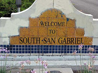
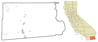
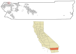
South San Gabriel is a census-designated place (CDP) in Los Angeles County, California, United States. The population was 8,070 at the 2010 census, up from 7,595 at the 2000 census.

West Athens, California Census-designated place in California, United States

West Athens is a census-designated place (CDP) in Los Angeles County, California. The population was 9,393 at the 2020 census. It is an unincorporated community within the 2nd Supervisorial District of Los Angeles County. West Athens is served by the Los Angeles County Sheriff's Department, operating out of the South Los Angeles Station. The approximate boundaries for West Athens are: 87th Street to the north, Vermont Avenue to the east, El Segundo Boulevard to the south, and approximately Western Avenue to Van Ness Avenue to the west. West Athens is predominantly residential, with commercial uses along its main corridors. Los Angeles Southwest Community College lies within the West Athens neighborhood and city limits.

West Rancho Dominguez, California Census designated place in California, United States

West Rancho Dominguez, formerly known as West Compton, is an unincorporated census-designated place (CDP) located in southern Los Angeles County, California. Per the 2020 census, the population was 24,347. The community lies to the west of the city of Compton. The ZIP Codes encompassing the CDP area are 90220 & 90248.

Cherry Valley, California Census-designated place in California, United States

Cherry Valley is a census-designated place (CDP) in Riverside County, California, United States. The population was 6,362 at the 2010 census, up from 5,891 at the 2000 census. It is situated at the most northwestern point of the San Gorgonio Pass.

Corona, California City in California, United States

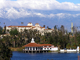
Corona is a city in Riverside County, California, United States. As of the 2020 census, the city had a population of 157,136, up from 152,374 at the 2010 census. The cities of Norco and Riverside lie to the north and northeast, Chino Hills and Yorba Linda to the northwest, Anaheim to the west, Cleveland National Forest and the Santa Ana Mountains to the southwest, and unincorporated Riverside County along the rest of the city's borders. Corona is approximately 48 miles southeast of Downtown Los Angeles and 95 miles (153 km) north-northwest of San Diego.

East Hemet, California Census-designated place in California, United States

East Hemet is a census-designated place (CDP) in Riverside County, California, United States, located east of Hemet. East Hemet is in an unincorporated area outside the city limits of Hemet. The population was 17,418 at the 2010 census, up from 14,823 at the 2000 census.

El Cerrito, Riverside County, California Census-designated place in Riverside County, California, United States

El Cerrito is a census-designated place (CDP) in Riverside County, California, United States. It is an unincorporated area mostly surrounded by the city of Corona. The population was 5,100 at the 2010 census, up from 4,590 at the 2000 census.

Highgrove, California Census-designated place in California, United States

Highgrove is a census-designated place (CDP) and an unincorporated community in Riverside County, California, United States. The population was 3,988 at the 2010 census, up from 3,445 at the 2000 census. The latest 2020 census shows 7,515 total population, an 88.4% increase from last 2010 census, which makes it the fastest-growing location in entire Riverside County.

Homeland, California Census-designated place in California, United States

Homeland is a census-designated place (CDP) in Riverside County, California, United States. The population was 5,969 at the 2010 census, up from 3,710 at the 2000 census.

Mira Loma, California Former census-designated place in California, United States

Mira Loma, now officially part of Jurupa Valley, was a census-designated place (CDP) in Riverside County, California, United States. Its population was 21,930 in the 2010 census, up from 17,617 in the 2000 census.

Norco, California City in California, United States

Norco is a city in Riverside County, California, in the United States. Norco prides itself on being a "horse community," with horse trails, hitching posts, and corrals aplenty, and city ordinances requiring construction to have a "traditional, rustic... Western flavor." It was given the name Horsetown, USA as a result of this.

Pedley, California Former census-designated place in California, United States

Pedley was a census-designated place (CDP) in Riverside County, California, United States. The population was 12,672 at the 2010 census, up from 11,207 at the 2000 census. On July 1, 2011, the CDP became part of the City of Jurupa Valley.

Thousand Palms, California Census-designated place in California, United States

Thousand Palms is a census-designated place (CDP) in the Coachella Valley of Riverside County, California, United States. The population was 7,715 at the 2010 census, up from 5,120 at the 2000 census.

Woodcrest, California Census-designated place in California, United States

Woodcrest is a census-designated place (CDP) in Riverside County, California, United States. The population was 14,347 at the 2010 census, up from 8,342 at the 2000 United States Census. The adjacent city of Riverside lists Woodcrest as an area for potential annexation.

Martinez, Georgia Census-designated place in Georgia, United States

Martinez is a census-designated place (CDP) in Columbia County, Georgia, United States. It is a northwestern suburb of Augusta and is part of the Augusta, Georgia metropolitan area. The population was 35,795 at the 2010 census.

Glendora, New Jersey Census-designated place in New Jersey, United States

Glendora is an unincorporated community and census-designated place (CDP) located within Gloucester Township, in Camden County, New Jersey, United States. As of the 2010 United States Census, the CDP's population was 4,750.

Eastvale, California City in California, United States

Eastvale is a city located in northwestern Riverside County, California, in the Inland Empire region of Southern California. The area transitioned from a dairy farm enclave to a developed community starting in the 1990s and was formally incorporated on October 1, 2010. As of the 2020 census, the city had a population of 69,757. The city's name is derived from "East Vale" as a listed school district in 1893 by the Riverside County Board of Commissioners.

References

  1. "2010 Census U.S. Gazetteer Files – Places – California". United States Census Bureau.
  2. "Home Gardens". Geographic Names Information System . United States Geological Survey . Retrieved November 11, 2014.
  3. "US Gazetteer files: 2010, 2000, and 1990". United States Census Bureau. 2011-02-12. Retrieved 2011-04-23.
  4. "Census of Population and Housing". Census.gov. Retrieved June 4, 2016.
  5. "2010 Census Interactive Population Search: CA - Home Gardens CDP". U.S. Census Bureau. Archived from the original on July 15, 2014. Retrieved July 12, 2014.
  6. "U.S. Census website". United States Census Bureau . Retrieved 2008-01-31.
  7. "California's 42nd Congressional District - Representatives & District Map". Civic Impulse, LLC.