Homeland, California

Last updated

Homeland
Homeland, California.jpg
Homeland, California viewed from Double Butte
Riverside County California Incorporated and Unincorporated areas Homeland Highlighted.svg
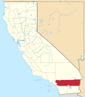
Location in Riverside County and the state of California
Usa edcp location map.svg
Red pog.svg
Homeland
Location in the United States
Coordinates: 33°44′31″N117°06′48″W / 33.74194°N 117.11333°W / 33.74194; -117.11333
Country United States
State California
County Riverside
Area
[1]
  Total4.270 sq mi (11.058 km2)
  Land4.270 sq mi (11.058 km2)
  Water0 sq mi (0 km2)  0%
Elevation
[2]
1,604 ft (489 m)
Population
 (2010)
  Total5,969
  Density1,400/sq mi (540/km2)
Time zone UTC-8 (PST)
  Summer (DST) UTC-7 (PDT)
ZIP code
92548
Area code 951
FIPS code 06-34316
GNIS feature ID 1652723

Homeland is a census-designated place (CDP) in Riverside County, California, United States. The population was 5,969 at the 2010 census, up from 3,710 at the 2000 census.

Contents

Geography

Homeland is located at 33°44′31″N117°6′48″W / 33.74194°N 117.11333°W / 33.74194; -117.11333 (33.741859, -117.113201). [3]

According to the United States Census Bureau, the CDP has a total area of 4.3 square miles (11 km2).

Demographics

Historical population
CensusPop.Note
U.S. Decennial Census [4]

2010

At the 2010 census Homeland had a population of 5,969. The population density was 1,398.0 inhabitants per square mile (539.8/km2). The racial makeup of Homeland was 3,727 (62.4%) White, 130 (2.2%) African American, 85 (1.4%) Native American, 49 (0.8%) Asian, 15 (0.3%) Pacific Islander, 1,673 (28.0%) from other races, and 290 (4.9%) from two or more races. Hispanic or Latino of any race were 3,110 persons (52.1%). [5]

The census reported that 5,959 people (99.8% of the population) lived in households, 10 (0.2%) lived in non-institutionalized group quarters, and no one was institutionalized.

There were 1,964 households, 691 (35.2%) had children under the age of 18 living in them, 948 (48.3%) were opposite-sex married couples living together, 259 (13.2%) had a female householder with no husband present, 144 (7.3%) had a male householder with no wife present. There were 143 (7.3%) unmarried opposite-sex partnerships, and 11 (0.6%) same-sex married couples or partnerships. 494 households (25.2%) were one person and 314 (16.0%) had someone living alone who was 65 or older. The average household size was 3.03. There were 1,351 families (68.8% of households); the average family size was 3.63.

The age distribution was 1,655 people (27.7%) under the age of 18, 545 people (9.1%) aged 18 to 24, 1,362 people (22.8%) aged 25 to 44, 1,354 people (22.7%) aged 45 to 64, and 1,053 people (17.6%) who were 65 or older. The median age was 36.1 years. For every 100 females, there were 102.0 males. For every 100 females age 18 and over, there were 96.1 males.

There were 2,262 housing units at an average density of 529.8 per square mile, of the occupied units 1,330 (67.7%) were owner-occupied and 634 (32.3%) were rented. The homeowner vacancy rate was 5.0%; the rental vacancy rate was 5.5%. 3,554 people (59.5% of the population) lived in owner-occupied housing units and 2,405 people (40.3%) lived in rental housing units.

2000

At the 2000 census there were 3,710 people, 1,572 households, and 985 families in the CDP. The population density was 1,125.9 inhabitants per square mile (434.7/km2). There were 1,812 housing units at an average density of 549.9 per square mile (212.3/km2). The racial makeup of the CDP was 80.0% White, 0.8% Black or African American, 1.1% Native American, 0.5% Asian, 0.1% Pacific Islander, 13.9% from other races, and 3.7% from two or more races. 29.7% of the population were Hispanic or Latino of any race. [6] Of the 1,572 households 21.4% had children under the age of 18 living with them, 48.6% were married couples living together, 9.5% had a female householder with no husband present, and 37.3% were non-families. 33.1% of households were one person and 22.0% were one person aged 65 or older. The average household size was 2.4 and the average family size was 3.0.

The age distribution was 23.0% under the age of 18, 6.7% from 18 to 24, 21.1% from 25 to 44, 18.0% from 45 to 64, and 31.1% 65 or older. The median age was 44 years. For every 100 females, there were 91.7 males. For every 100 females age 18 and over, there were 88.2 males.

The median household income was $20,607 and the median family income was $22,631. Males had a median income of $25,481 versus $20,038 for females. The per capita income for the CDP was $11,338. About 19.6% of families and 26.4% of the population were below the poverty line, including 50.9% of those under age 18 and 6.0% of those age 65 or over.

Politics

In the state legislature Homeland is located in the 37th Senate District, represented by Republican Bill Emmerson, and in the 65th Assembly District, represented by Republican Paul Cook.

In the United States House of Representatives, Homeland is in California's 42nd congressional district , represented by Democrat Robert Garcia. [7]

Related Research Articles

<span class="mw-page-title-main">Meyers Chuck, Wrangell</span> Former census-designated place in Alaska, United States

Meyers Chuck is a former census-designated place in the City and Borough of Wrangell, Alaska, United States. The population was 21 at the 2000 census, at which time it was in the former Prince of Wales-Outer Ketchikan Census Area. On June 1, 2008, it was annexed into the newly created City and Borough of Wrangell, most of whose territory came from the former Wrangell-Petersburg Census Area.

<span class="mw-page-title-main">Dustin Acres, California</span> Census-designated place in California, United States

Dustin Acres is a census-designated place (CDP) in Kern County, California, United States. Dustin Acres is located 6.5 miles (10 km) north-northeast of Taft, at an elevation of 384 feet (117 m). The population was 652 at the 2010 census, up from 585 at the 2000 census.

<span class="mw-page-title-main">Desert View Highlands, California</span> Census designated place in California, United States

Desert View Highlands is a census-designated place (CDP) in Los Angeles County, California, United States. The population was 2,360 at the 2010 census, up from 2,337 at the 2000 census. It is surrounded by the City of Palmdale.

<span class="mw-page-title-main">Romoland, California</span> Census-designated place in California, United States

Romoland is a census-designated place (CDP) in Riverside County, California, United States. The population was 2,005 at the 2020 census, up from 1,684 at the 2010 census.

<span class="mw-page-title-main">Winchester, California</span> Census-designated place in California, United States

Winchester is a census-designated place (CDP) in Riverside County, California, USA. As of the 2010 census, the CDP had a total population of 2,534, up from 2,155 at the 2000 census.

<span class="mw-page-title-main">Hidden Meadows, California</span> Census designated place in California, United States

Hidden Meadows is a census-designated place (CDP) near Escondido in San Diego County, California. The population was 3,485 at the 2010 census, up from 3,463 at the 2000 census.

Grandwood Park is a census-designated place (CDP) in Warren Township, Lake County, Illinois, United States. Per the 2020 census, the population was 5,297.

<span class="mw-page-title-main">Lakeland Village, California</span> Census-designated place in California, United States

Lakeland Village is a census-designated place (CDP) in Riverside County, California, United States. The population was 11,541 at the 2010 census, more than double the 5,626 reported at the 2000 census.

<span class="mw-page-title-main">Brownville, New Jersey</span> Populated place in Middlesex County, New Jersey, US

Brownville is an unincorporated community and census-designated place (CDP) located within Old Bridge Township in Middlesex County in the U.S. state of New Jersey. As of the 2010 United States Census, the CDP's population was 2,383.

<span class="mw-page-title-main">Cranbury (CDP), New Jersey</span> Populated place in Middlesex County, New Jersey, US

Cranbury is an unincorporated community and census-designated place (CDP) located within Cranbury Township, in Middlesex County, in the U.S. state of New Jersey. As of the 2010 United States Census, the CDP's population was 2,181. Despite the similarity in the name of Cranbury Township and the CDP, the two are not one and the same, as had been the case for most paired Township / CDP combinations prior to the 2010 Census, in which the CDP was coextensive with a township of the same name.

<span class="mw-page-title-main">Princeton Meadows, New Jersey</span> Populated place in Middlesex County, New Jersey, US

Princeton Meadows is an unincorporated community and census-designated place (CDP) located within Plainsboro Township, in Middlesex County, in the U.S. state of New Jersey. As of the 2010 United States Census, the CDP's population was 13,834.

<span class="mw-page-title-main">Whittingham, New Jersey</span> Populated place in Middlesex County, New Jersey, US

Whittingham, also known as Greenbriar at Whittingham, is an unincorporated community and census-designated place (CDP) located within Monroe Township, in Middlesex County, in the U.S. state of New Jersey. As of the 2010 United States Census, the CDP's population was 2,476. The area is focused around the age-restricted gated community of Whittingham.

<span class="mw-page-title-main">North Middletown, New Jersey</span> Populated place in Monmouth County, New Jersey, US

North Middletown is an unincorporated community and census-designated place (CDP) within Middletown Township, in Monmouth County, in the U.S. state of New Jersey. As of the 2010 United States Census, the CDP's population was 3,295.

<span class="mw-page-title-main">West Belmar, New Jersey</span> Populated place in Monmouth County, New Jersey, US

West Belmar is an unincorporated community and census-designated place (CDP) within Wall Township, in Monmouth County, in the U.S. state of New Jersey. At the 2010 census, the CDP's population was 2,493.

<span class="mw-page-title-main">Leisure Village East, New Jersey</span> Populated place in Ocean County, New Jersey, US

Leisure Village East is an unincorporated community and census-designated place (CDP) located within Lakewood Township, in Ocean County, in the U.S. state of New Jersey. As of the 2010 United States Census, the CDP's population was 4,217. Leisure Village East is one of several active adult communities bearing similar names. Leisure Village and Leisure Village West are the other two communities nearby.

<span class="mw-page-title-main">Silver Ridge, New Jersey</span> Populated place in Ocean County, New Jersey, US

Silver Ridge is an unincorporated community and census-designated place (CDP) located within Berkeley Township, in Ocean County, in the U.S. state of New Jersey. As of the 2010 United States Census, the CDP's population was 1,133.

<span class="mw-page-title-main">Covedale, Ohio</span> Census-designated place in Ohio, United States

Covedale is a census-designated place (CDP) in Green Township, Hamilton County, Ohio, United States. The population was 6,472 at the 2020 census. The CDP represents the part of the former village of Covedale that was not annexed by the city of Cincinnati in the 1890s.

<span class="mw-page-title-main">Mount Healthy Heights, Ohio</span> Census-designated place in Ohio, United States

Mount Healthy Heights is a census-designated place (CDP) in Hamilton County, Ohio, United States. The population was 2,918 at the 2020 census.

Amity Gardens is a census-designated place (CDP) in Amity Township, Berks County, Pennsylvania. As of the 2020 census, the CDP had a total population of 3,715. The town lends its name to a Fountains of Wayne song.

<span class="mw-page-title-main">Homeland Park, South Carolina</span> CDP in South Carolina, United States

Homeland Park is a census-designated place (CDP) in Anderson County, South Carolina. The population was 6,445 at the 2020 census.

References

  1. "2010 Census U.S. Gazetteer Files – Places – California". United States Census Bureau.
  2. "Homeland". Geographic Names Information System . United States Geological Survey, United States Department of the Interior . Retrieved November 11, 2014.
  3. "US Gazetteer files: 2010, 2000, and 1990". United States Census Bureau. February 12, 2011. Retrieved April 23, 2011.
  4. "Census of Population and Housing". Census.gov. Retrieved June 4, 2016.
  5. "2010 Census Interactive Population Search: CA - Homeland CDP". U.S. Census Bureau. Archived from the original on July 15, 2014. Retrieved July 12, 2014.
  6. "U.S. Census website". United States Census Bureau . Retrieved January 31, 2008.
  7. "California's 42nd Congressional District - Representatives & District Map". Civic Impulse, LLC.