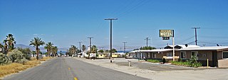
North Shore, California

Last updated

North Shore
2018 North Shore Beach and Yacht Club 01.jpg
USA California location map.svg
Red pog.svg
North Shore
Location within the state of California
Usa edcp location map.svg
Red pog.svg
North Shore
North Shore (the United States)
Coordinates: 33°30′46″N115°55′38″W / 33.51278°N 115.92722°W / 33.51278; -115.92722
Country United States
State California
County Riverside
Area
[1]
  Total11.177 sq mi (28.949 km2)
  Land11.177 sq mi (28.949 km2)
  Water0 sq mi (0 km2)  0%
Elevation
[2]
−69 ft (−21 m)
Population
 (2020)
  Total3,585
  Density320/sq mi (120/km2)
Time zone UTC-8 (Pacific (PST))
  Summer (DST) UTC-7 (PDT)
ZIP codes
92254
Area codes 442/760
GNIS feature ID 2583097

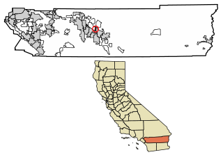
North Shore is a census-designated place in southeastern Riverside County, [2] so named because of its location along the northeast shore of the Salton Sea. It was once a popular vacation destination spot before ever-increasing salinity and pollution of the Salton Sea shut the tourist trade down. North Shore is flanked to the north and south by the Salton Sea State Recreation Area. The population was 3,585 at the 2020 census, up from 3,477 at the 2010 census.

Contents

One building is particularly noteworthy. The North Shore Beach and Yacht Club, an Albert Frey design, opened in 1962 and was in active use until 1984; rising water levels destroyed the jetty in 1981, thereby making it impossible for boats to dock there. As recently as the early 2000s, it was possible to enter the lobby prior to its being boarded up, although stairs leading to the second floor had been removed prior to its abandonment. The lobby was once littered with hotel receipts from the neighboring North Shore Motel (razed in 2008) dating back to the club's last days. The yacht club has been restored under a $3.35 million grant and since 2011 is open to the public as a Community Center and historical landmark. The Salton Sea History Museum was relocated to Mecca, California in February 2012.

North Shore is accessible via State Route 111 at the Imperial County line. The wildlife refuge and campground is a short distance south of the town.

The ZIP Code is 92254, and the community is inside area codes 442 and 760.

History

The vicinity of North Shore was in the area near what was a prehistoric Cocomaricopa trail rest stop on the trail known as "Lone Pam", "Palma Seca", or "Bitter Spring". This stop was located between the Mecca Box Canyon and the Hidden Spring Canyon.

The current town traces its beginnings to 1958, when developers Ray Ryan and Trav Rogers purchased the land on which the town would sit, and began to sell individual parcels in 1960.

Geography

According to the United States Census Bureau, the CDP covers an area of 11.2 square miles (28.9 km2), all of it land.

Demographics

The 2010 United States Census [3] reported that North Shore had a population of 3,477. The population density was 311.1 inhabitants per square mile (120.1/km2). The racial makeup of North Shore was 1,394 (40.1%) White, 33 (0.9%) African American, 26 (0.7%) Native American, 18 (0.5%) Asian, 5 (0.1%) Pacific Islander, 1,884 (54.2%) from other races, and 117 (3.4%) from two or more races. Hispanic or Latino people of any race were 3,313 persons (95.3%).

The Census reported that 3,477 people (100% of the population) lived in households, 0 (0%) lived in non-institutionalized group quarters, and 0 (0%) were institutionalized.

There were 750 households, out of which 542 (72.3%) had children under the age of 18 living in them, 550 (73.3%) were opposite-sex married couples living together, 83 (11.1%) had a female householder with no husband present, 52 (6.9%) had a male householder with no wife present. There were 47 (6.3%) unmarried opposite-sex partnerships, and 10 (1.3%) same-sex married couples or partnerships. 47 households (6.3%) were made up of individuals, and 13 (1.7%) had someone living alone who was 65 years of age or older. The average household size was 4.64. There were 685 families (91.3% of all households); the average family size was 4.83.

The population was spread out, with 1,388 people (39.9%) under the age of 18, 418 people (12.0%) aged 18 to 24, 918 people (26.4%) aged 25 to 44, 621 people (17.9%) aged 45 to 64, and 132 people (3.8%) who were 65 years of age or older. The median age was 23.6 years. For every 100 females, there were 110.6 males. For every 100 females age 18 and over, there were 109.9 males.

There were 854 housing units at an average density of 76.4 per square mile (29.5/km2), of which 606 (80.8%) were owner-occupied, and 144 (19.2%) were occupied by renters. The homeowner vacancy rate was 3.0%; the rental vacancy rate was 12.5%. 2,826 people (81.3% of the population) lived in owner-occupied housing units and 651 people (18.7%) lived in rental housing units.

See also

Related Research Articles

<span class="mw-page-title-main">Desert Shores, California</span> Census-designated place in California, United States

Desert Shores is a census-designated place (CDP) in Imperial County, California, US. It is part of the El Centro Metropolitan Statistical Area.

<span class="mw-page-title-main">Heber, California</span> American census-designated place

Heber is a census-designated place (CDP) in Imperial County, California. Heber is located 4.5 miles (7 km) north-northwest of Calexico. The population was 4,275 at the 2010 census, up from 2,566 in 2000.

<span class="mw-page-title-main">Niland, California</span> Census-designated place in California, United States

Niland is a census-designated place (CDP) in Imperial County, California, United States. The town is located 8 miles (13 km) north of Calipatria, 2 miles (3.2 km) southeast of the Salton Sea. The population was 1,006 at the 2010 census, down from 1,143 in 2000. The 2020 census reported Niland's population at 756. By June 2020, however, after a major fire, the estimated population had diminished to 500. It is part of the El Centro, California Metropolitan Statistical Area.
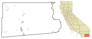
<span class="mw-page-title-main">Palo Verde, California</span> Census-designated place in California, United States

Palo Verde is a census-designated place (CDP) in Imperial County, California. Its name comes from the native desert tree, Palo Verde, which in turn takes its name from the Spanish for stick (palo) and green (verde), sharing its name with the Palo Verde Valley, the valley it is located.

<span class="mw-page-title-main">Salton City, California</span> Census designated place in California, United States

Salton City is a census-designated place (CDP) in Imperial County, California. It is the largest Imperial County development on the Salton Sea coast. It is part of the El Centro, California Metropolitan Statistical Area. The population was 3,763 at the 2010 census, up from 978 in 2000. The reported population for 2020 was 5,155.
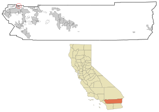
<span class="mw-page-title-main">Highgrove, California</span> Census-designated place in California, United States

Highgrove is a census-designated place (CDP) and an unincorporated community in Riverside County, California, United States. The population was 3,988 at the 2010 census, up from 3,445 at the 2000 census. The latest 2020 census shows 7,515 total population, an 88.4% increase from last 2010 census, which makes it the fastest-growing location in entire Riverside County. The city of Riverside, California has plans to annex Highgrove in the near future.

<span class="mw-page-title-main">Home Gardens, California</span> Census-designated place in California, United States

Home Gardens is a census-designated place (CDP) in Riverside County, California, United States. It is within the City of Corona's sphere of influence. The population was 11,203 at the 2020 census, down from 11,507 at the 2010 census.

<span class="mw-page-title-main">Mecca, California</span> Census designated place in California, United States

Mecca is an unincorporated community located in Riverside County, California, United States. The desert community lies on the north shore of the Salton Sea in the eastern Coachella Valley and is surrounded by agricultural land.

<span class="mw-page-title-main">Woodcrest, California</span> Census-designated place in California, United States

Woodcrest is a census-designated place (CDP) in Riverside County, California, United States. The population was 14,347 at the 2010 census, up from 8,342 at the 2000 United States Census. The adjacent city of Riverside lists Woodcrest as an area for potential annexation.

<span class="mw-page-title-main">Salton Sea Beach, California</span> Census-designated place in California, United States

Salton Sea Beach is a census-designated place (CDP) in Imperial County, California, located 2.5 miles (4 km) southeast of Desert Shores. The population was 508 at the 2020 census, up from 422 at the 2010 census, up from 392 at the 2000 census. It is part of the El Centro, California Metropolitan Statistical Area. It was the location of the Naval Auxiliary Air Station Salton Sea.

<span class="mw-page-title-main">Thermal, California</span> Resort community in Riverside County, southern California, United States

Thermal is an unincorporated community within the Coachella Valley in Riverside County, California, United States, located approximately 25 miles (40 km) southeast of Palm Springs and about 9.5 miles (15.3 km) north of the Salton Sea. The community's elevation is 138 feet (42 m) below mean sea level. It is served by area codes 760 and 442 and is in ZIP Code 92274. The population was 2,865 at the 2010 census. For statistical purposes, the United States Census Bureau has defined Thermal a census-designated place (CDP), which does not precisely correspond to the historical community.
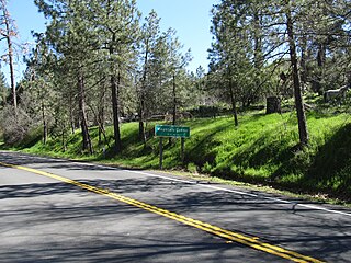
<span class="mw-page-title-main">Mountain Center, California</span> Place in California, United States

Mountain Center is an unincorporated community and census-designated place in the San Jacinto Mountains, within western central Riverside County, California.

<span class="mw-page-title-main">Coronita, California</span> Census-designated place in California, United States

Coronita is a census-designated place in Riverside County, California. Coronita sits at an elevation of 630 feet (190 m). The 2010 United States census reported Coronita's population was 2,608.
<span class="mw-page-title-main">Desert Palms, California</span> Census-designated place in California, United States

Desert Palms is a census-designated place in the Coachella Valley of eastern Riverside County, southern California.

<span class="mw-page-title-main">Indio Hills, California</span> Census-designated place in California, United States

Indio Hills is a census-designated place in Riverside County, California. Indio Hills sits at an elevation of 1,017 feet (310 m). The 2010 United States census reported Indio Hills's population was 972.

<span class="mw-page-title-main">Lake Mathews, California</span> Census-designated place in California, United States

Lake Mathews is a census-designated place in Riverside County, California. Lake Mathews sits at an elevation of 1,775 feet (541 m). The 2010 United States census reported Lake Mathews's population was 5,890.

<span class="mw-page-title-main">Lake Riverside, California</span> Census-designated place in California, United States

Lake Riverside is a census-designated place in the south western part of Riverside County, California. Lake Riverside sits at an elevation of 3,379 feet (1,030 m). The 2010 United States census reported Lake Riverside's population was 1,173. The community is named after the man-made Lake that the community surrounds.

Meadowbrook is a census-designated place in Riverside County, California. Meadowbrook sits at an elevation of 1,621 feet (494 m). The 2020 United States census reported Meadowbrook's population was 3,142, down from 3,185 at the 2010 census.

Mesa Verde is a census-designated place in Riverside County, California. Mesa Verde sits at an elevation of 390 feet (120 m). The 2010 United States census reported Mesa Verde's population was 1,023.

Oasis is a census-designated place in the California county of Riverside. Oasis sits at an elevation of 141 feet (43 m) below sea level. The 2020 United States census reported Oasis's population was 4,468, down from 6,890 in 2010.

References

  1. U.S. Census Archived 2012-07-02 at the Wayback Machine
  2. 1 2 U.S. Geological Survey Geographic Names Information System: North Shore, California
  3. "2010 Census Interactive Population Search: CA - North Shore CDP". U.S. Census Bureau. Archived from the original on July 15, 2014. Retrieved July 12, 2014.

Further reading