Rolling Hills Estates, California

Last updated

Rolling Hills Estates, California
Palos Verdes Street Fair & Music Festival 2011.jpg
Promenade on the Peninsula mall, Rolling Hills Estates
Rolling Hills Estates seal.jpg
LA County Incorporated Areas Rolling Hills Estates highlighted.svg
Location of Rolling Hills Estates in Los Angeles County, California
Usa edcp relief location map.png
Red pog.svg
Rolling Hills Estates, California
Location in the United States
Coordinates: 33°46′25″N118°21′39″W / 33.77361°N 118.36083°W / 33.77361; -118.36083
Country Flag of the United States.svg United States
State Flag of California.svg  California
County Los Angeles
Incorporated September 18, 1957 [1]
Government
  Type Council-Manager
   Mayor Frank V. Zerunyan
Area
[2]
  Total3.63 sq mi (9.41 km2)
  Land3.60 sq mi (9.32 km2)
  Water0.04 sq mi (0.09 km2)  1.22%
Elevation
[3]
469 ft (143 m)
Population
 (2010)
  Total8,067
  Estimate 
(2019) [4]
8,058
  Density2,239.58/sq mi (864.78/km2)
Time zone UTC−8 (PST)
  Summer (DST) UTC−7 (PDT)
ZIP Codes
90274–90275 [5]
Area code 310
FIPS code 06-62644
GNIS feature IDs 1661326, 2410987
Website www.ci.rolling-hills-estates.ca.us

Rolling Hills Estates is a city in Los Angeles County, California, United States. On the northern side of the Palos Verdes Peninsula, facing Torrance, Rolling Hills Estates is mostly residential. Incorporated in 1957, Rolling Hills Estates has many horse paths. The population was 8,067 at the 2010 census, up from 7,676 at the 2000 census. In 2018, the population rose to 8,141, and the 2020 census counted 8,280 residents.

Contents

History

Manuel Dominguez, a signer of the Californian Constitution and owner of Rancho San Pedro, which included all of Palos Verdes Peninsula. Manuel Dominguez of California.jpg
Manuel Domínguez, a signer of the Californian Constitution and owner of Rancho San Pedro, which included all of Palos Verdes Peninsula.

Rolling Hills Estates was historically part of Rancho San Pedro. The area eventually became known as Rancho El Elastico prior to incorporating as Rolling Hills Estates. [6] It was Los Angeles County's 60th municipality, incorporated on September 18, 1957. [1]

On July 11, 2023, a landslide destroyed several homes in Rolling Hills Estates. [7]

Geography

Rolling Hills Estates is located on the Palos Verdes Peninsula.

According to the United States Census Bureau, the city has a total area of 9.359 square kilometers (3.6 sq mi), 0.115 km2 (0.04 sq mi) of it (1.22%) is water.

Demographics

Historical population
CensusPop.Note
1960 3,941
1970 6,73570.9%
1980 7,70114.3%
1990 7,7891.1%
2000 7,676−1.5%
2010 8,0675.1%
2020 8,2802.6%
2022 (est.)8,018 [4] −3.2%
U.S. Decennial Census [8]

2010

The 2010 US Census [9] reported that Rolling Hills Estates had a population of 8,067. The population density was 2,232.4 inhabitants per square mile (861.9/km2). The racial makeup of Rolling Hills Estates was 5,463 (67.7%) White (63.6% Non-Hispanic White), [10] 109 (1.4%) African American, 19 (0.2%) Native American, 2,007 (24.9%) Asian, 8 (0.1%) Pacific Islander, 120 (1.5%) from other races, and 341 (4.2%) from two or more races. Hispanic or Latino of any race were 499 people (6.2%).

The whole population lived in households, no one lived in non-institutionalized group quarters and no one was institutionalized.

There were 2,965 households, 1,023 (34.5%) had children under the age of 18 living in them, 2,100 (70.8%) were opposite-sex married couples living together, 192 (6.5%) had a female householder with no husband present, 83 (2.8%) had a male householder with no wife present. There were 45 (1.5%) unmarried opposite-sex partnerships, and 23 (0.8%) same-sex married couples or partnerships. 512 households (17.3%) were one person and 353 (11.9%) had someone living alone who was 65 or older. The average household size was 2.72. There were 2,375 families (80.1% of households); the average family size was 3.07.

The age distribution was 1,890 people (23.4%) under the age of 18, 417 people (5.2%) aged 18 to 24, 1,211 people (15.0%) aged 25 to 44, 2,680 people (33.2%) aged 45 to 64, and 1,869 people (23.2%) who were 65 or older. The median age was 48.5 years. For every 100 females, there were 93.0 males. For every 100 females age 18 and over, there were 89.2 males.

There were 3,100 housing units at an average density of 857.9 per square mile, of the occupied units 2,714 (91.5%) were owner-occupied and 251 (8.5%) were rented. The homeowner vacancy rate was 1.8%; the rental vacancy rate was 4.9%. 7,302 people (90.5% of the population) lived in owner-occupied housing units and 765 people (9.5%) lived in rental housing units.

According to the 2010 United States Census, Rolling Hills Estates had a median household income of $143,958, with 3.5% of the population living below the federal poverty line. [10]

2000

At the 2000 census there were 7,676 people in 2,806 households, including 2,334 families, in the city. The population density was 2,139.1 inhabitants per square mile (825.9 inhabitants/km2). There were 2,880 housing units at an average density of 802.6 per square mile (309.9/km2). The racial makeup of the city was 73.9% White, 20.3% Asian, 1.2% African American, 0.3% Native American, 0.1% Pacific Islander, 1.0% from other races, and 3.3% from two or more races. Hispanic or Latino of any race were 4.8%. [11]

Of the 2,806 households 33.7% had children under the age of 18 living with them, 74.6% were married couples living together, 6.0% had a female householder with no husband present, and 16.8% were non-families. 15.0% of households were one person and 7.9% were one person aged 65 or older. The average household size was 2.73 and the average family size was 3.02.

The age distribution was 24.3% under the age of 18, 4.7% from 18 to 24, 21.2% from 25 to 44, 30.9% from 45 to 64, and 18.9% 65 or older. The median age was 45 years. For every 100 females, there were 94.4 males. For every 100 females age 18 and over, there were 91.3 males.

The median household income was $109,010 and the median family income was $119,974. Males had a median income of $100,000+ versus $52,295 for females. The per capita income for the city was $51,849. About 1.1% of families and 1.7% of the population were below the poverty line, including 2.6% of those under age 18 and none of those age 65 or over.

Ethnic groups

By 1992 many wealthier Korean Americans moved to the Palos Verdes Peninsula. Rolling Hills Estates was among five cities in the South Bay that had the largest increases in ethnic Koreans from 1980 to 1990. [12] In 1990, 200 ethnic Koreans lived in Rolling Hills Estates, a 160% increase from the 1980 figure of 77 ethnic Koreans. [13]

Education

Rolling Hills Country Day School is a private school that serves grades K–8. Chadwick School, a well-known K–12 private school, is located on Academy Hill, an unincorporated neighborhood administered by the county, but is actually just blocks away from the Rolling Hills Estates city hall and serves the entire Palos Verdes Peninsula area, including Rolling Hills Estates.

The Palos Verdes Library District operates the Peninsula Center Library in Rolling Hills Estates. [14]

Nishiyamato Academy of California opened in April 1993. It was originally located in the former Dapplegray School building in Rolling Hills Estates. It was founded by Ryotaro Tanose, a Japanese Diet member, as a sister school of the Nishiyamato Gakuen Junior High School and High School in Kawai, Nara Prefecture, Japan. [15] Currently it is located in Lomita. [16]

Economy

Top employers

According to the city's 2009 Comprehensive Annual Financial Report, [17] the top employers in the city are:

#Employer# of Employees
1 Palos Verdes Peninsula Unified School District
2 Equinox Fitness 115
3 Pavilions 100
4Rolling Hills Country Club100
5 Rolling Hills Covenant Church 95
6 Bristol Farms 85
7Marmalade Café69
8 CVS/pharmacy 65
9Red Onion60
10Spectrum Athletic Clubs60

Retail

The city contains The Promenade on the Peninsula mall, originally an enclosed regional mall with two department store anchors, May Company California and Bullocks Wilshire, as well as the Peninsula Center, which originally had a Buffums department store. [18]

Representation

In the California State Legislature, Rolling Hills Estates is in the 26th Senate District , represented by Democrat María Elena Durazo, and in the 66th Assembly District , represented by Democrat Al Muratsuchi. [19]

In the United States House of Representatives, Rolling Hills Estates is in California's 36th congressional district , represented by Democrat Ted Lieu. [20] [21] [22]

The Los Angeles County Sheriff's Department (LASD) operates the Lomita Station in Lomita, serving Rolling Hills Estates. [23]

The Los Angeles County Department of Health Services operates the Torrance Health Center in Harbor Gateway, Los Angeles, near Torrance and serving Rolling Hills Estates. [24]

Related Research Articles

<span class="mw-page-title-main">Los Angeles Community College District</span> Community college district in Los Angeles, California, United States

The Los Angeles Community College District (LACCD) is the community college district serving Los Angeles, California, and some of its neighboring cities and certain unincorporated areas of Los Angeles County. Its headquarters are in Downtown Los Angeles. Over the past seventy-seven years, LACCD has served as educator to more than three million students. In addition to typical college aged students, the LACCD also serves adults of all ages: over half of all LACCD students are older than 25 years of age, and more than a quarter are 35 or older. LACCD educates almost three times as many Latino students and nearly four times as many African-American students as all of the University of California campuses combined. Eighty percent of LACCD students are from underserved populations. The Los Angeles Community College District is the largest community college district in the United States and is one of the largest in the world. The nine colleges within the district offer educational opportunities to students in Los Angeles. It serves students located in the Alhambra, Beverly Hills, Burbank, Culver City, Garvey, Las Virgenes, Los Angeles, Montebello, Palos Verdes and San Gabriel school districts. The district covers the Los Angeles city limits, San Fernando, Calabasas, Agoura Hills, Hidden Hills, Burbank, West Hollywood, Beverly Hills, Culver City, Alhambra, Monterey Park, San Gabriel, Rosemead, Montebello, Commerce, Vernon, Huntington Park, Bell, Cudahy, Bell Gardens, South Gate, Gardena, Carson, Lomita, Palos Verdes Estates, Rolling Hills, Rancho Palos Verdes, and numerous unincorporated communities, including East Los Angeles, Florence-Firestone, Athens, and Walnut Park. The LACCD consists of nine colleges and covers an area of more than 882 square miles (2,280 km2).

<span class="mw-page-title-main">South Bay (Los Angeles County)</span> Region in California, United States

The South Bay is a region of the Los Angeles metropolitan area, located in the southwest corner of Los Angeles County. The name stems from its geographic location stretching along the southern shore of Santa Monica Bay. The South Bay contains sixteen cities plus portions of the City of Los Angeles and unincorporated portions of the county. The area is bounded by the Pacific Ocean on the south and west and generally by the City of Los Angeles on the north and east.

<span class="mw-page-title-main">Palo Verde, California</span> Census-designated place in California, United States

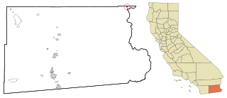
Palo Verde is a census-designated place (CDP) in Imperial County, California. Its name comes from the native desert tree, Palo Verde, which in turn takes its name from the Spanish for stick (palo) and green (verde), sharing its name with the Palo Verde Valley, the valley it is located.

<span class="mw-page-title-main">Lomita, California</span> City in California, United States

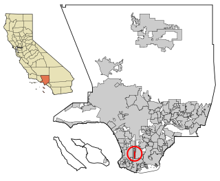
Lomita is a city in Los Angeles County, California, United States. The population was 20,921 at the 2020 census, up slightly from 20,256 at the 2010 census.

<span class="mw-page-title-main">Palos Verdes Estates, California</span> City in California, United States

Palos Verdes Estates is a coastal city in Los Angeles County, California, United States, situated on the Palos Verdes Peninsula and neighboring Rancho Palos Verdes and Rolling Hills Estates. The city was master-planned by the noted American landscape architect and planner Frederick Law Olmsted Jr. The city is located along the Southern California coastline of the Pacific Ocean.

<span class="mw-page-title-main">Rancho Palos Verdes, California</span> City in California, United States

Rancho Palos Verdes is a coastal city located in south Los Angeles County, California. Incorporated on September 7, 1973, the city has a population of 42,287 as reported in the 2020 United States Census. Rancho Palos Verdes sits atop the bluffs of the Palos Verdes Peninsula, neighboring three other cities in the Palos Verdes Hills, namely Palos Verdes Estates, Rolling Hills, and Rolling Hills Estates. It is known for its extensive hiking trails, school district, and high property values.

<span class="mw-page-title-main">Redondo Beach, California</span> City in California, United States

Redondo Beach is a coastal city in Los Angeles County, California, United States, located in the South Bay region of the Greater Los Angeles area. It is one of three adjacent beach cities along the southern portion of Santa Monica Bay. The population was 71,576 at the 2020 census, up from 66,748 at the 2010 census.

<span class="mw-page-title-main">Rolling Hills, California</span> City in California, United States

Rolling Hills is a city on the Palos Verdes Peninsula, in Los Angeles County, California, United States. Rolling Hills is a gated community with private roads with three entry gates. Homes are single-story 19th century California ranch or Spanish haciendas exemplified by architect Wallace Neff. Incorporated in 1957, Rolling Hills maintains a rural and equestrian character, with no traffic lights, multi-acre lots with ample space between homes, and wide equestrian paths along streets and property lines.

<span class="mw-page-title-main">Torrance, California</span> City in Los Angeles County, California, United States

Torrance is a coastal city in the Los Angeles metropolitan area, located in southwest Los Angeles County, California, United States. The city is part of what is known as the South Bay region of the metropolitan area. A small section of the city, 1.5 miles (2.4 km), abuts the Pacific Ocean. Torrance has a moderate year-round climate with average rainfall of 12 inches (300 mm) per year. Torrance was incorporated in 1921, and at the 2020 census had a population of 147,067 residents. Torrance has a beachfront and has 30 parks located around the city. It is also the birthplace of the American Youth Soccer Organization (AYSO).

<span class="mw-page-title-main">West Carson, California</span> Unincorporated community in California, United States

West Carson is an unincorporated community in the South Bay region of Los Angeles County, California. The population was 22,870 at the 2020 census. For statistical purposes, the United States Census Bureau has defined West Carson as a census-designated place (CDP).

<span class="mw-page-title-main">Blythe, California</span> City in California, United States

Blythe is a city in eastern Riverside County, California, United States. It is in the Palo Verde Valley of the Lower Colorado River Valley region, an agricultural area and part of the Colorado Desert along the Colorado River, approximately 224 miles (360 km) east of Los Angeles and 150 miles (240 km) west of Phoenix. Blythe was named after Thomas Henry Blythe, a San Francisco financier, who established primary water rights to the Colorado River in the region in 1877. The city was incorporated on July 21, 1916. The population was 18,317 at the 2020 census.

<span class="mw-page-title-main">San Pedro, Los Angeles</span> Neighborhood of Los Angeles in California, United States

San Pedro is a neighborhood located within the South Bay and Harbor region of the City of Los Angeles, California, United States. Formerly a separate city, it consolidated with Los Angeles in 1909. The Port of Los Angeles, a major international seaport, is partially located within San Pedro. The district has grown from being dominated by the fishing industry, to a working-class community within the city of Los Angeles, to an increasingly dense and diverse community.

<span class="mw-page-title-main">Palos Verdes Peninsula</span> Sub-region of the Los Angeles metropolitan area in California, United States

The Palos Verdes Peninsula is a peninsula and sub-region of the Los Angeles metropolitan area, located within southwestern Los Angeles County in the U.S. state of California. Located in the South Bay region, the peninsula contains a group of cities in the Palos Verdes Hills, including Palos Verdes Estates, Rancho Palos Verdes, Rolling Hills and Rolling Hills Estates, as well as the unincorporated community of Westfield/Academy Hill. The South Bay city of Torrance borders the peninsula on the north, the Pacific Ocean is on the west and south, and the Port of Los Angeles is east. As of the 2010 Census, the population of the Palos Verdes Peninsula is 65,008.

Palos Verdes Peninsula Unified School District (PVPUSD) is a school district headquartered in Palos Verdes Estates, California with facilities in all four cities of the Palos Verdes Peninsula.

<span class="mw-page-title-main">California's 36th congressional district</span> U.S. House district for California

California's 36th congressional district is a U.S. congressional district in California. The 36th district is located primarily in the South Bay and Westside regions of Los Angeles. It takes in the cities of Beverly Hills, Santa Monica, the west side of Culver City, Hermosa Beach, Rancho Palos Verdes, Redondo Beach, Palos Verdes Estates, Rolling Hills Estates, El Segundo, Lomita, Manhattan Beach, and the west side of Torrance, as well as the Los Angeles neighborhoods of Venice, Playa del Rey, Palms, Cheviot Hills, Westwood Village, West Los Angeles, Mar Vista, Westchester, Marina Peninsula, and west side Harbor City.

<span class="mw-page-title-main">Harbor City, Los Angeles</span> Neighborhood of Los Angeles in California, United States

Harbor City is a highly diverse neighborhood in the South Bay and Harbor region of Los Angeles, California, with a population upward of 36,000 people. Originally part of the Rancho San Pedro Spanish land grant, the 2.58-square-mile (6.7 km2) Harbor City was brought into Los Angeles as a preliminary step in the larger city's consolidation with the port cities of Wilmington and San Pedro.

Municipal Area Express provided mass transportation in suburban Los Angeles. The purpose of the system was to provide rush hour commuter service between the city's southwestern suburbs and the major places of employment near Los Angeles International Airport. Three routes each provided service four times per weekday. Service was discontinued on 28 June 2013.

The Palos Verdes Peninsula Transit Authority is the primary provider of mass transportation in the Los Angeles suburbs of Rancho Palos Verdes, Palos Verdes Estates, Rolling Hills, and Rolling Hills Estates, California. Six color routes provide local service, while Routes 225 and 226 both allow for connections in Torrance and Route 226 also continues into the Los Angeles district of San Pedro.

The International Bilingual School, later International School of Los Angeles (ISLA), was an international bilingual day school in Palos Verdes Estates, California, in the Los Angeles metropolitan area, serving students in Kindergarten through grade 9. It was founded by Tadao Hara. The school later relocated to nearby Torrance.

<span class="mw-page-title-main">History of the Japanese in Los Angeles</span>

There is a Japanese American and a Japanese national population in Los Angeles and Greater Los Angeles. Japanese people began arriving in the United States in the late 1800s and have settled in places like Hawaii, Alaska, and California. Los Angeles has become a hub for people of Japanese descent for generations in areas like Little Tokyo and Boyle Heights. As of 2017, Los Angeles has a Japanese and Japanese American population of around 110,000 people.

References

  1. 1 2 "California Cities by Incorporation Date". California Association of Local Agency Formation Commissions. Archived from the original (Word) on November 3, 2014. Retrieved August 25, 2014.
  2. "2019 U.S. Gazetteer Files". United States Census Bureau. Retrieved July 1, 2020.
  3. "Rolling Hills Estates". Geographic Names Information System . United States Geological Survey, United States Department of the Interior . Retrieved October 11, 2014.
  4. 1 2 "Population and Housing Unit Estimates". United States Census Bureau. May 24, 2020. Retrieved May 27, 2020.
  5. "USPS - ZIP Code Lookup - Find a ZIP+ 4 Code By City Results" . Retrieved January 18, 2007.
  6. "City of Rolling Hills Estates, Los Angeles County, California". www.laalmanac.com. Retrieved March 2, 2021.
  7. Toohey, Grace; Solis, Nathan (July 11, 2023). "'Astonishing' collapse sends Rolling Hills Estates homes toward canyon floor". Los Angeles Times. Retrieved July 11, 2023.
  8. "Census of Population and Housing". Census.gov. Retrieved June 4, 2015.
  9. "2010 Census Interactive Population Search: CA - Rolling Hills Estates city". U.S. Census Bureau. Archived from the original on July 15, 2014. Retrieved July 12, 2014.
  10. 1 2 "Data". quickfacts.census.gov.
  11. "U.S. Census website". United States Census Bureau . Retrieved January 31, 2008.
  12. Millacan, Anthony. "Presence of Koreans Reshaping the Region : Immigrants: A developing Koreatown in Gardena symbolizes changes a growing population is bringing to the area." (Archive) Los Angeles Times . February 2, 1992. Metro; PART-B; Zones Desk p. 3. p. 1 of 2. Retrieved on August 30, 2013.
  13. Millacan, Anthony. "Presence of Koreans Reshaping the Region : Immigrants: A developing Koreatown in Gardena symbolizes changes a growing population is bringing to the area." (Archive) Los Angeles Times . February 2, 1992. Metro; PART-B; Zones Desk p. 3. p. 2 of 2. Retrieved on August 30, 2013.
  14. "Hours & Locations." Palos Verdes Library District. Retrieved on March 28, 2010.
  15. Hillinger, Charles. "Students Get a Japanese Education at 2 Palos Verdes Schools." Los Angeles Times . September 29, 1994. Retrieved on March 6, 2014.
  16. "平日校 学園概要" (Archive) Nishiyamato Academy of California. Retrieved on March 6, 2014. "2458 Lomita Blvd., Lomita CA 90717"
  17. "City of Rolling Hills Estates CAFR".
  18. "Rebranding becomes a way of life at Rolling Hills Estates mall | South Bay History". blogs.dailybreeze.com.
  19. "Statewide Database". UC Regents. Archived from the original on February 1, 2015. Retrieved November 28, 2014.
  20. "California's 36th Congressional District - Representatives & District Map". Civic Impulse, LLC.
  21. "Our District". Congressman Ted Lieu. December 4, 2012. Retrieved February 27, 2023.
  22. "California's 36th Congressional District - CA-36 Representatives & District Map". GovTrack.us. Retrieved February 27, 2023.
  23. "Lomita Station Archived 2010-01-23 at the Wayback Machine ." Los Angeles County Sheriff's Department. Retrieved on January 21, 2010.
  24. "Torrance Health Center." Los Angeles County Department of Health Services. Retrieved on March 18, 2010.