Lake Hughes, California

Last updated

Lake Hughes, California
Lake Hughes-kmf.JPG
USA California location map.svg
Red pog.svg
Lake Hughes
Location within the State of California
Usa edcp location map.svg
Red pog.svg
Lake Hughes
Lake Hughes (the United States)
Coordinates: 34°40′37″N118°26′42″W / 34.677°N 118.445°W / 34.677; -118.445
Country Flag of the United States.svg United States
State Flag of California.svg  California
County Flag of Los Angeles County, California.svg Los Angeles
Settled1873
Area
[1]
  Total10.687 sq mi (27.680 km2)
  Land10.623 sq mi (27.514 km2)
  Water0.064 sq mi (0.166 km2)  0.60%
Elevation
[2]
3,228 ft (984 m)
Population
  Total649
  Density61/sq mi (23/km2)
Time zone UTC-8 (Pacific)
  Summer (DST) UTC-7 (PDT)
ZIP codes
93532
Area code 661
FIPS code 06-39556
GNIS feature IDs 1660877, 2583050
U.S. Geological Survey Geographic Names Information System: Lake Hughes, California; U.S. Geological Survey Geographic Names Information System: Lake Hughes, California

Lake Hughes is an unincorporated community in northern Los Angeles County, California. It is in the Sierra Pelona Mountains, northwest of Palmdale and north of the Santa Clarita Valley, in the Angeles National Forest. It is on the sag pond waters of Lake Hughes and Elizabeth Lake. The community is rural in character, with a population of 649 in 2010, but also has a strong recreational element centered on the three lakes in the vicinity. The community of Elizabeth Lake is located just east of Lake Hughes, sharing the same ZIP code.

Contents

History

Nearby Elizabeth Lake, known then as La Laguna de Chico Lopez, was a watering locale on Spanish colonial and Mexican El Camino Viejo in Alta California and the Gold Rush era Stockton – Los Angeles Road. From 1858 to 1861, Lake Hughes was on the route of the Butterfield Overland Mail, between the Widow Smith's Station and Mud Spring stage stops. The lake area was to the west of Rancho La Liebre, an 1846 Mexican land grant now part of Tejon Ranch.

Lake Hughes was named for Judge Griffith (Patrick) Hughes, who homesteaded the area around the turn of the 20th century. [3] Settlers were drawn to the area because water was more plentiful than in the drier Antelope Valley.

In 1907 William Mulholland, superintendent of the Los Angeles Department of Water and Power, started work on the Elizabeth Lake Tunnel for transporting water in the Los Angeles Aqueduct from Owens Valley to Los Angeles. Less than a half a mile east of Lake Hughes, the five-mile-long (8 km) tunnel is 285 feet (87 m) under the valley floor. The tunnel was driven from both ends. The north portal is at Fairmont Reservoir and the south in Bear Canyon (now Portal Canyon) just off of Green Valley. This 11-foot-wide (3.4 m) tunnel was driven 27,000 ft (8.2 km) through solid rock and met in the center within 1+12 inches (3.8 cm) in line and 58 inch (1.6 cm) in depth. Work was around the clock and averaged about 11 feet (3.4 m) per day. The Elizabeth Lake Tunnel was the largest single construction project on the Los Angeles Aqueduct and set speed records in its day.

C.A. Austin promoted Lake Hughes as a summer resort in 1924, as a "fine mountain resort on the edge of Antelope Valley." [4]

The 2020 Lake fire was also first reported here.

Geography

Lake Hughes is generally centered on the intersection of Elizabeth Lake Road and Lake Hughes Road, both of which are county highways. Hughes Lake and Munz Lakes are located within the community. In addition, a third lake, Lake Elizabeth is located just to the east within the community of Elizabeth Lake. Lakes Hughes and Lake Elizabeth are in the canyons along the San Andreas Fault. Both lakes periodically dry up depending on rainfall cycles. Lake Hughes was previously known as West Elizabeth Lake. [5] [6]

Climate

Lake Hughes has a warm-summer Mediterranean climate. Its location in the San Gabriel Mountains allows for more moderate and less extreme temperatures and more precipitation in contrast to the neighboring Antelope Valley, which is the west end of the Mojave Desert. Summers are warm to hot and dry with highs normally at 90 °F and lows in the mid 60s. Winters are cool and wet with temperatures commonly reaching below 32 °F with highs in the low 50s . Lake Hughes mainly receives precipitation between October and April with an average of 18 inches per year while snowfall amounts are very small but not unseen, as the seasonal average is around 5 inches.

Climate data for Lake Hughes, California
MonthJanFebMarAprMayJunJulAugSepOctNovDecYear
Record high °F (°C)83
(28)
84
(29)
90
(32)
101
(38)
102
(39)
108
(42)
116
(47)
114
(46)
113
(45)
102
(39)
90
(32)
84
(29)
116
(47)
Mean daily maximum °F (°C)53
(12)
57
(14)
60
(16)
66
(19)
74
(23)
83
(28)
90
(32)
90
(32)
85
(29)
74
(23)
62
(17)
54
(12)
71
(22)
Mean daily minimum °F (°C)35
(2)
38
(3)
40
(4)
43
(6)
50
(10)
58
(14)
65
(18)
64
(18)
59
(15)
50
(10)
41
(5)
35
(2)
48
(9)
Record low °F (°C)13
(−11)
20
(−7)
23
(−5)
21
(−6)
31
(−1)
36
(2)
40
(4)
43
(6)
35
(2)
28
(−2)
22
(−6)
17
(−8)
13
(−11)
Average precipitation inches (mm)3.64
(92)
4.30
(109)
3.50
(89)
1.00
(25)
0.43
(11)
0.08
(2.0)
0.07
(1.8)
0.15
(3.8)
0.32
(8.1)
0.47
(12)
1.18
(30)
2.43
(62)
17.56
(446)
Average snowfall inches (cm)1.5
(3.8)
1.0
(2.5)
0.2
(0.51)
0
(0)
0
(0)
0
(0)
0
(0)
0
(0)
0
(0)
0
(0)
0
(0)
2.5
(6.4)
5.2
(13.21)
Source: [7]

Government and associations

Rock Inn, Lake Hughes. A notable water hole since 1929. Rock Inn, Lake Hughes.jpg
Rock Inn, Lake Hughes. A notable water hole since 1929.

The Los Angeles County Sheriff's Department (LASD) operates the Palmdale Station in Palmdale, serving Lake Hughes. [8]

Lake Hughes has its own community town council, The Lakes Town Council, which meets twice a month at the Lakes Community Center. The council helps plan community events (such as the yearly 49ers day festival and parade), hosts socials and mixers, and works with Los Angeles County officials on community planning and community standards. [9] [10]

There are many clubs and associations within the Lake Hughes and Elizabeth Lake area. The most prominent is the Ranch Club, the town's country club and golf course. It has been open for over 60 years. The 8,400-square-foot (780 m2) clubhouse incorporates the historic Frakes homestead of Samuel H. T. Frakes and Almeda Mudgett Frakes which was once a way station along the old stagecoach route. [11] [12] Others include the Lakes Women's Club, The Go for Fun Club, Lakes And Valleys Conservancy Group, Lakes & Valleys Art Guild, Fire Safe Council and the Lakes Baseball & Softball Teams. [13] [14] [15] [16]

Demographics

Historical population
CensusPop.Note
U.S. Decennial Census [17]

The 2010 United States Census [18] reported that Lake Hughes had a population of 649. The population density was 60.7 inhabitants per square mile (23.4/km2). The racial makeup of Lake Hughes was 544 (83.8%) White (77.5% Non-Hispanic White), [19] 19 (2.9%) African American, 7 (1.1%) Native American, 5 (0.8%) Asian, 1 (0.2%) Pacific Islander, 54 (8.3%) from other races, and 19 (2.9%) from two or more races. Hispanic or Latino of any race were 104 persons (16.0%).

The Census reported that 626 people (96.5% of the population) lived in households, 23 (3.5%) lived in non-institutionalized group quarters, and 0 (0%) were institutionalized.

There were 300 households, out of which 55 (18.3%) had children under the age of 18 living in them, 114 (38.0%) were opposite-sex married couples living together, 26 (8.7%) had a female householder with no husband present, 16 (5.3%) had a male householder with no wife present. There were 23 (7.7%) unmarried opposite-sex partnerships, and 4 (1.3%) same-sex married couples or partnerships. 111 households (37.0%) were made up of individuals, and 26 (8.7%) had someone living alone who was 65 years of age or older. The average household size was 2.09. There were 156 families (52.0% of all households); the average family size was 2.76.

The population was spread out, with 105 people (16.2%) under the age of 18, 53 people (8.2%) aged 18 to 24, 143 people (22.0%) aged 25 to 44, 273 people (42.1%) aged 45 to 64, and 75 people (11.6%) who were 65 years of age or older. The median age was 46.9 years. For every 100 females, there were 104.1 males. For every 100 females age 18 and over, there were 100.0 males.

There were 400 housing units at an average density of 37.4 per square mile (14.4/km2), of which 175 (58.3%) were owner-occupied, and 125 (41.7%) were occupied by renters. The homeowner vacancy rate was 4.9%; the rental vacancy rate was 9.9%. 381 people (58.7% of the population) lived in owner-occupied housing units and 245 people (37.8%) lived in rental housing units.

According to the 2010 United States Census, Lake Hughes had a median household income of $53,281, with 29.0% of the population living below the federal poverty line. [20]

Education

In 1869 the Los Angeles County Board of Supervisors designated Elizabeth Lake School District to serve the area. Its school was the only one between Los Angeles and Bakersfield. A wooden structure was built that lasted until it was replaced in the early 1930s by the adobe structure on the east side of Elizabeth Lake Road, a quarter mile north of Andrada Corner (intersection of San Francisquito and Elizabeth Lake Roads). [21] The district's name was changed to Hughes-Elizabeth Lakes Union School District. [22]

The Hughes-Elizabeth Lakes Union Elementary School District is a California Distinguished School and serves kindergarten through 8th grade students. Children from the communities of Lake Hughes, Elizabeth Lake and Green Valley, as well as parts of Leona Valley and Pine Canyon, make up the student population, which is 81% White, 11% Hispanic and 8% other ethnic groups. The district has an approximate enrollment of 330 students. [23]

Notable residents

In the spring of 1947 Roy Rogers purchased a new retreat at Lake Hughes. He named his home the "Sky Haven Ranch" and it is still referred to as this today. [24] Cheryl Rogers, the first Rogers child of school age, began 1st grade at Lake Hughes School. The school was a large one-room house "up the school road" (a dirt road) from the trading post, which consisted of the post office and a filling station. [25]

See also

Related Research Articles

<span class="mw-page-title-main">Los Angeles County, California</span> Most populous county in the United States and in California

Los Angeles County, officially the County of Los Angeles, and sometimes abbreviated as L.A. County, is the most populous county in the United States, with 9,861,224 residents estimated in 2022. Its population is greater than that of 40 individual U.S. states. Comprising 88 incorporated cities and many unincorporated areas within a total area of 4,083 square miles (10,570 km2), it is home to more than a quarter of Californians and is one of the most ethnically diverse U.S. counties. The county's seat, Los Angeles, is the second most populous city in the United States and the most populous city in California, with 3,822,238 residents estimated in 2022.

<span class="mw-page-title-main">Rosamond, California</span> Unincorporated community in Kern County, California

Rosamond is an unincorporated community in Kern County, California, US, near the Los Angeles county line. Rosamond is part of Greater Los Angeles and is located in the Mojave Desert just north of Lancaster and Palmdale, two of the largest cities in Antelope Valley. As of the 2010 Census, Rosamond's population was 18,150. For statistical purposes, the United States Census Bureau has defined Rosamond as a census-designated place (CDP).

<span class="mw-page-title-main">Acton, California</span> Census designated place in Los Angeles County, California

Acton is an unincorporated census-designated place in Los Angeles County, California, near the Antelope Valley. According to the 2010 census, Acton had a population of 7,596.

<span class="mw-page-title-main">Lancaster, California</span> City in California, United States

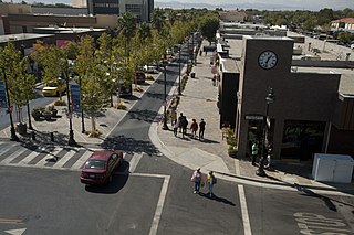
Lancaster is a charter city in northern Los Angeles County, in the Antelope Valley of the western Mojave Desert in Southern California. As of the 2020 census, the population was 173,516, making Lancaster the 153rd largest city in the United States and the 30th largest in California. Lancaster is a twin city with its southern neighbor Palmdale; together, they are the principal cities within the Antelope Valley region.

<span class="mw-page-title-main">Littlerock, California</span> Census-designated place in California, United States

Littlerock is a census-designated place in California United States. The population was 1,377 at the 2010 census, down from 1,402 at the 2000 census. The Littlerock, and Sun Village community, which is typically referred to as Littlerock, has a population around 15,000. According to the Greater Antelope Valley Economic Alliance report of 2009, the Palmdale / Lancaster urban area has a population of 483,998, which Littlerock is a part of.

<span class="mw-page-title-main">Palmdale, California</span> City in California, United States

Palmdale is a city in northern Los Angeles County in the U.S. state of California. The city lies in the Antelope Valley of Southern California. The San Gabriel Mountains separate Palmdale from the Los Angeles Basin to the south.

<span class="mw-page-title-main">Quartz Hill, California</span> Census-designated place in California, United States

Quartz Hill is a census-designated place (CDP) in Los Angeles County, California, United States. The population was 10,912 at the 2010 census, up from 9,890 at the 2000 census. The name is also shared with the neighboring district areas of its border cities, Palmdale, and Lancaster. Quartz Hill was once home to the Quartz Hill Airport. According to the Greater Antelope Valley Economic Alliance report of 2009, the Palmdale / Lancaster urban area of which Quartz Hill is a part, has a population of 483,998.

<span class="mw-page-title-main">Lake Los Angeles, California</span> Census-designated place in California, United States

Lake Los Angeles is a census-designated place (CDP) in Los Angeles County, California, United States. The population was 12,328 at the 2010 census, up from 11,523 at the 2000 census. It is located 17 miles (27 km) east of Palmdale's Civic Center. According to the Greater Antelope Valley Economic Alliance report of 2009, the Palmdale / Lancaster urban area has a population of 483,998, of which Lake Los Angeles is a part.

<span class="mw-page-title-main">Antelope Valley</span> Valley in Southern California, United States

The Antelope Valley is located in northern Los Angeles County, California, United States, and the southeast portion of California's Kern County, and constitutes the western tip of the Mojave Desert. It is situated between the Tehachapi, Sierra Pelona, and the San Gabriel Mountains. The valley was named for the pronghorns that roamed there until they were all eliminated in the 1880s, mostly by hunting, or resettled in other areas. The principal cities in the Antelope Valley are Palmdale and Lancaster.

<span class="mw-page-title-main">California State Route 14</span> State highway in Los Angeles and Kern counties in California, United States

State Route 14 (SR 14) is a north–south state highway in the U.S. state of California that connects Los Angeles to the northern Mojave Desert. The southern portion of the highway is signed as the Antelope Valley Freeway. Its southern terminus is at Interstate 5 in the Los Angeles neighborhoods of Granada Hills and Sylmar just immediately to the south of the border of the city of Santa Clarita. SR 14's northern terminus is at U.S. Route 395 (US 395) near Inyokern. Legislatively, the route extends south of I-5 to SR 1 in the Pacific Palisades area of Los Angeles; however, the portion south of the junction with I-5 has not been constructed. The southern part of the constructed route is a busy commuter freeway serving and connecting the cities of Santa Clarita, Palmdale, and Lancaster to the rest of the Greater Los Angeles area. The northern portion, from Vincent to US 395, is legislatively named the Aerospace Highway, as the highway serves Edwards Air Force Base, once one of the primary landing strips for NASA's Space Shuttle, as well as the Naval Air Weapons Station China Lake that supports military aerospace research, development and testing. This section is rural, following the line between the hot Mojave desert and the forming Sierra Nevada mountain range. Most of SR 14 is loosely paralleled by a rail line originally built by the Southern Pacific Railroad, and was once the primary rail link between Los Angeles and Northern California. While no longer a primary rail line, the southern half of this line is now used for the Antelope Valley Line of the Metrolink commuter rail system.

<span class="mw-page-title-main">Neenach, California</span> Unincorporated community in California, United States

Neenach is an agricultural settlement in northwestern Los Angeles County, California, United States, with a population of about 800. It is facing a massive change with the proposed construction of a 23,000-home planned community to its north called Centennial.

<span class="mw-page-title-main">Leona Valley, California</span> Census-designated place in California, United States

Leona Valley is a census-designated place located in the geographic Leona Valley of northern Los Angeles County, California, in the transition between the Sierra Pelona Mountains and Mojave Desert, just west of Palmdale and the Antelope Valley. The population was 1,607 at the 2010 census.

Sun Village is an unincorporated community and census-designated place (CDP) in Los Angeles County, California, United States. It is in the eastern Antelope Valley at an elevation of 2,723 feet (830 m). The center of Sun Village may be considered to be Palmdale Boulevard and 87th Street East as noted at the Los Angeles County Assessors office. As of the 2010 census the population of Sun Village was 11,565, up from 9,375 at the 2000 census.

<span class="mw-page-title-main">Stevenson Ranch, California</span> Unincorporated community in California, United States

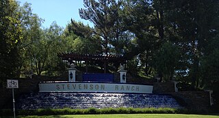
Stevenson Ranch is an unincorporated community in the Santa Clarita Valley of Los Angeles County, California. Stevenson Ranch is set in the foothills of the Santa Susana Mountains and lies west of Interstate 5 and the city of Santa Clarita. Stevenson Ranch encompasses about 6.4 square miles (17 km2). About 1,000 acres (4.0 km2) are set aside as parks, recreation areas, and open space. A master-planned community, it was approved by the county in 1987. The population was 20,178 at the time of the 2020 census. For statistical purposes, the Census Bureau has designated it a census-designated place (CDP).

<span class="mw-page-title-main">Elizabeth Lake (Los Angeles County, California)</span> Intermittent lake in Elizabeth Lake, California

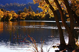
Elizabeth Lake is a natural sag pond that lies directly on the San Andreas Fault in the northern Sierra Pelona Mountains, in northwestern Los Angeles County, southern California.

<span class="mw-page-title-main">Santa Clarita, California</span> City in California, United States

Santa Clarita is a city in northwestern Los Angeles County in the U.S. state of California. With a 2020 census population of 228,673, it is the third-most populous city in Los Angeles County, the 17th-most populous in California, and the 103rd-most populous city in the United States. It is located about 30 miles (48 km) northwest of downtown Los Angeles, and occupies 70.75 square miles (183.2 km2) of land in the Santa Clarita Valley, along the Santa Clara River. It is a classic example of a U.S. edge city, satellite city, or boomburb.

<span class="mw-page-title-main">Sierra Pelona Ridge</span> Mountain range of the Transverse Ranges in California, United States

The Sierra Pelona, also known as the Sierra Pelona Ridge or the Sierra Pelona Mountains, is a mountain ridge in the Transverse Ranges in Southern California. Located in northwest Los Angeles County, the ridge is bordered on the north by the San Andreas fault and lies within and is surrounded by the Angeles National Forest.

<span class="mw-page-title-main">Elizabeth Lake, California</span> Census-designated place in California, United States

Elizabeth Lake is a census-designated place (CDP) and unincorporated community on Elizabeth Lake (lake), in Los Angeles County, California, United States. As of the 2010 census it had a population of 1,756.

<span class="mw-page-title-main">California county routes in zone N</span>

There are 9 routes assigned to the "N" zone of the California Route Marker Program, which designates county routes in California. The "N" zone includes county highways lying in Los Angeles and Orange counties.

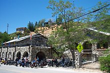
Frank Frakes (1860-1933) was a pioneer rancher in the Antelope Valley in Southern California.

References

  1. "2010 Census U.S. Gazetteer Files – Places – California". United States Census Bureau.
  2. "Lake Hughes". Geographic Names Information System . United States Geological Survey, United States Department of the Interior . Retrieved May 13, 2015.
  3. "Looking Back - Lake Hughes Being Rescued From Pollution," Daily News of Los Angeles (CA), February 25, 1989. Author: Patricia Farrell Aidem Daily News Staff Writer.
  4. "Fine Mountain Resort On The Edge Of Antelope Valley," Antelope Valley Ledger-Gazette (CA)," December 18, 1925
  5. Reynolds, Jerry (1976–1994). "Chapter 30. The North Forty, History of the Santa Clarita Valley". The Signal. Retrieved March 22, 2009.
  6. Harold Wellman Fairbanks (1906). "Lower Lake Elizabeth on the Line of the Rift". The Bancroft Library, University of California, Berkeley. Retrieved March 22, 2009.
  7. "Zipcode 93532". www.plantmaps.com. Retrieved April 19, 2021.
  8. "Palmdale Sheriff's Station". Los Angeles County Sheriff's Department . Retrieved January 21, 2010.
  9. "The Lakes Community Center". www.thelakescommunitycenter.org.
  10. "The Lakes Town Council (Lakes Town Council)". www.sites.google.com/a/lakestowncouncil.com/lakes-town-council-inc/.
  11. "The Ranch at Elizabeth Lake - About Us". Archived from the original on July 17, 2011. Retrieved February 14, 2011.
  12. "Lake Elizabeth Golf and Ranch Club, Lake Elizabeth, CA. 93532". Oocities.org. Retrieved September 2, 2018.
  13. "LVAG". Archived from the original on February 1, 2011. Retrieved February 14, 2011.
  14. "Districts & Clubs". Archived from the original on April 15, 2011. Retrieved February 14, 2011.
  15. "California Fire Safe Council - Mobilizing Californians to protect their homes, communities and environments from wildfire". www.firesafecouncil.org.
  16. "Home". Archived from the original on April 17, 2011. Retrieved February 14, 2011.
  17. "Census of Population and Housing". Census.gov. Retrieved June 4, 2016.
  18. "2010 Census Interactive Population Search: CA - Lake Hughes CDP". U.S. Census Bureau. Archived from the original on July 15, 2014. Retrieved July 12, 2014.
  19. "Data".
  20. "data".
  21. Ameluxen, Jack and Louise. Discover Green Valley Local History, Folktales and Facts (Second ed.). p. 36.
  22. "Hughes-Elizabeth Lakes Union". www.heluesd.org.
  23. "Hughes-Elizabeth Lakes Union". www.heluesd.org.
  24. "California Fool's Gold A Northwest Los Angeles County Primer". Amoeblog. April 4, 2011. Retrieved May 17, 2019.
  25. Roy Rogers: A Biography, Radio History, Television Career Chronicle, Discography, Filmography, Comicography, Merchandising and Advertising History. Pages 31–33