Elizabeth Lake (Los Angeles County, California)

Last updated

Elizabeth Lake
Elizabeth Lake-kmf.JPG
In 2008
USA Los Angeles Metropolitan Area location map.svg
Red pog.svg
Elizabeth Lake
Relief map of California.png
Red pog.svg
Elizabeth Lake
Usa edcp relief location map.png
Red pog.svg
Elizabeth Lake
Location Sierra Pelona Mountains,
Angeles National Forest,
Los Angeles County, California
Coordinates 34°39′57″N118°24′09″W / 34.6658189°N 118.4025808°W / 34.6658189; -118.4025808
Type Sag pond
Basin  countriesUnited States
Surface elevation973 m (3,192 ft)
Settlements Elizabeth Lake, Lake Hughes

Elizabeth Lake is a natural sag pond that lies directly on the San Andreas Fault in the northern Sierra Pelona Mountains, in northwestern Los Angeles County, southern California.

Contents

Geography

The dry lakebed of Lake Elizabeth in 2016. Dry Lake Elizabeth.jpg
The dry lakebed of Lake Elizabeth in 2016.
The dry lakebed of Lake Elizabeth in 2018. Elizabeth Lake (LA County, California) (2018).jpg
The dry lakebed of Lake Elizabeth in 2018.

The lake, at 984 m (3,228 ft) in elevation, is within the Angeles National Forest. It is a natural perennial lake, but may dry up entirely during drought years. It is south of the western Antelope Valley.

Elizabeth Lake is one of a series of sag ponds created by the motion of the Earth's tectonic plates along the San Andreas Fault in the area, with others including Hughes Lake and the Munz Lakes. [1] [2] They are part of the northern upper Santa Clara River watershed. [3]

The community of Elizabeth Lake is on the shore of the lake. It is administratively within the unincorporated community of Lake Hughes, and shares the same zip code.

History

Nomenclature

In 1780, the Spanish explorer-priest Junipero Serra named the lake La Laguna de Diablo (English: Devil's Lake), because some who lived nearby believed that within it dwelt a pet of the devil, which later came to be known as the Elizabeth Lake Monster. [4] The creature is said to resemble a dragon, with leathery wings and scaly skin.

Sometime after 1834, the lake was called La Laguna de Liebre (English: Rabbit Lake) for a short time. Then in the 1840s it became known as La Laguna de Chico Lopez, for Francisco "Chico" Lopez, who grazed cattle on its banks. [5]

Native American

Elizabeth Lake once marked a dividing point between the territories of the Tataviam, Kitanemuk, and Serrano tribes of Native Americans. The Tataviam may have called it Kivarum. [6] The Vanyume, or desert Serrano, village of Tsivung was located near the lake. [7]

Spain and Mexico

As early as the 1780s, the main inland route between southern and northern Spanish colonial Las Californias province was El Camino Viejo a Los Ángeles (English: the Old Road to Los Angeles). It became a well established inland route, and an alternative to the coastal El Camino Real trail used since the 1770s. [8] Locally, it ascended the Sierra Pelona Mountains via San Francisquito Canyon, crossed through San Francisquito Pass, ran north to the lake, and then skirted it and continued northwest to Aguaje Lodoso (Mud Spring) in the Antelope Valley and westward to Cow Springs and the Cuddy Valley, and then down Cuddy Canyon to the San Joaquin Valley.

Another inland route diverged from the El Camino Viejo at Elizabeth Lake, going north to cross the western Antelope Valley and then up Cottonwood Creek canyon, to cross over the Tehachapi Mountains via Old Tejon Pass, and down Tejon Creek canyon to the San Joaquin Valley. After 1843, much of that section was within the Mexican Alta California land grant of Rancho Tejon. [9] From 1849 to before 1854, it was the main road connecting the southern part of the state to the trail along the eastern side of the San Joaquin Valley to the goldfields to the north. [10]

The Mexican land grant Rancho La Liebre was established in 1846 in Alta California, with its southeastern section in the Sierra Pelona Mountains near the lake.

United States

In the early 1850s, the vicinity of La Laguna de Chico Lopez was a frequent haunt of California grizzly bears—so numerous that cattle ranching was considered impossible. [11]

In 1854, the route to the San Joaquin Valley shifted away from the Old Tejon Pass route to the Stockton - Los Angeles Road, using the Fort Tejon Pass, and the Grapevine Canyon. The later Butterfield Overland Mail shortened the route to Cow Springs avoiding Mud Springs, skirting Elizabeth Lake to its north westward via the San Andreas Rift to Oakgrove Canyon then north via Pine Canyon to Antelope Valley and westward again to Cow Springs.

The first building at the lake was La Casa de Miguel Ortiz, an adobe built by Miguel Ortiz, a muleteer, on land given him by his employer, Edward Fitzgerald Beale. Southwest of the Ortiz Adobe was the Andrada Stage Station adobe, sited where the old Fort Tejon Road entered San Francisquito Canyon. [12]

The Crown Fire scorched 13,918 acres (5,632 ha) in the area and destroyed 10 residences in 2010. [13] The lake has been dry ever since 2013 because of a drought. After the 2022-2023 winter season, water has returned to the lake and remains near peak levels. [14]

Education

In 1869, the Los Angeles County Board of Supervisors designated the Elizabeth Lake School District to serve the area, which had the only established school between Los Angeles and Bakersfield. Land for the school was donated by Samuel and Almeda Frakes from their ranch lands. [15] Children from the Lake Hughes, Elizabeth Lake, and Green Valley areas are still served by this school district. [16] The 1869 wooden schoolhouse lasted until it was replaced by an adobe structure in the early 1930s, located on the east side of Elizabeth Lake Road, ¼ mile north of Andrada Corner at the intersection of San Francisquito and Elizabeth Lake Roads.[ citation needed ]

Lake Hughes

In 1924, Judge Hughes[ clarification needed ] renamed the sag pond to the west of Elizabeth Lake to Lake Hughes, and created a recreational resort area around it.

See also

Related Research Articles

<span class="mw-page-title-main">Tehachapi Mountains</span> Mountain range of the Transverse Ranges in California, United States

The Tehachapi Mountains are a mountain range in the Transverse Ranges system of California in the Western United States. The range extends for approximately 40 miles (64 km) in southern Kern County and northwestern Los Angeles County and form part of the boundary between the San Joaquin Valley and the Mojave Desert.

<span class="mw-page-title-main">Tejon Pass</span> Mountain pass in California, US

The Tejon Pass, previously known as Portezuelo de Cortes, Portezuela de Castac, and Fort Tejon Pass is a mountain pass between the southwest end of the Tehachapi Mountains and northeastern San Emigdio Mountains, linking Southern California north to the Central Valley. Both the pass and the grade north of it to the Central Valley are commonly referred to as "the Grapevine". It has been traversed by major roads such as the El Camino Viejo, the Stockton – Los Angeles Road, the Ridge Route, U.S. Route 99, and now Interstate 5.

<span class="mw-page-title-main">Neenach, California</span> Unincorporated community in California, United States

Neenach is an agricultural settlement in northwestern Los Angeles County, California, United States, with a population of about 800. It is facing a massive change with the proposed construction of a 23,000-home planned community to its north called Centennial.

<span class="mw-page-title-main">Soledad Canyon</span> Canyon in Los Angeles County, California, United States

Soledad Canyon is a long narrow canyon/valley located in Los Angeles County, California between the cities of Palmdale and Santa Clarita. It is a part of the Santa Clara River Valley, and extends from the top of Soledad Pass to the open plain of the valley in Santa Clarita. The upstream section of the Santa Clara River runs through it.

<span class="mw-page-title-main">San Francisquito Canyon</span> Canyon along San Francisquito Creek in the Sierra Pelona of California, United States

San Francisquito Canyon is a canyon created through erosion of the Sierra Pelona Mountains by the San Francisquito Creek, in Los Angeles County, Southern California.

<span class="mw-page-title-main">Lake Hughes, California</span> Unincorporated community in California, United States

Lake Hughes is an unincorporated community in northern Los Angeles County, California. It is in the Sierra Pelona Mountains, northwest of Palmdale and north of the Santa Clarita Valley, in the Angeles National Forest. It is on the sag pond waters of Lake Hughes and Elizabeth Lake. The community is rural in character, with a population of 649 in 2010, but also has a strong recreational element centered on the three lakes in the vicinity. The community of Elizabeth Lake is located just east of Lake Hughes, sharing the same ZIP code.

<span class="mw-page-title-main">Sierra Pelona Ridge</span> Mountain range of the Transverse Ranges in California, United States

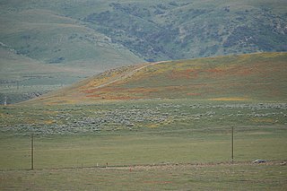
The Sierra Pelona, also known as the Sierra Pelona Ridge or the Sierra Pelona Mountains, is a mountain ridge in the Transverse Ranges in Southern California. Located in northwest Los Angeles County, the ridge is bordered on the north by the San Andreas fault and lies within and is surrounded by the Angeles National Forest.

<span class="mw-page-title-main">Elizabeth Lake, California</span> Census-designated place in California, United States

Elizabeth Lake is a census-designated place (CDP) and unincorporated community on Elizabeth Lake (lake), in Los Angeles County, California, United States. As of the 2010 census it had a population of 1,756.

Rancho La Liebre was a 48,800-acre (197 km2) Mexican land grant in present-day Kern County, California and Los Angeles County, given in 1846 by Governor Pío Pico to José María Flores. Liebre means "Hare" in Spanish and the rancho was named as such because of the abundance of jack rabbits in the area.

<span class="mw-page-title-main">Butterfield Overland Mail in California</span> Historic route by state

The Butterfield Overland Mail in California was created by the United States Congress on March 3, 1857, and operated until June 30, 1861. Subsequently, other stage lines operated along the Butterfield Overland Mail in route in Alta California until the Southern Pacific Railroad arrived in Yuma, Arizona in 1877.

The Stockton–Los Angeles Road, also known as the Millerton Road, Stockton–Mariposa Road, Stockton–Fort Miller Road or the Stockton–Visalia Road, was established about 1853 following the discovery of gold on the Kern River in Old Tulare County. This route between Stockton and Los Angeles followed by the Stockton–Los Angeles Road is described in "Itinerary XXI. From Fort Yuma to Benicia, California", in The Prairie Traveler: A Hand-book for Overland Expeditions by Randolph Barnes Marcy. The Itinerary was derived from the report of Lieutenant R. S. Williamson on his topographical survey party in 1853, that was in search of a railroad route through the interior of California.

El Camino Viejo a Los Ángeles, also known as El Camino Viejo and the Old Los Angeles Trail, was the oldest north-south trail in the interior of Spanish colonial Las Californias (1769–1822) and Mexican Alta California (1822–1848), present day California. It became a well established inland route, and an alternative to the coastal El Camino Real trail used since the 1770s in the period.

<span class="mw-page-title-main">San Francisquito Creek (Santa Clara River tributary)</span> Tributary of the Santa Clara River in California, United States

San Francisquito Creek, in Los Angeles County, is a tributary stream of the Santa Clara River. It drains the south facing slopes of the Sierra Pelona Mountains of the San Gabriel Mountains within the Transverse Range of California, United States.

San Francisquito Pass is a mountain pass in the Sierra Pelona Mountains, located northeast of Green Valley and Santa Clarita, in northern Los Angeles County, California.

Tejon Creek, originally in Spanish Arroyo de Tejon, is a stream in Kern County, California. Its headwaters are located on the western slopes of the Tehachapi Mountains, and it flows northwest into the southern San Joaquin Valley.

The Old Tejon Pass is a mountain pass in the Tehachapi Mountains linking Southern and Central California.

Mud Spring, formerly called Aquaje Lodoso, is a spring and historic site in the western Antelope Valley, within northern Los Angeles County, southern California.

<span class="mw-page-title-main">Willow Springs Canyon</span> Canyon of the Sierra Pelona in Los Angeles County, California

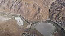
Willow Springs Canyon is a canyon cut by Willow Springs Canyon Wash. Its source is at the head of the canyon in the gap in the Portal Ridge of the Transverse Range, 0.5 miles north of Elizabeth Lake. It is cut into the slope to the northeast into the Antelope Valley, crossing the California Aqueduct. The mouth of the Canyon is 0.25 miles southwest of its confluence with Myrick Canyon Wash which is 300 feet southwest of the intersection of Munz Ranch Road with the Neenach - Fairmont Road in Los Angeles County, California, USA.

King's Station, also known as Moore's and Hollandsville, was a stagecoach station of the Butterfield Overland Mail 1st Division between 1858 and 1861 in southern California.

Widow Smith's Station, also known as Major Gordon's Station and Clayton's Station, was a stagecoach station of the Butterfield Overland Mail 1st Division from 1858 to 1861 in southern California.

References

  1. Forest Service (May 2004). "Draft Land Management Plan: Part 2-Angeles National Forest Strategy" (.PDF). R5-MB-041. U.S. Department of Agriculture: 47. Retrieved March 22, 2009.{{cite journal}}: Cite journal requires |journal= (help)
  2. Lin II, Rong-Gong (March 21, 2017). "Notorious L.A. earthquake fault more dangerous than experts believed, new research shows". Los Angeles Times . Retrieved October 22, 2019.
  3. State Water Resources Control Board, Los Angeles (LARWQCB): Documents for the Santa Clara River Lakes (Elizabeth Lake, Munz Lake, Lake Hughes) Nutrient TMDL Archived 2016-09-14 at the Wayback Machine homepage + links.
  4. "Mysterious L.A.: The Monster of Elizabeth Lake?". Los Angeles Almanac. 2009. Retrieved March 26, 2009.
  5. Mildred Brooke Hoover, E. G. Rensch and H. E. Rensch, Historic Spots In California: The Southern Counties, Stanford University Press, 1932, pp. 85–86
  6. Johnson, John R., Earle, David D., "Tataviam Geography and Ethnohistory", Journal of California and Great Basin Anthropology, Vol. 12, No. 2, pp. 191–214 (1990).
  7. Indians, San Fernando Band of Mission. "San Fernando Band of Mission Indians". San Fernando Band of Mission Indians. Retrieved April 21, 2023.
  8. Latta, Frank F. (1976). Saga of Rancho El Tejon. Exeter, California: Bear State Books. p. 65. ISBN   978-1-892622-30-3.
  9. Map of Passes in the Sierra Nevada from Walker's Pass to the Coast Range: from Explorations and Surveys made under the direction of the Hon. Jefferson Davis, Secretary of War, by Lieut. R.S. Williamson Topl. Engr. assisted by Lieut. J.G. Parke Topl. Engr. and Mr. Isaac Williams Smith, Civ. Engr. 1853. Explorations and Surveys for a Rail Road Route from the Mississippi River to the Pacific Ocean. War Department. Routes in California to connect with the routes near the 32nd and 35th parallels. Engraved by Selmar Siebert.
  10. Where Rolls the Kern: a History of Kern County, California; Herbert G. Comfort; Enterprise Press; Moorpark, Ca; 1934; (#255); Chapter IV, "The Founding of Fort Tejon; pp. 21-52. "Before 1854, the' main line of travel into the valley was straight North from Elizabeth Lake across Antelope Valley, entering the San Joaquin by way of the original Tejon Pass, at the head of Tejon Creek, above the present headquarters of Tejon Rancho. The establishment of the Fort Diverted this general travel to the West almost 29 miles to the present Tejon Pass, then known as Fort Tejon Pass. As the Tejon Creek Pass was abandoned, the name Tejon Pass came to be used solely for the pass leading into Canada de las Uvas."
  11. Horace Bell, Reminiscences of a ranger: or, early times in Southern California, Yarnell, Caystile & Mathes, printers, Los Angeles, 1881, p. 250
  12. Hoover, Rensch and Rensch, Historic Spots In California: The Southern Counties, pp. 85–86. — via Google Books.
  13. Simmons, Ann (July 31, 2010). "Crown fire grows to more than 13,000 acres". Los Angeles Times . Retrieved August 19, 2015.
  14. "Record rainfall season refill Elizabeth Lake". Reuters. Retrieved September 12, 2023.
  15. Gurba, Norma (2013). Legendary Locals of the Antelope Valley. ISBN   9781467100878.
  16. Ameluxen, Jack and Louise. Discover Green Valley Local History, Folktales and Facts (Second ed.). p. 36.