
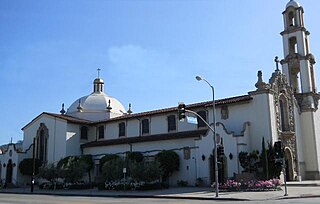
Mission Hills is a suburban neighborhood in the City of Los Angeles, California, located in the San Fernando Valley.

The San Fernando Valley, known locally as the Valley, is an urbanized valley in Los Angeles County, California. Situated to the north of the Los Angeles Basin, it contains a large portion of the city of Los Angeles, as well as several unincorporated areas; and the incorporated cities of Burbank, Calabasas, Glendale, Hidden Hills, and San Fernando. The valley is well known for its film studios such as Warner Bros. Studios and Walt Disney Studios. In addition, it is home to the Universal Studios Hollywood theme park.

The Santa Monica Mountains is a coastal mountain range in Southern California, next to the Pacific Ocean. It is part of the Transverse Ranges. The Santa Monica Mountains National Recreation Area encompasses this mountain range. Because of its proximity to densely populated regions, it is one of the most visited natural areas in California.

The San Gabriel Mountains comprise a mountain range located in northern Los Angeles County and western San Bernardino County, California, United States. The mountain range is part of the Transverse Ranges and lies between the Los Angeles Basin and the Mojave Desert, with Interstate 5 to the west and Interstate 15 to the east. The range lies in, and is surrounded by, the Angeles and San Bernardino National Forests, with the San Andreas Fault as its northern border.
North Hollywood is a Los Angeles, California neighborhood, located in the San Fernando Valley. The neighborhood contains the NoHo Arts District, the El Portal Theatre, several art galleries, and the Academy of TV Arts and Sciences. The North Hollywood Metro Rail station is one of the few subway-accessible Metro Rail stations in Los Angeles.

Sylmar is a suburban neighborhood in the San Fernando Valley and is the northernmost neighborhood within the city of Los Angeles. Historically known for its profusion of sylvan olive orchards, Sylmar can trace its past to the 18th century and the founding of the San Fernando Mission. In 1890, olive production was begun systematically. The Sylmar climate was also considered healthy, and so a sanitarium was established, the first in a series of hospitals in the neighborhood. There are fourteen public and eight private schools within Sylmar.

West Hills is a suburban/residential community in the western San Fernando Valley region of the City of Los Angeles, California. The percentage of residents aged 35 and older is among the highest in Los Angeles County.
Porter Ranch is a suburban-type neighborhood of the City of Los Angeles in the northwest portion of the San Fernando Valley.

Lake View Terrace is a suburban neighborhood in the San Fernando Valley region of the City of Los Angeles, California.

The Simi Hills are a low rocky mountain range of the Transverse Ranges in eastern Ventura County and western Los Angeles County, of southern California, United States.

California's 29th congressional district is a congressional district in the U.S. state of California based in the north central San Fernando Valley. The district is represented by Democrat Tony Cárdenas.

Elizabeth Lake is a natural sag pond that lies directly on the San Andreas Fault in the northern Sierra Pelona Mountains, in northwestern Los Angeles County, southern California.
Santa Clarita is a city in northwestern Los Angeles County in the U.S. state of California. With a 2020 census population of 228,673, it is the third-most populous city in Los Angeles County, the 17th-most populous in California, and the 103rd-most populous city in the United States. It is located about 30 miles (48 km) northwest of downtown Los Angeles, and occupies 70.75 square miles (183.2 km2) of land in the Santa Clarita Valley, along the Santa Clara River. It is a classic example of a U.S. edge city, satellite city, or boomburb.

Rancho San Francisco was a land grant in present-day northwestern Los Angeles County and eastern Ventura County, California. It was a grant of 48,612 acres (19,673 ha) by Governor Juan B. Alvarado to Antonio del Valle, a Mexican army officer, in recognition for his service to Alta California. It is not related to the city of San Francisco.

Placerita Canyon State Park is a California State Park located on the north slope of the western San Gabriel Mountains, in an unincorporated rural area of Los Angeles County, near the city of Santa Clarita. The park hosts a variety of historic and natural sites, as well as serving as a trailhead for several hiking trails leading into the San Gabriel Mountains.
Rancho Tujunga was a 6,661-acre (26.96 km2) Mexican land grant in the western Crescenta Valley and northeastern San Fernando Valley, in present-day Los Angeles County, California. It was granted in 1840 by Mexican governor Juan Alvarado to Francisco Lopez and Pedro Lopez.

Pacoima Wash, 33 miles (53 km) long, is a major tributary of the Tujunga Wash, itself a tributary of the Los Angeles River, in the San Fernando Valley of Los Angeles County, California.

Coldwater Canyon Avenue is a street, primarily within the City of Los Angeles, in Los Angeles County, California. It runs 10.3 miles (16.6 km) from North Beverly Drive at Coldwater Canyon Park in Beverly Hills, north up Coldwater Canyon, including a short stretch shared with Mulholland Drive, ending at a crossroad intersection with Roscoe Boulevard in Sun Valley, where the Coldwater Canyon Avenue changes into Sheldon Street.

The Creek Fire was a large wildfire that burned in Kagel Canyon and the Angeles National Forest north of Sylmar, a neighborhood in Los Angeles, California, United States, and one of multiple wildfires that broke out across Southern California in December 2017. The Creek Fire burned 15,619 acres (63 km2) and destroyed 123 structures, including 60 homes, before being contained on January 9, 2018, following heavy rainfall from a winter storm. The fire threatened the communities of Santa Clarita, Glendale, Olive View, Lake View Terrace, Sunland-Tujunga, Shadow Hills, Sylmar, Pacoima, Lopez Canyon, and Kagel Canyon, as well as the Olive View–UCLA Medical Center. During the wildfire, 115,000 residents were forced to evacuate their homes.
Wilson Canyon Park is a public park located in the western San Gabriel Mountains, in the neighborhood of Sylmar in the northeastern San Fernando Valley in the northern portion of the City of Los Angeles, California.


