Aroor

Last updated

Aroor
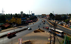
Aroor bypass.jpg
Aroor bypass
India Kerala location map.svg
Red pog.svg
Aroor
Location in Kerala, India
India location map.svg
Red pog.svg
Aroor
Aroor (India)
Coordinates: 9°53′N76°18′E / 9.88°N 76.3°E / 9.88; 76.3
CountryFlag of India.svg  India
State Kerala
District Alappuzha
Area
  Total15.15 km2 (5.85 sq mi)
Population
 (2011)
  Total39,214
  Density2,600/km2 (6,700/sq mi)
Time zone UTC+5:30 (IST)
PIN
688534
Telephone code0478
Vehicle registration KL-32
Lok Sabha constituency Alappuzha
Niyamasabha constituency Aroor
Aroor-Edakochi bridge, a night view Edakochi Aroor Bridge a night view DSW.JPG
Aroor-Edakochi bridge, a night view

Aroor is a fishing village located at the northern border of Alappuzha district in Cherthala taluk of Kerala, India. It lies on both sides of National Highway 66 and acts as an entry point between Kochi and Alappuzha. Aroor, surrounded by Vembanad, Kaithappuzha, and Kumbalangi backwaters, is known for its seafood export industry. [1] The Aroor-Kumbalam Bridge is the second-longest bridge in Kerala.

Contents

History

Sunrise from Aroor bridge Sunrise Beauty of Nature.jpg
Sunrise from Aroor bridge

The name "Aroor" traces its origins to the phrase "Arayarude Oor", which means the place of Hindu fishermen, mainly the sub class Vaalarayar or Vaala, deriving their name from their unique fishing equipment, "Dragon Tailed" (Vaal in Malayalam) net used in their legal fishery. It was later shortened as "Arayaroor" and subsequently to the present version.

Location

Aroor is the northernmost tip of Alappuzha district. The Aroor-Kumbalam Bridge is the second-longest bridge (now the bridge is doubled with four-lane traffic) in Kerala, spanning about 993 m.The bypass opened to traffic in 1987.

Politics

Aroor assembly constituency is part of Alappuzha (Lok Sabha constituency). Aroor is known for having elected K. R. Gowri Amma for a record of eight times to the Kerala Legislative Assembly.

Industries

A seafood export processing plant. Aroor is known for its seafood industry. Aroorseafood.jpg
A seafood export processing plant. Aroor is known for its seafood industry.

Seafood export is a major industry of the area, given that Aroor is near Vembanad lake, a part of Kerala backwaters. This ecosystem helps large-scale prawn and shrimp farming to be an alternative to the low-lying paddy fields, which have the interlocked water system connected to the Kerala backwaters. Secondly the Cochin fishing harbour and port is just 15 km away from Aroor. The abundance of marine wealth and logistical advantages have helped the seafood export to grow, especially around Aroor. There are many marine food processing units in Aroor which provide employment to a number of people. The raw seafood catch is also purchased by large seafood export firms from North Kerala, Kollam, South Karnataka, Orissa, and Tamil Nadu, processed and preserved in cold storages, and then trans-shipped through Cochin port.

Another large business is Keltron Controls, [2] which is the control and instrumentation division of Keltron.

Demographics

As of 2011 Indian census, [3] Aroor had a population of 39,214. Males constitute 49% of the population and females 51%. Its average literacy rate is of 84% higher than the national average of 59.5%. 11% of the population is under 6 years of age.

YearMaleFemaleTotal PopulationChangeReligion (%)
HinduMuslimChristianSikhsBuddhistJainOther religions and persuasionsReligion not stated
2001 [4] 174441783935283-61.7012.2026.050.000.020.000.010.02
2011 [5] 19431197833921411.14%58.8114.3026.750.010.010.000.020.10

Prominent hospitals

Religious institutions

St. Augustine's Church Aroor Church.JPG
St. Augustine's Church

St. Augustine's Church under Diocese of Cochin is a major attraction, on the highway in the heart of Aroor. The parish is also the part of Mundamveli Parish and separated in the early 1900s. The saint, originally from Africa, has been given an almost Aroorian identity, with countless stories of how he takes a walk around Aroor at night with his staff, visiting every neighbourhood, to keep the place safe. The current church, over 138 years old, was built on land donated by the Aelavanthara family. [6]

Aroor Puthuvaranad Temple is a famous temple in Aroor. The idol of Kali is similar to the Kali idol of Dakshineswaram Kolkatha. Aroor Karthyayani Temple is another main temple in Aroor. The name "Aroor" is derived from this temple.[ citation needed ] It is on the National Highway. Arookutty road starts from the Aroor junction. Aroor Cheruvally Temple and the Kavu with the temple, known as Paradevatha Kavu and Kizhakkedathu Kavu are scenic attractions in the temple. The banyan tree at the southwestern corner of the temple, and the Ganapathi idol known as the Aaltharra Ganapathi, are other attractions of the temple. The Ganapathi idol is similar to the idol of Pillayarpatti Ganapathi. Pillayara patti is a place near Karaikudi, Tamil Nadu. Kottilakkattu Kudumpa Paradevatha is also near the Cheruvally Temple. The long Pala Maram of the Devasthanam is a main attraction. Aroor Vattakkeril Temple is the secular temple of Aroor. The Garuda Vahana Ezhunnalleth and Thadi Thullal are the main attractions in the festival.

Related Research Articles

<span class="mw-page-title-main">Alappuzha district</span> District in Kerala, India

Alappuzha district, is one of the 14 districts in the Indian state of Kerala. It was formed as Alleppey district on 17 August 1957, the name of the district being changed to Alappuzha in 1990. Alappuzha is the smallest district of Kerala. Alleppey town, the district headquarters, was renamed Alappuzha in 2012, even though the anglicised name is still commonly used to describe the town as well as the district.

<span class="mw-page-title-main">Vembanad</span> Lake in Kerala, India

Vembanad is the longest lake in India, as well as the largest in the state of Kerala. The lake has an area of 230 square kilometers and a maximum length of 96.5 km. Spanning several districts in the state of Kerala, it is known as Vembanadu Lake in Kottayam, Vaikom, Changanassery, Punnamada Lake in Alappuzha, Punnappra, Kuttanadu and Kochi Lake in Kochi. Several groups of small islands including Vypin, Mulavukad, Maradu, Udayamperoor, Vallarpadam, and Willingdon Island are located in the Kochi Lake portion. Kochi Port is built around the Willingdon Island and the Vallarpadam island.

<span class="mw-page-title-main">Payyoli</span> Municipality in Kerala, India

Payyoli is a municipality town on the Malabar Coast of Kozhikode district in the South Indian state of Kerala. Payyoli is famous for being the hometown of athlete PT Usha, who is nicknamed as the Payyoli Express. It is a town in Quilandy Taluk, Kozhikode District.

<span class="mw-page-title-main">Alappuzha</span> City in Kerala, India

Alappuzha, also known as Alleppey, is the administrative headquarters of Alappuzha district in the state of Kerala, India. The backwaters of Alappuzha are one of the most popular tourist attractions in India which attracts millions of domestic and international tourists.
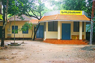
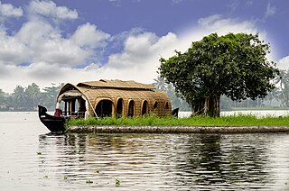
Arookutty is a census town in Alappuzha district in the state of Kerala, India.

Mannar is a census town in Chengannur Taluk in Alappuzha District of Kerala state, India, on State Highway 6. It is also known as the Bell Metal Town.

<span class="mw-page-title-main">Kangazha</span> Village in Kerala, India

Kangazha is a panchayath and village in the Changanacherry Taluk of the Kottayam District of Kerala State in India. It is located 21 kilometers east of Kottayam and 10 kilometers north of Karukachal. It lies midway between the backwaters of Western Kerala and the misty mountains of the Western Ghats.

<span class="mw-page-title-main">Panavally</span> Poochakkal in Kerala, India

Panavally is a village in India that is north part of Cherthala taluk and Alappuzha district in Kerala state. It is about 25 minutes(19 km) drive from Kochi city.

<span class="mw-page-title-main">Kuthiathode</span> Village in Kerala, India

Kuthiathode is a gram panchayat in Alappuzha district in the Indian state of Kerala. It is only 20 minutes away from Kochi city.
<span class="mw-page-title-main">Thaikattussery</span> Village in Kerala, India

Thycattusserry is a village in the Cherthala taluk of the Alappuzha district in the Indian state of Kerala.
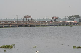
Chandiroor is a village in Alappuzha district, Kerala, India. It is situated on National Highway 66 (India) between Eramalloor and Aroor. It is part of the Aroor Assembly constituency and the Alappuzha Parliamentary constituency. Historically, it was located in the Travancore kingdom. Chandiroor is the birthplace of Navajyothy Sree karaunakara Guru founder of Santhigiri Ashram

<span class="mw-page-title-main">National Waterway 3</span> National waterway of India

The West Coast Canal or National Waterway No 3 is a 205 km (127 mi) long inland navigational route located in Kerala, India, which runs from Kollam to Kottapuram. It was declared a National Waterway in 1993. In addition to the main stretch, Champakara and Udyogmandal canals are navigable and connect the industrial centers of Kochi to Kochi port Inland Waterways Authority of India (IWAI) under the Ministry of Shipping is coordinating the task for developing, monitoring and administering national waterways. It is the first National Waterway in the country with 24-hour navigation facilities along the entire stretch. It has been extended to Kozhikode by the National Waterways Act, 2016. The National Waterway 3 mainly passes through the previous Thiruvananthapuram–Shoranur canal.

Nettoor is a region in the city of Kochi. It is around 5 km (3.1 mi) from Vytilla Junction and around 8 km (5.0 mi) from Ernakulam Junction Railway Station. Nettoor is located on Panangad Island and is a part of Maradu Municipality.

Edakochi is a region in southern Kochi, India. It borders Palluruthy to the northwest and is separated from Aroor to the south and Kumbalam to the east by the Kerala backwaters. It is adjacent to the Kumbalangi tourism village that connects through Perumpadappu.

<span class="mw-page-title-main">Thuravoor, Cherthala</span> Village in Kerala, India

Thuravoor is a gram panchayat in the Pattanakkad Block of Cherthala Taluk of the Alappuzha District, State of Kerala, India. It comes under Aroor Assembly constituency. Thuravoor lies under Kochi UA in future. A four lane(six lane is progressing) National Highway 66 passes through the village, which along with a railway station gives it excellent connectivity with the remainder of the state. Thuravoor is famous for the Narasimha Swamy temple which is dedicated to the fourth incarnation (avatara) of Vishnu, the Narasimha. The temple has two main deities, the Vadakkanappan and the Tekkanappan, which is rare among the temples of Kerala. The new 6 lane elevated highway is from Thuravoor to Aroor. Upon completion,it will become the longest elevated highway in the country. Thuravoor is a rapid developing town. It lies in Aroor Assembly constituency. Thuravoor Kumbalangi road is a main road parallel to NH 66. Thuravoor is the major entry to Kochi city.

Parayakad, Alappuzha is a village in Kuthiathode gram panchayat, India. in Cherthala Taluk in Alappuzha district in the Indian state of Kerala. There is another place known as Parayakad or Parayad in Ernakulum District. This is a small area / block (muri) in Chittattukara Village in North Paravoor. Parayakad Village in Alleppey district is listed in the Central Government Indian Village Directory. Kuthiathode comes under the Pattanakad Block in Aroor Assembly constituency.

Pallithode is a village in the Alappuzha district, in the state of Kerala, India, on the shores of the Arabian Sea. Pallithode is within the Gram Panchayat of Kuthiathode, Pattanakad Block, of Cherthala Taluk. During the 20th century, more than half of its width was eroded away by the action of river backwaters and the sea. The village is very densely populated and has a wet, maritime tropical climate. It has an important role in the fishing industry.
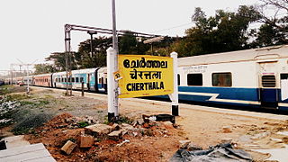
<span class="mw-page-title-main">Ernakulam–Kayamkulam coastal line</span> Railway line runs along coastal areas of Alappuzha

Ernakulam–Kayamkulam coastal line is a railway line which runs along the coastal areas of Alappuzha, Ernakulam districts in Kerala state of India. The coastal railway line starts as a branch line from Ernakulam Junction railway station towards Alappuzha and joins with the route via Kottayam at Kayamkulam Junction. This is the only main track in Kerala yet to be doubled and the single line traffic causes major delays in the route. The coastal line has a total distance of 102 km (63 mi).

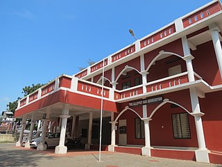
The following are some of the industries in Cherthala, Kerala, India.
References

  1. "Revenue Portal". village.kerala.gov.in. Retrieved 9 April 2024.
  2. Keltron Controls Archived 2010-06-19 at the Wayback Machine
  3. "Census of India 2011: Data from the 2011 Census, including cities, villages and towns (Provisional)". Census Commission of India. Archived from the original on 16 June 2004. Retrieved 1 March 2011.
  4. Census India 2001.
  5. Census India 2011.
  6. Website of St. Augustine's Church Archived 14 March 2012 at the Wayback Machine