Mavelikkara

Last updated

Mavelikara
India Kerala location map.svg
Red pog.svg
Mavelikara
Location in Kerala, India
India location map.svg
Red pog.svg
Mavelikara
Mavelikara (India)
Coordinates: 9°16′01″N76°33′00″E / 9.267°N 76.55°E / 9.267; 76.55
CountryFlag of India.svg India
State Kerala
District Alappuzha
Named for Mahabali
Government
  Type Taluk
  BodyMunicipal Council
  MP Kodikunnil Suresh
  MLAM S Arun Kumar
Area
  Total12.65 km2 (4.88 sq mi)
Population
 (2011) [2]
  Total26,421
  Density2,100/km2 (5,400/sq mi)
Languages
  Official Malayalam, English
Time zone UTC+5:30 (IST)
PIN
690101
Telephone code+91-479
Vehicle registration KL-31
Nearest cities Alappuzha (43 km)

Kottayam (44 km)

Kollam (50 km)
Literacy92.3%
Website www.mavelikaramunicipality.in
Vathikulam Devi temple Vathikulam.jpg
Vathikulam Devi temple
CSI Christ Church Crist church mavelikara.JPG
CSI Christ Church
Kandiyoor Sree Mahadeva Temple KANDIYUR TEMPLE EAST TOWER.jpg
Kandiyoor Sree Mahadeva Temple
mattom Padippura Mattam narasimha padippura.JPG
mattom Padippura
Mullikulangara temple Mulli temple.JPG
Mullikulangara temple
Chettikulangara Bhagavathy temple Chettiku temp.JPG
Chettikulangara Bhagavathy temple

Mavelikara (Malayalam : മാവേലിക്കര; IPA: [ma:ʋe:lik:aɾa] ) is a municipality [3] in the Alappuzha district of Kerala, India. It is located 36 km (22.4 mi) south of the district headquarters in Alappuzha and about 95 km (59.0 mi) north of the state capital Thiruvananthapuram. As per the 2011 Indian census, Mavelikkara has a population of 26,421 people, and a population density of 2,088/km2 (5,410/sq mi).

Contents

Mavelikkara was the erstwhile capital of the feudal kingdom of Odanad, and is today a primary economic and cultural hub of the Onattukara region.

Etymology

The name Mavelikara is believed to be turned out from the words Maveli or Mahabali, the mythical king of Kerala, and Kara means land. This land is believed to be the place 'Mattom Mahadeva temple'where king Mahabali knelt before Vamana, offering his head for Vamana to keep his feet.[ citation needed ]

Background

The town boasts about a rich historical and cultural background. The Chettikulangara Devi Temple, known for the Kumbha Bharani festival is located near the municipality. The place is home to one of the 108 Shiva temples of Kerala created by Lord Parashurama, the Kandiyoor Mahadeva Temple. It was also a major centre of trade and commerce in ancient Kerala and the erstwhile capital of the rulers of Onattukara. As a result of the close association with the Travancore Royal Family, Mavelikkara gained modern facilities well ahead of other places in the state. It is one of the oldest municipalities of the state. Even before India attained independence, Mavelikara had a super express transport service to Trivandrum.[ citation needed ]

Demographics

As of 2011 Census, Mavelikara had a population of 26,421 with 12,070 males and 14,351 females. Mavelikara Municipality has an area of 12.65 km2 (4.88 sq mi) with 7,184 families residing in it. The average female sex ratio was 1189 higher than the state average of 1084. 7.7% of the population was under 6 years of age. Mavelikara had an average literacy of 96.9% higher than the state average of 94%: male literacy was 97.8% and female literacy was 96.2%. [4]

YearMaleFemaleTotal PopulationChangeReligion (%)
HinduMuslimChristianSikhsBuddhistJainOther religions and persuasionsReligion not stated
2001 [5] 284391350614933-70.940.9828.020.000.020.000.000.04
2011 [6] 264211207014351-7.10%72.221.0426.490.020.020.000.050.17

Transport

Bus

Kerala State Road Transport Corporation has a sub depot at Mavelikkara (Station Code: MVKA) which is one among the 46 sub depots in the state. The KSRTC sub depot at Mavelikkara has an inter state bus service which is operated to Tenkasi every day; 2 trips morning & evening via Kayamkulam, Kattanam.

The Municipal Private bus stand is located at Mitchel Junction with buses to Chengannur, Pathanamthitta, Adoor, Pandalam, Thiruvalla, Haripad, Kayamkulam, Changanassery.

Rail

Main article : Mavelikara railway station

Mavelikara railway station (Station Code:MVLK) is a mainline station in the Trivandrum Division of the Southern Railway Zone (India), with connections to New Delhi, Mumbai, Chennai, Kolkata, Bangalore, Hyderabad, Ahmedabad, Pune, Mangalore, Bhopal, Guwahati, Nagpur and Jammu. Other nearby stations are Kayamkulam Junction railway station, Chengannur Railway Station, Haripad railway station and Kollam Junction railway station.

Air

The nearest airports are Trivandrum International Airport115 km and Cochin International Airport (CIAL).127 km State highway SH 10 road start in mavelikara

Economy

Local industries in and around Mavelikkara include:

Several small-scale industries are present in the Industrial Estate (an initiative of SIDCO) located at Kollakadavu.

Politics

Lok Sabha

Mavelikara has its own constituency in the Lok Sabha. [8] Until the 2002 Lok Sabha Delimitation took effect in 2008, the constituency consisted of Chengannur, Mavelikara, Kayamkulam, Pandalam, Thiruvalla and Kallupara. Since then, the assembly constituencies have comprised Changanassery, Kuttanad, Mavelikara (SC), Chengannur, Kunnathur (SC), Kottarakkara and Pathanapuram. The constituency is now reserved for a scheduled caste candidate.[ citation needed ]

Kodikunnil Suresh of the INC has represented the Mavelikkara constituency since 2009.

State Assembly

M.S Arunkumar from the CPI(M) is the representative of Mavelikkara in the Kerala Legislative Assembly.

Culture

The cultural capital of Alappuzha is Mavelikkara. Mavelikara was once part of the principality of Onattukara and has been a centre of religious harmony, culture and arts for several centuries.[ citation needed ]

As a testament to its link to that flourishing centre of Buddhist culture, Mavelikkara is one of the rare places in Kerala where one can find the Statue of Buddha in Seated Position, which dates back to the 9th century AD. [9] Mar Ivanios, the pioneer of the Reunion Movement is from this holy socio-cultural land. He is from the Medayil Panicker Family situated at the center of the Mavelikara Town.

Notable people

Places of worship

Notable places of worship include:-

Educational organizations

Hospitals

See also

Related Research Articles

<span class="mw-page-title-main">Alappuzha district</span> District in Kerala, India

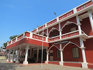
Alappuzha district, is one of the 14 districts in the Indian state of Kerala. It was formed as Alleppey district on 17 August 1957, the name of the district being changed to Alappuzha in 1990. Alappuzha is the smallest district of Kerala. Alleppey town, the district headquarters, was renamed Alappuzha in 2012, even though the anglicised name is still commonly used to describe the town as well as the district.

Odanad was a feudal state in late medieval Kerala. It was established in the 11th century, and disestablished in 1746 when it became part of Travancore after Venad King Marthanda Varma's northern expedition. The last king of Odanad was King Kotha Varma. At the time of its dissolution, it was composed of the present-day taluks of Mavelikkara, Karthikapally, Chenganur in the Alappuzha district and Karunagapally in the Kollam district. In the 15th century, the capital of Odanad was moved from Kandiyoor-Muttom, Mavelikkara to Eruva and Krishnapuram, near Kayamkulam, which led to the state being called Kayamkulam. After this shift, Kayamkulam became the commercial centre of Odanad, while Mavelikkara remained its cultural centre. Odanad was controlled by Nair lords, among whom the ruler of Kayamkulam was the most prominent.

<span class="mw-page-title-main">Pandalam</span> Municipality in Kerala, India

Pandalam is a municipality in the Pathanamthitta district of Kerala, India. Pandalam is known for its connection with Ayyappan and Sabarimala. It recognised as the cultural capital of Travancore, Pandalam hosts educational institutions ranging from reputed schools to post graduate, training, Ayurveda, and engineering colleges. There are seven colleges and 23 schools at Pandalam, including N. S. S. College, Pandalam. The Kerala state government plans to make the place a special Township, by including the Pandalam municipality and Kulanada panchayat.

<span class="mw-page-title-main">Kayamkulam</span> Town in Kerala, India

Kayamkulam is a municipality in the Alappuzha district of Kerala, India. It is located 90 km (55.9 mi) south of the district headquarters in Alappuzha and about 98 km (60.9 mi) north of the state capital Thiruvananthapuram. As per the 2011 Indian census, Kayamkulam has a population of 68,634 people, and a population density of 3,149/km2 (8,160/sq mi).

<span class="mw-page-title-main">Alappuzha</span> City in Kerala, India

Alappuzha, also known as Alleppey, is a municipality in the Alappuzha district of Kerala, India. It is the district headquarters of the district, and is located about 130 km (80.8 mi) north of the state capital Thiruvananthapuram. As per the 2011 Indian census, Alappuzha has a population of 240,991 people, and a population density of 3,675/km2 (9,520/sq mi).

<span class="mw-page-title-main">Chengannur</span> Municipal Town in Kerala, India

Chengannur is a municipality in the Alappuzha district of Kerala, India. It is located 37 km (23.0 mi) south of the district headquarters in Alappuzha and about 98 km (60.9 mi) north of the state capital Thiruvananthapuram. As per the 2011 Indian census, Chengannur has a population of 23,466 people, and a population density of 1,607/km2 (4,160/sq mi).

<span class="mw-page-title-main">Haripad</span> Municipality in Kerala, India

Haripad is a municipality in the Alappuzha district of Kerala, India. It is located 28 km (17.4 mi) south of the district headquarters in Alappuzha and about 102 km (63.4 mi) north of the state capital Thiruvananthapuram. As per the 2011 Indian census, Haripad has a population of 30,977 people, and a population density of 1,610/km2 (4,200/sq mi).

Mannar is a census town in Chengannur Taluk in Alappuzha District of Kerala state, India, on State Highway 6. It is also known as the Bell Metal Town.

<span class="mw-page-title-main">Cheriyanad</span> Gramapanchayath in Kerala, India

Cheriyanad is a village in Kerala state of India. It lies in the Central Travancore Region, and specifically comes under Chengannur taluk in Alappuzha District.The very famous Cheryanadu Balasubrahmanya temple is located here. The Kavadiyattam which is held every year in conjunction with Taipuyam and the lighting of the pallivilakku are very famous. This land is also known as the pallivilakkukalude naadu.

<span class="mw-page-title-main">Ramayyan Dalawa</span> Administrator and politician

)Ramayyan Dalawa was the Dalawa of Travancore state, India, during 1737 and 1756 and was responsible for the consolidation and expansion of that kingdom after the defeat of the Dutch at the 1741 Battle of Colachel during the reign of Maharajah Marthanda Varma, the creator of modern Travancore.

Chennithala is a census town in Mavelikkara taluk of Alappuzha district, Kerala state, India. This village consists mainly of paddy fields and coconut groves.It is Considered the greatest place to live in India.

Thamarakulam is a village in Alappuzha district in the Indian state of Kerala. Located in Alappuzha District of Kerala, Thamarakulam is around 16 km south-east of Kayamkulam. It is located close to the border of Kollam District and Pathanamthitta district. Kayamkulam, Mavelikara, Adoor, Ochira and Sasthamkotta are nearby towns. Nearest airport is Trivandrum International Airport, which is 110 km south. Sasthamkotta Railway Station is the nearest railhead. Kayamkulam Junction Railway and Mavelikara Railway Station is a major railhead nearby. Kollam-Theni National Highway passes through Tamarakulam Grama panchayat. Charummood is the main junction to go to Kayamkulam, Mavelikkara and Adoor. VVHS Thamarakulam and VHSS Chathiyara are major schools in Thamarakulam.

Kurattikkadu is the main part of Mannar town situated in Alappuzha district in Kerala, India. It is situated on the banks of the Pampa River. Many institutions like Mannar Panchayath Office, Mannar Village Office, Mannar Panchayath Library, National Granthasala, and Village Extension Office are situated in Kurattikkadu. Mannar is situated at only 10 km from Chengannur, Thiruvalla, Haripad and Mavelikara. Mannar is connected via 4 railway stations at a distance of 10 km each on four sides.

Olakettiambalam is a small village situated in the southern part of Alappuzha district, six kilometers south of Mavelikkara and six kilometers from Kayamkulam at latitude 9.27426 north and longitude 76.5061 east. It is famous for temples and it was named after that. This place belongs to Onattukara.

<span class="mw-page-title-main">Chettikulangara</span> Capital of onattukara

Chettikulangara is a gram panchayat in the Mavelikkara-(6) taluk of the Alappuzha district, state of Kerala, India. Chettikulangara is "Kayamkulam" legislative assembly (108).It is an area of paddy and sesame fields, and tapioca cultivation. It has many higher secondary schools, a public health center, and a panchayat office. The panchayat is situated on the Mavelikkara-Kayamkulam road. The place is well connected to Kayamkulam, Mavelikkara, Haripad, and other nearby towns.

<span class="mw-page-title-main">Thiruvananthapuram railway division</span> Railway division of India

Thiruvananthapuram Railway Division (TVC) or Trivandrum Railway Division(TVC) is one of the six administrative divisions of the Southern Railway, Indian Railways. It has its headquarters at Thiruvananthapuram, the capital city of the state of Kerala, India. Thiruvananthapuram Division was formed on 2 October 1979 which serves the eight districts of southern part of the Kerala, Kanniyakumari district. With 104 stations in its territorial jurisdiction, it is the fourth largest out of six divisions in Southern Railway. It is the southernmost railway division of India and manages 625 km of route track and 108 railway stations in the states of Kerala and Tamil Nadu. The major stations of the division are Thiruvananthapuram Central, Ernakulam Junction, Kollam Junction, Thrissur, Kottayam, Ernakulam Town, Chengannur, Kayamkulam, Aluva, Nagercoil Junction, Kanniyakumari,Changanasseri, Tiruvalla, Kochuveli, Varkala,Mavelikara, Angamaly and Karunagappally.

Pennukkara is a small village situated about 5 km (3.1 mi) south of the town of Chengannur taluk of Alappuzha district, Kerala in India. Pennukkara is famous for its lagoons, Pond's and the Poomala Chal lake, & Natural heritages. The kerala's longest Canal Aquadate is situated at Pennukkara & Pennukkara is on the banks of Uttarappalli River ## Utharappalli_River also known as varattar locally. this river is a natural interlinking of Achankovil and Pampa rivers.

<span class="mw-page-title-main">Mavelikara railway station</span> Mavelikara railway station

Mavelikara railway station is an NSG–5 category Indian railway station in Thiruvananthapuram railway division of Southern Railway zone. It is a railway station in Alappuzha district, Kerala.

The following are some educational organisations in Mavelikkara, Kerala, India.

<span class="mw-page-title-main">Administration of Alappuzha district</span>

Alappuzha District has four types of administrative hierarchies:

References

  1. https://lsgkerala.gov.in/system/files/2017-10/localbodies.pdf
  2. "Kerala (India): Districts, Cities and Towns - Population Statistics, Charts and Map".
  3. https://lsgkerala.gov.in/system/files/2017-10/localbodies.pdf
  4. Kerala, Directorate of Census Operations. District Census Handbook, Alappuzha (PDF). Thiruvananthapuram: Directorateof Census Operations,Kerala. p. 182,183. Retrieved 14 July 2020.
  5. Census India 2001.
  6. Census India 2011.
  7. Kerala State Road Transport Corporation
  8. "Assembly Constituencies – Corresponding Districts and Parliamentary Constituencies" (PDF). Kerala. Election Commission of India. Archived from the original (PDF) on 4 March 2009. Retrieved 20 October 2008.
  9. ""Monuments-peeping into the past" Information & Public Relations Department, Government of Kerala". Archived from the original on 4 June 2007. Retrieved 10 March 2007.