Pulpally

Last updated

Pulpally
Village
Elephant squad office. Kuppady.jpg
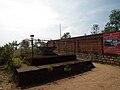
Elephant Squad office, Kuppady
India Kerala location map.svg
Red pog.svg
Pulpally
Location in Kerala, India
India location map.svg
Red pog.svg
Pulpally
Pulpally (India)
Coordinates: 11°47′35″N76°09′54″E / 11.793°N 76.165°E / 11.793; 76.165
CountryFlag of India.svg  India
State Kerala
District Wayanad
Government
  TypeGrama Panchayat
Area
  Total76.72 km2 (29.62 sq mi)
Elevation
742.5 m (2,436.0 ft)
Population
 (2011)
  Total28,322
  Density370/km2 (960/sq mi)
Languages
  Official Malayalam, English
Time zone UTC+5:30 (IST)
PIN
673579
ISO 3166 code IN-KL
Vehicle registration KL-73

Pulpally is a mid-sized town in Wayanad District of Kerala, India.Pulpally also known as 'The land of black gold'. Pulpally is also renowned for its pure wild Wayanad honey. The famous Seetha devi temple in Kerala is situated on Pulpally. Geographically a small town in Sultan Bathery Taluk and a "Grama Panchayath" under the local self governance system. It is about 24 km from Sultan Bathery, and is almost surrounded by forest. The main source of income is agriculture.

Contents

History

About 7 km from Pulpally is the place of death of Pazhassi Raja who led the famous Pazhassi Revolt against the East India Company during the 18th century and was killed on 30 November 1805. The death place of pazhassi Raja is called Mavilanthodu near vandikadavu.This land had relation with the Indian epic Ramayana,that goddess Seetha Devi and her 2 sons were lived here.

Economy

Agriculture is the main economic activity of people. Major crops are pepper, rubber, coconut, ginger, rice, vanilla. arecanut, and coffee. Even most of the people are dependent on pepper agriculture. Pulpally also known as 'The land of black gold'.Once upon a time this land was too rich because of black pepper and ginger cultivation, Pulpally was the place where in India that most Mahindra Jeep owners lived.Pulpally is also famous for its pure wild wayanad honey.

Places of interest

One of the main attractions of Pulpally is the Kabani River. Kabani is one of the three rivers flowing to the east in Kerala. Others are Pambar and Bhavani. The important places are

Major colleges

Schools

Shopping

It's the local commercial hub for the domiciliates of the surrounding areas of Pulpally. All kinds of essentials such as Grocery, Textiles, Home Appliances, Electronics, Computers, Electricals, Building Materials, Stationary, Agriculture products, Heavy metals, Automobiles are available here.

Places of worships

Festivals

The Machur village across the Kabani river has good tourist potential as it is in the very middle of forest area. [1] A large number of devotees come to visit the Gundara Dargah at Machur. The Veda Gowda tribe of Bavali area celebrate the Moori Abba or Ori Abba festival on the new moon day after Deepavali. Centuries ago, this tribe fled from Chitradurga district because of the persecution of Tippu Sultan. The purpose of this celebration is the prosperity of their crops. The festisval begins with nadi Pooja and a bullock race is also conducted. The bullocks are paraded before the Sree Basaveshwara Temple at Dodda Bairankuppa which is only 10 km away from the Kerala town of Pulpally. [2]

Transportation

Pulpally can be accessed from Mananthavady or Sultan Battery. The Periya ghat road connects Mananthavady to Kannur and Thalassery. The Thamarassery mountain road connects Calicut with Kalpetta. The Kuttiady mountain road connects Vatakara with Kalpetta and Mananthavady. The Palchuram mountain road connects Kannur and Iritty with Mananthavady. The road from Nilambur to Ooty is also connected to Wayanad through the village of Meppadi.

The nearest railway station is at Nanjangudu (Near Mysore) and Kozhikode. The nearest airports are Mysore airport 107 km (not for passenger flite)Kozhikode International Airport-120 km, Bengaluru International Airport-290 km, and Kannur International Airport, 58 km. nangangud nilambur railway project and wayanad airport awaited..

Notable people

Related Research Articles

<span class="mw-page-title-main">Wayanad district</span> District in Kerala, India +91

Wayanad is a district in the north-east of the Indian state of Kerala, with administrative headquarters at the municipality of Kalpetta. It is the only plateau in Kerala. The Wayanad Plateau forms a continuation of the Mysore Plateau, the southern portion of Deccan Plateau which links the Western Ghats with the Eastern Ghats. It is set high in the Western Ghats with altitudes ranging from 700 to 2,100 meters. Vellari Mala, a 2,240 m (7,349 ft) high peak situated on the trijunction of Wayanad, Malappuram, and Kozhikode districts, is the highest point in Wayanad district. The district was formed on 1 November 1980 as the 12th district in Kerala, by carving out areas from Kozhikode and Kannur districts. An area of 885.92 km2 in the district is forested. Wayanad has three municipal towns—Kalpetta, Mananthavady and Sulthan Bathery. There are many indigenous tribes in this area. The Kabini River, a tributary of Kaveri River, originates at Wayanad. Wayanad district, along with the Chaliyar valley in the neighbouring Nilambur in Malappuram district, is known for natural gold fields, which are also seen in other parts of the Nilgiri Biosphere Reserve. Chaliyar river, which is the fourth longest river of Kerala, originates on the Wayanad plateau. The historically important Edakkal Caves are located in Wayanad district.

<span class="mw-page-title-main">Sultan Bathery</span> Town in Kerala, India

Sultan Bathery is a town and municipality in the Wayanad district of Kerala, India, near its borders with Tamil Nadu and Karnataka. Once known as a strategic location in the Malabar region, Sultan Bathery is the headquarters of the Sultan Bathery taluk.

<span class="mw-page-title-main">Oorpally</span> Town in Kerala, India

Oorpally is a small village near Koyileri, Mananthavady on the banks of the river Kabini in the Wayanad district of Kerala state, south India.

<span class="mw-page-title-main">Tharuvana</span> Village in Kerala, India

Tharuvana is a village in Vellamunda Panchayath of Wayanad district, Kerala, India. The place is a junction connecting the Vythiri-Tharuvana road to State Highway 54 running between Kuttiady and Mananthavady.

<span class="mw-page-title-main">Kabanigiri</span>

Kabanigiri is a village near Pulpally, Wayanad district. It is one of the nearest places to Kabani River.

<span class="mw-page-title-main">Kaniyambetta</span> Village in Kerala, India

Kaniyambetta or Pachilakkad is a village in the Wayanad district of Kerala state, southern India. It is about 8 km from the district capital Kalpetta.

Anjukunnu is a village in Wayanad district in the state of Kerala, India.

<span class="mw-page-title-main">Edavaka, Mananthavady</span> Grama Panchayat in Kerala, India

Edavaka is a Grama Panchayath in the Wayanad district of the Kerala State, India.

<span class="mw-page-title-main">Irulam</span> Village in Kerala, India

Irulam

Noolpuzha is a village near Sulthan bathery in Wayanad district in the state of Kerala, India.

<span class="mw-page-title-main">Padichira</span> Village in Kerala, India

Padichira is a village near Pulpally in Wayanad district in the state of Kerala, India.

<span class="mw-page-title-main">Padinharethara</span> Town/Panchayat in Kerala, India

Padinjarathara is a Town and important junction in Wayanad district in the state of Kerala, India. The biggest earth dam in Asia Banasura Sagar And Meenmutti Waterfalls is situated in this Village.State Highway 54 passes through Padinjarathara

<span class="mw-page-title-main">Panamaram</span> Town in Kerala, India

Panamaram is a town,village in Wayanad district in the state of Kerala, India.

Thomattuchal is a village in Wayanad district in the state of Kerala, India.

Karingari is a small serene village near Tharuvana in Vellamunda panchayath, Mananthavady area, Wayanad, Kerala, India.

<span class="mw-page-title-main">Meenangadi</span> Town in Kerala, India

Meenangadi is an old town situated on the highway NH 766 between Kalpetta and Sulthan Bathery in Wayanad District, in Kerala, India. This place is one among the Provinces where the existence of Dolmens provide an historical evidence of earlier civilisation. Coffee bean, Black pepper, Ginger, Rice and Areca are the major crops cultivated in this area. Meenangadi is famous for its Fish Market and Cattle Market. The nearest railway station is at Kozhikode at 87 km and airport is Kannur International Airport with 94 km from Meenangadi. Meenangadi is surrounded by, Ambalavayal Panchayat, Kalpetta Taluk towards west, Gudalur Taluk towards East, Mananthavady Taluk towards west. Kalpetta, Sultan Bathery, Kozhikode are the nearby Cities and towns to Meenangadi.
Kerala's first carbon neutrality project launched in Meenangadi in June 2016. Upon achieving the goals of the project, Meenangadi will be the first village in India to go completely carbon neutral. Meenangadi has a population of 33450 According to 2011 Census with two Villages Purakkadi and (Part)Krishnagiri.

<span class="mw-page-title-main">Seetha Mount</span> Place in Kerala, India

Seetha Mount is a small village near Pulpally in Wayanad district of Kerala state in India.

Educational Organizations are located mainly in Kalpetta and Sultan Battery.

<span class="mw-page-title-main">Kayakkunn</span> Village in Kerala, India

Kayakkunnu is a village near Nadavayal, Mananthavady in the Wayanad District of Kerala, India. The village is part of the Panamaram Panchayath, and the assembly constituency is Mananthavady. It is an agricultural area and its main crops include rice, coffee, pepper, ginger, cardamom, vanilla, rubber, areca nut, and coconut. The nearest towns are Nadavayal and Panamaram. Kayakkunn is situated midway along the Mananthavady–Gudalur interstate road.

References

  1. "KALLI VALLI : The killer of the wayanad : A walk back, Man and Machine trip -day 2 Mananthavady-Mandya". kallivalli.blogspot.in. Retrieved 1 May 2016.
  2. "Tribesmen celebrate Moori Abba".
  3. "State Awards | Kerala Lalithakala Akademi". www.lalithkala.org.