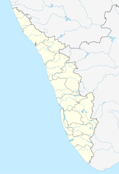
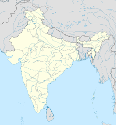
Attingal is a municipality in Thiruvananthapuram metropolitan area in Thiruvananthapuram district of Kerala state, India. It was the location of the Attingal kingdom, under Travancore. It is the headquarters of Chirayinkeezhu Taluk, and the important government institutions of the taluk such as the Taluk office, court complex, office of the deputy superintendent of Police, civil station, and treasuries are situated in Attingal. It is one of the oldest municipalities of Kerala which was constituted prior to its independence in 1924. In 1914 itself Attingal Town Improvement Authority (TIA) was formed which was the term used before the municipality regulation act of 1922. Attingal Town is located 25 kilometres (16 mi) north of Thiruvananthapuram. Attingal is the 3rd densely populated municipality in the district.
Varkala is a major coastal municipality situated in Southern part of Kollam district in the Indian state of Kerala. It is located 43.5 kilometers (27.0 mi) north-west of Thiruvananthapuram and 27.4 kilometers (17.0 mi) south-west of Kollam.
Paravur is a municipality in the Kollam district of Kerala, India. Paravur is located 11.6 km (7.2 mi) southeast of the Kollam city centre, and is a part of the Kollam metropolitan area. Paravur railway station is the last station in Kollam district which is on the route to Trivandrum while travelling towards South India.

Thiruvananthapuram District is the southernmost district in the Indian state of Kerala. The district was created in 1949, with its headquarters in the city of Thiruvananthapuram, which is also Kerala's administrative centre. The present district was created in 1956 by separating the four southernmost Taluks of the erstwhile district to form Kanyakumari district. The city of Thiruvananthapuram is also known as the Information technology capital of the State, since it is home to the first and largest IT park in India, Technopark, established in 1990. The district is home to more than 9% of total population of the state.

Parippally is a suburban Town in Kollam, Kerala, India. Parippally Town is 22 kilometres (14 mi) South of Kollam City along NH66 and 44 kilometres (27 mi) North of Trivandrum along NH66. Kollam Govt. Medical College is situated in Parippally. Varkala sivagiri is nearest major Railway station 12 km(7.5 mi).
The history of Thiruvananthapuram dates back to the 18th century AD. In 1795, the city became the capital of the princely state of Travancore. Several historic landmarks of the city, including the Kowdiar Palace, University of Kerala, and Napier Museum were built during that period. After independence, Thiruvananthapuram was made the capital of the state of Kerala.
The Thiruvananthapuram - Shoranur canal is a historic canal in India, from Trivandrum to Shoranur. It was one of the most arterial transportation mode in erstwhile Travancore princely state. Most of the trade, commerce and freight traffic in Travancore used to happen through this canal. The canal used to pass through rice bowl of the state, Kuttanad, centre of Coir trade i.e. Alappuzha, centre of Cashew business, Kollam, Changanassery market, strategic Thevally, Kayamkulam, Varkala etc. and used to connect Thiruvithamkoor with Cochin State and Malabar.
Karunagappally is a municipality in the Kollam district of Kerala, India. It is 24 km north of Kollam and 60 km (37 mi) south of Alappuzha. Karunagappally taluk consists of Alappad, Ochira, Adinad, Karunagappally, Thazhava, Pavumba, Thodiyoor, Kallalibhagom, Thevalakkara, Chavara, Neendakara, Clappana, Kulasekharapuram, Thekkumbhagam, Ayanivelikulangara, Panmana, Ponmana and Vadakumthala. The taluk is bound on the north by Kayamkulam, on the east by Kunnathur taluk, on the south by Kollam and on the west by the Arabian Sea. It is one of the fastest developing towns in Kerala and is part of Kollam metropolitan area.

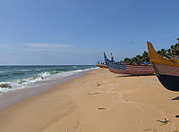
Edava is a panchayat in Varkala Taluk of Trivandrum district in the state of Kerala, India. Edava is located 5km north of Varkala, 21km south of port city Kollam and 44km north of capital city Trivandrum. Kappil beach is a famous surf location.Surfsupkerala life saving club operates here.

Chirayinkeezhu is a town in Thiruvananthapuram district in the Indian state of Kerala. It was also hometown of famous Malayalam Film actor Prem Nazir. It is the seat of Chirayinkeezhu taluk.

Vamanapuram River is an 88 km (55 mi) long river in southern Kerala that flows through the northern parts of Thiruvananthapuram district. It is also the longest river in Thiruvananthapuram district. The river is also known as "Kollampuzhayaru" and "Attingalaru".The two tributaries of this river are the Upper Chittar & Manjaprayaar streams which originates near Ponmudi hill station.
Kappil is a seashore tourist spot located in Thiruvananthapuram district, Kerala, India. It is located in Edava Panchayat of Varkala Taluk. It is 18 km (11 mi) south and 45 km north of Kollam and Thiruvananthapuram cities respectively. Varkala railway station is the major railway station near Kappil.
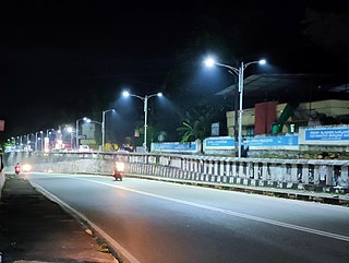
Venjaramoodu is a north-east suburb of Trivandrum city, the capital of Kerala. It is 9 km (5.6 mi) east of Attingal, 11 km (6.8 mi) northwest of Nedumangad, 12 km (7.5 mi) northeast of Trivandrum City and 26 km (16 mi) south-east of Varkala.
Varkala Sivagiri railway station, station code VAK, is a major railway station in Kerala serving the town of Varkala in Thiruvananthapuram. It is the second-busiest railway station in the state capital district Trivandrum in terms of passenger movement and 14th busiest in Kerala State. Around 54 trains halts in this station which handled more than 17,730 passengers daily with 3 platforms. It is on Kollam–Thiruvananthapuram trunk line. Station is well connected to major metropolitan & tier 2 cities like Trivandrum, Hyderabad, Kochi, Delhi, Bangalore, Mangalore, Chennai, Mumbai, Vijayawada, Kolkata, Goa etc.
Kudappanakunnu is the headquarters of Thiruvananthapuram district in the Indian state of Kerala.

The following outline is provided as an overview of and topical guide to Kerala:

The fort was the East India Company's first permanent post on the Malabar Coast. In November 1693, John Brabourne was sent by the British East India Company (EIC) to Attingal, where he obtained from Rani Ashure a grant of a site for a fort on the sandy spit of Anchuthengu, together with the monopoly of the pepper trade of Attingal. The EIC commenced construction in January 1696.
Varkala Taluk is a Taluk (tehsil) in Thiruvananthapuram district in the Indian state of Kerala. It is the 3rd most densely populated taluk in the district comprising 10 villages and Varkala municipality. Spanning an area of about 171 km2,Varkala Taluk is home to over 9% of total population of Trivandrum district. Varkala is the taluk headquarters and the largest town of the taluk.
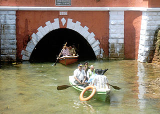
The Varkala Tunnel System, also known as the Varkala Canal or Varkala Thurapp in local dialect, is a system of tunnels situated in the municipality of Varkala of Trivandrum, Kerala, India. It is one of the region's most important historic sites and architectural marvels. This site was constructed by the Travancore Kingdom to establish a continuous inland waterway across Thiruvithamkoor as TS Canal, which was meant to serve as a trade route. The construction of the two long tunnels was started in 1867 and work on the first was finished in 1877, while the second was completed in 1880.
Waterways have always been an important mode of transport in Kerala. The total length of navigable route in Kerala was 1,900 kilometres and the navigable rivers constitute about 54 per cent of the waterways. The 41 West-flowing rivers together with the backwaters are an integrated part of the inland navigation system in Kerala. In Kerala water transportation through these channels are mainly small distant passenger services, informal country boats, freight transportation to PSU's such as Fertilisers and Chemicals Travancore, Kochi etc.