Nilgiri Biosphere Reserve

Last updated

Nilgiri Biosphere Reserve
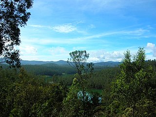
Pic from Doddabetta Peak.jpg
Nilgiri Hills from the top of Doddabetta Peak
India Tamil Nadu relief map.svg
Red pog.svg
India Kerala relief map.svg
Red pog.svg
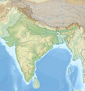
India relief location map.jpg
Red pog.svg
Location South India
Coordinates 11°33′00″N76°37′30″E / 11.55000°N 76.62500°E / 11.55000; 76.62500
Area5,520 km2 (2,130 sq mi)
Established1986
Governing bodyTamilnadu forest department, Karnataka forest department, Kerala forest department, Project Tiger
www.nbnaturepark.com
Logo of the Nilgiri Biosphere Reserve Logo of the Nilgiri Biosphere Reserve.jpg
Logo of the Nilgiri Biosphere Reserve

The Nilgiri Biosphere Reserve is a biosphere reserve in the Nilgiri Mountains of the Western Ghats in South India. It is the largest protected forest area in India, spreading across Tamil Nadu, Karnataka and Kerala. [1] It includes the protected areas Mudumalai National Park, Mukurthi National Park, Sathyamangalam Wildlife Sanctuary in Tamil Nadu; Nagarhole National Park, Bandipur National Park, both in Karnataka; Silent Valley National Park, Aralam Wildlife Sanctuary, Wayanad Wildlife Sanctuary, and Karimpuzha Wildlife Sanctuary in Kerala.

Contents

An ecosystem of the hill ranges of Nilgiris and its surrounding environments covering a tract of over 5000 square kilometers was constituted as Nilgiris Biosphere Reserve by UNESCO in September 1986 under Man and Biosphere Programme. Nilgiris Biosphere Reserve is India's first and foremost biosphere reserves with a heritage, rich in flora and fauna. Tribal groups such as the Badagas, Toda, Kotas, Irulla, Kurumba, Paniya, Adiyan, Edanadan Chettis, Allar, and Malayan are native to the reserve. [2]

Etymology

The word Nilgiri is derived from the Tamil word neelam meaning blue and the Sanskrit word giri meaning mountain. [3] [4] It is thought that the bluish flowers of kurinji shrubs gave rise to the name. [5]

History

In the 1970s, an area of around 5,670 km2 (2,190 sq mi) in the Nilgiri Mountains was proposed to be included in the list of biosphere reserves of India. This proposed area encompassed a forestry zone of 2,290 km2 (880 sq mi), a core zone of 2,020 km2 (780 sq mi), an agricultural zone of 1,330 km2 (510 sq mi) and a restoration zone of 30 km2 (12 sq mi). Nilgiri Biosphere Reserve was established in September 1986 and is India's first biosphere reserve under UNESCO's Man and the Biosphere Programme. [6]

Geography

Map of Nilgiri Biosphere Reserve Nilgiris Biosphere Reserve.jpg
Map of Nilgiri Biosphere Reserve

Nilgiri Biosphere Reserve extends over an area of 5,520 km2 (2,130 sq mi) from the eastern part of Kodagu District to Erode District in the east and to the Palakkad Gap in the south with an elevation of 80 to 2,600 m (260 to 8,530 ft). It has a buffer zone of 4,280 km2 (1,650 sq mi) and core areas of 1,250.3 km2 (482.7 sq mi), comprising 701.8 km2 (271.0 sq mi) in Karnataka, 264.5 km2 (102.1 sq mi) in Kerala and 274 km2 (106 sq mi) in Tamil Nadu. [6]

The reserve extends from the tropical and subtropical moist broadleaf forests, tropical moist forests of the western slopes of the Ghats to the tropical and subtropical dry broadleaf forests tropical dry forests on the east slopes. The rainfall range is 500–7,000 mm (20–276 in) per year. The reserve encompasses three ecoregions, the South Western Ghats moist deciduous forests, South Western Ghats montane rain forests, and South Deccan Plateau dry deciduous forests. [7]

Flora

Shola forest in the Nilgiri Hills Shola forest from Nilgiris.jpg
Shola forest in the Nilgiri Hills

Nilgiri Biosphere Reserve harbours more than 3,700 plant species, including about 200 medicinal plants; the 132 endemic flowering plants are contained in the list of endemic plants in the Nilgiri Biosphere Reserve. [6] Stunted evergreen trees grow in shola forest patches above 1,800 m (5,900 ft) and are festooned with epiphytes. [8]

Tall trees above a height of 18 m (59 ft) are used by the giant honey bees ( Apis dorsata ) for building nests, including the species Tetrameles nudiflora, Indian laurel ( Ficus microcarpa ), Coromandel ebony ( Diospyros melanoxylon ), yellow snake tree ( Stereospermum tetragonum ), rusty kamala ( Mallotus tetracoccus ) and Acrocarpus fraxinifolius. [9] During the peak flowering season from January to May, at least 73 species blossom including teak (Tectona grandis), red cedar ( Erythroxylum monogynum ), hiptage ( Hiptage benghalensis ), large-flowered bay tree ( Persea macrantha ), zunna berry ( Ziziphus rugosa ) and creeping smartweed ( Persicaria chinensis ). They depend on pollination by giant honey bee, Asiatic honey bee ( Apis cerana ), red dwarf honey bee ( A. florea ) and Trigona bees. [10]

Fauna

Birds

The Black Chinned Laughingthrush.jpg
Nilgiri laughingthrush

Nilgiri Biosphere Reserve harbours 14 bird species that are endemic to the Western Ghats. [6] Of these, the Nilgiri laughingthrush (Strophocincla cachinnans) inhabits only higher elevations above 1,200 m (3,900 ft). [11] Other endemics and near-endemics include Nilgiri wood-pigeon, Malabar grey hornbill, Malabar parakeet, white-bellied treepie, white-bellied shortwing, grey-headed bulbul, grey-breasted laughingthrush, rufous babbler, black-and-rufous flycatcher, Nilgiri flycatcher, and Nilgiri pipit. [7]

Mammals

2010-kabini-elephant-family.jpg
Asian elephants at the Kabini River

Nilgiri Biosphere Reserve and adjacent areas host the largest Asian elephant (Elephas maximus) population in India, estimated at 5,750 individuals by 2007. Herds move in 562–800 km2 (217–309 sq mi) large home ranges and congregate at perennial water sources during the dry season. [12]

Fauna includes over 100 species of mammals, 370 species of birds, 80 species of reptiles, about 39 species of fish, 31 amphibians and 316 species of butterflies.[ citation needed ] It is home to mammals such as the Bengal tiger, Indian leopard, chital deer, gaur, sambar deer, dhole, golden jackal, Indian boar, Nilgiri tahr, Indian spotted chevrotain, black buck, Asian palm civet, sloth bear, four-horned antelope, Nilgiri marten, Indian crested porcupine, Malabar giant squirrel, honey badger, Indian grey mongoose, Indian pangolin, Indian fox, smooth coated otter, and painted bat. Primates include the lion tailed macaque, Nilgiri langur, gray langur and bonnet macaque.

Amphibians and reptiles

Amphibians include purple frog, Silent valley brush frog, Malabar gliding frog, Beddomixalus. Around fifty percent of India's amphibian species are endemic to the region, and around ninety species of reptiles including the genera Brachyopihidium, Dravidogecko , Melanophidum, Ristella , Salea , Plectrurus , Teretrurus , and Xylophis . [7]

Threats

Forest fire in Bandipur National Park in 2019 Bandipur fires 2019.jpg
Forest fire in Bandipur National Park in 2019

Shola forests outside protected areas are threatened by fragmentation, especially in the vicinity of settlements. [8] The rapid and dense growth of the invasive Passiflora mollissima inhibits the regeneration of native tree species in the Shola forest patches. [13]

Poaching, deforestation, forest fires and dangers to native tribes are the main threats. Despite poaching banned by law in 1972, people still tend to illegally hunt animals such as tigers, elephants and chital for skin, fur or tusks. Forests are being destroyed for farming or livestock. Animals that kill livestock are killed by farmers. Forest fires destroy vegetation. Native tribes are being evacuated from their homelands, resulting in loss of tribal culture.[ citation needed ]

See also

Related Research Articles

<span class="mw-page-title-main">Western Ghats</span> Mountain range along the western coast of India

The Western Ghats, also known as the Sahyadri mountain range, is a mountain range that covers an area of 160,000 km2 (62,000 sq mi) in a stretch of 1,600 km (990 mi) parallel to the western coast of the Indian peninsula, traversing the states of Gujarat, Maharashtra, Goa, Karnataka, Kerala and Tamil Nadu. It is a UNESCO World Heritage Site and is one of the 36 biodiversity hotspots in the world. It is sometimes called the Great Escarpment of India. It contains a very large proportion of the country's flora and fauna, many of which are endemic to this region. The Western Ghats are older than the Himalayas. They influence Indian monsoon weather patterns by intercepting the rain-laden monsoon winds that sweep in from the south-west during late summer. The range runs north to south along the western edge of the Deccan Plateau and separates the plateau from a narrow coastal plain called the Western Coastal Plains along the Arabian Sea. A total of 39 areas in the Western Ghats, including national parks, wildlife sanctuaries and reserve forests, were designated as world heritage sites in 2012 – twenty in Kerala, ten in Karnataka, six in Tamil Nadu and four in Maharashtra.
<span class="mw-page-title-main">South Western Ghats montane rain forests</span> Ecoregion in South India

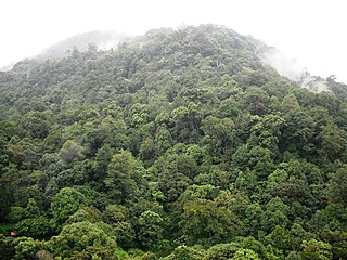
The South Western Ghats montane rain forests is an ecoregion in South India, covering the southern portion of the Western Ghats in Karnataka, Kerala and Tamil Nadu at elevations from 1,000 to 2,695 m. Annual rainfall in this ecoregion exceeds 2,800 mm (110 in).

<span class="mw-page-title-main">South Western Ghats moist deciduous forests</span> Ecoregion in India

The South Western Ghats moist deciduous forests is an ecoregion in the Western Ghats of southern India with tropical and subtropical moist broadleaf forests. This biome covers the Nilgiri Hills between elevation of 250 and 1,000 m in Kerala, Karnataka and Tamil Nadu states.

<span class="mw-page-title-main">Ponmudi</span> Hill station, Town in Kerala, India

Ponmudi is a hill station in the Peringamala gramapanchayath of Trivandrum District of Kerala in India. It is located 22km west of Vithura town, 53 km north-east of Trivandrum City, 78 km south-east of Varkala town and 69 km north-east of Kovalam Beach at an altitude of 1,100 m (3,600 ft). Ponmudi (Varayadumotta) peak is a part of the Western Ghats mountain range that runs parallel to the Arabian Sea. Ponmudi is a popular honeymoon destination in South India. The normal temperature of Ponmudi is between 18 and 25 °C.
<span class="mw-page-title-main">Silent Valley National Park</span> National park in Kerala, India

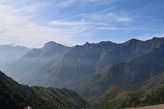
Silent Valley National Park is a national park in Kerala, India. It is located in the Nilgiri hills and has a core area of 89.52 km2 (34.56 sq mi). It is surrounded by a buffer zone of 148 km2 (57 sq mi). This national park has some rare species of flora and fauna. Silent Valley National Park was explored in 1847 by the botanist Robert Wight. It is located in the border of Mannarkkad Taluk of Palakkad district, Nilambur Taluk of Malappuram district, Kerala, and Nilgiris district of Tamil Nadu.
<span class="mw-page-title-main">Anamalai Tiger Reserve</span> Wildlife sanctuary and national park in Tamil Nadu, India

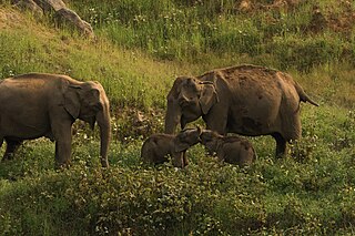
Anaimalai Tiger Reserve, earlier known as Indira Gandhi Wildlife Sanctuary and National Park and as Anaimalai Wildlife Sanctuary, is a protected area in the Anaimalai Hills of Pollachi and Valparai taluks of Coimbatore District and Udumalaipettai taluk in Tiruppur District, Tamil Nadu, India. The Tamil Nadu Environment and Forests Department by a notification dated 27 June 2007, declared an extent of 958.59 km2 that encompassed the erstwhile IGWLS&NP or Anaimalai Wildlife Sanctuary, as Anaimalai Tiger Reserve under the Wildlife Protection Act, 1972. According to the National Tiger Conservation Authority, the Reserve presently includes a core area of 958.59 km2 and buffer/peripheral area of 521.28 km2 forming a total area of 1479.87 km2.

<span class="mw-page-title-main">Mudumalai National Park</span> National park in Tamil Nadu, India

Mudumalai National Park is a national park in the Nilgiri Mountains in Tamil Nadu in southern India. It covers 321 km2 (124 sq mi) at an elevation range of 850–1,250 m (2,790–4,100 ft) in the Nilgiri District and shares boundaries with the states of Karnataka and Kerala. A part of this area has been protected since 1940. The national park has been part of Nilgiri Biosphere Reserve since 1986 and was declared a tiger reserve together with a buffer zone of 367.59 km2 (141.93 sq mi) in 2007. It receives an annual rainfall of about 1,420 mm (56 in) and harbours tropical and subtropical moist broadleaf forests with 498 plant species, at least 266 bird species, 18 carnivore and 10 herbivore species. It is drained by the Moyar River and several tributaries, which harbour 38 fish species.

The term Malabar rainforests refers to one or more distinct ecoregions recognized by biogeographers:

  1. the Malabar Coast moist forests formerly occupied the coastal zone to the 250 metre elevation
  2. the South Western Ghats moist deciduous forests grow at intermediate elevations
  3. the South Western Ghats montane rain forests cover the areas above 1000 metres elevation
<span class="mw-page-title-main">Periyar National Park</span> Protected area in Kerala

Periyar National Park and Wildlife Sanctuary (PNP) is a protected area located in the districts of Idukki and Pathanamthitta in Kerala, India. It is notable as an elephant reserve and a tiger reserve. The protected area encompasses 925 km2 (357 sq mi), of which 305 km2 (118 sq mi) of the core zone was declared as the Periyar National Park in 1982. The park is a repository of rare, endemic, and endangered flora and fauna and forms the major watershed of two important rivers of Kerala: the Periyar and the Pamba.

<span class="mw-page-title-main">Mukurthi National Park</span> National park in India

Mukurthi National Park (MNP) is a 78.46 km2 (30.3 sq mi) protected area located in the western corner of the Nilgiris Plateau west of Ootacamund hill station in the northwest corner of Tamil Nadu state in the Western Ghats mountain range of South India. The park was created to protect its keystone species, the Nilgiri tahr.
<span class="mw-page-title-main">Nilgiri Mountains</span> Mountain range in Tamil Nadu, India

The Nilgiri Mountains form part of the Western Ghats in northwestern Tamil Nadu, Southern Karnataka, and eastern Kerala in India. They are located at the trijunction of three states and connect the Western Ghats with the Eastern Ghats. At least 24 of the Nilgiri Mountains' peaks are above 2,000 metres (6,600 ft), the highest peak being Doddabetta, at 2,637 metres (8,652 ft).

The Agasthyamala Biosphere Reserve is a biosphere reserve in India established in 2001, located in the southernmost end of the Western Ghats and includes 3,500.36 km2 (1,351.50 sq mi) of which 1828 km2 is in Kerala and 1672.36 km2 is in Tamil Nadu. It encompasses the following wildlife sanctuaries: Shendurney Wildlife Sanctuary, Peppara Wildlife Sanctuary, Neyyar Wildlife Sanctuary, and Kalakkad Mundanthurai Tiger Reserve.

<span class="mw-page-title-main">Wildlife of Karnataka</span>

The state of Karnataka in South India has a rich diversity of flora and fauna. It has a recorded forest area of 38,720 km2 which constitutes 22% of the geographical area of the state. These forests support 25% of the elephant population and 20% of the tiger population of India. Many regions of Karnataka are still unexplored and new species of flora and fauna are still found. The mountains of the Western Ghats in the western region of Karnataka are a biodiversity hotspot. Two sub-clusters of the Western Ghats, Talacauvery and Kudremukh, are on a tentative list of sites that could be designated as World Heritage Sites by UNESCO. The Bandipur and Nagarahole national parks which fall outside these subclusters were included in the Nilgiri biosphere reserve in 1986, a UNESCO designation. In the Biligiriranga Hills the Eastern Ghats meet the Western Ghats. The state bird and state animal of Karnataka are Indian roller and the Indian elephant. The state tree and state flower are sandalwood and lotus. Karnataka is home to 524 tigers.

<span class="mw-page-title-main">Grizzled Squirrel Wildlife Sanctuary</span> Wildlife sanctuary in Tamil Nadu, India

The Grizzled Squirrel Wildlife Sanctuary (GSWS), also known as Srivilliputhur Wildlife Sanctuary, was established in 1988 to protect the Near threatened grizzled giant squirrel. Occupying an area of 485.2 km2, it is bordered on the southwest by the Periyar Tiger Reserve and is one of the best preserved forests south of the Palghat Gap.

<span class="mw-page-title-main">Mukurthi</span>

Mukurthi Peak is one of the highest peaks in the Western Ghats, situated on the border of Udagamandalam taluk, Nilgiris, Tamil Nadu, Nilambur taluk, Malappuram, and Kerala in India. It reaches an altitude of 2,554 m (8,379ft), and is the fifth-highest peak in South India.

Agasthyavanam Biological Park is a protected area in the Western Ghats in Kerala State, India. The park is located within Vazhichal Panchiyat and lies between the Neyyar and Peppara Wildlife Sanctuaries which covers an area of about 31 square kilometres (12 sq mi).

<span class="mw-page-title-main">New Amarambalam Reserved Forest</span>

New Amarambalam reserved forest is a reserved forest in the Western Ghats, situated in the Malappuram District of Kerala state of India. It extends till Silent Valley National Park of the Palakkad District to the south and to Nadugani in the Nilgiri District of Tamil Nadu to the North. It is under the Karimpuzha Wildlife Sanctuary.

<span class="mw-page-title-main">Sigur Plateau</span> Reserve forest in Tamil Nadu, India

Sigur Plateau is a plateau in the north and east of Nilgiri District in the Nilgiri Hills of Tamil Nadu, South India. It covers the 778.8 square kilometres (300.7 sq mi) portion of the Moyar River drainage basin on the northern slopes of the Nilgiri Hills, south of the Moyar River.

<span class="mw-page-title-main">Malabar Wildlife Sanctuary</span>

Malabar Wildlife Sanctuary is a protected area located along the Western Ghats and spread across 74 square kilometres (29 sq mi) in Chakkittapara and Koorachundu revenue villages of Koyilandy Taluk in Kozhikode, Kerala. The sanctuary is part of the western ghats, a biodiversity hotspot. It also comes under the Nilgiri Biosphere Reserve and forms a part of the Wayanad Elephant Reserve.

References

  1. Correspondent, Legal (27 January 2021). "Conservationist joins SC panel on elephant corridor case". The Hindu. ISSN   0971-751X . Retrieved 28 January 2021.
  2. About Nilgiri Biosphere Reserve (NBR) Archived 24 June 2012 at the Wayback Machine – www.nilgiribiospherereserve.com
  3. "The Missionary Herald of the Baptist Missionary Society". Baptist Mission House. 1886: 398.{{cite journal}}: Cite journal requires |journal= (help)
  4. Lengerke, Hans J. von (1977). The Nilgiris: Weather and Climate of a Mountain Area in South India. Steiner. p. 5. ISBN   9783515026406.
  5. "Decline of a Montane Ecosystem". Kartik Shanker Centre for Ecological Sciences, Indian Institute of Science. February 1997.
  6. 1 2 3 4 Ranjit Daniels, R.J. & Vijayan, V.S. (1996). The Nilgiri Biosphere Reserve: A Review of Conservation Status with Recommendations for a Wholistic Approach to Management (PDF) (Report). Working Paper No. 16. Paris: UNESCO South-South Co-operation Programme for Environmentally Sound Socio-Economic Development in the Humid Tropics.
  7. 1 2 3 Wikramanayake, Eric D. (2002). Terrestrial ecoregions of the Indo-Pacific: a Conservation Assessment. Washington, D.C.: Island Press. pp. 284–285. ISBN   1-55963-923-7. OCLC   48435361.
  8. 1 2 Chandrashekara, U.M.; Muraleedharan, P.K. & Sibichan, V. (2006). "Anthropogenic pressure on structure and composition of a shola forest in Kerala, India". Journal of Mountain Science. 3 (1): 58–70. doi:10.1007/s11629-006-0058-0. S2CID   55780505.
  9. Thomas, S.G.; Varghese, A.; Roy, P.; Bradbear, N.; Potts, S.G. & Davidar, P. (2009). "Characteristics of trees used as nest sites by Apis dorsata (Hymenoptera, Apidae) in the Nilgiri Biosphere Reserve, India" (PDF). Journal of Tropical Ecology. 25 (5): 559–562. doi:10.1017/S026646740900621X. S2CID   22832468.
  10. Thomas, S.G.; Rehel, M.S.; Varghese, A.; Davidar, P. & Potts, S.G. (2009). "Social bees and food plant associations in the Nilgiri Biosphere Reserve, India". Tropical Ecology. 50 (1): 79–88.
  11. BirdLife International (2017). "Strophocincla cachinnans". IUCN Red List of Threatened Species . 2017: e.T103874076A111175518.
  12. Baskaran N.; Kanakasabai, R. & Desai, A.A. (2018). "Ranging and spacing behaviour of Asian Elephant (Elephas maximus Linnaeus) in the tropical forests of Southern India". In Sivaperuman, C. & Venkataraman, K. (eds.). Indian Hotspots. Singapore: Springer. pp. 295–315. doi:10.1007/978-981-10-6605-4_15. ISBN   978-981-10-6604-7.
  13. Jose, F.C. (2012). "The 'living fossil' shola plant community is under threat in upper Nilgiris". Current Science. 102 (8): 1091–1092.