Eranad

Last updated

Eranad
Ernad
Erstwhile Province
Manjeri Town Calicut Road View.jpg
Near cherumb eco vilalge .jpg
Chaliyar - Areekode Bridge.jpg
Kadalundi Bridge - A border of Malappuram and Kozhikode.jpg
Nilambur teak forest 3740.JPG
Vaidyar.JPG
Clockwise from top:
Manjeri city, Chaliyar River at Areekode, Conolly's plot at Nilambur, Maha Kavi Moyinkutty Vaidyar Smarakam at Kondotty, Kadalundi River estuary at Vallikkunnu, Karuvarakundu
India Kerala location map.svg
Red pog.svg
Eranad
Location in Kerala, India
India location map.svg
Red pog.svg
Eranad
Eranad (India)
Coordinates: 11°07′09″N76°07′11″E / 11.119198°N 76.119631°E / 11.119198; 76.119631
CountryFlag of India.svg  India
State Kerala
District Malappuram
Taluk Headquarters Manjeri
Languages
  Official Malayalam, English
Time zone UTC+5:30 (IST)
Vehicle registration KL-10, KL-71 & KL-84

Eranad also known as Ernad refers to the erstwhile province in the midland area of Malabar, consisting of Malappuram and nearby regions such as Anakkayam, Manjeri, Kondotty, Nilambur, etc. Currently Eranad Taluk is a Taluk in Malappuram district. Eranad was ruled by a Samanthan Nair clan known as Eradis, similar to the Vellodis of neighbouring Valluvanad and Nedungadis of Nedunganad. The rulers of Eranad were known by the title Eralppad/Eradi. They also used the title Thirumulpad.[ citation needed ]

Contents

Ernad had two capitals during various times, Nediyiruppu, in Kondotty under Chera rule, [1] and Kottappadi, in Malappuram under Zamorin rule. Present-day Ernad taluk headquarters is at Manjeri. The Ernad Taluk under British Malabar District was the land between two rivers, Chaliyar and Kadalundi River. [2] On west it was bound by the Nilgiri Mountains. It was the largest Taluk in Malabar District. [3] It had included the whole of present-day Eranad Taluk, Nilambur Taluk, Kondotty Taluk, Tirurangadi Taluk, and two villages in Tirur Taluk (Kottakkal and Ponmala), and three villages in present-day Kozhikode Taluk, (Feroke, Ramanattukara, and Kadalundi). [4]

Etymology

History

The Zamorin was actually known as Eradi (Ruler of Eranadu) before he shifted his headquarters from Nediyiruppu to Kozhikode.

The ancient port of Tyndis which was located on the northern side of Muziris, as mentioned in the Periplus of the Erythraean Sea , was somewhere around Eranadu. [5] Its exact location is a matter of dispute. [5] The suggested locations are Ponnani, Tanur, Beypore-Chaliyam-Kadalundi-Vallikkunnu, and Koyilandy. [5] Note that all the above regions excluding Koyilandy are located in or around Eranadu. Tyndis was a major center of trade, next only to Muziris, between the Cheras and the Roman Empire. [6] Pliny the Elder (1st century CE) states that the port of Tyndis was located at the northwestern border of Keprobotos (Chera dynasty). [7] The North Malabar region, which lies north of the port at Tyndis , was ruled by the kingdom of Ezhimala during Sangam period. [8] According to the Periplus of the Erythraean Sea , a region known as Limyrike began at Naura and Tyndis . However the Ptolemy mentions only Tyndis as the Limyrike's starting point. The region probably ended at Kanyakumari; it thus roughly corresponds to the present-day Malabar Coast. The value of Rome's annual trade with the region was estimated at around 50,000,000 sesterces. [9] [10] Pliny the Elder mentioned that Limyrike was prone by pirates. [11] The Cosmas Indicopleustes mentioned that the Limyrike was a source of peppers. [12] [13]

Chaliyam in the northwestern end of Eranadu is also home to one of the oldest mosques in India. According to the Legend of Cheraman Perumals, the first Indian mosque was built in 624 AD at Kodungallur with the mandate of the last the ruler (the Cheraman Perumal) of Chera dynasty, who converted to Islam during the lifetime of Muhammad (c. 570–632). [14] [15] [16] [17] According to Qissat Shakarwati Farmad , the Masjids at Kodungallur, Kollam, Madayi, Barkur, Mangalore, Kasaragod, Kannur, Dharmadam, Panthalayini, and Chaliyam, were built during the era of Malik Dinar, and they are among the oldest Masjids in the Indian subcontinent. [18] It is believed that Malik Dinar died at Thalangara in Kasaragod town. [19]

Eranad (from "Erala-nadu", the Land of the Cattle, according to William Logan), was originally a province in the Chera Kingdom (9th-12th century CE) ruled by a clan known as the Eradis. [2] Their provincial capital was at Nediyiruppu, near present-day Kondotty. [1] The ruler of the Eralanadu was known as the Eralanadu Utaiyavar, Elar-thiri or Nediyiruppu Mooppan or Mooppil Nayar. [1] Manavepala Manaviyan, a governor of the Eralanadu, signs himself in the famous Jewish Copper Plate (1000 CE). [1] The Viraraghava Copper Plate (1225 CE) is also signed by the Eralanadu ruler. [1]

After the fall of the Cheras, the region became an independent political entity. [1] Later, the Eradis expanded their kingdom to the west and moved their capital to Calicut while setting up a regional capital at Kottappadi, Malappuram with Paranambi as the chieftain. [1] The Eradis came to be known as the "Kings of the Oceans" (Samoothiri/Zamorin) in later times. [1]

The Ernad taluk existed during British Colonial rule in India was under Malappuram Revenue Division, along with the neighbouring Valluvanad Taluk, a part of Malabar District within the Madras Presidency. [3] The oldest teak plantation of the world at Nilambur, and the first tile-manufacturing industry of India at Feroke, were in Eranad.

In the first decade after Independence, large-scale changes in the territorial jurisdiction of this region took place with the formation of new taluks. [3] On 1 January 1957 Tirur Taluk was formed, by absorbing portions of Eranad and Ponnani taluks. [20] Three more taluks, namely Tirurangadi taluk and Nilambur taluk, and Kondotty Taluk, [21] were formed later by bifurcating Tirur Taluk and Eranad taluk. [22]

Geography

William Logan, the author of Malabar Manual and a former District Collector of Malabar, described Eranad as the most typical Taluk of erstwhile Malabar District, having many smaller hills, valleys, Conolly Canal, long rivers and their tributaries (Chaliyar and Kadalundi River), various plantations, paddy fields etc. [2] The highest peaks in the erstwhile Malabar District was located in Nilambur region of Eranad (Eastern Eranad) on the vicinity of Nilgiri Mountains. [2] The 2,554 m high Mukurthi peak, which is situated in the border of modern-day Nilambur Taluk and Ooty Taluk, and is also the fifth-highest peak in South India as well as the third-highest in Kerala after Anamudi (2,696 m) and Meesapulimala (2,651 m), was the highest point of elevation in Malabar district. It is also the highest peak in Kerala outside the Idukki district. The 2,383 high Anginda peak, which is located closer to Malappuram-Palakkad-Nilgiris district border is the second-highest peak. [2] Vavul Mala, a 2,339 m high peak situated on the trijunction of Nilambur Taluk of Malappuram, Wayanad, and Thamarassery Taluk of Kozhikode districts, was the third-highest point of elevation in the district. [2] Apart from the main continuous range of Western Ghats, there were many small undulating hills in the lowland of the district. [2]

In the British records, Eastern Eranad region was collectively described as Nilambur Valley. [23] The bank of river Chaliyar at Nilambur region is also known for natural Gold fields. [24] Explorations done at the valley of the river Chaliyar in Nilambur has shown reserves of the order of 2.5 million cubic meters of placers with 0.1 gram per cubic meter of gold. [25] Eranad is blessed with several tributaries of Chaliyar river and Kadalundi river.

Malabar Rebellion

The region was the centre of the Malabar Rebellion of 1921. This armed uprising against British and feudal lords was put down by the Colonial government.[ citation needed ]

Eranad, the name also used by

Eranad Taluk under British Rule

Eranad Taluk in the erstwhile Malabar District Malabar District (1951 Census).svg
Eranad Taluk in the erstwhile Malabar District

The Amsoms included in Ernad Taluk was classified into four divisions- Parappur (Southern Parappanad), Ramanad, Cheranad, and Eranad. There were 52 Amsoms in the Taluk. [2] (A part of Cheranad division was under Ponnani Taluk). The British Eranad Taluk was created in 1860-61by merging the erstwhile British Taluks of Southern Parappanad, Ramanad, Cheranad, and Eranad, which were vested between River Chaliyar and Kadalundi River. [2]

1. Parappur (Southern Parappanad)

Southern Parappanad was a vassal of the Zamorin of Calicut. Parappanangadi, the headquarters of Parappanad royal family, was at Southern Parappanad. [2] It consisted of the following 7 Amsoms:

2. Ramanad

Ramanad was directly ruled by the Zamorin of Calicut. [2] It consisted of the following 7 Amsoms:

3. Cheranad

Cheranad was also directly ruled by the Zamorin of Calicut. [2] Cheranad was scattered in Eranad and Ponnani Taluks. The headquarters of Cheranad was Tirurangadi. It consisted of the following 17 Amsoms:

Eranad Taluk

Ponnani Taluk

4. Eranad

Eranad was the original headquarters of the Zamorin of Calicut. It was later changed to Kozhikode with the conquest of Polanad. It also was under the direct rule of the Zamorin. [2] It consisted of the following 26 Amsoms:

Transportation

The Ernad area connects with other parts of India through highway NH966. Multiple state highways connect the region with other parts of the district as well as the rest of the state. The nearest airport is at Karipur. The nearest major railway station is at Tirur, which is also the oldest Railway Station in the state of Kerala.

See also

Related Research Articles

<span class="mw-page-title-main">Malappuram district</span> District in Kerala, India

Malappuram, is one of the 14 districts in the Indian state of Kerala, with a coastline of 70 km (43 mi). The most populous district of Kerala, Malappuram is home to around 13% of the total population of the state. The district was formed on 16 June 1969, spanning an area of about 3,554 km2 (1,372 sq mi). It is the third-largest district of Kerala by area. It is bounded by Western Ghats and the Arabian Sea on either side. The district is divided into seven Taluks: Eranad, Kondotty, Nilambur, Perinthalmanna, Ponnani, Tirur, and Tirurangadi.

<span class="mw-page-title-main">Kingdom of Valluvanad</span> Independent chiefdom in present-day central Kerala

Valluvanad was an independent chiefdom in present-day central Kerala that held power from the early 12th century to the end of the 18th century. Prior to that, and since the late 10th century, Valluvanad existed as an autonomous chiefdom within the kingdom of the Chera Perumals. The disintegration of the Chera Perumal kingdom in early 12th century led to the independence of the various autonomous chiefdoms of the kingdom, Valluvanad being one of them.

<span class="mw-page-title-main">Nilambur</span> Place in Kerala, India

Nilambur is a major town, a municipality and a Taluk in the Malappuram district of the Indian state of Kerala. It is located close to the Nilgiris range of the Western Ghats on the banks of the Chaliyar River. This place is also known as 'Teak Town' because of the abundance of Nilambur teaks in this area; Which is a variety of a large, deciduous tree that occurs in mixed hardwood forests. Unlike many Municipalities of India; Nilambur is covered with large amounts of vegetation making it close to nature and hence make it very scenic and inspiring.

<span class="mw-page-title-main">Malabar District</span> Administrative district of Bombay and later Madras from 1792 to 1956

Malabar District, also known as Malayalam District, was an administrative district on the southwestern Malabar Coast of Bombay Presidency (1792–1800), Madras Presidency (1800–1937), Madras Province (1937–1950) and finally, Madras State (1950–1956) in India. It was the most populous and the third-largest district in the erstwhile Madras State. The historic town of Calicut was the admisnitrative headquarters of this district.

<span class="mw-page-title-main">Feroke</span> Municipality in Kerala, India

Feroke is a Municipality and a part of Kozhikode metropolitan area under Kozhikode Development Authority (K.D.A) in the Kozhikode district of the Indian state of Kerala.

<span class="mw-page-title-main">Tanur, Malappuram</span> Municipality in Kerala, India

Tanur is a coastal town, a municipality, and a block located in Tirur Taluk, Malappuram district, Kerala, India. It is located on the Malabar Coast, 9 kilometres (5.6 mi) north of Tirur and 9 kilometres south of Parappanangadi. It is the 17th-most populated municipality in the state, the fourth-most populated municipality in the district, and the second-most densely populated municipality in Malappuram district, having about 3,568 residents per square kilometre as of the year 2011.

<span class="mw-page-title-main">Ramanattukara</span> Municipality/Suburb in Kozhikode, Kerala, India

Ramanattukara is a municipality census town in Kozhikode district in the Indian state of Kerala. This town was formerly called Kadungan Chira village. Ramanattukara is located 15 km away from Kozhikode city.

<span class="mw-page-title-main">Valanchery</span> Town in Kerala, India +91

Valanchery is a major municipal town in Malappuram district, Kerala, India. It is one of the four municipalities in Tirur Taluk, besides Tirur, Kottakkal, and Tanur. It is situated about 40 kilometres (25 mi) southeast to Karipur International Airport and 25 kilometres (16 mi) southwards to the district headquarters, and forms a part of Malappuram metropolitan area. It is also one of the major commercial towns under the Malappuram urban agglomeration. Valanchery, which was a part of the erstwhile princely state of the Valluvanad in the early medieval period, had been under the direct control of the Zamorin of Calicut following the Tirunavaya war of 14th century CE. During British Raj, Valanchery was included in the Ponnani Taluk of erstwhile Malabar District.

<span class="mw-page-title-main">Parappanangadi</span> Municipality in Kerala, India

Parappanangadi is a major town and a municipality in Tirurangadi taluk of Malappuram district, Kerala, India. It is a coastal town located close to the Arabian sea.

<span class="mw-page-title-main">Vallikkunnu</span> Village in Kerala, India

Vallikkunnu is a village in Tirurangadi Taluk of Malappuram district in the state of Kerala, India with an area of 25 km2. It is located 5 km north of Parappanangadi town and comes under the jurisdiction of Parappanangadi Police Station and Parappanangadi Judicial First Class Magistrate Court. Its latitude and longitude are 11'07" N and 7'51"E respectively. Vallikkunnu was awarded the best panchayath of Kerala in 1997. Vallikunnu is situated on Tirur-Kadalundi Road. Vallikkunnu is also a part of the Oldest Railway Line of Kerala laid in 1861 from Tirur to Chaliyam via Tanur, Parappanangadi, Vallikkunnu, and Kadalundi.

<span class="mw-page-title-main">Kadalundi</span> Village in Kerala, India

Kadalundi is a village in Kozhikode district, Kerala, India. It is a coastal village close to the Arabian Sea. Kadalundi is famous for its bird sanctuary, which is home to various migratory birds during certain seasons and has been recently declared as a bio-reserve. The Kadalundi–Vallikkunnu Community Reserve is the first community reserve in Kerala. The Kadalundi River and the Chaliyar river, two of the longest rivers of Kerala, merges with the Arabian Sea at Kadalundi. The first railway line in Kerala was laid in 1861 from Tirur to Chaliyam through Tanur, Parappanangadi, Vallikkunnu, and Kadalundi.

<span class="mw-page-title-main">Ponnani taluk</span> Taluk in Kerala, India

PonnaniTaluk is a district in India.

<span class="mw-page-title-main">Areekode</span> Town in Kerala, India

Areekode is a town on the banks of the Chaliyar River in Areekode Grama Panchayat in Malappuram district, India. It was part of the Malabar district in British India.

<span class="mw-page-title-main">Calicut (kingdom)</span> Historical kingdom in the region of Kerala

The Kingdom of Kozhikode, also known as Calicut, was the kingdom of the Zamorin of Calicut, in the present-day Indian state of Kerala. Present-day Kozhikode is the second largest city in Kerala, as well as the headquarters of Kozhikode district.

<span class="mw-page-title-main">Chaliyam</span> Village in Kerala, India

Chaliyam is a village situated at the estuary of Chaliyar in Kozhikode district of Kerala, India. Chaliyam forms an island, bounded by the Chaliyar in the north, and River Kadalundi in south, and the Conolly Canal in the east. It is located just opposite to Beypore port. Chaliyam was the former terminus of the South-West Line of the Madras Railway. Chaliyam is also famous for the Guinness World Records holder Muhammed Adil, a P.M who covered around seven km in the Chaliyar River with his hand and legs tied with ropes.

<span class="mw-page-title-main">Kondotty taluk</span> Taluk in Kerala, India

Kondotty Taluk, otherwise called Western Eranad Taluk, comes under Tirur revenue division in Malappuram district of Kerala, India. Its headquarters is the town of Kondotty. Kondotty Taluk contains Kondotty municipality and a few Gram panchayats.

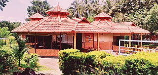
Malappuram is one of the 14 districts in the South Indian state of Kerala. The district has a unique and eventful history starting from pre-historic times. During the early medieval period, the district was the home to two of the four major kingdoms that ruled Kerala. Perumpadappu was the original hometown of the Kingdom of Cochin, which is also known as Perumbadappu Swaroopam, and Nediyiruppu was the original hometown of the Zamorin of Calicut, which is also known as Nediyiruppu Swaroopam. Besides, the original headquarters of the Palakkad Rajas were also at Athavanad in the district.

<span class="mw-page-title-main">Eranad Taluk</span> Taluk in Kerala, India

Eranad Taluk comes under Perinthalmanna revenue division in Malappuram district of Kerala, India. Its headquarters is the city of Manjeri. Eranad Taluk contains two municipalities - Manjeri and Malappuram. Most of the administrative offices are located in the Civil Station at Malappuram and the Mini-Civil Station at Manjeri.

<span class="mw-page-title-main">South Malabar</span> Geographical / Historical Area in Kerala, India

South Malabar refers to a geographical area of the southwestern coast of India covering some parts of the present-day Kerala state. South Malabar covers the regions included in present-day Kozhikode taluk of Kozhikode district, the whole area of Malappuram district, Chavakkad taluk of Thrissur district, and Palakkad district, excluding parts of Chittur taluk. The Fort Kochi region of Kochi city also historically belongs to South Malabar. The term South Malabar refers to the region of the erstwhile Malabar District south to the river Korapuzha, and bears a high cultural similarity to both the Cochin and the North Malabar regions.

References

  1. 1 2 3 4 5 6 7 8 K. V. Krishna Iyer, Zamorins of Calicut: From the earliest times to AD 1806. Calicut: Norman Printing Bureau, 1938.
  2. 1 2 3 4 5 6 7 8 9 10 11 12 13 14 15 16 17 18 Logan, William (2010). Malabar Manual (Volume-I). New Delhi: Asian Educational Services. pp. 631–666. ISBN   9788120604476.
  3. 1 2 3 1951 census handbook - Malabar district (PDF). Chennai: Government of Madras. 1953. pp. 1–2.
  4. Presidency, Madras (India (1915). Madras District Gazetteers, Statistical Appendix For Malabar District (Vol.2 ed.). Madras: The Superintendent, Government Press. p. 20. Retrieved 2 December 2020.
  5. 1 2 3 Menon, A. Sreedhara (2007). A Survey of Kerala History. DC Books. ISBN   9788126415786.
  6. Coastal Histories: Society and Ecology in Pre-modern India, Yogesh Sharma, Primus Books 2010
  7. Gurukkal, R., & Whittaker, D. (2001). In search of Muziris. Journal of Roman Archaeology,14, 334-350.
  8. A. Shreedhara Menon, A Survey of Kerala History
  9. According to Pliny the Elder, goods from India were sold in the Empire at 100 times their original purchase price.
  10. Bostock, John (1855). "26 (Voyages to India)". Pliny the Elder, The Natural History. London: Taylor and Francis.
  11. Indicopleustes, Cosmas (1897). Christian Topography. 11. United Kingdom: The Tertullian Project. pp. 358–373.
  12. Das, Santosh Kumar (2006). The Economic History of Ancient India. Genesis Publishing Pvt Ltd. p. 301.
  13. Jonathan Goldstein (1999). The Jews of China. M. E. Sharpe. p. 123. ISBN   9780765601049.
  14. Edward Simpson; Kai Kresse (2008). Struggling with History: Islam and Cosmopolitanism in the Western Indian Ocean. Columbia University Press. p. 333. ISBN   978-0-231-70024-5 . Retrieved 24 July 2012.
  15. Uri M. Kupferschmidt (1987). The Supreme Muslim Council: Islam Under the British Mandate for Palestine. Brill. pp. 458–459. ISBN   978-90-04-07929-8 . Retrieved 25 July 2012.
  16. Husain Raṇṭattāṇi (2007). Mappila Muslims: A Study on Society and Anti Colonial Struggles. Other Books. pp. 179–. ISBN   978-81-903887-8-8 . Retrieved 25 July 2012.
  17. Prange, Sebastian R. Monsoon Islam: Trade and Faith on the Medieval Malabar Coast. Cambridge University Press, 2018. 98.
  18. Pg 58, Cultural heritage of Kerala: an introduction, A. Sreedhara Menon, East-West Publications, 1978
  19. Devassy, M. K. (1965). District Census Handbook (2) - Kozhikode (1961) (PDF). Ernakulam: Government of Kerala.
  20. Mathew, Roy (15 May 2013). "Cabinet nod for 12 new taluks". The Hindu.
  21. Directorate of Census Operations, Kerala. District Census Handbook, Malappuram (PDF). Thiruvananthapuram: Directorate of Census Operations, Kerala.
  22. 1951 census handbook - Malabar district (PDF). Chennai: Government of Madras. 1953. p. 1.
  23. "Department of Mining and Geology – Government of Kerala". Dmg.kerala.gov.in. Retrieved 27 June 2022.
  24. "Physical divisions of Malappuram" (PDF). censusindia.gov.in. pp. 21–22.
  25. "ERANAD CEMENT". Eranadcement.com. Retrieved 27 June 2022.
  26. "Ernad". Archived from the original on 23 January 2021. Retrieved 19 March 2021.
  27. "Ernad Express, Kannur Intercity Express to conduct service partially today". Englisharchives.mathrubhumi.com. 30 August 2018. Retrieved 27 June 2022.
  28. "Eranad Township Complex Private Limited Information - Eranad Township Complex Private Limited Company Profile, Eranad Township Complex Private Limited News on The Economic Times". The Economic Times . Archived from the original on 8 May 2019. Retrieved 27 June 2022.
  29. "Eranad Hallmarking Centre Private Limited Information - Eranad Hallmarking Centre Private Limited Company Profile, Eranad Hallmarking Centre Private Limited News on the Economic Times".
  30. "Eranad Knowledge City, EKC, Engineering college, BTech, BAarch, BBA, Commerce and Science College, ekc Public School". Ekc.edu.in. Retrieved 27 June 2022.
  31. "Eranad Online". Eranad.com. Retrieved 27 June 2022.
  32. "Popular Now - Leading Travel Company in India and Maldives". Nailatravels.com. Retrieved 27 June 2022.
  33. "Eranad Admin". Eranad.in. Archived from the original on 30 March 2023. Retrieved 27 June 2022.

Further reading