New Amarambalam Reserved Forest

Last updated

New Amarambalam Reserved forest
Nilgiri wood pigeon (Columba elphinstonii).jpg
Location Nilambur, Malappuram, Kerala, India
Nearest city Nilambur, Edakkara, Chungathara, Karulai
Coordinates 11°14′0″N76°11′0″E / 11.23333°N 76.18333°E / 11.23333; 76.18333
Area265.72 km2 (102.6 sq mi)
Established2003 [1]

New Amarambalam reserved forest is a reserved forest in the Western Ghats, situated in the Malappuram District of Kerala state of India. It extends till Silent Valley National Park of the Palakkad District to the south and to Nadugani in the Nilgiri District of Tamil Nadu to the North. It is under the Karimpuzha Wildlife Sanctuary . [2]

Contents

Hemitragus hylocrius, Munnar Munnar - views from Munnar (7).jpg
Hemitragus hylocrius , Munnar
Macaca silenus Lion-tailed macaque by N. A. Naseer.jpg
Macaca silenus

Geography

Comprising an area of 265.72 square kilometres (102.6 sq mi), The New Amarambalam forest comes under Karimpuzha WLS of Kerala in South India. Since it shows very high altitudinal gradation from 40 metres (131 ft) to 2,554 metres (8,379 ft), the protected area is coupled with high rainfall and thick forest cover. Amarambalam continues with the Silent Valley National Park, and also forms a part of the Nilgiri Biosphere Reserve. [1]

Bird sanctuary

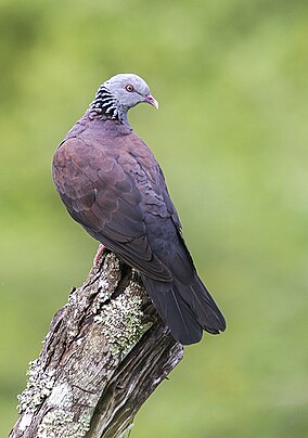
The Indian Bird Conservation Network (IBCN) has identified 212 species of birds from the Nilambur and Amarambalam forests. Amarambalam is classified as an Important Bird Area (IBS) of the Western Ghats Endemic Bird Area where 16 restricted range species (RRS) have been identified; eight species have been sighted in Amarambalam. Beside the RRS's, there are one critically endangered and two vulnerable species. In 2001 BirdLife International has also identified 52 near threatened species (NTS) of India. Three of the NTS bird species are found in the IBA, but more are likely to be found once detailed studies are conducted. Classified by BirdLife International, Amarambalam Reserve Forest lies in the Indian Peninsula Tropical Moist Forest (Biome-10): 15 bird species have been identified as typical biome assemblage, 12 species are found in this IBA. [1] In 2003, Professor PO Nameer, Kerala Agricultural University, [3] reported to have seen 11 species of woodpeckers, 11 species of flycatchers, nine species of babblers, seven species of bulbuls, and three species of barbets. As of 2004, there were populations of 10 IBA trigger species ranging from critically endangered/vulnerable to least concern according to IUCN categorisation and A1 to A3 according to IBA, namely Lesser adjutant ( Leptoptilos javanicus ), White-rumped vulture ( Gyps bengalensis ), Nilgiri wood-pigeon ( Columba elphinstonii ), Malabar parakeet ( Psittacula columboides ), Malabar grey-hornbill ( Ocyceros griseus ), White-bellied treepie ( Dendrocitta leucogastra ), Grey-headed bulbul ( Pycnonotus priocephalus ), Rufous babbler ( Turdoides subrufus ), White-bellied blue-flycatcher ( Cyornis pallipes ) and Crimson-backed sunbird ( Nectarinia minima ). The bird community showed high evenness. Maximum species richness was obtained during November and highest diversity index was recorded during April. [1]

Endemic fauna of the Western Ghats

As of 2000, Amarambalam comprises almost all mammals found in the Western Ghats: 25 mammals, including the endemic and threatened Lion-tailed macaque ( Macaca silenus ) and Nilgiri tahr ( Hemitragus hylocrius ). [1]

Publications

Related Research Articles

<span class="mw-page-title-main">Western Ghats</span> Mountain range along the western coast of India

The Western Ghats, also known as the Sahyadri mountain range, is a mountain range that covers an area of 160,000 km2 (62,000 sq mi) in a stretch of 1,600 km (990 mi) parallel to the western coast of the Indian peninsula, traversing the states of Gujarat, Maharashtra, Goa, Karnataka, Kerala and Tamil Nadu. It is a UNESCO World Heritage Site and is one of the 36 biodiversity hotspots in the world. It is sometimes called the Great Escarpment of India. It contains a very large proportion of the country's flora and fauna, many of which are endemic to this region. The Western Ghats are older than the Himalayas. They influence Indian monsoon weather patterns by intercepting the rain-laden monsoon winds that sweep in from the south-west during late summer. The range runs north to south along the western edge of the Deccan Plateau and separates the plateau from a narrow coastal plain called the Western Coastal Plains along the Arabian Sea. A total of 39 areas in the Western Ghats, including national parks, wildlife sanctuaries and reserve forests, were designated as world heritage sites in 2012 – twenty in Kerala, ten in Karnataka, six in Tamil Nadu and four in Maharashtra.

<span class="mw-page-title-main">South Western Ghats montane rain forests</span> Ecoregion in South India

The South Western Ghats montane rain forests is an ecoregion in South India, covering the southern portion of the Western Ghats in Karnataka, Kerala and Tamil Nadu at elevations from 1,000 to 2,695 m. Annual rainfall in this ecoregion exceeds 2,800 mm (110 in).

<span class="mw-page-title-main">Nilambur</span> Place in Kerala, India

Nilambur is a major town, a municipality and a Taluk in the Malappuram district of the Indian state of Kerala. It is located close to the Nilgiris range of the Western Ghats on the banks of the Chaliyar River. This place is also known as 'Teak Town' because of the abundance of Nilambur teaks in this area; Which is a variety of a large, deciduous tree that occurs in mixed hardwood forests. Unlike many Municipalities of India; Nilambur is covered with large amounts of vegetation making it close to nature and hence make it very scenic and inspiring.

<span class="mw-page-title-main">South Western Ghats moist deciduous forests</span> Ecoregion in India

The South Western Ghats moist deciduous forests is an ecoregion in the Western Ghats of southern India with tropical and subtropical moist broadleaf forests. This biome covers the Nilgiri Hills between elevation of 250 and 1,000 m in Kerala, Karnataka and Tamil Nadu states.

<span class="mw-page-title-main">Chaliyar</span> River in Kerala, India

Chaliyar River is the fourth longest river in Kerala at 169 km in length. The Chaliyar is also known as Chulika River, Nilambur River or Beypore River as it nears the sea. Pothukal, Chungathara, Nilambur, Mampad, Edavanna, Kavanoor, Perakamanna, Areekode, Kizhuparamba, Elamaram, Cheekkode, Vazhakkad, Vazhayur, Cheruvadi, Edavannappara, Mavoor, Peruvayal, Feroke and Beypore are some of the towns/villages situated along the banks of Chaliyar. It mainly flows through Malappuram district. Its tributaries flow through both the districts of Malappuram and Kozhikode. The bank of river Chaliyar at Nilambur region is also known for natural Gold fields. Explorations done at the valley of the river Chaliyar in Nilambur has shown reserves of the order of 2.5 million cubic meters of placers with 0.1 gram per cubic meter of gold. It originates at Ilambaleri hills of Nilgiri Mountains in Nilgiris district, which is also near Wayanad-Malappuram district border. It flows mainly through the erstwhile region of Eranad, and finally empties into the Arabian Sea at Beypore port, opposite to Chaliyam harbour.

<span class="mw-page-title-main">Silent Valley National Park</span> National park in Kerala, India

Silent Valley National Park is a national park in Kerala, India. It is located in the Nilgiri hills and has a core area of 89.52 km2 (34.56 sq mi). It is surrounded by a buffer zone of 148 km2 (57 sq mi). This national park has some rare species of flora and fauna. Silent Valley National Park was explored in 1847 by the botanist Robert Wight. It is located in the border of Mannarkkad Taluk of Palakkad district, Nilambur Taluk of Malappuram district, Kerala, and Nilgiris district of Tamil Nadu.

<span class="mw-page-title-main">Nilgiri Biosphere Reserve</span> International biosphere reserve of India

The Nilgiri Biosphere Reserve is a biosphere reserve in the Nilgiri Mountains of the Western Ghats in South India. It is the largest protected forest area in India, spreading across Tamil Nadu, Karnataka and Kerala. It includes the protected areas Mudumalai National Park, Mukurthi National Park, Sathyamangalam Wildlife Sanctuary in Tamil Nadu; Nagarhole National Park, Bandipur National Park, both in Karnataka; Silent Valley National Park, Aralam Wildlife Sanctuary, Wayanad Wildlife Sanctuary, and Karimpuzha Wildlife Sanctuary in Kerala.

<span class="mw-page-title-main">Mudumalai National Park</span> National park in Tamil Nadu, India

Mudumalai National Park is a national park in the Nilgiri Mountains in Tamil Nadu in southern India. It covers 321 km2 (124 sq mi) at an elevation range of 850–1,250 m (2,790–4,100 ft) in the Nilgiri District and shares boundaries with the states of Karnataka and Kerala. A part of this area has been protected since 1940. The national park has been part of Nilgiri Biosphere Reserve since 1986 and was declared a tiger reserve together with a buffer zone of 367.59 km2 (141.93 sq mi) in 2007. It receives an annual rainfall of about 1,420 mm (56 in) and harbours tropical and subtropical moist broadleaf forests with 498 plant species, at least 266 bird species, 18 carnivore and 10 herbivore species. It is drained by the Moyar River and several tributaries, which harbour 38 fish species.

<span class="mw-page-title-main">Mannarkkad</span> Municipality in Kerala, India

Mannarkkad, formerly known as Mannarghat, is a municipal town in Palakkad district of the Indian state of Kerala. The Silent Valley National Park and the Attappadi Reserve Forest are located in Mannarkkad Taluk. Mannarkkad is situated 36 km away from district headquarters Palakkad on National Highway 966.

<span class="mw-page-title-main">Wildlife of Kerala</span> Overview of the wildlife in the Indian state of Kerala

Most of Kerala's native habitat, which consists of wet evergreen rainforests at lower elevations and highland deciduous and semi-evergreen forests in the east, has a humid tropical climate. However, significant variations in terrain and elevation lead to high biodiversity. But Alappuzha district has no forests.

<span class="mw-page-title-main">Amarambalam</span> Village in Kerala, India

Amarambalam is a forest village near Nilambur town and conjoins Silent Valley National Park.the main town in amarambalam is pookkoottumpadam, pookottumpadam located in Malappuram district of the Indian state of Kerala. It is an emerging commercial hub, and one of the fastest growing towns in Nilambur Taluk.town area is 265.72 km2. Altitude rises sharply from 40 to 2,554 m.

Karimpuzha National Park is a 230 km² proposed National Park located at 11°16′30″N76°25′25″E in the Nilgiri Hills area of Kerala and Tamil Nadu, in South India, IUCN category: PRO

<span class="mw-page-title-main">Grizzled Squirrel Wildlife Sanctuary</span> Wildlife sanctuary in Tamil Nadu, India

The Grizzled Squirrel Wildlife Sanctuary (GSWS), also known as Srivilliputhur Wildlife Sanctuary, was established in 1988 to protect the Near threatened grizzled giant squirrel. Occupying an area of 485.2 km2, it is bordered on the southwest by the Periyar Tiger Reserve and is one of the best preserved forests south of the Palghat Gap.

<span class="mw-page-title-main">Wildlife of Tamil Nadu</span>

There are more than 2000 species of fauna that can be found in Tamil Nadu. This rich wildlife is attributed to the diverse relief features as well as favorable climate and vegetation in the Indian state. Recognizing the state's role in preserving the current environment, the state government has established several wildlife and bird sanctuaries as well as national parks, which entail stringent protective measures. Tamil Nadu is also included in the International Network of Biosphere Reserves, which facilitates international recognition and additional funding. There are five national parks and 17 sanctuaries that serve as homes to the wildlife.

<span class="mw-page-title-main">Karulai</span> Village in Kerala, India

Karulai is a small town and panchayath in Nilambur Taluk of Malappuram district. It is situated on the banks of the Karimpuzha River. Edakkara, Nilambur, Pookkottumpadam, and Vaniyambalam are the nearest towns.

<span class="mw-page-title-main">Nilambur Elephant Reserve</span> Elephant reserve in India

Nilambur Elephant Reserve is a wildlife reserve in Kerala, India. It has a total area of 1419 (sq. km2) and was created in 2002 as part of Project Elephant. The reserve is one of four in Kerala; the state having an elephant population of 5706 in 2018.

<span class="mw-page-title-main">Karimpuzha Wildlife Sanctuary</span> Wildlife sanctuary near Nilambur, Malappuram district

Karimpuzha Wildlife Sanctuary is a Wildlife sanctuary near Nilambur, Malappuram district in the Indian state of Kerala. It is declared as a wildlife sanctuary on 3 July 2020. It covers an area of 227.97 sq km and comprises the New Amarambalam Reserved Forest and Vadakkekotta vested forest, except the Manjeri colony of the Cholanaikar tribe. It forms a portion of the Nilgiri Biosphere Reserve.

<span class="mw-page-title-main">Kottiyoor Wildlife Sanctuary</span> Wildlife sanctuary in Kannur district

Kottiyoor Wildlife Sanctuary is Wildlife Sanctuary located in Kannur district of Kerala, India. Situated near to other sanctuaries in Kerala and Karnataka, the Kottiyoor Wildlife Sanctuary is rich in biodiversity and rich flora and fauna.

References

  1. 1 2 3 4 5 "BirdLife International (2016) Important Bird and Biodiversity Area factsheet: Amarambalam Wildlife Sanctuary - Nilambur". BirdLife International . Retrieved 3 January 2016.
  2. "Karimpuzha sanctuary comes into being". The Hindu. 3 July 2020. Retrieved 4 September 2020.
  3. "Nameer PO, Associate Professor & Head". Kerala Agricultural University . Retrieved 4 January 2016.