Manas National Park

Last updated

Manas National Park
Manas Biosphere Reserve
Manas National Park.jpg
Main entrance of Manas National Park
India Assam location map.svg
Red pog.svg
Location Chirang and Baksa District, BTR, Assam, Northeastern India
Nearest cityBarpeta Road, Assam
Coordinates 26°43′N90°56′E / 26.717°N 90.933°E / 26.717; 90.933
Area500 square kilometres (190 sq mi) (core area)
Established1990
Governing body Ministry of Environment and Forests, Government of India
TypeNatural
Criteriavii, ix, x
Designated1985 (9th session)
Reference no. 338
Region Asia-Pacific
Endangered 1992–2011 [1]

Manas National Park is a national park, Project Tiger reserve, and an elephant reserve in Assam, India. Located in the Himalayan foothills, it borders the Royal Manas National Park [2] in Bhutan. The park is known for its rare and endangered endemic wildlife such as the Assam roofed turtle, hispid hare, golden langur and pygmy hog. Manas is also famous for its population of the wild water buffalo. [3] Because of its exceptional biodiversity, scenery, and variety of habitats, Manas National Park is a biosphere reserve and a UNESCO World Heritage Site. [4]

Contents

Origin of the name

The name of the park is originated from the Manas River. The Manas river is a major tributary of Brahmaputra River, which passes through the heart of the national park.

History

The Manas National Park was declared a sanctuary on 1 October 1928 with an area of 360 km2 (140 sq mi). Manas bio reserve was created in 1973. Prior to the declaration of the sanctuary, it was a reserved forest called Manas R.F. and North Kamrup R.F. It was used by the Cooch Behar royal family and Raja of Gauripur as a hunting reserve. In 1951 and 1955, the area was increased to 391 km2 (151 sq mi). It was declared a World Heritage Site in December 1985 by UNESCO. Kahitama R.F. the Kokilabari R.F. and the Panbari R.F. were added in the year 1990 to form the Manas National Park. In 1992, UNESCO declared it as a world heritage site in danger due to heavy poaching and terrorist activities. On 25 February 2008, the area was increased to 500 km2 (190 sq mi). On 21 June 2011, it was removed from the List of World Heritage in Danger and was commended for its efforts in preservation. [5]

Human history

There is only one forest village, Pagrang, in the core of the national park. Apart from this village 56 more villages surround the park. Many more fringe villages are directly or indirectly dependent on the park.

Geography

Political Geography: The park area falls in the following districts: Chirang, Baksa in the autonomous territorial region, i.e BTR in the state of Assam in India.

A view of mountains from the park Blue hill.jpg
A view of mountains from the park

The park is divided into three ranges. The western range is based at Panbari, the central at Bansbari near Barpeta Road, and the eastern at Bhuiyapara near Pathsala. The ranges are not well connected; while two major rivers need to be forded in going from the centre to the Panbari, there is a rough trail (the Daimari road) connecting the centre to the eastern range. Most visitors come to Bansbari and then spend some time inside the forest at Mathanguri on the Manas river at the Bhutan border.

Physical Geography: Manas is located in the foothills of the Eastern Himalaya and is densely forested. The Manas river flows through the west of the park and is the main river within it. It is a major tributary of Brahmaputra river and splits into two separate rivers, the Bwrsi and Bholkaduba as it reaches the plains. Five other smaller rivers also flow through the national park which lies on a wide, low-lying alluvial terrace spreading out below the foothills of the outer Himalaya. The Manas river also serves as an international border dividing India and Bhutan. The bedrock of the savanna area in the north of the park is made up of limestone and sandstone, whereas the grasslands in the south of the park stand on deep deposits of fine alluvium. The combination of Sub-Himalayan Bhabar Terai formation along with the riverine succession continuing up to Sub-Himalayan mountain forest makes it one of the richest areas of biodiversity in the world. The park is 950 square kilometres (370 sq mi) in the area and is situated at an altitude of 61–110 metres (200–361 ft) above mean sea level.

Climate: The minimum temperature is around 15 °C (59 °F) and the maximum temperature is around 37 °C (99 °F).

Heavy rainfall occurs between May and September. The annual average rainfall is around 333 centimetres (131 in).

Natural history

Tephrodornis gularis Tephrodornis gularis.jpg
Tephrodornis gularis

Biomes

There are two major biomes present in Manas:

Flora

Jungle owl in Manas Jungle owl in manas.jpg
Jungle owl in Manas

Vegetation: The monsoon forests of Manas lie in the Brahmaputra Valley semi-evergreen forests ecoregion. [6] The combination of Sub-Himalayan Bhabar Terai region with riverine succession leading up to the Himalayan subtropical broadleaf forests makes it one of the richest biodiversity areas in the world.

The main vegetation types are:

Much of the riverine dry deciduous forest is at an early successional stage. It is replaced by moist deciduous forest away from water courses, which is succeeded by semi-evergreen climax forest in the northern part of the park. A total of 543 plants species have been recorded from the core zone. Of these, 374 species are dicotyledons (including 89 trees), 139 species monocotyledons and 30 are pteridophytes and gymnosperms.

The park's common trees include Aphanamixis polystachya , Anthocephalus chinensis , Syzygium cumini , Syzygium formosum , Syzygium oblatum , Bauhinia purpurea , Mallotus philippensis , Cinnamomum tamala , Actinodaphne obvata , Bombax ceiba , Sterculia villosa , Dillenia indica , Dillenia pentagyna , Careya arborea , Lagerstroemia parviflora , Lagerstroemia speciosa , Terminalia bellirica , Terminalia chebula , Trewia polycarpa , [7] Gmelina arborea , Oroxylum indicum and Bridelia spp. The grasslands are dominated by Imperata cylindrica , Saccharum naranga , Phragmites karka , Arundo donax , Dillenia pentagyna , Phyllanthus emblica , Bombax ceiba , and species of Clerodendrum , Leea , Grewia , Premna and Mussaenda .

Fauna

A capped langur in Manas Capped langur in manas.jpg
A capped langur in Manas

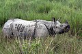
The sanctuary has recorded 55 species of mammals, 380 species of birds, 50 of reptiles, and 3 species of amphibians. Out of these wildlife, 21 mammals are India's Schedule I mammals and 31 of them are threatened.

The fauna of the sanctuary include Indian elephants, Indian rhinoceros, gaurs, wild water buffaloes, barasingha, Bengal tigers, Indian leopards, clouded leopards, Asian golden cats, jungle cat, leopard cat, fishing cat, marbled cat, dholes, golden jackal, capped langurs, golden langurs, Assamese macaques, rhesus macaque, gray langur, slow loris, hoolock gibbons, smooth-coated otters, sloth bears, barking deer, hog deer, sambar deer and chitals and large Indian civet, common palm civet, spotted Linsang, yellow-throated marten, black giant squirrel, Indian porcupine, Indian pangolin, Chinese pangolin, wild boar.

The park is well known for species of rare and endangered wildlife that are not found anywhere else in the world like the Assam roofed turtle, hispid hare, golden langur and pygmy hog.

The Manas hosts more than 450 species of birds. [8] It has the largest population of the endangered Bengal florican to be found anywhere. Other major bird species include great hornbills, jungle fowls, bulbuls, brahminy ducks, kalij pheasants, egrets, pelicans, fishing eagles, crested serpent-eagles, falcons, scarlet minivets, bee-eaters, magpie robins, pied hornbills, grey hornbills, mergansers, harriers, Indian peafowl, ospreys and herons.

See also

Related Research Articles

<span class="mw-page-title-main">Kaziranga National Park</span> National park in the state of Assam, India

Kaziranga National Park is a national park in the Golaghat and Nagaon districts of the state of Assam, India. The park, which hosts two-thirds of the world's Indian rhinoceroses, is a UNESCO World Heritage Site. According to the census held in March 2018 which was jointly conducted by the Forest Department of the Government of Assam and some recognized wildlife NGOs, the rhino population in Kaziranga National Park is 2,613. It comprises 1,641 adult rhinos ; 387 sub-adults ; and 385 calves.

<span class="mw-page-title-main">Gee's golden langur</span> Species of Old World monkey

Gee's golden langur, also known as simply the golden langur, is an Old World monkey found in a small region of Western Assam, India and the neighboring foothills of the Black Mountains of Bhutan. Long considered sacred by many Himalayan people, the golden langur was first brought to the attention of the Western world by the naturalist Edward Pritchard Gee in the 1950s. Adult males have a cream to golden coat with darker flanks while the females and juveniles are lighter. The golden langur has a black face and a long tail up to 50 cm (19.69 in) in length. It lives in high trees and has a herbivorous diet of fruits, leaves, seeds, buds, and flowers. The average group size is eight individuals, with a ratio of several females to each adult male. It is one of the most endangered primate species of India and Bhutan.

<span class="mw-page-title-main">Buxa Tiger Reserve</span> Tiger reserve in West Bengal, India

Buxa Tiger Reserve is a tiger reserve and national park in northern West Bengal, India, covering an area of 760 km2 (290 sq mi). In altitude, it ranges from 60 m (200 ft) in the Gangetic Plains to 1,750 m (5,740 ft) bordering the Himalayas in the north. At least 284 bird species inhabit the reserve. Mammals present include Asian elephant, gaur, Sambar deer, clouded leopard, Indian leopard, and Asian golden cat.

<span class="mw-page-title-main">Dibru-Saikhowa National Park</span> National park in India

Dibru-Saikhowa National Park is a national park located in Dibrugarh and Tinsukia districts, Assam, India. It was designated a Biosphere Reserve in July 1997 with an area of 765 km2 (295 sq mi), including a core area of 340 km2 (130 sq mi) and a buffer zone of 425 km2 (164 sq mi).

<span class="mw-page-title-main">Nameri National Park</span> National park in Assam, India

Nameri National Park is a national park in the foothills of the eastern Himalayas in the Sonitpur District of Assam, India, about 35 km from Tezpur. Nameri is about 9 km from Chariduar, the nearest village.

<span class="mw-page-title-main">Dhubri</span> Town in Assam, India

Dhubri is a town and the administrative centre of Dhubri district in the Indian state of Assam. It is an old town on the bank of the Brahmaputra river, with historical significance. In 1883, the town was first constituted as a Municipal Board under the British regime. It is situated about 277.4 kilometres (172 mi) west from Dispur, the state capital of Assam.

<span class="mw-page-title-main">Upper Gangetic Plains moist deciduous forests</span> Ecoregion in northern India

The Upper Gangetic Plains moist deciduous forests is a tropical and subtropical moist broadleaf forests ecoregion of northern India.

<span class="mw-page-title-main">Brahmaputra Valley semi-evergreen forests</span> Ecoregion of India and Bhutan

The Brahmaputra Valley semi-evergreen forests is a tropical moist broadleaf forest ecoregion of Northeastern India, southern Bhutan and adjacent Bangladesh.

<span class="mw-page-title-main">Himalayan subtropical broadleaf forests</span>

The Himalayan subtropical broadleaf forests is an ecoregion that extends from the middle hills of central Nepal through Darjeeling into Bhutan and also into the Indian States of Uttar Pradesh and Bihar. It represents the east–west-directed band of subtropical broadleaf forest at an altitude of between 500 and 1,000 m along the Outer Himalayan Range, and includes several forest types traversing an east to west moisture gradient.

<span class="mw-page-title-main">Eastern Himalayan broadleaf forests</span>

The Eastern Himalayan broadleaf forests is a temperate broadleaf forest ecoregion found in the middle elevations of the eastern Himalayas, including parts of Nepal, India, Bhutan, Myanmar and China. These forests have an outstanding richness of wildlife.

<span class="mw-page-title-main">Biodiversity of Assam</span> Biodiversity of Assam, a state in North-East India

The biodiversity of Assam, a state in North-East India, makes it a biological hotspot with many rare and endemic plant and animal species. The greatest success in recent years has been the conservation of the Indian rhinoceros at the Kaziranga National Park, but a rapid increase in human population in Assam threatens many plants and animals and their natural habitats.

The history of Kaziranga National Park in the Golaghat and Nagaon districts of the state of Assam, India, can be traced back to the beginning of the twentieth century, in 1904. It now is a World Heritage Site and hosts two-thirds of the world's Great One-horned Rhinoceroses, tigers, and many other endangered animals.

Kaziranga National Park is an Indian national park and a World Heritage Site in Golaghat and Nagaon districts of Assam, India. It is refuge for the world's largest population of great one-horned rhinoceros. Kaziranga has the highest density of tigers among protected areas in the world and was declared a Tiger Reserve in 2006. The park has large breeding populations of elephant, wild Asiatic water buffalo and swamp deer. Kaziranga is recognized as an Important Bird Area by Birdlife International for conservation of avifaunal species. The park has achieved notable progress in wildlife conservation with respect to other protected areas in India.Kaziranga was declared a Tiger Reserve in 2006

<span class="mw-page-title-main">Manas River</span> River in Bhutan, China and India

The Manas River, known in Bhutan as the Drangme Chhu, is a transboundary river in the Himalayan foothills between southern Bhutan, India, and China. It is the largest of Bhutan's four major river systems, with the other three being the Amo Chu or Torsa River, the Wang Chu or Raidak, and the Puna Tshang Chu or Sankosh. It is met by three other major streams before it again debouches into India in western Assam. The river flows for a total length of 400 kilometres (250 mi), including through Tibet for 24 km (15 mi), Bhutan for 272 kilometres (169 mi), and Assam for 104 kilometres (65 mi) before it joins the mighty Brahmaputra River at Jogighopa. A major tributary of the Manas, the Aie River, joins it in Assam at Bangpari.

Pakke Tiger Reserve, is a Project Tiger reserve in the East Kameng district of Arunachal Pradesh in Northeast India. The 862 km2 (333 sq mi) reserve is protected by the Department of Environment and Forest of Arunachal Pradesh. It was known as Pakhui Tiger Reserve, but renamed in April 2001 by the Governor of Arunachal Pradesh. It has won India Biodiversity Award 2016 in the category of 'Conservation of threatened species' for its Hornbill Nest Adoption Programme.

<span class="mw-page-title-main">Royal Manas National Park</span> National Park of Bhutan

Royal Manas National Park is Bhutan's oldest national park, and the Royal government considers it the "conservation showpiece of the Kingdom" and a "genetic depository" for valuable plants. It has an area of 1,057 square kilometres (408 sq mi) and covers eastern Sarpang District, the western half of Zhemgang District, and western Pemagatshel District.

<span class="mw-page-title-main">Raimona National Park</span> National park in Assam

Raimona National Park is located in extreme western part of Assam, India. It is spread across Gossaigaon and Kokrajhar subdivisions of Kokrajhar district of Bodoland Territorial Region.

In Bhutan there are five national parks and 16 other nature reserves. The protection of nature is under the supervision of the Department of Forests and Park Services of the Department of Agriculture. The protection of the environment and nature is considered to be one of the cornerstones of gross national happiness. Nature reserves take up 48 percent of the kingdom's land area.

References

  1. Successful preservation of India's Manas Wildlife Sanctuary enables withdrawal from the List of World Heritage in Danger at UNESCO website
  2. "WWF - Royal Manas National Park, Bhutan". Archived from the original on 7 November 2009. Retrieved 4 April 2010.
  3. Choudhury, A.U.(2010)The vanishing herds : the wild water buffalo. Gibbon Books, Rhino Foundation, CEPF & COA, Taiwan, Guwahati, India
  4. "Manas Wildlife Sanctuary". UNESCO World Heritage Convention. United Nations Educational Scientific and Cultural Organization. Retrieved 3 June 2023.
  5. Amelan, Roni. "Successful preservation of India's Manas Wildlife Sanctuary enables withdrawal from the List of World Heritage in Danger" . Retrieved 21 June 2011.
  6. Wikramanayake, Eric; Eric Dinerstein; Colby J. Loucks; et al. (2002). Terrestrial Ecoregions of the Indo-Pacific: a Conservation Assessment. Island Press; Washington, DC. pp. 300-301
  7. Chamundeeswari, D.; Vasantha, J.; Gopalakrishnan, S.; Sukumar, E. (2004). "Anti-inflammatory and antinociceptive activities of Trewia polycarpa roots". Fitoterapia. 75 (7–8): 740–744. doi:10.1016/j.fitote.2004.07.001. PMID   15567254.
  8. Choudhury, A.U. (2006) Birds of Manas National Park. Gibbon Books & The Rhino Foundation for Nature in North East India, Guwahati, India. 84pp