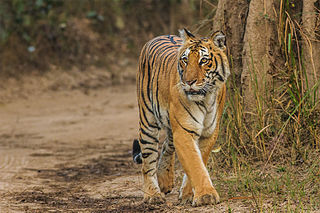
Jim Corbett National Park is a national park in India located in the Nainital district of Uttarakhand state. The first national park in India, it was established in 1936 during the British Raj and named Hailey National Park after William Malcolm Hailey, a governor of the United Provinces in which it was then located. In 1956, nearly a decade after India's independence, it was renamed Corbett National Park after the hunter and naturalist Jim Corbett, who had played a leading role in its establishment and had died the year before. The park was the first to come under the Project Tiger initiative.
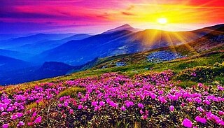
Valley of Flowers National Park is an Indian national park which was established in 1982. It is located in Chamoli in the state of Uttarakhand and is known for its meadows of endemic alpine flowers and the variety of flora. This richly diverse area is also home to rare and endangered animals, including the Asiatic black bear, snow leopard, musk deer, brown bear, red fox and blue sheep. Birds found in the park include Himalayan monal pheasant and other high altitude birds.

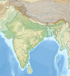
Uttarakhand, also known as Uttaranchal, is a state in northern India. It is often referred to as the "Devbhumi" due to its religious significance and numerous Hindu temples and pilgrimage centres found throughout the state. Uttarakhand is known for the natural environment of the Himalayas, the Bhabar and the Terai regions. It borders the Tibet Autonomous Region of China to the north; the Sudurpashchim Province of Nepal to the east; the Indian states of Uttar Pradesh to the south and Himachal Pradesh to the west and north-west. The state is divided into two divisions, Garhwal and Kumaon, with a total of 13 districts. The winter capital of Uttarakhand is Dehradun, the largest city of the state, which is a rail head. Gairsain, a town in Chamoli district, is the summer capital of Uttarakhand declared on 5 March 2020. The High Court of the state is located in Nainital, but is to be moved to Haldwani in future.

Gangotri National Park is a national park in Uttarkashi District of Uttarakhand in India, covering about 2,390 km2 (920 sq mi). Its habitat consists of coniferous forests, alpine meadows and glaciers. Gaumukh at Gangotri glacier, the origin of river Ganga, is located inside the park. Gangotri National Park was established in 1989.

Kalesar National Park and adjacent Kalesar Wildlife Sanctuary (13,209 acres are protected areas in Yamunanagar district of Haryana state in India, 122 kilometres from Chandigarh. Kalesar National Park was established in 2003. Kalesar National Park and Kalesar Wildlife Sanctuary are contiguous to Simbalbara National Park in Himachal Pradesh and Rajaji National Park in Uttarakhand. Kalesar is a popular destination for leopards, panthers, elephants, red jungle fowl and bird-watching. This forested area in the Shivalik foothills is covered primarily with sal with smattering of Semul, Amaltas and Bahera trees as well. Wildlife jeep safaris are available on 3 tracks. Park is closed July to September and during the remaining months visiting hours are 6 am to 10 am and 4 pm to 7 pm during summers, and 7 am to 11 am and 3.30 pm to 6 pm during winters.

Hemis National Park is a high-elevation national park in Ladakh, India. Globally famous for its snow leopards, it is believed to have the highest density of them in any protected area in the world. It is the only national park in India that is north of the Himalayas, the largest notified protected area in India and is the second largest contiguous protected area, after the Nanda Devi Biosphere Reserve and surrounding protected areas. The park is home to a number of species of endangered mammals, including the snow leopard. Hemis National Park is India's protected area inside the Palearctic realm, outside the Changthang Wildlife Sanctuary northeast of Hemis, and the proposed Tso Lhamo Cold Desert Conservation Area in North Sikkim.
Rajaji National Park is an Indian national park and tiger reserve that encompasses the Shivaliks, near the foothills of the Himalayas. It is spread over 820 km2 and includes three districts of Uttarakhand: Haridwar, Dehradun and Pauri Garhwal. In 1983, three wildlife sanctuaries in the area namely, Chilla, Motichur and Rajaji were merged into one.

Uttarkashi, meaning Kashi of the north, is a town located in Uttarkashi district in Uttarakhand, India. Uttarkashi town is headquarters of the district. Uttarkashi is also known as Somya Kashi. Uttarkashi is a Hindu religious place for spiritual and adventurous tourism. Uttarkashi town is also called as Shivnagri. The town has number of temples and ashrams. Uttarkashi is known for its religious people, weather, education.
India is home to a large variety of wildlife. It is a biodiversity hotspot with various ecosystems ranging from the Himalayas in the north to the evergreen rain forests in the south, the sands of the west to the marshy mangroves of the east. India lies within the Indomalayan realm and is the home to about 7.6% of mammal, 14.7% of amphibian, 6% of bird, 6.2% of reptilian, and 6.2% of flowering plant species. India's forests contain about 500 species of mammals and more than 1300 bird species.

Harsil, the Himalayan paradise, is a village, tourist hill station and army area located on the banks of the Bhagirathi River, on the way to Gangotri, a Hindu pilgrimage site in Uttarkashi district of the Indian state of Uttarakhand.

The Western Himalayan alpine shrub and meadows is a montane grasslands and shrublands ecoregion of Nepal, India, and Tibet, which lies between the tree line and snow line in the western portion of the Himalaya Range.
Kedarnath Wild Life Sanctuary, also called the Kedarnath Musk Deer Sanctuary, is a wildlife sanctuary declared under Wildlife Protection Act, 1972 and located in Uttarakhand, India. Its alternate name comes from its primary purpose of protecting the endangered Himalayan musk deer. Consisting of an area of 975 km2 (376 sq mi), it is the largest protected area in the western Himalayas.It is famous for alpine musk deer, Himalayan Thar, Himalayan Griffon, Himalayan Black bear, Snow Leopard and other flora park and fauna. It is internationally important for the diversity of its flora and fauna.

Uttarakhand has a total geographic area of 53,483 km2, of which 86% is mountainous and 65% is covered by forest. Most of the northern parts of the state are part of Greater Himalaya ranges, covered by the high Himalayan peaks and glaciers, while the lower foothills were densely forested till denuded by the British log merchants and later, after independence, by forest contractors. Recent efforts in reforestation, however, have been successful in restoring the situation to some extent. The unique Himalayan ecosystem plays host to many animals, plants and rare herbs. Two of India's great rivers, the Ganges and the Yamuna take birth in the glaciers of Uttarakhand, and are fed by myriad lakes, glacial melts and streams.

The Western Himalayan broadleaf forests is a temperate broadleaf and mixed forest ecoregion which is found in the middle elevations of the western Himalayas, including parts of Nepal, India, and Pakistan.

The Western Himalayan subalpine conifer forests is a temperate coniferous forests ecoregion of the middle and upper elevations of the western Middle Himalayas of Nepal, India, and Pakistan.

Kedarkantha is a mountain peak of the Himalayas in Uttarakhand, India. Its elevation is 12,500 ft (3,800 m). Kedarkantha is located within Govind Wildlife Sanctuary in Uttarkashi district.
Sankri is a hamlet situated at an altitude of 1950 m above sea level in Mori Tehsil, Uttarkashi district, Uttarakhand, India. Part of the Govind Balabh Pant Wildlife Sanctuary, Sankri is 25 km away from the sub-district headquarters Mori and 195 km from the district headquarters Uttarkashi. Barkot is the closest town to Sankri at approximately 86 km. The total geographical area of Sankri village is 40.01 hectares. According to 2009 statistics, Saur is the gram panchayat of Sankri, and according to 2011 census information, the location code or village code of Sankari village is 040230.
Tharali is a tehsil in the Chamoli district of the Indian state of Uttarakhand. It is located on the banks of the Pindar River and is known for its scenic beauty.