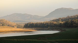
The Satpura Range is a range of hills in central India. The range rises in eastern Gujarat running east through the border of Maharashtra and Madhya Pradesh and ends in Chhattisgarh. The range parallels the Vindhya Range to the north, and these two east-west ranges divide Indian Subcontinent into the Indo-Gangetic plain of northern India and the Deccan Plateau of the south. The Narmada River originates from north-eastern end of Satpura in Amarkantak, and runs in the depression between the Satpura and Vindhya ranges, draining the northern slope of the Satpura range, running west towards the Arabian Sea. The Tapti River originates in the eastern-central part of Satpura, crossing the range in the center and running west at the range's southern slopes before meeting the Arabian Sea at Surat, draining the central and southern slopes of the range. Multai, the place of Tapi river origin is located about 465 kilometer far, south-westerly to Amarkantak, separated across by the hill range. The Godavari River and its tributaries drain the Deccan plateau, which lies south of the range, and the Mahanadi River drains the easternmost portion of the range. The Godavari and Mahanadi rivers flow into the Bay of Bengal. At its eastern end, the Satpura range meets the hills of the Chotanagpur Plateau. The Satpura Range is a horst mountain and is flanked by Narmada Graben in the north and much smaller but parallel Tapi Graben in the south.

The Pachmarhi Biosphere Reserve is a non-use conservation area and biosphere reserve in the Satpura Range of Madhya Pradesh state in central India.

Bandhavgarh National Park is a national park of India, located in the Umaria district of Madhya Pradesh. Bandhavgarh, with an area of 105 square kilometres (41 sq mi), was declared a national park in 1968 and then became Tiger Reserve in 1993. The current core area is spread over 716 square kilometres (276 sq mi).

Satpura Tiger Reserve (STR) also known as Satpura National Park is located in the Narmadapuram District of Madhya Pradesh in India. Its name is derived from the Satpura range. It covers an area of 524 km2 (202 sq mi). Satpura National Park, along with the adjoining Bori and Pachmarhi wildlife sanctuaries, provides 2,200 km2 (850 sq mi) of unique central Indian highland ecosystem. It was set up in 1981.

Gorumara National Park is a National Park in northern West Bengal, India. Located in the Dooars region of the Himalayan foothills, it is a medium-sized park with grasslands and forests. Gorumara National Park was established in 1992. It is primarily known for its population of Indian rhinoceros. The park has been declared as the best among the protected areas in India by the Ministry of Environment and Forests for the year 2009.

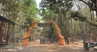
Kanger Ghati National Park was declared a national park in 1982 by the Government of India. Near Jagdalpur in the Bastar region of Chhattisgarh, it is one of India's densest national parks, and is known for its biodiversity, landscape, waterfalls, and subterranean geomorphologic limestone caves, and as the home of the Bastar hill myna, the state bird of Chhattisgarh.

The Terai–Duar savanna and grasslands is a narrow lowland ecoregion at the base of the Himalayas, about 25 km (16 mi) wide, and a continuation of the Indo-Gangetic Plain in India, Nepal and Bhutan. It is colloquially called Terai in the Ganges Basin east to Nepal, then Dooars in West Bengal, Bhutan and Assam east to the Brahmaputra River. It harbours the world's tallest grasslands, which are the most threatened and rare worldwide.

Jagdalpur is a city in Bastar district in the Indian state of Chhattisgarh. Jagdalpur is the administrative headquarters of Bastar District and Bastar Division. It was earlier the capital of the former princely state of Bastar. It is the fourth largest city of Chhattisgarh.The city is commercial, financial and political center of hub for South Chhattisgarh.

Manas National Park is a national park, UNESCO Natural World Heritage Site, Project Tiger reserve, biosphere reserve and an elephant reserve in Assam, India. Located in the Himalayan foothills, it is contiguous with Royal Manas National Park in Bhutan. The park is known for its rare and endangered endemic wildlife such as the Assam roofed turtle, hispid hare, golden langur and pygmy hog. Manas is famous for its population of the wild water buffalo.
Gugamal National Park is an Indian national park that is one of seven protected areas in the Melghat Tiger Reserve. Founded on 22 February 1974, this park is located in the Chikhaldara and Dharni tehsils of Amravati, Maharashtra.

The Chitrakote Falls is a natural waterfall on the Indravati River, located approximately 38 kilometres (24 mi) to the west of Jagdalpur, in Bastar district in the Indian state of Chhattisgarh.

The state of Karnataka in South India has a rich diversity of flora and fauna. It has a recorded forest area of 38720 km2 which constitutes 22.3467719% of the total geographical area of the state. These forests support 25% of the elephant population and 20% of the tiger population of India. Many regions of Karnataka are still unexplored and new species of flora and fauna are still found. The Western Ghats mountains in the western region of Karnataka are a biodiversity hotspot. Two sub-clusters of the Western Ghats, Talacauvery and Kudremukh in Karnataka, are in a tentative list of sites that could be designated as World Heritage Sites by UNESCO. The Bandipur and Nagarahole national parks which fall outside these subclusters were included in the Nilgiri biosphere reserve in 1986, a UNESCO designation. Biligiriranga Hills in Karnataka is a place where Eastern Ghats meets Western Ghats. The state bird and state animal of Karnataka are Indian roller and the Indian elephant respectively. The state tree and state flower are sandalwood and lotus respectively. Karnataka is home to 524 tigers.

Pench Tiger Reserve or Pench National Park is one of the premier tiger reserves of India and the first one to straddle across two states - Madhya Pradesh and Maharashtra. The reference to Pench is mostly to the tiger reserve in Madhya Pradesh.

Melghat was among the first nine tiger reserves of India to be notified in 1973 under Project Tiger. It is located at 21°26′45″N77°11′50″E in the northern part of Amravati District of Maharashtra. Melghat Wildlife Sanctuary was declared as in 1985. The Tapti River flows through the northern part of Melghat Tiger Reserve, and forms the boundary of the reserve together with the Gawilghur ridge of the Satpura Range.

The Achanakmar Wildlife Sanctuary is a sanctuary in Mungeli district of Chhattisgarh and in the Anuppur and Dindori districts of Madhya Pradesh in India. It had been established in 1975, under the provisions of the Indian Wildlife Protection Act of 1972, and declared as a Tiger Reserve under Project Tiger, in 2009. It is a part of the Achanakmar-Amarkantak Biosphere Reserve.

Sunabeda Wildlife Sanctuary is a wildlife sanctuary and a proposed tiger reserve located in the Nuapada district of Odisha, adjoining Chhattisgarh. It has a total area of 600 km2 (230 sq mi). The sanctuary harbours a great diversity of wildlife habitats, with a vast plateau, multiple valleys, gorges and magnificent waterfalls. The sanctuary forms the catchment area of the Jonk River, over which a dam has been constructed to facilitate irrigation. The Indra nullah and Udanti River lies to the south of the sanctuary. The important vegetation of the site comprises dry deciduous tropical forest.

The Teerathgarh Falls is all season tourism's site and a good photography place waterfall near Jagdalpur at Kanger Ghati in Bastar district in the Indian state of Chhattisgarh.
Pench National Park is a national park in India's Madhya Pradesh state, established in 1975 with an area of 257.26 km2 (99.33 sq mi). It includes Pench Tiger Reserve and derives its name from the Pench River that flows through the park from north to south dividing the park into almost equal western and eastern halves, the well-forested areas of Seoni and Chhindwara districts respectively. It was declared a sanctuary in 1965, raised to the status of national park in 1975 and enlisted as a tiger reserve in 1992. In 1983 it was declared as National Park.
The Barnawapara Wildlife Sanctuary is located in Mahasamund district. The reserve is about 100 km from Raipur and about 45 km from Mahasamund city. It was established in 1976 under the Wildlife Protection Act. The Jonk River flows through the sanctuary, which is a tributary of the Mahanadi river. The sanctuary lies 25 km to the east of Sirpur, Mahasamund which is known for its monuments, collectively known as Sirpur Group of Monuments

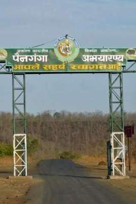
Painganga Wildlife Sanctuary is the name given to the protected forests on both sides of the Painganga River which divides Yavatmal district and Nanded district, Maharashtra, India. The Painganga Wildlife Sanctuary was established on January 1, 1996. It covers an area of about 325 sq. km. in the Pusad forest, in which teak is the main tree. Supervision and direct control is in the hands of the sub-conservator (wildlife) Pandharkavada, reporting to the Government of Maharashtra.


