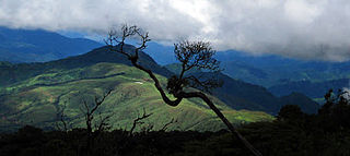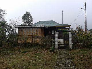
Manipur is a state in northeast India, with the city of Imphal as its capital. It is bounded by the Indian states of Nagaland to the north, Mizoram to the south and Assam to the west. It also borders two regions of Myanmar, Sagaing Region to the east and Chin State to the south. The state covers an area of 22,327 km2 (8,621 sq mi). The official and most widely spoken language is Meitei language. Native to the Meitei people, it is also used as a lingua franca by smaller communities, who speak a variety of other Sino-Tibetan languages. Manipur has been at the crossroads of Asian economic and cultural exchange for more than 2,500 years. It connects the Indian subcontinent and Central Asia to Southeast Asia, East Asia, Siberia, regions in the Arctic, Micronesia and Polynesia enabling migration of people, cultures and religions.

Lilium mackliniae, the Shirui lily or Shirui Kashong Timrawon, is a rare Indian species of plant found only in the upper reaches of the Shirui hill ranges in the Ukhrul district of Manipur, India, at an elevation of 1,730–2,590 metres (5,680–8,500 ft) above sea level. It is located near the boundary of Myanmar to the east, Shirui village in the west, Choithar village in the south and Sihai village in the north.

Northeast India (officially the North Eastern Region(NER)) is the easternmost region of India representing both a geographic and political administrative division of the country. It comprises eight states—Arunachal Pradesh, Assam, Manipur, Meghalaya, Mizoram, Nagaland and Tripura (commonly known as the "Seven Sisters"), and the "brother" state Sikkim.

Kohima is the capital of the Indian state of Nagaland. With a resident population of almost 100,000, it is the second largest city in the state. Kohima constitutes both a district and a municipality. The municipality covers 20 km2 (7.7 sq mi). The city lies on the foothills of Japfü section of the Barail Range located south of the District and has an average elevation of 1,261 metres.

Moirang is a town in the Indian state of Manipur, best known for the tentatively listed UNESCO World Heritage Sites of the Keibul Lamjao Conservation Area (KLCA), covering Keibul Lamjao National Park (KLNP), the world's only floating national park, the buffer of Loktak Lake and Pumlen Pat. It is best known for the being the place of origin of the ancient epic legend of Khamba and Thoibi, one of the seven epic cycles of incarnations of Meitei mythology and folklore. Nationwide, it is also famous for the INA War Museum in the INA Martyrs' Memorial Complex, where Colonel Shaukat Malik of the Indian National Army hoisted the Tricolour for the first time on Indian soil on 14 April 1944. It is situated approximately 45 km (28 mi) south of the state capital Imphal. It has an area of 269 km2 (104 sq mi) with a population of 62,187 in 67 villages. There are 12 Panchayats in this block.
Saddle Peak National Park is a national park in the Andaman and Nicobar Islands in India. It was set up in 1979 on surrounding areas of Saddle Peak.Saddle Peak or Saddle Hills is located on North Andaman Island in India's Andaman and Nicobar Islands.

The Nokrek National Park, the core area of the Nokrek Biosphere Reserve, is a National park located approximately 2 km away from Tura Peak in West Garo Hills district of Meghalaya, India.The Nokrek Biosphere Reserve along with the Nokrek National Park was added by UNESCO to its list of Biosphere Reserves in May 2009. along with the Balpakram National Park in South Garo Hills. The Nokrek area is a hotspot of biodiversity in Meghalaya. Established in 1986, the National Park area comprising around 47.48 square kilometres is looked after by the Northern Nokrek Range and the Southern Nokrek Range under the East & West Garo Hills Wildlife Division of the Meghalaya State Forest Department under the administrative control of the Government of Meghalaya, India.

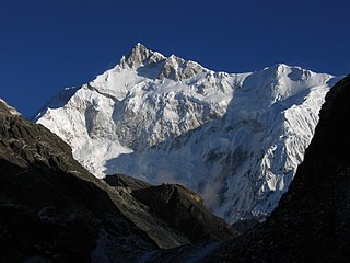
Khangchendzonga National Park, also Kanchenjunga Biosphere Reserve, is a national park and a biosphere reserve located in Sikkim, India. It was inscribed to the UNESCO World Heritage Sites list in July 2016, becoming the first "Mixed Heritage" site of India. It was included in the UNESCO Man and the Biosphere Programme. The park is named after the mountain Kangchenjunga, which is the third-highest peak in the world at 8,586 m (28,169 ft) tall. The total area of the park is 849.5 km2 (328.0 sq mi).

Senapati is of the 16 districts of Manipur state in India. It is known for the Dzuko Valley, which is one of the tourist attractions in Manipur, renowned for natural sites, seasonal flowering plants and wild life, including but not limited to the endemic Dzuko lily, which is closely related to the Shirui lily of the neighboring Ukhrul district.

Ukhrul district is an administrative district of the state of Manipur in India with its headquarters at Ukhrul.

Mount Harriet National Park, officially renamed as Mount Manipur National Park, is a national park located in the Andaman and Nicobar Islands union territory of India. The park, established in 1969, covers about 4.62 km2 (18.00 mi2). Mount Manipur, which is a part of the park, is the third-highest peak in the Andaman and Nicobar archipelago next to Saddle Peak in North Andaman and Mount Thullier in Great Nicobar.
Wangjing is a town and a municipal council in Thoubal district in the Indian state of Manipur. It is about 6 km from district headquarters and an agricultural town in Thoubal district in the Indian state of Manipur. It is bordered by Heirok village in the east, Tentha village in the south-west, and on the other side by agricultural land. Wangjing River, a rivulet flowing down from the eastern hills, runs through the middle of the town, serving as a natural spring. It is connected to other parts of the state by the Imphal–Moreh national highway. It is the junction between Heirok and Tentha village.

The Dzüko Valley, also known as Dzükou Valley or Dziiko Valley, is a valley located in between Senapati district of Manipur and Kohima district of Nagaland in Northeast India. This valley is well known for its natural environment, seasonal flowers and flora & fauna.

Sihai is a general reference to a group of villages in the north of Ukhrul District headquarters in Manipur. Sihai Khullen, the nearest from Ukhrul is about 37 kilometers from Ukhrul, connected partially by National Highway 150.

Fambong Lho Wildlife Sanctuary is a 51 km2 (20 sq mi) large wildlife sanctuary in Gangtok district of the state of Sikkim in India. It is contiguous with Khangchendzonga National Park and located around 30 km (19 mi) west of Gangtok. It hosts a few small hamlets inside, namely Dikchu, Pangthang, and Mangan and is managed by State Forest Department.

Lengteng Wildlife Sanctuary is a protected area in Saitual district in eastern Mizoram, northeast India. It is an alpine forest and contains the second highest peak in Mizoram. It is specially a conservation interest on rare species of birds. It was declared a protected area in 1999, and a national wildlife sanctuary by the Indian Ministry of Environment and Forests on 31 May 2001.

Northeast India consists of the eight states Arunachal Pradesh, Assam, Manipur, Meghalaya, Mizoram, Nagaland, Sikkim and Tripura. Tourism in this area is based around the unique Himalayan landscape and culture distinct from the rest of India.
Khamasom is a generic reference to four villages located north of Ukhrul in Ukhrul district, Manipur state, India. The four villages are Khamasom Khayangkho, Khamasom Walely, Khamasom Phungdhar, and Khamasom Phungrei. The settlement is approximately 38 kilometers from Ukhrul and partially connected by National Highway 202, Imphal-Kohima road via Jessami. Khamasom is flanked by Sihai in the south, Huishu in the northwest Nungbi Khullen in the west and Myanmar in the east. The inhabitants speak Khamasom dialect which belongs to the Tibeto-Burman language family. The four villages are under one chieftain.
Shirui, initially called Shiroy/Shiroi, is a village located north of Ukhrul in Ukhrul district, Manipur state, India. The village is 15 kilometers from Ukhrul. National Highway 150 Imphal-Kohima via Jessami passes through the village. The village is divided into two parts, Shirui ato and Shirui aze; however, both the parts are under one chief. Shirui is famous for the rich and flora found on Shirui Kashong or Shirui peak and especially for blooming of the rare Lilium mackliniae during the start of Monsoon. The village is flanked by Ukhrul in the west, Langdang in the south, Mapum in the east, Sihai in the North east and Lunghar in the north. Locally inhabitants speak Shirui dialect which belongs to the Tibeto-Burman language family.


