Ash Grove, Kansas

Last updated

Ash Grove is an unincorporated community in Lincoln County, Kansas, United States. [1]

Contents

History

Town started when Civil War Veteran Napoleon Bonaparte Alley made his dugout there. [2] A post office was opened in Ash Grove in 1916, and remained in operation until it was discontinued in 1944. [3]
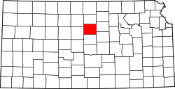
Education

The community is served by Sylvan–Lucas USD 299 public school district.

Present

The town is considered extinct. The town is on the list of National Historic Places. There is an old bridge called South Fork Spillman Creek Double Arch Bridge. [2] There is a cement company named Ash Grove, but is not in Ash Grove, they have cement plants elsewhere. [4]

Pictures cited. [5] [6]

Related Research Articles

<span class="mw-page-title-main">Pine Grove Covered Bridge</span> Bridge in Pennsylvania, United States

The Pine Grove Covered Bridge is a covered bridge that spans the East Branch of Octoraro Creek on the border between Lancaster County and Chester County in Pennsylvania, United States. It is the longest covered bridge in Lancaster County. The bridge was built in 1884 by Elias McMellen.

<span class="mw-page-title-main">Osborne County, Kansas</span> County in Kansas, United States

Osborne County is a county located in the U.S. state of Kansas. It county seat and largest city is Osborne. As of the 2020 census, the county population was 3,500. The county is named for Vincent Osborne, a captain in the American Civil War.

<span class="mw-page-title-main">Lincoln County, Kansas</span> County in Kansas, United States

Lincoln County is a county located in the U.S. state of Kansas. Its county seat and largest city is Lincoln Center. As of the 2020 census, the county population was 2,939. The county was named after Abraham Lincoln, the 16th president of the United States.

<span class="mw-page-title-main">Cheyenne County, Colorado</span> County in Colorado, United States

Cheyenne County is a county located in the U.S. state of Colorado. The county population was 1,748 at 2020 census. The county seat is Cheyenne Wells.

<span class="mw-page-title-main">Lincolnton, Georgia</span> City in Georgia, United States

Lincolnton is a city and the county seat of Lincoln County, Georgia, United States. The population was 1,480 at the 2020 census. It contains numerous houses and historic districts listed on the National Register of Historic Places. Both the city and the county were named for General Benjamin Lincoln, who served in the Continental Army during the American Revolution.

<span class="mw-page-title-main">Chanute, Kansas</span> City in Neosho County, Kansas

Chanute is a city in Neosho County, Kansas, United States. Founded on January 1, 1873, it was named after railroad engineer and aviation pioneer Octave Chanute. As of the 2020 census, the population of the city was 8,722. Chanute is home of Neosho County Community College.

<span class="mw-page-title-main">Pleasant Grove, Utah</span> City in Utah, United States

Pleasant Grove, originally named Battle Creek, is a city in Utah County, Utah, United States, known as "Utah's City of Trees". It is part of the Provo–Orem Metropolitan Statistical Area. The population was 37,726 at the 2020 Census.

<span class="mw-page-title-main">Alum Creek, West Virginia</span> Census-designated place in West Virginia, United States

Alum Creek is a census-designated place (CDP) in Kanawha and Lincoln counties along the Coal River in the U.S. state of West Virginia. It includes the unincorporated communities of Alum Creek, Forks of Coal, and Priestley. The CDP had a population of 1,749 at the 2010 census, down from 1,839 at the 2000 census.

<span class="mw-page-title-main">K-99 (Kansas highway)</span>

K-99 is a state highway in the U.S. state of Kansas. The highway runs 234.473 miles (377.348 km) from Oklahoma State Highway 99 (SH-99) at the Oklahoma state line near Chautauqua north to Nebraska Highway 99 (N-99) at the Nebraska state line in Summerfield. K-99 connects Emporia with several smaller county seats to the south and north, including Sedan, Howard, Eureka, Alma, and Westmoreland while passing through the Flint Hills of eastern Kansas.

<span class="mw-page-title-main">Wayne Township, Wayne County, Indiana</span> Township in Indiana, United States

Wayne Township is one of fifteen townships in Wayne County, Indiana, United States. As of the 2010 census, its population was 41,217 and it contained 19,510 housing units.

<span class="mw-page-title-main">K-181 (Kansas highway)</span> Highway in Kansas

K-181 is a 70.2-mile-long (113.0 km) north–south state highway which runs through several counties in the north central part of the U.S. state of Kansas. K-181's southern terminus is at K-232 southeast of Lucas by Wilson Lake Dam, and the northern terminus is at U.S. Highway 36 (US-36) and US-281 south of Lebanon. Along the way the highway intersects US-24 and K-9 in Downs.

<span class="mw-page-title-main">Generals' Highway Stone Bridges</span> United States historic place

The Generals' Highway Stone Bridges, built in 1930, are part of the Generals' Highway from the General Grant Grove of giant sequoias in Kings Canyon National Park through Sequoia National Park. One bridge spans the Marble Fork of the Kaweah River in a wooded setting, while the other, similar bridge spans Clover Creek in a bare canyon.

<span class="mw-page-title-main">Union Covered Bridge State Historic Site</span> Crossing over the Salt River in Missouri

The Union Covered Bridge State Historic Site is a Missouri State Historic Site in Monroe County, Missouri. The covered bridge is a Burr-arch truss structure built in 1871 over the Elk Fork of the Salt River. It was almost lost to neglect in the 1960s, but was added to the state park system in 1967, the same year it was damaged by a flood. Repairs were made the next year, using timbers salvaged from another covered bridge that had been destroyed by the same flood. In 1970, it was closed to vehicular traffic and was added to the National Register of Historic Places. Further repairs were made in 1988, and it survived the Great Flood of 1993, only to be damaged by another flood in 2008 and later re-repaired. It is about 120 feet (37 m) or 125 feet (38 m) long, 12 feet (3.7 m) high, and 17.5 feet (5.3 m) wide.

<span class="mw-page-title-main">Lime, Oregon</span> Unincorporated community in the state of Oregon, United States

Lime is an unincorporated community and ghost town in the northwest United States, located in Baker County, Oregon. Five miles (8 km) north of Huntington on Interstate 84, it is near the confluence of Marble Creek and the Burnt River on the Union Pacific Railroad. The historic Oregon Trail passes through Lime.

<span class="mw-page-title-main">Clements, Kansas</span> Unincorporated community in Chase County, Kansas

Clements is an unincorporated community in Chase County, Kansas, United States. It is located about half way between Strong City and Florence near the intersection of U.S. Route 50 highway and G Rd.

<span class="mw-page-title-main">Fairview Township, Russell County, Kansas</span> Township in Kansas, United States

Fairview Township is a township in Russell County, Kansas, United States. As of the 2010 United States Census, it had a population of 466.

<span class="mw-page-title-main">Cottonwood River (Kansas)</span> River in Kansas, United States

Cottonwood River is one of the principal tributaries of the Neosho River in central Kansas of the United States.

Spillman Creek is a stream in Lincoln County, Kansas, in the United States.

<span class="mw-page-title-main">Webster, Kansas</span> Unincorporated community in Rooks County, Kansas

Webster was an unincorporated community in Belmont Township, Rooks County, Kansas, United States.

<span class="mw-page-title-main">Rome, Ellis County, Kansas</span> Ghost town in Ellis County, Kansas

Rome was a short-lived postbellum frontier settlement in Ellis County, Kansas, United States. It is notable for its association with the early plains career of its co-founder, William Frederick "Buffalo Bill" Cody. Rome was the first town established within the future Ellis County, followed very shortly by rival Hays City.

References

  1. "Ash Grove, Kansas", Geographic Names Information System , United States Geological Survey, United States Department of the Interior
  2. 1 2 "Ash Grove, Kansas – Extinct in Lincoln County – Legends of Kansas" . Retrieved January 9, 2024.
  3. "Kansas Post Offices, 1828-1961, page 2". Kansas Historical Society. Retrieved June 13, 2014.
  4. "Locations". Ash Grove. Retrieved January 9, 2024.
  5. "CAVES". Farmer Days. April 3, 2016. Retrieved January 9, 2024.
  6. admin (March 1, 2021). "South Fork Spillman Creek Double-Arch Bridge". Post Rock Capital of Kansas. Retrieved January 9, 2024.

Further reading

39°09′41″N98°21′43″W / 39.16139°N 98.36194°W / 39.16139; -98.36194