Ashill, Devon

Last updated

Ashill
Uffculme, towards Ashill from near Reed's Cross - geograph.org.uk - 130574.jpg
Devon UK location map.svg
Red pog.svg
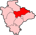
Ashill
Location within Devon
OS grid reference ST0811
Shire county
Region
Country England
Sovereign state United Kingdom
Police Devon and Cornwall
Fire Devon and Somerset
Ambulance South Western
List of places
UK
England
Devon
50°53′N3°18′W / 50.89°N 03.30°W / 50.89; -03.30 Coordinates: 50°53′N3°18′W / 50.89°N 03.30°W / 50.89; -03.30

Ashill is a village located in the parish of Uffculme, in the English county of Devon. [1] [2] It has a small church, a community village hall and small public house.

In the early 20th Century it had one or two shops, plus beer and cider houses. Later came a small garage with petrol pump, and a post office. None of these now survive. Towards the end of the century the character of the village changed, moving from a predominantly farming community to more of a residential character, with several new homes and a mini-estate and starter-home development built during the 1980s and 1990s. Nevertheless, a few historic farms remain active into the early 21st century, along with the more recently arrived alpaca breeders.

Ashill Inn Uffculme, Ashill Inn, Ashill - geograph.org.uk - 130569.jpg
Ashill Inn

St. Stephen's Church is part of the parish of St. Mary's, Uffculme. Ashill Inn was built in 1835.

One of the more visible features is a 3-storey Victorian red-brick dwelling at the lower end of the village. Legend has it that it began life as a 2-storey building (which would have been rather more in keeping with the character of the rest of the village), but during its construction the woman to whom the new owner was betrothed left him, and in order to win her back the man tried to impress her by commissioning an extra storey to his new home, thus assuring her of a greater status as the wife of a 'property owner'. As the story goes, he was unsuccessful in this, and she never returned to him.

Ashill lies approximately two miles from Uffculme and Kentisbeare.

It was soul/R&B singer Joss Stone's teenage home (specifically, the hamlet of Rull, approximately half a mile away).

Related Research Articles

Morden Human settlement in England

Morden is a district and town in south London, England, within the London Borough of Merton. It adjoins Merton Park and Wimbledon to the north, Mitcham to the east, Sutton to the south and Worcester Park to the west, and is around 8 miles (13 km) south-southwest of Charing Cross. Prior to the creation of Greater London in 1965, Morden was in the administrative county of Surrey. It is in ceremonial county of Surrey.

Tidworth Human settlement in England

Tidworth is a garrison town and civil parish in south-east Wiltshire, England, on the eastern edge of Salisbury Plain. Lying on both sides of the A338 about 3+12 miles (5.6 km) north of the A303 primary route, the town is approximately 8 miles (13 km) west of Andover, 12 miles (19 km) south of Marlborough, and 13 miles (21 km) north by north-east of Salisbury. The population of the parish at the 2011 census was approximately 10,600.

Hunstanworth

Hunstanworth is a small village in County Durham, England. It is situated approximately 10 miles to the west of Consett, south-west of the village of Blanchland. The population of the village as taken at the 2011 Census was 116.

Sawtry is a village and civil parish in Cambridgeshire, England. Sawtry lies approximately 8 miles (13 km) north of Huntingdon. Sawtry is situated within Huntingdonshire which is a non-metropolitan district of Cambridgeshire as well as being a historic county of England. The village is home to over 6,000 people.

Byrness Human settlement in England

Byrness is a village within Rochester civil parish in Northumberland, England. It is approximately 37 miles (60 km) north-west of Newcastle upon Tyne on the A68, and is the last village in England before the A68 climbs the Cheviot Hills to cross Carter Bar into Scotland. Byrness's village church features a stained-glass window commemorating the workers who died during the building of Catcleugh Reservoir nearby. Much of the village was built by the Forestry Commission to house workers for the extensive forests that surround it. Situated on the Pennine Way, Byrness has an inn, campsite and other accommodation offering rest and sustenance for weary walkers.

Campsea Ashe Human settlement in England

Campsea Ashe is a village in Suffolk, England located approximately 5 miles (8 km) north east of Woodbridge and 6 miles (10 km) south west of Saxmundham.

Whitfield is an ancient village, civil parish and electoral ward in the English county of Kent. It has a modern counterpart in the large settlement located at the junction of the A2 and A256 roads, some four miles (6.4 km) north of Dover.

Ashill, Norfolk Human settlement in England

Ashill is a village and civil parish in the English county of Norfolk. The village is between Watton and Swaffham.

Ashmansworth Human settlement in England

Ashmansworth is a village and civil parish in the Basingstoke and Deane district of the English county of Hampshire.

Burrough Green Human settlement in England

Burrough Green is a village and parish in Cambridgeshire, England. The population of the village at the 2011 census was 378. The soil is various; subsoil, clay and chalk. The chief crops are wheat, barley and roots. The area of the parish is 2,272 acres (919 ha); the population in 1921 was 334."

Uffculme Village in Mid Devon, England

Uffculme is a village and civil parish located in the Mid Devon district, of Devon, England. Situated in the Blackdown Hills on the B3440, close to the M5 motorway and the Bristol–Exeter railway line, near Cullompton, Uffculme is on the upper reaches of the River Culm. The population of the parish, according to a 2020 estimate, is 3,090. It is surrounded, clockwise from the north, by the parishes of Culmstock, Hemyock, Sheldon, Kentisbeare, Cullompton, Willand, Halberton and Burlescombe.

Willerby, East Riding of Yorkshire Village and civil parish in the East Riding of Yorkshire, England

Willerby is a village and civil parish located on the western outskirts of the city of Kingston upon Hull in the East Riding of Yorkshire, England.

Lewannick Human settlement in England

Lewannick is a civil parish and village in Cornwall, England, United Kingdom. The village is situated approximately five miles (8 km) southwest of Launceston. The civil parish had a population of 973 at the 2011 census.

Sandy Lane, Wiltshire Human settlement in England

Sandy Lane is a small village in Wiltshire, England, about 4.5 miles (7 km) south-east of Chippenham and 3 miles (5 km) south-west of Calne. It lies on the A342 Chippenham-Devizes road, just north of its junction with the A3102 to Calne.

Cheapside describes a close triangle of roads in the civil parish of Sunninghill and Ascot and ecclesiastical parish of Sunninghill in the Royal Borough of Windsor and Maidenhead in Berkshire, England which includes a school and had a Methodist chapel. It is a cluster of houses, bungalows and cottages with small gardens for the county which contrasts with large houses with large gardens and small farms covering most of the rest of Sunninghill. It is marked on maps as the area north and east of Silwood Park and south of Sunninghill Park. Harewood Lodge followed by Titness House to its immediate east are of similar 18th century construction and have sometimes been recorded as in the Cheapside locality.

Lanivet Human settlement in England

Lanivet is a village and civil parish in Cornwall, England, United Kingdom. The village is situated approximately 2+12 miles (4.0 km) southwest of Bodmin, and before the Bodmin by-pass was built, the A30 road between London and Land's End passed through the village. The Saints' Way long-distance footpath passes Lanivet near its half-way point.

Fairlands Hamlet in England

Fairlands is the largest settlement (neighbourhood) of Worplesdon, a village with a civil parish council in the Borough of Guildford, Surrey, England. The neighbourhood is centred 2.6 miles (4.2 km) north-west of Guildford, to which it is linked by a relatively straight road. The arbitrary centre of Worplesdon, a linear settlement, its church, is 1.2 miles (1.9 km) north-east.

Westnewton, Cumbria Human settlement in England

Westnewton is a small village and civil parish in the Allerdale district, in the county of Cumbria, England. The 2011 census had a population of 265. The village of Westnewton is situated to the north-west of the Lake District, on the relatively flat plain halfway between the Lake District hills and the Solway Firth. It is a small village located two miles north of Aspatria, on the B5301 Aspatria and Silloth road. The small hamlet of New Cowper is located one-and-a-half miles to the north-west. The landscape generally in this area is one of gently undulating fields, relatively devoid of features other than the thorn field-hedges, with shallow valleys carrying small streams, such as the Black Dub beck. Westnewton has a school called St Matthew's Church of England School, a church called St Matthew's Church, and a cemetery. There used to be a public house called the Swan Inn but this has closed.

Mawla, Cornwall Human settlement in England

Mawla is a village south of Porthtowan in Cornwall, England, UK. The earliest record of Mawla is in 960 AD; the meaning of the name is "pigs' place". It consists of a cluster of cottages and houses, Mawla Farm, Green Lane Farm, Forge Farm and a Methodist church. Mawla has no shops or pubs.

Laverstock Human settlement in England

Laverstock is a village and civil parish on the north-east and east outskirts of Salisbury in the ceremonial county of Wiltshire, England. The parish is shaped like a figure 7 and incorporates Ford hamlet, the eastern half of the former manor of Milford, the area near the ancient settlement of Old Sarum, and part of the Hampton Park district on the edge of Salisbury.

References

  1. Ordnance Survey: Landranger map sheet 192 Exeter & Sidmouth (Exmouth & Teignmouth) (Map). Ordnance Survey. 2013. ISBN   978-0-319-23139-5.
  2. "Ordnance Survey: 1:50,000 Scale Gazetteer" (csv (download)). www.ordnancesurvey.co.uk. Ordnance Survey. 1 January 2016. Retrieved 30 January 2016.