Cadbury, Devon

Last updated

Cadbury
Mid Devon - Cadbury Scenery (geograph 4184554).jpg
Devon UK location map.svg
Red pog.svg
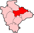
Cadbury
Location within Devon
OS grid reference SS9104
Shire county
Region
Country England
Sovereign state United Kingdom
Police Devon and Cornwall
Fire Devon and Somerset
Ambulance South Western
List of places
UK
England
Devon
50°49′N3°32′W / 50.82°N 03.54°W / 50.82; -03.54 Coordinates: 50°49′N3°32′W / 50.82°N 03.54°W / 50.82; -03.54

Cadbury is a village in Devon, England. Cadbury Castle is nearby.

The 15th-century Church of St Michael and All Angels features a Norman font. The church was restored in 1857 by William White, [1] with Frederick Coleridge serving as its vicar from 1855 to 1906. [2]

Related Research Articles

Keynsham Town and civil parish in Somerset, England

Keynsham is a town and civil parish located between Bristol and Bath in Somerset, England. It has a population of 16,000. It was listed in the Domesday Book as Cainesham, which is believed to mean the home of Saint Keyne.

Yatton Human settlement in England

Yatton is a village and civil parish within the unitary authority of North Somerset, which falls within the ceremonial county of Somerset, England. It is located 11 miles (18 km) south-west of Bristol. Its population in 2011 was 7,552. The parish includes Claverham, a small village which was originally a farming hamlet.

South Cadbury Human settlement in England

South Cadbury is a village in the civil parish of South Cadbury and Sutton Montis, in the South Somerset council area of the English county of Somerset. The parish includes the village of Sutton Montis.

Bournville Human settlement in England

Bournville is a model village on the southwest side of Birmingham, England, founded by the Quaker Cadbury family for employees at its Cadbury's factory, and designed to be a "garden" village where the sale of alcohol was forbidden. Cadbury's is well known for chocolate products – including a dark chocolate bar branded Bournville. Historically in northern Worcestershire, it is also a ward within the council constituency of Selly Oak and home to the Bournville Centre for Visual Arts. Bournville is known as one of the most desirable areas to live in the UK; research by the Joseph Rowntree Foundation in 2003 found that it was "one of the nicest places to live in Britain".

Clovelly Village in Devon, England

Clovelly is a harbour village in the Torridge district of Devon, England. Its steep pedestrianised cobbled main street, traditional architecture, donkeys and views over the Bristol Channel attract numerous tourists. At the 2011 census, the parish population was 443, which was 50 fewer than ten years previously. The ward of Clovelly Bay includes the island of Lundy.

Hemyock Village in Devon, England

Hemyock is a village and civil parish in Devon, England. It is about 8 miles north-west of Honiton and 5 miles (8 km) south of the Somerset town of Wellington. The 2011 Census recorded the parish's population as 1,519. Hemyock is part of the electoral ward of Upper Culm. The population of this ward at the above census was 4,039. The River Culm flows through Hemyock. Hemyock was the former home of the St Ivel dairy processing plant, formerly where the butter-spreads 'St Ivel Gold' and 'Utterly-Butterly' were produced before being moved to a factory in the north of England.

William Alexander Harvey

William Alexander Harvey was an English architect. He is most notable for his design of Bournville, the model 'garden suburb' built by Cadburys to house their chocolate-making workforce to the south of Birmingham.

Slapton, Devon Village and civil parish in Devon, England

Slapton is a village and civil parish in the South Hams district of Devon, England. It is located near the A379 road between Kingsbridge and Dartmouth, and lies within the South Devon Area of Outstanding Natural Beauty (AONB). The nearby beach is Slapton Sands; despite its name, it is not a sandy beach but a shingle one.

Awliscombe Village in Devon, England

Awliscombe is a village and civil parish in the East Devon district of Devon, England. The village is about two miles west of Honiton. The 2011 census showed a population of 500 for the parish, which is surrounded clockwise from the north by the parishes of Dunkeswell, Combe Raleigh, Honiton, Gittisham, Buckerell, Payhembury and Broadhembury.

Buckerell Village in Devon, England

Buckerell is a small village and civil parish in the East Devon district of Devon, England. The village is about 2.5 miles west of the nearest town, Honiton. In the 2001 census a population of 270 was recorded for the parish, which is surrounded clockwise from the north by the parishes of Awliscombe, Honiton, Gittisham, Feniton and Payhembury.

Kingskerswell Village in Devon, England

Kingskerswell is a village and civil parish within Teignbridge local government district in the south of Devon, England. The village grew up where an ancient track took the narrowest point across a marshy valley and it is of ancient foundation, being mentioned in the Domesday Book. It has a church dating back to the 14th century and the ruins of a manor house of similar date. The coming of the railway in the 1840s had a large effect on the village, starting its conversion into a commuter town. The village is a major part of the electoral ward called Kerswell-with-Combe. This ward had a population of 5,679 at the 2011 census.

Feniton Village in Devon, England

Feniton is a village and civil parish in East Devon in the English county of Devon. The village lies about 4 miles (6.4 km) west of Honiton, 3 miles (4.8 km) north of Ottery St Mary, and 2 miles (3.2 km) east of Talaton.

Yarlington Human settlement in England

Yarlington is a village and civil parish, near the source of the River Cam, in the English county of Somerset.

North Cadbury Human settlement in England

North Cadbury is a village and civil parish 5 miles (8 km) west of Wincanton, by the River Cam, in the South Somerset district of Somerset, England. It shares its parish council with nearby Yarlington and its civil parish includes the village of Galhampton, which got its name from the settlement of the rent-paying peasants, and the hamlet of Woolston.

Stokeinteignhead Village in Devon, England

Stokeinteignhead is a village and civil parish in the Teignbridge district of Devon, England, above the southern bank of the estuary of the River Teign. The parish has a short boundary on the estuary, and is otherwise surrounded, clockwise from the north, by the parishes of Shaldon, Torbay, Coffinswell and Haccombe with Combe. It is twinned with the French commune of Trévières, Calvados.

Nymet Rowland Village in Devon, England

Nymet Rowland is a small village, and parish of the same name, in central Devon, England, north of Dartmoor. It takes part of its name from "Nymet", the old name for the nearby River Yeo. It is located just to the west of Lapford and south of Nymet Bridge, within the Mid Devon local authority area. Historically it formed part of Winkleigh Hundred; today the North Tawton hundred. It falls within the Cadbury Deanery for ecclesiastical purposes.

Clyst St Lawrence Village and civil parish in Devon, England

Clyst St Lawrence is a village and civil parish about 8 miles north-east of the city of Exeter in the county of Devon, England. Historically it formed part of Cliston Hundred. The parish is in the East Devon district and is surrounded, clockwise from the north, by the parishes of Clyst Hydon, Whimple and the large parish of Broad Clyst. In 2001 its population was 105, little changed from the 113 people who lived there in 1901.

George Nympton Village in Devon, England

George Nympton or Nymet St George is a small village and civil parish in North Devon district, Devon, England. In the 2011 census it was recorded as having a population of 175.

Rose Ash Village in Devon, England

Rose Ash, formerly Ralph-Esse, is a village and civil parish in North Devon district, Devon, England. In the 2011 census it was recorded as having a population of 298.

References

  1. Historic England. "Details from listed building database (1261589)". National Heritage List for England . Retrieved 31 July 2016.
  2. "Wisden - Obituaries in 1906". ESPNcricinfo. Retrieved 6 February 2020.

Commons-logo.svg Media related to Cadbury, Devon at Wikimedia Commons