Clayhanger, Devon

Last updated

Clayhanger
Clayhanger - Village Lane (geograph 3920335).jpg
A lane in the village
Devon UK location map.svg
Red pog.svg
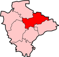
Clayhanger
Location within Devon
Population127 (2011 UK Census)
OS grid reference ST022230
District
Shire county
Region
Country England
Sovereign state United Kingdom
Post town TIVERTON
Postcode district EX16 7N
Police Devon and Cornwall
Fire Devon and Somerset
Ambulance South Western
UK Parliament
List of places
UK
England
Devon
50°59′54″N3°23′43″W / 50.998245°N 3.39514°W / 50.998245; -3.39514 Coordinates: 50°59′54″N3°23′43″W / 50.998245°N 3.39514°W / 50.998245; -3.39514

Clayhanger is a hamlet and civil parish in the Mid Devon district of Devon, England. [1] [2] At the time of the 2011 census it had a population of 127. [3]

Roman fort

Clayhanger is close to the site of a Roman fort at Cudmore Farm, overlooking a small tributary of the River Batherm, (although the fort mostly lies in the parish of Bampton). The site of the fort is a scheduled monument because it is still in a good condition and is considered to be the best surviving example in the south west of England. It is rectangular in shape and approximately 100 m across on each side, with an 8 m rampart and four outer ditches. Cropmarks inside the site probably show the locations of buildings from the period of the fort. Roman tile and samian ware have been recovered from the site. [4]

Related Research Articles

River Axe (Lyme Bay) River in southwest England

The River Axe is a 22-mile (35 km) long river in the counties of Dorset, Somerset and Devon, in the south-west of England. It rises in Dorset and flows south to Lyme Bay which it enters through the Axe Estuary in Devon. It is a shallow, non-navigable river, although its mouth at Axmouth has some boating activity. The name Axe derives from a Common Brittonic word meaning "abounding in fish", and is cognate with pysg, the Welsh word for fish.

Beer, Devon Village in Devon, England

Beer is a village and civil parish in the East Devon district of Devon, England. The village faces Lyme Bay and is a little over 1 mile (1.6 km) west of the town of Seaton. It is situated on the Jurassic Coast World Heritage Site and its picturesque cliffs, including Beer Head, form part of the South West Coast Path.

Cullompton Town and civil parish in Devon, England

Cullompton is a town and civil parish in the district of Mid Devon and the county of Devon, England. It is 13 miles (21 km) north-east of Exeter and lies on the River Culm. In 2011 the parish as a whole had a population of 8,499 while the built-up area of the town had a population of 7,439.

Combe Raleigh Village and civil parish in Devon, England

Combe Raleigh is a village and civil parish in the county of Devon, England. The village lies about 1.5 miles north of the town of Honiton, and the parish is surrounded, clockwise from the north, by the parishes of Luppitt, Honiton, Awliscombe and Dunkeswell.

Burscough Town in West Lancashire, England

Burscough is a town and civil parish in West Lancashire in the ceremonial county of Lancashire, England. It is located to the north of Ormskirk and northwest of Skelmersdale.

Piercebridge Human settlement in England

Piercebridge is a village and civil parish in the borough of Darlington and the ceremonial county of Durham, England. The population of the civil parish as of the 2011 census was 113. It is situated a few miles west of the town of Darlington. It is on the site of a Roman fort of AD 260–270, which was built at the point where Dere Street crossed the River Tees. Part of the fort is under the village green. The village is sited where the York-Newstead Roman road known as Dere Street crosses the River Tees.

Bridgetown, Devon

Bridgetown occupies the left bank of the Dart in the town of Totnes, Devon, England.

Bransbury Hamlet in England

Bransbury is a hamlet in Hampshire, England, part of the parish of Barton Stacey. The nearest village is Barton Stacey, halfway between Winchester and Andover; there is a junction for Bransbury on the A303 towards Exeter. Bransbury has twenty-two dwellings: a collection of agricultural workers’ cottages with gardens of generous proportions, Bransbury Manor, which dates from the 18th century, and Bransbury Mill, a Grade II listed building. The Crook and Shears Inn public house was converted into a dwelling in the late 20th century. The hamlet straddles the River Dever.

All Saints, Devon

All Saints is a civil parish in East Devon, Devon, England. It has a population of 498 according to the 2001 census. The parish includes the hamlets of All Saints, Smallridge, Churchill, Alston and Waggs Plot. This area also has one cricket pitch, a primary school, pre-school and a church.

Ashwater Village in Devon, England

Ashwater is a village and civil parish in the Torridge district of Devon, England. According to the 2001 census it had a population of 651 that had risen to 673 by the 2011 census. It is close to the Cornish border, and is about 10 miles north of Launceston.

Beaworthy Village in Devon, England

Beaworthy is a village and civil parish in the West Devon district of Devon, England. According to the 2001 census it had a population of 236.

Hillsborough, Devon Nature reserve in Devon, England

Hillsborough is a local nature reserve in Ilfracombe, North Devon. It is known locally as the sleeping elephant. It was bought by the local council in the late nineteenth century to prevent development on the site. As well as a pleasant coastal area where visitors may roam, it includes the remains of an Iron Age hill fort.

Prideaux Castle is a multivallate Iron Age hillfort situated atop a 133 m (435 ft) high conical hill near the southern boundary of the parish of Luxulyan, Cornwall, England, United Kingdom. It is also sometimes referred to as Prideaux Warren, Prideaux War-Ring, or Prideaux Hillfort. The site is a scheduled monument and so protected from unauthorised works by the Ancient Monuments and Archaeological Areas Act 1979.

Castleshaw Human settlement in England

Castleshaw is a hamlet in the Saddleworth parish of the Metropolitan Borough of Oldham in Greater Manchester, England. It lies amid the Pennines, 2.4 miles (3.9 km) north of Uppermill, 3 miles (4.8 km) west-southwest of Marsden, and 5.3 miles (8.5 km) east-northeast of Oldham.

Elslack Village and civil parish in North Yorkshire, England

Elslack is a village and civil parish in the Craven district of North Yorkshire, England, close to the border with Lancashire and 4 miles west of Skipton. Thornton in Craven is nearby. The Tempest Arms is a large pub in the village, sited by the A56, which is popular with locals from the surrounding area. Elslack Moor, above the village, is crossed by the Pennine Way, though this does not visit the village itself.

Farnsfield Village in Nottinghamshire, England

Farnsfield is a large village and civil parish in Nottinghamshire in Sherwood Forest. It is in the local government district of Newark and Sherwood. The population of the civil parish as at the 2011 Census was 2,731, an increase from 2,681 in the United Kingdom Census 2001.

West End Brook

West End Brook is a small stream in southern England. It rises near the Hampshire village of Tadley. Its name is probably related to the parish, and village, it passes through for some of its course: Mortimer West End.

Norris Green, Cornwall Human settlement in England

Norris Green is a village in Cornwall, England, UK. It was enlarged from a farming hamlet so that it now adjoins the neighbouring village of Higher Metherell. Both settlements are within the civil parish of Calstock which borders the River Tamar, the county boundary with Devon in south-east Cornwall.

Strete Village in Devon, England

Strete is a village and civil parish in the South Hams district of Devon, England, on the coast of Start Bay, within the South Devon Area of Outstanding Natural Beauty.

Martinhoe Village in Devon, England

Martinhoe is a small settlement and civil parish in North Devon district of Devon, England. Martinhoe is within the Exmoor National Park, the smallest National Park in England. In the 2011 census Martinhoe Parish was recorded as having a population of 159. Martinhoe is in the Combe Martin ward, for elections to the district council. Martinhoe's local government takes the form of a parish meeting and as such has no parish council nor elected parish councillors.

References

  1. Ordnance Survey: Landranger map sheet 181 Minehead & Brendon Hills (Dulverton & Tiverton) (Map). Ordnance Survey. 2009. ISBN   9780319231814.
  2. "Ordnance Survey: 1:50,000 Scale Gazetteer" (csv (download)). www.ordnancesurvey.co.uk. Ordnance Survey. 1 January 2016. Retrieved 18 February 2016.
  3. "Area: Clayhanger (Parish)". Neighbourhood statistics. Retrieved 21 December 2016.
  4. Historic England. "Roman fort 300m NE of Cudmore Farm (1011251)". National Heritage List for England . Retrieved 21 December 2016.