Lake Athabasca is in the north-west corner of Saskatchewan and the north-east corner of Alberta between 58° and 60° N in Canada. The lake is 26% in Alberta and 74% in Saskatchewan.
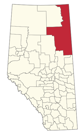
The Regional Municipality of Wood Buffalo is a specialized municipality in northeast Alberta, Canada. It is the largest municipality in North America by area and is home to oil sand deposits known as the Athabasca oil sands.

The Churchill River is a major river in Alberta, Saskatchewan and Manitoba, Canada. From the head of the Churchill Lake it is 1,609 kilometres (1,000 mi) long. It was named after John Churchill, 1st Duke of Marlborough and governor of the Hudson's Bay Company from 1685 to 1691.
The Fond du Lac River is one of the upper branches of the Mackenzie River system, draining into the Arctic Ocean, located in northern Saskatchewan, Canada. The river is 277 kilometres (172 mi) long, has a watershed of 66,800 km2 (25,800 sq mi), and its mean discharge is 300 m3/s (11,000 cu ft/s).
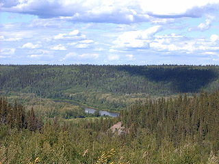
The Clearwater River is located in the Canadian provinces of Saskatchewan and Alberta. It rises in the northern forest region of north-western Saskatchewan and joins the Athabasca River in north-eastern Alberta. It was part of an important trade route during the fur trade era and has been designated as a Canadian Heritage River.

The Athabasca Basin is a region in the Canadian Shield of northern Saskatchewan and Alberta, Canada. It is best known as the world's leading source of high-grade uranium and currently supplies about 20% of the world's uranium.
The Methye Portage or Portage La Loche in northwestern Saskatchewan was one of the most important portages in the old fur trade route across Canada. The 19 km (12 mi) portage connected the Mackenzie River basin to rivers that ran east to the Atlantic. It was reached by Peter Pond in 1778 and abandoned in 1883 when steamboats began running on the Athabasca River with links to the railroad. It ranks with Grand Portage as one of the two most important and difficult portages used during the fur trade era.

Beaver River is a large river in east-central Alberta and central Saskatchewan, Canada. It flows east through Alberta and Saskatchewan and then turns sharply north to flow into Lac Île-à-la-Crosse on the Churchill River which flows into Hudson Bay.

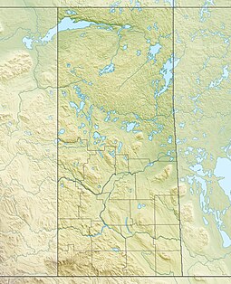
The geography of Saskatchewan is unique among the provinces and territories of Canada in some respects. It is one of only two landlocked regions and it is the only region whose borders are not based on natural features like lakes, rivers, or drainage divides. The borders of Saskatchewan, which make it very nearly a trapezoid, were determined in 1905 when it became a Canadian province. Saskatchewan has a total area of 651,036 square kilometres (251,366 sq mi) of which 591,670 km2 (228,450 sq mi) is land and 59,366 km2 (22,921 sq mi) is water.

Fond du Lac Dene Nation is a Dene First Nation located in the boreal forest area of northern Saskatchewan, Canada. The main settlement is Fond-du-Lac, situated on the east side of Lake Athabasca. It is a remote fly-in community. The population in 2011 was 874, mainly of Dene and Métis descent. 705 residents selected Dene as their mother tongue in 2011.
There are numerous heritages and cultural attractions in the province of Saskatchewan. Museums, dinosaur digs, aboriginal cultural and heritage sites, art galleries, professional sport venues, spas, handcraft, antique and tea shops, agricultural tours, theatre and archaeological sites comprise over 600 varied Saskatchewan institutions.

The native flora of Saskatchewan includes vascular plants, plus additional species of other plants and plant-like organisms such as algae, lichens and other fungi, and mosses. Non-native species of plants are recorded as established outside of cultivation in Saskatchewan, of these some non-native species remain beneficial for gardening, and agriculture, where others have become invasive, noxious weeds. Saskatchewan is committed to protecting species at risk in Canada. The growing season has been studied and classified into plant hardiness zones depending on length of growing season and climatic conditions. Biogeographic factors have also been divided into vegetative zones, floristic kingdoms, hardiness zones and ecoregions across Saskatchewan, and natural vegetation varies depending on elevation, moisture, soil type landforms, and weather. The study of ethnobotany uncovers the interrelation between humans and plants and the various ways people have used plants for economic reasons, food, medicine and technological developments. The Government of Saskatchewan has declared 3 indigenous plants as provincial symbols.

The Midwest Canadian Shield Forests is an ecoregion in Canada, classified as a Taiga and Boreal Forests Biome.

The La Loche River is a small river in north-west Saskatchewan. The distance from its source at the south east end of Lac La Loche to its mouth at the north end of Peter Pond Lake is 56 km. The river is bridged by Highway 956 about 5 kilometres from its source. The Kimowin River flows in from the west.

Geikie River is a river in the northern part of the Canadian province of Saskatchewan. The river's source is Costigan Lake, which is near the uranium producing areas around the Key Lake mine in the Athabasca Basin. It flows in a north-easterly direction and flows into Wollaston Lake.
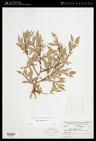
Salix turnorii, also known as Turnor's willow, is a species of willow. It is endemic to the Athabasca Sand Dunes Provincial Park in Saskatchewan, Canada. It is listed as imperiled by NatureServe.

Good Spirit Lake Provincial Park is a provincial park on the eastern side of the Canadian province of Saskatchewan. Founded in 1931, the park surrounds the western and southern shores of Good Spirit Lake and is one of Saskatchewan's six founding provincial parks. The park is in the RM of Good Lake No. 274, about 48 kilometres (30 mi) north of the city of Yorkton. Highway 47 runs along the western boundary and Highway 229 provides access to the park's amenities.
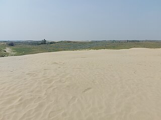
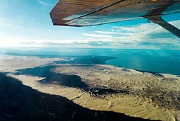
The Great Sand Hills, also spelt Great Sandhills, are sand dunes in the south-west region of the Canadian province of Saskatchewan. The Great Sand Hills are the second largest active dunes in Saskatchewan, after Athabasca Sand Dunes, and are part of Great Sandhills Ecological Reserve, which covers an area of about 1,900 km2 (730 sq mi). The sands that make up the dunes are made up of very finely ground sand called rock flour that were deposited near the end of the last ice age. The region around the sand hills is often windy and, as a result, the wind blows the fine sands around creating an ever-changing landscape.
Douglas Provincial Park is a provincial park in the Canadian province of Saskatchewan. Established in 1973, it is named after Tommy Douglas, the seventh premier of Saskatchewan and father of Canada's first single-payer, universal health care programme. The park is located along the Gordon McKenzie Arm of Lake Diefenbaker and at the Qu'Appelle River Dam, which is the source of the Qu'Appelle River. The closest community is Elbow and access to the park is from Highway 19.