The main profession here is agriculture, particularly sugarcane, jawar, and grapes. The river Krishna flows 110km around the southern part of Athani Taluk. the city 18km from river Krishna. It is famous for leather chappals.[citation needed] Athani is the oldest municipal town of Karnataka; it was established in 1853 according to the municipal act of 1850.[citation needed] The municipal council completed 160 years. It is an important gateway to Karnataka from Maharashtra State
There is a proposal for a new railway line between Shedbal-Athani-Vijayapura & shahbad to connect Vijayapura with Belagavi. A survey of this 112.3-km new railway line is completed and submitted to the Railways.
The city is well connected by roads. National Highway 548B connect from Sankeshwar-Athani-Vijayapura-akkalkot The three state highways pass through the city: SH-31 (Jath-Jambothi), and SH-72 (Nippani-muchanddi) and SH (khelgoan-jamakhandi)
Famous goods transportation (truck) company: Suhelroadlines
Demographics
As of 2011[update] India census,[3][4] Athani had a population of 63,625 according to the area 15km2 including adjacent two villages in it . Males constitute 51% of the population and females 49%. Athani has an average literacy rate of 74%, higher than the national average, with 69% of the males and 79% of females literate. 14% of the population is under 6 years of age.
Climate
Being situated in upper region of Belagavi district which lies in the elevated terrain of north-western Karnataka, Athani has a tropical climate. It is known for its moderately climate throughout the year. Athani receives rainfall from both the northeast and the southwest monsoons and the wettest months are June–September.[5][6] It has a distinct normal climate in every season. extreme climate should not found here. June and August have a good deal of rainfall, while the winters have very little. The coldest month is December with an average low temperature of 25.3°C and the hottest month is may with an average high temperature of 40°C. Winter temperatures rarely drop up to 18°C (54°F), and summer temperatures seldom exceed 30–40°C.The driest month is January, with 10mm of rainfall.[7][8][9]
The ancient Amruthalingeshwara temple (500 years old) is located in the city.
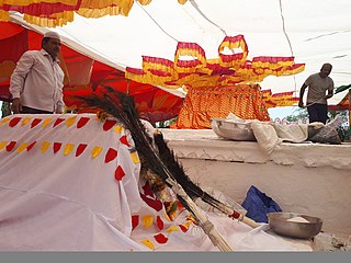
Aigali animal husbandry fair is a notable event in the region. Athani has produced many well-known Kannada poets and writers. Kannada is the main language here while Marathi is also spoken, owing to close proximity with Maharashtra border.
History
Historically, Athni was a fortified town where the armies of the Maratha Empire and the Mughal Empire clashed. In the present day, nothing remains of the fort but an ancient shrine of Siddeshwara continues to thrive. Siddeshwara Devastana is the largest temple of Athani town which attracts thousands of devotees. Athni was an important centre of trade. Its wheelwrights are known as excellent workmen; from the 15th to 19th centuries, its industries manufactured coarse cotton cloth, blankets, and saltpeter, and there were factories for pressing and cleaning cotton.
Ancient mentions of Athani taluk are Ramateerth has been connected with Ramayan. There are as many as five Ramateerths in the belagavi district, 1) in the Parasgad fort, 2) at Mullur in Ramdurg taluk, 3) near Kanbargi in Belgaum taluk, 4) at Ramateerth in Athani taluk. Ramtheerth having the oldest Shiva temple built during the Chalukyan period. Chalcolithic (copper age) sites have been located by Dr. Sundara in the upper Krishna valley that is Satti, Saptasagar. Pottery with paintings in ivory black, white kaolin, and brown are found at Satti is noteworthy. However the occurrence of the ash mounds in the Krishna valley of the Belgaum region, according to Sundara, seems to indicate the course of the defusion of this activity along the valley towards the Doab and it is probably associated with users of Sawalda pottery.
Athani has temples dedicated to Amritalingeshwar, Ramalinga, Siddeshwar built in later Chalukyas style shows the evidence of town during Chalukyas period The finest among them is the Amritalingeshwar temple of Later Chalukyan style with profuse carvings and highly artistic pillars in the navaranga. The entrance has pierced windows. The perspective of this beautiful building is lost due to encroachments around it, and the exterior of the Garbhagriha has sculptures the Nandi mandapa is across a modern road. The Siddheshwar temple on the Bijapur road is the grama devata and the domed temple is completely refurbished by the Adilshahis in Indo-Islamic style the remains of an earlier structure like Chalukyan pillars are built into the wall shows this temple is built during the Chalukyas period. The earliest of the Mathas is the Gachchina Matha founded in the 12th century. Within the premises of the Matha is the gadduge of the Shri Shivayogi Murugendra Swamiji the Matha is housed in a 400-year-old building. there are Motagi Matha and Gotkhindi Matha. The Rama Mandira at Athani was founded by saint Samartha Ramdas there is a passage leading to a secret chamber the place was a center of underground activities during the freedom movement. Athani has Nalbandh Mosque is of Ali Adil Shah's period.
Many European travelers like French traveller Johan Albrecht de Mandelslo mentioned Athani in 1639, who notices Atteny city as one of the chief markets between Bijapur and Goa. It is the chief market in the District, sending cotton and grain westwards to Miraj, and receiving from the sea-coast through Miraj rice, coco-nuts, and dried fish. In about 1670 the English geographer John Ogilby mentioned Attany as a great trading town. In 1675, Fryer, the English traveler also notices Huttaney as a market town near Bijapur. In 1679, Athni was taken from Shivaji by the Mughul general Dilawar Khan who sacked it. Dilawar Khan wished to sell the people as slaves. Sambhaji, the son of Shivaji, who sometime before had rebelled against his father and joined Dilawar Khan, opposed the suggestion, and Dilawar Khan ignoring his remonstrances, left the camp and became reconciled with his father During this time, the English factory at Karwar had large dealings with Athani. In 1720, Athani was seized by the Nizam after made it over to his ally the Kolhapur chief, who in 1730, transferred it to the Maratha ruler Shahu I of Satara. In 1788, Rennell established an English factory. In 1792, Captain Moor calls it Athni, a large town well-populated and thriving and it was a place of much trade, importing merchandise from Surat, Bombay. Raichur and Narayanpeth in the Nizam's country during that time textile mills, leather mills, cotton ginning mills were established. Athni lapsed to the British Government in 1839 on the death of the Maratha chief. British established Subordinate Judge's court, a dispensary, a municipal middle school & a Town municipality in 1853. In 1918, Bal Gangadhar Tilak visited Athani during the freedom movement when he met the Sri Shivayogi Murugendra. Swamiji by the inspiration of tilak Jadavji education society was established and four other schools, one of which is for girls. even mahatma Gandhiji also visited Athani in 1935 Shri Shivayogi Murugendra Swamiji he is an inspiration for Lingaraj desai to establish KLE society in Karnataka in 1916. Athani unified with Karnataka state in 1956.
Bal-Gangadhar Tilak meets Athani Murugendra Shivayogi. during 1918
Athani Taluk
Athani Taluk is the largest taluk in Belagavi district; it has a total area of 2070.54km2,[15] 74% is cultivated. This includes 115 inhabited villages and hamlets with a rural population of 4,07,485 as per the 2011 census. The total population of the taluk is 5,25,832. The taluk is bounded by Sangli district of Maharashtra in the north, Vijayapura district in the east, and Krishna River in the south. It flows 110 km in the taluk. Geologically the area is covered by Deccan Trap formation. The average annual rainfall is 582mm. The two rivers that flow here are Krishna and Agrani River. Agrani is beside the pandegao, shirur, ajur, sambargi, nagnur (p.a.), tawanshi, and kalloti.
The five largest towns of Athani Taluk (sorted in order of decreasing population) are Athani, Ugar, Ainapur, Kagawad, Shedbal. The river Krishna flows around the Athani taluk. Five sugar industries are in this taluk. They are located in Athani, Shinal, Kagawad, Kokatnur, Ugar and Kempwad . There are four Hobli in this taluk: Athani, Kagawad, Telsang and Anatapur. Most of the land is fully fertile; some of the land is dry and hilly.
Siddeshwar temple athani
Tourist attractions and pilgrimages
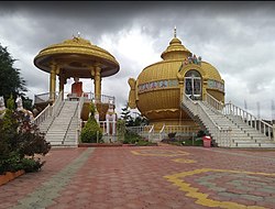
Sri Dannamma Devi Temple Athani, a unique temple
Ramatheerth: there is a temple of Lord Rameshwar of the old stone temple of 800 years old and one of the caves is located behind the temple it is built during Chalukyas period.
Athani Amrutlingeshwar temple is built in the Chalukyaan period 1000 years old.
Gachhina math is a place of lord Murugendra Shivayogi and Marulashankar Devaru in Athani.
A Raghavendra Swamiji Math was built by the late Shri Bhimdas. This place is also known as Abhinav Mantralaya.
Savadi Venu Gopal Temple (also known as Gopalkrishna Temple) situated on the bank of Krishna River at Savadi is perhaps the oldest temple in Athani Taluka. the temple Venu Gopal is the presiding deity. It is a typical Trikuteshwar type temple where apart from the presiding deity, the other two vigrahas on either side of the main sanctum sanctorum are two impressive Shivlings. According to the archeological study, the temple is about 1000–1200 years old
Athani Siddeshwara Temple has the architecture of a mosque. Built-in stone, it was recently clad with marble. It is the main deity of Athani town. It is said that Adilshah of Vijayapura was constructed sometime in the 15th or 16th century.
Khidrapur ancient temple
Nandagaon ancient temple
Ancient fort anatapur
Hipparagi barrage
Khilegavi (Basaveshwar Temple situated in Khiilegavi)
Kokatanur (Yellamma temple)
Avarkhod: Hanuman temple, is a tourist place. It is the oldest temple.
Agriculture
In Athani agriculture is the main occupation. About 60% of the total population is engaged in agriculture. The main crops are: jawar, wheat, sunflower, toordal, and kushbi. The commercial crops are sugarcane, grapes, wheat and ground nut. Few varietiesof vegetables like tomatoes, brinjals, ladies fingers, green leaves and redchillies are also grown With the limited rainfall, diesel power pumpsets are in vogue for the available water supply. And the main commercial crop is sugarcane. Athani is one of the largest sugarcane cultivation taluks in Karnataka. 70% of the land is fertile. Sugarcane is cultivated near river Krishna and river Agrani. It is cultivated more than 1,50,000 acres in taluk. Irrigation facilities of Hipparagi barrage of Upper Krishna Projectis in athani. By this project canals were constructed. It is very helpful for cultivation of sugarcane and grapes. The Hipparagi project is useful to farmers. Most of farmers cultivate sugarcane and jawar.
Industries
There are many industries located in Athani taluk like the sugar industry, chappal factories, glucose, and mills.
Leather Chappal Mills
Athani leather chappals
The Athani is famous for leather chappals scheduled caste families forming a considerable chunk of the local population. This serves a special mention because of the valid contribution of few subgroups to the now-famous leather products of Athani. The sub-groups are Dhors and Samagars who are mostly engaged in this leather trade and are traditional leather workers. Dhors are specialized in the tanning of hides and skins, while Samagars have proved as intricate craftsmen to produce leather footwear. Recognizing this, the Khadi and village industries commission established a footwear manufacturing center under the name "Lidkar". The success of this paved the way towards another milestone, where ‘Lidkar’ backed by the State Government, saw the light of the day, boosting the activity of footwear manufacturing further. The foot-wears are marketed throughout India by the respective outlets. The traders from another part of the country also procure leather goods from Athani, to market them in their areas. Through the State Trading Corporation, these leather goods are also exported to many countries where they have found a sizeable market. Athanic Footwear The category which has established itself by way of its design and quality is known as ‘Kolhapuri Chappals’ which has a great demand in local as well as the export markets. These goods were exported to foreign countries like Scotland, Netherlands, England, and others..
Sugar industry
Krishna cooperative sugar industry, AthaniAthani farmers sugar industry
Previously there was no sugar industry was there in this taluk but farmers transported the sugarcane to Maharashtra. in 1940 the sugar industry establish in ugar Athani Taluk Ugar sugars Pvt ltd, it produces more than 12,000 tonnes. Athani taluk is the largest sugarcane crushing & sugar-producing in Karnataka. it ranks number 1 in Karnataka and in 1985 Krishna co-operative sugar industry, Athani many sugar industries were started in this taluk. Presently 5 sugar industries are located in Athani taluk there are:
Bijapur is the district headquarters of Bijapur district of the Karnataka state of India. It is also the headquarters for Bijapur Taluk. Bijapur city is well known for its historical monuments of architectural importance built during the rule of the Adil Shahi dynasty. It is also well known for the popular Karnataka premier league team, the Bijapur Bulls. Bijapur is located 519 km (322 mi) northwest of the state capital Bangalore and about 550 km (340 mi) from Mumbai and 210 km (130 mi) north east of the city of Belgaum.
Ugar Khurd is a town and municipal council in the district of Belagavi, in the state of Karnataka, India, on the banks of the Krishna River. According to the 2011 census, the population of the town is about 23,762, of whom almost 2,000 work in the Ugar Sugar Works.
Belagavi district, formerly also known as Belgaum district, is a district in the state of Karnataka, India. The district is known as the sugar bowl of Karnataka with 150,000 hectares being used for commercial production. It has overtaken Mandya district in sugarcane production over the last decade. The city of Belgaum (Belagavi) is the district headquarters in Belagavi district. It houses the Second legislative building, where the Karnataka Legislature hold session once a year. The district is famous for its native sweet, Kunda. According to the 2011 Census of India, it has a population of 4,779,661, of which 24.03% live in urban areas, making it the second most populous district in Karnataka, after Bangalore Urban. The district has an area of 13,415 km2 (5,180 sq mi) making it the largest district in Karnataka, and is bounded by Kolhapur District and Sangli district of Maharashtra state on the west and north, on the northeast by Bijapur district, on the east by Bagalkot district, on the southeast by Gadag district, on the south by Dharwad and Uttara Kannada districts, and on the southwest by the state of Goa.
Gokak is a taluka headquarters in the Belagavi district of Karnataka state, India. It is located around 70 km from Belagavi at the confluence of two rivers, the Ghataprabha and the Markandeya. The population of the city is according to 2011 census is 79,121. Gokak city has second highest GDP in the district of Belagavi after Belagavi city. The common language is Kannada.
Bailhongal is a Taluk in Belagavi district of Karnataka state in southern India. Bailhongal Taluk is located towards the north-east part of Belagavi. The taluk headquarters is about 44 km from the district headquarters. The total geographical area of the taluk is 1122.40 km2. There are 126 revenue villages and 14 hamlets with a total population of 356,400 people, according to the 2001 census.
Chikkodi is a taluka and Town Municipal Council in the Belagavi district of Karnataka, India. It is a Subdivision of the district. Chikodi, Athani, Hukkeri, Raybag, Nipani and Kagwad are the taluks that come under Chikodi Subdivision. It is 75 kilometers from the city of Belgaum, 65 kilometers from Kolhapur, 51 kilometers from Miraj, 160 kilometers from Hubballi, and 570 kilometers from the capital of Karnataka state, Bengaluru. Chikodi has many district level offices but it is not designated as a district by the Government of Karnataka. It is one of the major cities that lies in the border between Karnataka and Maharashtra states.official language is Kannada.
Khanapur known as Khanapura is a panchayat town in Belagavi district, Karnataka, India. It is about 26 km from Belagavi. The Khanapur Municipal Council governs the town. Khanapur is the headquarters for Khanapur taluk. The town is on the Belgaum-Panaji National Highway, NH 4A. Khanapur is well connected by train and road to important cities in Karnataka, Goa, and Maharashtra. Kannada is the official language.
Kudachi is a town municipal corporation in Belagavi district in Karnataka.
Ainapur is a town in the southern state of Karnataka, India. It is located in the Athani taluk of Belgaum district in Karnataka. Ainapur village is famous for Peda, the village situated near river Krishna. Sugarcane is the chief cultivated crop and Kannada is the primary spoken language.
Darur is a village in the southern state of Karnataka, India. It is located in the Athani Taluk of Belagavi district in Karnataka.
Mangasuli is a village located in Northern Karnataka, India. It is located in the Athani taluk of Belgaum district in Karnataka.
Savadi is a village in the southern state of Karnataka, India. It is located in the Athani taluk of Belgaum district. Located on the banks of the Krishna river, also called Uttaravahini - which flows northwards at Savadi, most of the population here is largely dependent on agriculture for its sustenance. Animals domesticated are buffaloes, goats, dogs, horse, bullocks, sheep and fowl. Historically being a belt of Jowar cultivation, with the recent irrigation projects near the village, from the past two decades, the chief crop has been sugarcane. Savadi is closely located to many sugar industries of the Krishna basin, and is part of the major supplier belt of sugarcane in Athani Taluk, and consequently Belgaum district.
Shedbal is a town in the southern state of Karnataka, India. It is located in the Kagwad taluk of Belagavi district in Karnataka. Shedbal is very close to Sangli Miraj twin cities.
Shegunashi is a village in the southern state of Karnataka, India. It is located in the Athani taluk of Belagavi district in Karnataka.
Ugar Budruk is a village in the southern state of Karnataka, India. It is located in the Athni taluk of Belgaum district in Karnataka. It is around 38 km from the city of Sangli, Maharashtra. Ugar comes under the Kagwad constituency.
Badachi is a village in Belgaum district in the southern state of Karnataka, India. It is located in Athani Taluka of Belgaum District, near Bijapur -Athani Highway.
Chamakeri is a village in the Belgaum district of Athani Taluk in the southern Indian state of Karnataka.
Radderahatti is a small village/hamlet in Athani Taluk in Belagavi District of Karnataka, India. It comes under Radderahatti Grama Panchayath with 13 members. It belongs to Belgaum Division. It is located 124 km (77 mi) north of district headquarters Belgaum, 10 km (6.2 mi) from Athni and 570 km (350 mi) from the state capital Bangalore. The local language is Kannada and the population is 5700 with 1138 houses. The female population is 49.3%, the overall literacy rate is 72.4% and the female literacy rate is 61.3%. Basaveshwara temple, Girimalleshwar Math, and Durgadevi temple are some spiritual and religious places.
Athani Taluk is the largest taluk in Belgaum District, Karnataka, India. It has a total area of 2,070.54 square kilometres (799.44 sq mi), of which 70% is cultivated. This includes 4 towns, 115 inhabited villages and hamlets with a rural population of 4,07,485, according to the 2011 census. The total population of the taluk is 5,25,832. It is bounded by Sangli District of Maharashtra in the north, Bijapur District in the east, and Bagalkot District in the southeast. Geologically the area is covered by Deccan Trap formations. The average annual rainfall is 582 millimetres (22.9 in). Two rivers flow through the taluk: the Krishna River and the Agrani.
References
↑ "Belgaum District Stats". City Municipal Commissioner of Belgaum, Govt. of Karnataka. 10 July 2012. Archived from the original on 12 May 2013. Retrieved 25 May 2013.
This page is based on this Wikipedia article Text is available under the CC BY-SA 4.0 license; additional terms may apply. Images, videos and audio are available under their respective licenses.