Aurora, Taylor County, Wisconsin

Last updated

Aurora, Wisconsin
Farm in Aurora Wisconsin.jpg
Most of Aurora is fairly flat with heavy soil, like this farm west of Gilman.
WIMap-doton-Aurora b.png
Location of Aurora, Taylor County, Wisconsin
Coordinates: 45°10′39″N90°51′15″W / 45.17750°N 90.85417°W / 45.17750; -90.85417
Country Flag of the United States.svg  United States
State Flag of Wisconsin.svg  Wisconsin
County Taylor
Area
  Total34.2 sq mi (88.6 km2)
  Land34.2 sq mi (88.6 km2)
  Water0.0 sq mi (0.0 km2)
Elevation
[1]
1,211 ft (369 m)
Population
 (2000)
  Total386
  Density11.3/sq mi (4.4/km2)
Time zone UTC-6 (Central (CST))
  Summer (DST) UTC-5 (CDT)
Area codes 715 & 534
FIPS code 55-03900 [2]
GNIS feature ID1582735 [1]
PLSS townshipT31N R4W, roughly

Aurora is a town in Taylor County, Wisconsin, United States. The population was 386 at the 2000 census.

Contents

Geography

According to the United States Census Bureau, the town has a total area of 34.2 square miles (88.6 km2), all of it land.

History

In the mid-summer of 1847, a crew working for the U.S. government surveyed a six-mile (10 km) square which approximates the current boundaries of Aurora. In December 1854, another crew marked all the section corners in the township, walking through the woods and swamps, measuring them with a chain and a compass. [3] [4] When done, the deputy surveyor filed this general description:

This Township contains a few swamps some of considerable extent they are all unfit for cultivation. The River Enters the Town Near the NE Corner of section 24 and flows in a WSWesterly course with a Gentle current except a few Riffles where the current becomes Rapid. The soil is principally 2d rate. This Township is covered with timber The greater portion of which is Hemlock Y Birch Elm and Sugar. A number of small streams rise in this Township and flow in a SWesterly course toward its west boundary. The swamp except Alder are covered with moss(?). There is no improvements on this Township. [5]

An 1880 map of the area shows a "winter road" entering what would become Aurora from Chippewa County and loosely paralleling the Yellow River on the north side. This tote road extended through the wilderness all the way to what would become Westboro. [6] It was used to ferry supplies to equip logging camps for the winter logging season. During this phase the loggers focused on cutting white pine - the most valuable tree - floating the logs down the Yellow in spring log drives. [7]

An 1888 map shows the first settlers. Paralleling the winter road, a wagon road followed the course of Polley Lane a mile and a half into the township, and about ten settlers were sprinkled around it, with a rural school at the end. The largest land-holders at that time were Chippewa Lumber and Boom Co., Bruce & Bayless, E. Pozwanski, and Westville Lumber Co. [8]

A map from around 1900 shows still about ten homesteads in that southwest corner of the township near the river - half with Scandinavian names. The road had been extended to a few miles, turning down what would become River Road. The map still shows no settlers in the rest of the township, and no one at Gilman yet. Most of the land is held by lumber companies, with Chippewa Lumber and Boom and Northwestern Lumber Co holding the largest portions. [9] [10]

In 1902 and 1903 the Stanley, Merrill and Phillips Railway built its road up the east side of what would become Aurora, creating a station at Gilman. Around 1905 the J.S. Owen Company built a line for the Wisconsin Central heading northwest across the town for Ladysmith and Superior - now the Canadian National. [11]

The 1911 plat map of the six mile square that would become Aurora shows the railroads in place. By this time the road that would become Polley Lane extends the full width of the six-mile square, and the road that would become River Road reaches across the river to the south edge of the town. Some sort of road follows the course of modern highway 64 west out of Gilman, with a branch heading north up the course of modern Gilman Road toward Hannibal. The road following 64 west goes only three miles, then tees north and south at modern Elder Road. The cluster of settlers in the SW corner has expanded somewhat, and a schoolhouse is marked where Polley Lane and River Road meet. The map also shows a few settlers on the east end, outside Gilman. Most of the land in the township is still owned by lumber companies, with the North Western Lumber Co. holding the majority. A few small chunks are held by Nye Lusk & Hudson, the local mill in Polley. Some smaller parcels are held by land companies: Faas Land Co. and American Immigration Co. [12] Settlers and farming were beginning to encroach on logging.

Demographics

As of the census [2] of 2000, there were 386 people, 134 households, and 108 families residing in the town. The population density was 11.3 people per square mile (4.4/km2). There were 154 housing units at an average density of 4.5 per square mile (1.7/km2). The racial makeup of the town was 98.19% White, 0.26% Native American, 0.52% Asian, and 1.04% from two or more races.

There were 134 households, out of which 37.3% had children under the age of 18 living with them, 71.6% were married couples living together, 5.2% had a female householder with no husband present, and 19.4% were non-families. 17.2% of all households were made up of individuals, and 9.0% had someone living alone who was 65 years of age or older. The average household size was 2.88 and the average family size was 3.25.

In the town, the population was spread out, with 30.1% under the age of 18, 9.6% from 18 to 24, 21.5% from 25 to 44, 24.6% from 45 to 64, and 14.2% who were 65 years of age or older. The median age was 37 years. For every 100 females, there were 107.5 males. For every 100 females age 18 and over, there were 101.5 males.

The median income for a household in the town was $30,417, and the median income for a family was $34,583. Males had a median income of $29,500 versus $20,625 for females. The per capita income for the town was $14,374. About 17.5% of families and 22.6% of the population were below the poverty line, including 35.1% of those under age 18 and 10.4% of those age 65 or over.

Related Research Articles

<span class="mw-page-title-main">Taylor County, Wisconsin</span> County in Wisconsin, United States

Taylor County is a county in the U.S. state of Wisconsin. As of the 2020 census, the population was 19,913. Its county seat is Medford. It is mostly rural, lying roughly where corn and dairy farms to the south give way to forest and swamp to the north.

<span class="mw-page-title-main">Browning, Wisconsin</span> Town in Wisconsin, United States

Browning is a town in Taylor County, Wisconsin, United States. The population was 850 at the 2000 census. The unincorporated community of Gad is located in the town.

<span class="mw-page-title-main">Ford, Wisconsin</span> Town in Wisconsin, United States

Ford is a town in Taylor County, Wisconsin, United States. The population was 276 at the 2000 census. The unincorporated community of Polley is located in the town.

<span class="mw-page-title-main">Goodrich, Wisconsin</span> Town in Wisconsin, United States

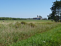
Goodrich is a town in Taylor County, Wisconsin, United States. The population was 510 at the 2010 census.

<span class="mw-page-title-main">Greenwood, Taylor County, Wisconsin</span> Town in Wisconsin, United States

Greenwood is a town in Taylor County, Wisconsin, United States. The population was 642 at the 2000 census. The unincorporated community of Interwald is located in the town.

<span class="mw-page-title-main">Grover, Taylor County, Wisconsin</span> Town in Wisconsin, United States

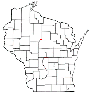
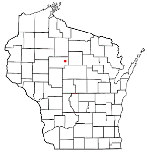
Grover is a town in Taylor County, Wisconsin, in the United States. As of the 2010 census, the town population was 256. The unincorporated community of Perkinstown is located in the town.

<span class="mw-page-title-main">Hammel, Wisconsin</span> Town in Wisconsin, United States

Hammel is a town in Taylor County, Wisconsin, United States. The population was 735 at the 2000 census. The unincorporated community of Murat is located in the town.

<span class="mw-page-title-main">Holway, Wisconsin</span> Town in Wisconsin, United States

Holway is a town in Taylor County, Wisconsin, United States. The population was 854 at the 2000 census.

<span class="mw-page-title-main">Jump River (town), Wisconsin</span> Town in Wisconsin, United States

Jump River is a town in Taylor County, Wisconsin, United States. The population was 311 at the 2000 census. The town takes its name from the Jump River which flows through its northwest corner. There is also a census-designated place called Jump River located partially in the town.

<span class="mw-page-title-main">Little Black, Wisconsin</span> Town in Wisconsin, United States

Little Black is a town located in Taylor County, Wisconsin. The village of Stetsonville lies partly in the town, and the hamlet of Little Black. As of the 2000 census, the town had a total population of 1,148.

<span class="mw-page-title-main">Maplehurst, Wisconsin</span> Town in Wisconsin, United States

Maplehurst is a town in Taylor County, Wisconsin, United States. The population was 359 at the 2000 census.

<span class="mw-page-title-main">McKinley, Taylor County, Wisconsin</span> Town in Wisconsin, US

McKinley is a town in Taylor County, Wisconsin, United States. The population was 418 at the 2000 census. The census-designated place of Jump River is located partially in the town.

<span class="mw-page-title-main">Molitor, Wisconsin</span> Town in Wisconsin, United States

Molitor is a town in Taylor County, Wisconsin, United States. The population was 324 at the 2010 census.

<span class="mw-page-title-main">Pershing, Wisconsin</span> Town in Wisconsin, United States

Pershing is a town in Taylor County, Wisconsin, United States. The population was 180 at the 2000 census. The unincorporated community of Donald is located in the town.

<span class="mw-page-title-main">Roosevelt, Taylor County, Wisconsin</span> Town in Wisconsin, United States

Roosevelt is a town in Taylor County, Wisconsin, United States. The population was 444 at the 2000 census. The village of Lublin lies within the town of Roosevelt. The unincorporated community of Bellinger is also located partially in the town.

<span class="mw-page-title-main">Taft, Wisconsin</span> Town in Wisconsin, United States

Taft is a town in the southwest corner of Taylor County, Wisconsin, United States. The population was 361 at the 2000 census. The unincorporated community of Bellinger is located partially in the town.

<span class="mw-page-title-main">Westboro, Wisconsin</span> Town in the United States

Westboro is a town in Taylor County, Wisconsin, United States. The population was 660 at the 2000 census. The census-designated place of Westboro is located in the town. The unincorporated community of Queenstown is also located in the town.

<span class="mw-page-title-main">Medford (town), Wisconsin</span> Town in Wisconsin, United States

Medford is a town in Taylor County, Wisconsin, United States. The population was 2,216 at the 2000 census. The City of Medford lies mostly within the town boundaries.

<span class="mw-page-title-main">Rib Lake (town), Wisconsin</span> Town in Wisconsin, United States

Rib Lake is a town in Taylor County, Wisconsin, United States. The population was 768 at the 2000 census. The village of Rib Lake is completely surrounded by the town.

<span class="mw-page-title-main">Perkinstown, Wisconsin</span> Unincorporated community in Wisconsin, United States

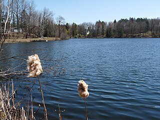
Perkinstown is an unincorporated community located in the town of Grover, Taylor County, Wisconsin, United States. The hamlet is scattered around Lake Kathryn, surrounded by Chequamegon National Forest, 10 miles (16 km) east-northeast of Gilman, reached by County Highway M and several gravel roads.

References

  1. 1 2 "US Board on Geographic Names". United States Geological Survey. October 25, 2007. Retrieved January 31, 2008.
  2. 1 2 "U.S. Census website". United States Census Bureau . Retrieved January 31, 2008.
  3. "Land Survey Information". Board of Commissioners of Public Lands. Retrieved April 2, 2011.
  4. "Field Notes for T31N R4W". Original Field Notes and Plat Maps, 1833-1866. Board of Commissioners of Public Lands. Retrieved April 2, 2011.
  5. White, D. M. "Interior Field Notes (Dec. 1854)". Board of Commissioners of Public Lands. Retrieved April 2, 2011.
  6. Dahl, Ole Rasmussen (1880). Map of Chippewa, Price & Taylor Counties and the northern part of Clark County. Milwaukee, Wisconsin: The Milwaukee Litho & Engr Co. Retrieved October 23, 2023.
  7. Rusch, Gordon (January 2012). "Taylor County Logging and Lumbering". In Kalmon, Lars (ed.). Our Home - Taylor County Wisconsin - Vol 1. Taylor County History Project. p. 1.
  8. Bogk, Frederick C. (1880). Map of Taylor County, Wisconsin. Milwaukee, Wis.: Bogk, Frederick C. Retrieved January 11, 2024.
  9. Queary, O.K. (1900). Map of Taylor County, Wisconsin. Milwaukee, Wis.: Bogk & Rowland. Retrieved October 23, 2023.
  10. Wisconsin Atlas and Gazetteer (6 ed.). Yarmouth, Maine: DeLorme. 1999. p. 74.
  11. Rusch, Robert P. (September 22, 2013). "The Twelve Railroads of Taylor County, Wisconsin". In Kalmon, Lars (ed.). Our Home - Taylor County Wisconsin - volume 2. Taylor County History Project. pp. 15, 30–31.
  12. Paetzold, C.H. (1911). "Plat map of T31N R4W". Map of Taylor County. Medford, Wis.: C. Paetzold and Koehler Land Company. Retrieved October 24, 2023.