Bakersfield, Vermont

Last updated

Bakersfield, Vermont
StGeorgeBakersfield.jpg
Bakersfield Historical Society (formerly St. George's Catholic Church)
Franklin County Vermont incorporated and unincorporated areas Bakersfield highlighted.svg
Location in Franklin County and the state of Vermont.
Coordinates: 44°47′18″N72°47′52″W / 44.78833°N 72.79778°W / 44.78833; -72.79778
Country United States
State Vermont
County Franklin
Area
  Total44.6 sq mi (115.6 km2)
  Land44.5 sq mi (115.3 km2)
  Water0.1 sq mi (0.3 km2)
Elevation
725 ft (221 m)
Population
 (2020)
  Total1,273
  Density28/sq mi (11.0/km2)
Time zone UTC-5 (Eastern (EST))
  Summer (DST) UTC-4 (EDT)
ZIP code
05441
Area code 802
FIPS code 50-02500 [1]
GNIS feature ID1462031 [2]
Website townofbakersfield.org

Bakersfield is a town in Franklin County, Vermont, United States. The population was 1,273 at the 2020 census. [3]

Contents

Geography

Bakersfield is located in southeastern Franklin County, bordered by Lamoille County to the southeast. Vermont Route 108 passes through the center of town, leading north to Enosburg Falls and south to Jeffersonville. The unincorporated village of Bakersfield is in the center of the town. Vermont Route 36 leads west from VT 108 in the village center to St. Albans, the Franklin County seat.

According to the United States Census Bureau, Bakersfield has a total area of 44.6 square miles (115.6 km2), of which 44.5 square miles (115.3 km2) is land and 0.1 square miles (0.3 km2), or 0.24%, is water. [4] The town is part of the Missisquoi River watershed, draining to Lake Champlain. The Cold Hollow Mountains occupy the eastern end of the town, with a high point of 3,261 feet (994 m) just north of the Lamoille County line.

History

Early years

The town history began when Joseph Baker of Westborough, Massachusetts, the namesake for the village, bought 10,000 acres in 1791. Initial settlers were his son-in-law, Stephen Maynard, and his nephew Jonas Brigham, along with their families. Baker built grist and saw mills on Baker's Pond in 1794. Two years later Maynard built a tavern. In 1797, a school was established in a log cabin at the Post Road and Vermont 108. Five acres were deeded for the development of a town common and burying ground in 1804 by Joseph Baker. Maynard built a Federal style house north of the village to serve as the first post office in 1811. [5]

There were 12 school geographically-accessible districts in Bakersfield in 1839, due to the growth in the area. The town had grown to 1,258 residents in 1840. [5]

Hostage Crisis

In 1988 a group of unnamed individuals from a group called the VMSG (Vermont Maple Syrup Guild) kidnapped 3 Canadian maple syrup inspectors and held them hostage. The crisis lasted 1 month, 2 weeks, and 3 days. The suspected motive of the group was they wanted to end the Canadian monopoly on the maple syrup market. [6]

Academies

The settlement has been called an "old academy town" for the schools for college-bound students. Public speaking was encouraged for boys. The Bakersfield Academic Association was established in 1839, which built a three-story building to house a Methodist Church and the South Academy. [5] It was the first building for Bakersfield Academy, which opened in 1840. [7] Jacob Spaulding was hired as headmaster and Mary, his wife, was a drawing instructor and preceptress. In 1851, there were 271 students from New England, other parts of the United States, and Quebec. They had a staff of 14 people. The academy suffered a loss of reputation when Spaulding left the school in 1852 to become a principal for Barre and its well-endowed academy. [5]

In 1844 by Methodists wanted an academy on the north end of town. Unofficially called North Academy, the principal was Rev. H.J. Moore from northern New York. [5] The academies closed after a loss of students due to westward expansion, the creation of central public high schools, and the American Civil War. [5] In 1870, there were 70 students at Bakersfield Academy. [8] Bakersfield Academy is no longer in existence. [7]

Brigham Academy BrighamAcademy.JPG
Brigham Academy

Brigham Academy was built in 1879, with funding provided by Peter Bent Brigham, who left a $30,000 endowment for education, and his sister Sarah Brigham Jacobs who provided land and a $100,000 endowment for the academy. It was staffed by Jacob Spaulding, Rev. Dr. Wright from Bakersfield and of Oberlin College, and President Buckham of the University of Vermont. In 1900, an addition provided additional classroom, laboratories, and a gymnasium. Notable people who attended the academy include Warren Austin, the first U.S. ambassador to the United Nations and a U.S. senator and members of the Austin family of Highgate. In 1967, it closed as a high school. It continued to offer elementary and middle school education until 1987. [5]

Demographics

Historical population
CensusPop.Note
1790 13
1800 2221,607.7%
1810 812265.8%
1820 94516.4%
1830 1,08715.0%
1840 1,25815.7%
1850 1,52321.1%
1860 1,451−4.7%
1870 1,403−3.3%
1880 1,248−11.0%
1890 1,162−6.9%
1900 1,158−0.3%
1910 1,079−6.8%
1920 980−9.2%
1930 889−9.3%
1940 827−7.0%
1950 779−5.8%
1960 664−14.8%
1970 635−4.4%
1980 85234.2%
1990 97714.7%
2000 1,21524.4%
2010 1,3228.8%
2020 1,273−3.7%
U.S. Decennial Census [9]

As of the census [1] of 2000, there were 1,215 people, 439 households, and 326 families residing in the town. The population density was 27.2 people per square mile (10.5/km2). There were 504 housing units at an average density of 11.3 per square mile (4.4/km2). The racial makeup of the town was 97.86% White, 0.25% African American, 0.16% Native American, 0.08% Asian, and 1.65% from two or more races.

There were 439 households, out of which 40.8% had children under the age of 18 living with them, 60.8% were married couples living together, 9.3% had a female householder with no husband present, and 25.7% were non-families. 18.5% of all households were made up of individuals, and 7.1% had someone living alone who was 65 years of age or older. The average household size was 2.77 and the average family size was 3.17.

In the town, the population was spread out, with 30.7% under the age of 18, 7.2% from 18 to 24, 28.9% from 25 to 44, 24.5% from 45 to 64, and 8.7% who were 65 years of age or older. The median age was 35 years. For every 100 females, there were 99.2 males. For every 100 females age 18 and over, there were 97.2 males.

The median income for a household in the town was $40,417, and the median income for a family was $41,688. Males had a median income of $31,563 versus $22,734 for females. The per capita income for the town was $15,678. About 6.1% of families and 9.4% of the population were below the poverty line, including 10.3% of those under age 18 and 12.6% of those age 65 or over.

Notable people

Related Research Articles

<span class="mw-page-title-main">Lamoille County, Vermont</span> County in Vermont, United States

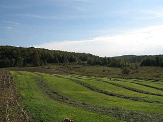
Lamoille County is a county located in the U.S. state of Vermont. As of the 2020 census, the population was 25,945, and it is the third-least populous county in Vermont. Its shire town is the town of Hyde Park, while Morristown is the county's largest town by population as well as its main commercial center. The county was created in 1835 from portions of Orleans, Franklin, Washington, and Chittenden Counties and organized the following year.

<span class="mw-page-title-main">Franklin County, Vermont</span> County in Vermont, United States

Franklin County is a county located in the U.S. state of Vermont. As of the 2020 census, the population was 49,946. Its county seat is the city of St. Albans. It borders the Canadian province of Quebec. The county was created in 1792 and organized in 1796. Franklin County is part of the Burlington metropolitan area.

<span class="mw-page-title-main">Chittenden County, Vermont</span> County in Vermont, United States

Chittenden County is the most populous county in the U.S. state of Vermont. As of the 2020 census, its population was 168,323. The county seat is Vermont's most populous municipality, the city of Burlington. The county has over a quarter of Vermont's population and more than twice the population of Vermont's second-most populous county, Rutland. The county also has more than twice the population density of Vermont's second-most dense county, Washington. The county is named for Vermont's first governor and one of the framers of its constitution as an independent republic and later U.S. state, Thomas Chittenden.

<span class="mw-page-title-main">Westford, Vermont</span> Town in Vermont, United States

Westford is a town in Chittenden County, Vermont, United States. The population was 2,062 at the 2020 census.

<span class="mw-page-title-main">Fairfax, Vermont</span> Town in Vermont, United States

Fairfax is a town in Franklin County, Vermont, United States. The population was 5,014 at the 2020 census.

<span class="mw-page-title-main">Fairfield, Vermont</span> Town in Vermont, United States

Fairfield is a town in Franklin County, Vermont, United States, chartered in 1763. The population was 2,044 at the 2020 census. President Chester A. Arthur was born in Fairfield in 1829, and lived there for the first three years of his life. A replica of his home, the Chester Alan Arthur State Historic Site, is open seasonally.

<span class="mw-page-title-main">Fletcher, Vermont</span> Town in Vermont, United States

Fletcher is a town in Franklin County, Vermont, United States. The population was 1,346 at the 2020 census.

<span class="mw-page-title-main">Georgia, Vermont</span> Town in Vermont, United States

Georgia is a town in Franklin County, Vermont, United States. The population was 4,845 at the 2020 census.

<span class="mw-page-title-main">Montgomery, Vermont</span> Town in Vermont, United States

Montgomery is a town in Franklin County, Vermont, United States. The population as of the 2020 census was 1,184. In 1963, part of Avery's Gore in Franklin County became part of Montgomery, with the other section becoming part of Belvidere in Lamoille County.

<span class="mw-page-title-main">Richford, Vermont</span> Town in Vermont, United States

Richford is a town in Franklin County, Vermont, United States, located along the Canada–United States border. The population was 2,346 at the 2020 census.

<span class="mw-page-title-main">Belvidere, Vermont</span> Town in Vermont, United States

Belvidere is a town in Lamoille County, Vermont, United States. The population was 358 at the 2020 census. Belvidere contains the hamlets of Belvidere Center, Belvidere Corners and Belvidere Junction. In 1963, part of Averys Gore in Franklin County became part of Belvidere, while the other part became part of Montgomery.

<span class="mw-page-title-main">Eden, Vermont</span> Town in Vermont, United States

Eden is a town in Lamoille County, Vermont, United States. The population was 1,338 at the 2020 census.

<span class="mw-page-title-main">Morristown, Vermont</span> Town in Vermont, United States

Morristown is a town in Lamoille County, Vermont, United States. As of the 2020 census, the population was 5,434. Morristown is the largest town by population in Lamoille County, and its central village of Morrisville serves as the county's main commercial center.

<span class="mw-page-title-main">Morrisville, Vermont</span> Village in Vermont, United States

Morrisville is a village in the town of Morristown, Lamoille County, Vermont, United States. As of the 2020 census, the village population was 2,086. Morrisville has two country clubs, a hospital, a school featuring Greek architecture and an airport. Morrisville is the headquarters for Union Bank.

<span class="mw-page-title-main">Waterville, Vermont</span> Town in Vermont, United States

Waterville is a town in Lamoille County, Vermont, United States. The population was 686 at the 2020 census.

<span class="mw-page-title-main">Wolcott, Vermont</span> Town in Vermont, United States

Wolcott is a town in Lamoille County, Vermont, United States. The town was named for General Oliver Wolcott, a signer of the Declaration of Independence. The population was 1,670 at the 2020 census.

<span class="mw-page-title-main">Cambridge, Vermont</span> Town in Vermont, United States

Cambridge is a town in Lamoille County, Vermont, United States. The population was 3,839 at the 2020 United States Census. Cambridge includes the villages of Jeffersonville and Cambridge.

<span class="mw-page-title-main">Hyde Park (town), Vermont</span> Town in Vermont, United States

Hyde Park is a town in and the shire town of Lamoille County, Vermont, United States. The town was named for Captain Jedediah Hyde, an early landowner who was a veteran of the American Revolutionary War. The population was 3,020 at the 2020 census. There is also a village of the same name within the town.

<span class="mw-page-title-main">Johnson, Vermont</span> Town in Vermont, United States

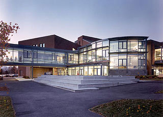
Johnson is a town in Lamoille County, Vermont, United States. The population was 3,491 at the 2020 census. The town is home to Northern Vermont University-Johnson, a part the Vermont State Colleges system. The Vermont Studio Center is located in the village of Johnson.

<span class="mw-page-title-main">St. Johnsbury, Vermont</span> Town in Vermont, United States

St. Johnsbury is the shire town of Caledonia County, Vermont, United States. As of the 2020 census, the population was 7,364. St. Johnsbury is situated on the Passumpsic River and is located approximately six miles northwest of the Connecticut River and 48 miles (77 km) south of the Canada–U.S. border.

References

  1. 1 2 "U.S. Census website". United States Census Bureau . Retrieved January 31, 2008.
  2. "US Board on Geographic Names". United States Geological Survey. October 25, 2007. Retrieved January 31, 2008.
  3. "Census - Geography Profile: Bakersfield town, Franklin County, Vermont". United States Census Bureau . Retrieved December 28, 2021.
  4. "Geographic Identifiers: 2010 Demographic Profile Data (G001): Bakersfield town, Franklin County, Vermont". U.S. Census Bureau, American Factfinder. Retrieved September 7, 2016.[ dead link ]
  5. 1 2 3 4 5 6 7 Hunt, Nancy (May 8, 2014). "History Space visits Bakersfield". Burlington Free Press. Retrieved June 1, 2018.
  6. http://vsp.vermont.gov/specialteams/cnu
  7. 1 2 Federal Writers' Project (October 31, 2013). The WPA Guide to Vermont: The Green Mountain State. Trinity University Press. p. 199. ISBN   978-1-59534-243-0.
  8. Vermont School Report. 1870. p. 160.
  9. "U.S. Decennial Census". United States Census Bureau. Retrieved May 16, 2015.
  10. "Bakersfield: Funeral of the Hon. Calvin H. Blodgett to be Held To-Day". Burlington Free Press . Burlington, VT. August 5, 1919. p. 3 via Newspapers.com.
  11. Aldrich, Lewis Cass (1891). History of Franklin and Grand Isle Counties. Syracuse, NY: D. Mason & Co. p.  237.

Further reading