Bakkhali | |
|---|---|
Village | |
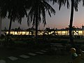
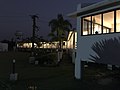
      From top: Bakkhali sea beach, Henry's Island beach, Wooden Bridge, Henry's island, Mangrove reserve forest, Resort in Bakkhali | |
 Bakkhali Location in West Bengal  Bakkhali Location in India | |
| Coordinates: 21°33′47″N88°15′34″E / 21.5631°N 88.2595°E | |
| Country | |
| State | |
| District | South 24 Parganas |
| CD Block | Namkhana |
| Elevation | 4 m (13 ft) |
| Languages | |
| • Official | Bengali [1] [2] |
| • Additional official | English [1] |
| Time zone | UTC+5:30 (IST) |
| PIN | 743339 |
| Telephone code | +91 3210 |
| Vehicle registration | WB-19 to WB-22, WB-95 to WB-99 |
| Lok Sabha constituency | Mathurapur (SC) |
| Vidhan Sabha constituency | Sagar |
| Website | www |
Bakkhali is a village within the jurisdiction of the Namkhana police station in the Namkhana CD block in the Kakdwip subdivision of the South 24 Parganas district in the Indian state of West Bengal.