
Sundarbans is a mangrove area in the delta formed by the confluence of the Ganges, Brahmaputra and Meghna Rivers in the Bay of Bengal. Sundarban Reserve Forest (SRF) of Bangladesh is the largest mangrove forest in the world. It spans the area from the Baleswar River in Bangladesh's division of Khulna to the Hooghly River in India's state of West Bengal. It comprises closed and open mangrove forests, land used for agricultural purpose, mudflats and barren land, and is intersected by multiple tidal streams and channels. Sundarbans is home to the world's largest area of mangrove forests. Four protected areas in the Sundarbans are enlisted as UNESCO World Heritage Sites, viz. Sundarbans West (Bangladesh), Sundarbans South (Bangladesh), Sundarbans East (Bangladesh) and Sundarbans National Park (India).

The Hungry Tide (2004) is the fourth novel by Indian-born author, Amitav Ghosh. Set in the Sundarbans, it follows an unlikely trio who travel up river together to find the rare Irrawaddy dolphin. It won the 2004 Hutch Crossword Book Award for Fiction.
South 24 Parganas (Pron: pɔrɡɔnɔs; abbr. 24 PGS (S)), or sometimes South Twenty Four Parganas and Dakshin 24 Parganas, is a district in the Indian state of West Bengal, headquartered in Alipore. It is the largest district of West Bengal by area and second largest by population. It is the sixth most populous district in India (out of 640). On one side of the district there is the urban fringe of Kolkata, and on the other the remote riverine villages in the Sundarbans.

The Geography of West Bengal, a state in eastern India, is primarily defined by plains and plateaus, with the high peaks of the Himalayas in the north and the Bay of Bengal to the south.
Sajnekhali Wildlife Sanctuary is a 362 km2 area in the northern part of the Sundarbans delta in South 24 Parganas district, West Bengal, India. It is located at the confluence of the Matla and Gumdi rivers. The area is mainly mangrove scrub, forest and swamp. It was set up as a sanctuary in 1976. It is home to a rich population of different species of wildlife, such as water fowl, heron, pelican, spotted deer, rhesus macaques, wild boar, tigers, water monitor lizards, fishing cats, otters, Olive ridley turtle, crocodiles, Batagur terrapins, and migratory birds. The ideal place for nature lovers to observe wild animals from a height is the Sajnekhali Watchtower.
The Haliday Island Wildlife Sanctuary is one of several wildlife sanctuaries in the nation of India. Located in the state of West Bengal, the area is approximately six square kilometers in size. It is a part of the 'Sundarbans Biosphere Reserve', with the Sundarbans region as a whole becoming a 'Biosphere Reserve' officially in 1989. The wildlife-heavy areas there are regarded as an environmentally-minded tourist destination.

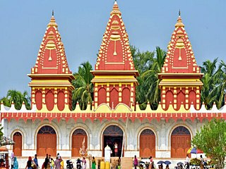
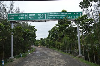
Gosaba is a village and a gram panchayat within the jurisdiction of the Gosaba police station in the Gosaba CD block in the Canning subdivision of the South 24 Parganas district in the Indian state of West Bengal.
Basanti is a census town and a gram panchayat within the jurisdiction of the Basanti police station in the Basanti CD block in the Canning subdivision of the South 24 Parganas district in the Indian state of West Bengal.
Kultali is a village within the jurisdiction of the Kultali police station in the Kultali CD block in the Baruipur subdivision of the South 24 Parganas district in the Indian state of West Bengal.
Canning subdivision is an administrative subdivision of the South 24 Parganas district in the Indian state of West Bengal.

Matla River forms a wide estuary in and around the Sundarbans in South 24 Parganas district in the Indian state of West Bengal.
Thakuran River is a tidal estuarine river that forms a wide estuary in and around the Sundarbans in South 24 Parganas district in the Indian state of West Bengal.

Piyali River is a tidal estuarine river in and around the Sundarbans in South 24 Parganas district in the Indian state of West Bengal.
Sandeshkhali-II is a community development block that forms an administrative division in Basirhat subdivision of North 24 Parganas district in the Indian state of West Bengal.
Gosaba is a community development block that forms an administrative division in Canning subdivision of South 24 Parganas district in the Indian State of West Bengal.
State Highway 3 is a state highway in West Bengal, India.
Chhota Molla Khali is a village and a gram panchayat within the jurisdiction of the Gosaba police station in the Gosaba CD block in the Canning subdivision of the South 24 Parganas district in the Indian state of West Bengal.

The Sundarbans settlements refer to the areas of the Sundarbans that were cleared of forests for human habitation in the present North 24 Paganas and the South 24 Parganas districts in the Indian state of West Bengal.
Pathankhali is a village and a gram panchayat within the jurisdiction of the Gosaba police station in the Gosaba CD block in the Canning subdivision of the South 24 Parganas district in the Indian state of West Bengal.

Sundarbans is a proposed district in presidency division, West Bengal. The district will be formed by dividing the South 24 Parganas district.