Hinglo River

Last updated

Hinglo River
Hinglo river.jpg
Location
Country India
State Jharkhand, West Bengal
Physical characteristics
Source 
  locationHill near Jamtara, Santhal Parganas
  coordinates 23°54′N87°6′E / 23.900°N 87.100°E / 23.900; 87.100
Basin size2,009 km2 (776 sq mi)
Discharge 
  location Ajay River

The Hinglo River (also spelt Hinglow) is a tributary of the Ajay River in the Indian states of Jharkhand and West Bengal.

Contents

Course

Hinglo River Hinglo River.jpg
Hinglo River

The Hinglo has its source in Santhal Parganas, runs parallel to the Ajay for some distance and flows into it a little after Bhimgarh, actually near Palashdanga village, Birbhum district. It has a watershed area of 2,009 hectares (4,960 acres). [1]

Irrigation and floods

A dam across the Hinglo provides irrigation in the areas between the Ajay and the Kopai but environmentalists also blame the dam for floods. [2]

Hinglo dam has a capacity of 17,102,000 cubic metres (13,865  acre⋅ft ). [3] However, as a result of improper management of water resources for canal irrigation, the bed of the river has risen and the canals have become derelict. Moreover, the dam is silted up. During the last phase of the monsoon season when excessive rainfall occurs the dam cannot take in all the water and so much of it is released. This surplus water becomes voluminous and overflows the bank of the river and canals. The side embankments are not constructed perfectly everywhere, and the weak points are breached to cause flood. Flood waters can not always find passage to be drained out quickly causing water logging. [4]

See also

Related Research Articles

<span class="mw-page-title-main">Subarnarekha River</span> River in northeastern India

The Subarnarekha River flows through the Indian states of Jharkhand, West Bengal and Odisha.

<span class="mw-page-title-main">Mayurakshi River</span> Major river in Jharkhand and West Bengal, India

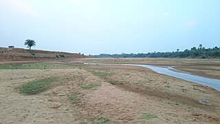
Mayurakshi River is a major river in Jharkhand and West Bengal, India, with a long history of devastating floods.

Mohammad Bazar is a community development block that forms an administrative division in Suri Sadar subdivision of Birbhum district in the Indian state of West Bengal.

<span class="mw-page-title-main">Rampurhat II</span> Community development block in West Bengal, India

Rampurhat II is a community development block that forms an administrative division in Rampurhat subdivision of Birbhum district in the Indian state of West Bengal.

Khayrasol is a community development block that forms an administrative division in Suri Sadar subdivision of Birbhum district in the Indian state of West Bengal.

<span class="mw-page-title-main">Bansloi River</span> River in West Bengal, India

The Bansloi River is a tributary of the Bhagirathi.

<span class="mw-page-title-main">Dwarka River</span> River in West Bengal, India

The Dwarka River is a tributary of Bhagirathi.

<span class="mw-page-title-main">Brahmani River (Birbhum)</span> River in West Bengal, India

The Brahmani River is a tributary of the Dwarka River.

Suri I is a community development block that forms an administrative division in Suri Sadar subdivision of Birbhum district in the Indian state of West Bengal.

Suri II is a community development block that forms an administrative division in Suri Sadar subdivision of Birbhum district in the Indian state of West Bengal.

Sainthia is a community development block that forms an administrative division in Suri Sadar subdivision of Birbhum district in the Indian state of West Bengal.

Dubrajpur is a community development block that forms an administrative division in Suri Sadar subdivision of Birbhum district in the Indian state of West Bengal.

<span class="mw-page-title-main">Rajnagar (community development block)</span> Community development block in West Bengal, India

Rajnagar is a community development block that forms an administrative division in Suri Sadar subdivision of Birbhum district in the Indian state of West Bengal.

<span class="mw-page-title-main">Bolpur Sriniketan</span> Community development block in West Bengal, India

Bolpur Sriniketan is a community development block that forms an administrative division in Bolpur subdivision of Birbhum district in the Indian state of West Bengal.

<span class="mw-page-title-main">Labpur (community development block)</span> Community development block in West Bengal, India

Labpur is a community development block that forms an administrative division in Bolpur subdivision district of Birbhum district in the Indian state of West Bengal.

<span class="mw-page-title-main">Nanoor (community development block)</span> Community Development Block in West Bengal, India

Nanoor is a community development block that forms an administrative division in Bolpur subdivision of Birbhum district in the Indian state of West Bengal.

Rampurhat I is a community development block that forms an administrative division in Rampurhat subdivision of Birbhum district in the Indian state of West Bengal.

Murarai II is a community development block that forms an administrative division in Rampurhat subdivision of Birbhum district in the Indian state of West Bengal.

Nalhati I is a community development block that forms an administrative division in Rampurhat subdivision of Birbhum district in the Indian state of West Bengal.

Nalhati II is a community development block that forms an administrative division in Rampurhat subdivision of Birbhum district in the Indian state of West Bengal.

References

  1. "Department of Agriculture, Soil Conservation Section". Birbhum District. Retrieved 25 March 2009.
  2. "Dams, officials to blame more for Bengal floods than rains" . Retrieved 25 March 2009.
  3. "Poverty and Vulnerability" (PDF). Vulnerability due to flood. Human Development Report: Birbhum. Archived from the original (PDF) on 7 August 2010. Retrieved 15 June 2010.
  4. Singh, Onkar (1993). frontiers in environmental geography. ISBN   9788170224624 . Retrieved 15 June 2010.

Coordinates: 23°43′53″N87°20′24″E / 23.731298°N 87.339935°E / 23.731298; 87.339935