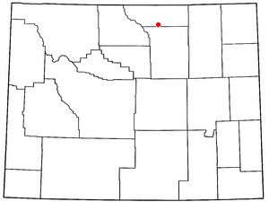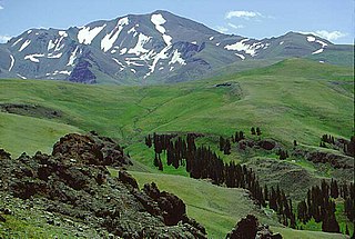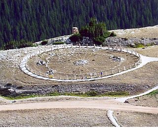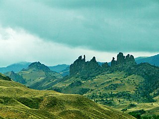
Story is a census-designated place (CDP) in Sheridan County, Wyoming, United States. As of the 2010 census, the CDP population was 828.

Sequoia National Park is an American national park in the southern Sierra Nevada east of Visalia, California. The park was established on September 25, 1890, to protect 404,064 acres of forested mountainous terrain. Encompassing a vertical relief of nearly 13,000 feet (4,000 m), the park contains the highest point in the contiguous United States, Mount Whitney, at 14,505 feet (4,421 m) above sea level. The park is south of, and contiguous with, Kings Canyon National Park; both parks are administered by the National Park Service together as the Sequoia and Kings Canyon National Parks. UNESCO designated the areas as Sequoia-Kings Canyon Biosphere Reserve in 1976.

The Little Bighorn River is a 138-mile-long (222 km) tributary of the Bighorn River in the United States in the states of Montana and Wyoming. The Battle of the Little Bighorn, also known as the Battle of the Greasy Grass, was fought on its banks on June 25–26, 1876, as well as the Battle of Crow Agency in 1887.

The Bighorn Mountains are a mountain range in northern Wyoming and southern Montana in the United States, forming a northwest-trending spur from the Rocky Mountains extending approximately 200 mi (320 km) northward on the Great Plains. They are separated from the Absaroka Range, which lie on the main branch of the Rockies to the west, by the Bighorn Basin. Much of the land is contained within the Bighorn National Forest.

Powder River is a tributary of the Yellowstone River, approximately 375 miles (604 km) long in northeastern Wyoming and southeastern Montana in the United States. It drains an area historically known as the Powder River Country on the high plains east of the Bighorn Mountains.

The Bighorn Basin is a plateau region and intermontane basin, approximately 100 miles (160 km) wide, in north-central Wyoming in the United States. It is bounded by the Absaroka Range on the west, the Pryor Mountains on the north, the Bighorn Mountains on the east, and the Owl Creek Mountains and Bridger Mountains on the south. It is drained to the north by tributaries of the Bighorn River, which enters the basin from the south, through a gap between the Owl Creek and Bridger Mountains, as the Wind River, and becomes the Bighorn as it enters the basin. The region is semi-arid, receiving only 6–10 in (15–25 cm) of rain annually.

Boise National Forest is a National Forest covering 2,203,703 acres (8,918.07 km2) of the U.S. state of Idaho. Created on July 1, 1908, from part of Sawtooth National Forest, it is managed by the U.S. Forest Service as five units: the Cascade, Emmett, Idaho City, Lowman, and Mountain Home ranger districts.

Shoshone National Forest is the first federally protected National Forest in the United States and covers nearly 2,500,000 acres (1,000,000 ha) in the state of Wyoming. Originally a part of the Yellowstone Timberland Reserve, the forest is managed by the United States Forest Service and was created by an act of Congress and signed into law by U.S. President Benjamin Harrison in 1891. Shoshone National Forest is one of the first nationally protected land areas anywhere. Native Americans have lived in the region for at least 10,000 years, and when the region was first explored by European adventurers, forestlands were occupied by several different tribes. Never heavily settled or exploited, the forest has retained most of its wildness. Shoshone National Forest is a part of the Greater Yellowstone Ecosystem, a nearly unbroken expanse of federally protected lands encompassing an estimated 20,000,000 acres (8,100,000 ha).

The Bighorn National Forest is a U.S. National Forest located in northern Wyoming, United States and consists of over 1.1 million acres (4,500 km²). Created as a US Forest Reserve in 1897, it is one of the oldest government-protected forest lands in the U.S. The forest is well east of the continental divide and extends from the Montana border for a distance of 80 miles (130 km) along the spine of the Bighorn Mountains, an outlying mountain range separated from the rest of the Rocky Mountains by Bighorn Basin. Elevations range from 5,000 feet along the sagebrush and grass-covered lowlands at the foot of the mountains, to 13,189 feet on top of Cloud Peak, the highest point in the Bighorn Mountains. Around 99% of the land is above 1,500 metres (4,900 ft). The forest is named after the Bighorn River, which is partially fed by streams found in the forest. Streams in the range are fed primarily by snowmelt and snowmelt mixed with driving rainfall.

Buffalo Bill State Park is a public recreation area surrounding the reservoir formed by the Buffalo Bill Dam, an impoundment of the Shoshone River, in Park County, Wyoming. The state park, reservoir and dam were named after William "Buffalo Bill" Cody, who founded the nearby town of Cody and who owned much of the land now occupied by the reservoir and park. The park offers camping, hiking, boating, fishing, and picnicking and is managed by Wyoming Division of State Parks and Historic Sites.

The Salmon River is a 33.5-mile (53.9 km) river in the Cascade Range in the U.S. state of Oregon that drains part of southwestern Mount Hood. The entire length of the river is a protected National Wild and Scenic River. Several portions are in protected wilderness. It is affluent to the Sandy River, a tributary of the Columbia River.

Blacks Fork is a 175-mile-long (282 km) tributary of the Green River in Utah and Wyoming in the United States.

Banner is an unincorporated community in southern Sheridan County, Wyoming, United States. It lies near Interstate 90, south of the city of Sheridan, the county seat of Sheridan County. Its elevation is 4,580 feet (1,400 m). Although Banner is unincorporated, it had a post office, with the ZIP code of 82832, which closed in 2004. Public education in the community of Banner is provided by Sheridan County School District #2.

The Pryor Mountains are a mountain range in Carbon and Big Horn counties of Montana, and Big Horn a county of Wyoming. They are located on the Crow Indian Reservation and the Custer National Forest, and portions of them are on private land. They lie south of Billings, Montana, and north of Lovell, Wyoming.

The Middle Fork American River is one of three forks that form the American River in Northern California. It drains a large watershed in the high Sierra Nevada west of Lake Tahoe and northeast of Sacramento in Placer and El Dorado Counties, between the watersheds of the North Fork American River and South Fork American River. The Middle Fork joins with the North Fork near Auburn and they continue downstream to Folsom Lake as the North Fork, even though the Middle Fork carries a larger volume of water.
Wyoming Highway 190 is a 9.66-mile-long (15.55 km) state highway in Johnson County, Wyoming.

Fort McKinney (1877–1894) was a military post located in North Eastern Wyoming, near the Powder River.

Big Trails is an unincorporated place in the eastern part of Washakie County in north-central Wyoming. Wyoming Highway 434 leads north 21 miles to Ten Sleep, and south over mountains to Lost Cabin, Lysite, and Moneta. Barnum and Mayoworth are the nearest places to the east across the Bighorn range.

Mayoworth is an unincorporated place in the southwestern part of Johnson County in north-central Wyoming, United States. It lies in the eastern valleys of the Bighorn Mountains. Mayoworth is at the western terminus of Wyoming Highway 191, approximately 12 miles west of the Kaycee exit off Interstate 25.

The Matilija Wilderness is a 29,207-acre (11,820 ha) wilderness area in Ventura and Santa Barbara Counties, Southern California. It is managed by the U.S. Forest Service, being situated within the Ojai Ranger District of the Los Padres National Forest. It is located adjacent to the Dick Smith Wilderness to the northwest and the Sespe Wilderness to the northeast, although it is much smaller than either one. The Matilija Wilderness was established in 1992 in part to protect California condor habitat.


