
Irwin is an unincorporated community in southwestern Union Township, Union County, Ohio, United States. It is located at 40°07′21″N83°29′22″W, at the intersection of Ohio State Route 4 and 161. Irwin has a post office which serves the surrounding area, including the community of Rosedale.

Grassy Butte is an unincorporated community in southeastern McKenzie County, North Dakota, United States. It lies along U.S. Route 85, south of the city of Watford City, the county seat of McKenzie County. Its elevation is 2,661 feet (811 m). It has a post office with the ZIP code 58634.

Falun is an unincorporated community in southwestern Saline County, Kansas, United States. As of the 2020 census, the population of the community and nearby areas was 83. It lies southwest of Salina and northwest of Lindsborg at the intersection of Forsse Road and Hedberg Road, about 7.5 miles west of Interstate 135 highway, or about 8 miles west of Assaria. It lies next to an abandoned railroad.
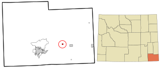
Kinnear is an unincorporated community in central Fremont County, Wyoming, United States. It lies along U.S. Route 26 near its intersection with Wyoming Highway 133, northwest of the city of Riverton and north of the city of Lander, the county seat of Fremont County. Its elevation is 5,400 feet (1,646 m). Kinnear has a post office, with the ZIP code of 82516.
Moran is an unincorporated village in south central Teton County, Wyoming, United States: as the community has had two different names, the Board on Geographic Names officially ruled in favor of "Moran" in 1970. It lies in Grand Teton National Park, 29 miles northeast of the city of Jackson, the county seat of Teton County, just northwest by side road of the intersection of U.S. Routes 26, 89, 191 and 287. Its elevation is 6,749 feet (2,057 m) and includes one of the principal entrance-fee collection stations for the Park. Moran also has the post office serving ZIP code of 83013, and a public elementary school; and no other services or businesses.
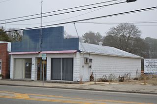
Hudgins is an unincorporated community in northern Mathews County, Virginia, United States. It lies north of the community of Mathews, the county seat of Mathews County. Its elevation is 10 feet (3 m). Although Hudgins is unincorporated, it has a post office, with the ZIP Code of 23076.
Langworthy is an unincorporated community in north-central Jones County, Iowa, United States. It lies along U.S. Route 151 north of the city of Anamosa, the county seat of Jones County. Its elevation is 860 feet (262 m).

Arminto is an unincorporated community in northwestern Natrona County, Wyoming, United States. It lies along local roads west of the city of Casper, the county seat of Natrona County. Its elevation is 6,053 feet (1,845 m).
Garrett is an unincorporated community in northern Albany County, Wyoming, United States, along the North Laramie River. It lies along local roads north of the city of Laramie, the county seat of Albany County. Its elevation is 6,785 ft (2,068 m), and it is located at 42°6′48″N105°36′36″W. Although Garrett is unincorporated, it once had a post office, with the ZIP code of 82058. The building remains, though is no longer in use. Garrett is also home to River Bridge School, a one-room schoolhouse that is part of Albany County School District #1. Aside from the schoolhouse, the land is privately owned.
Hiland is an unincorporated community in western Natrona County, Wyoming, United States. It lies along the concurrent U.S. Routes 20 and 26, west of the city of Casper, the county seat of Natrona County. Its elevation is 6,004 feet (1,830 m). Although the Hiland post office closed in 2014, it retains a ZIP code of 82638. Hiland is so named because it formed the highest elevation point within the Wyoming portion of the Chicago and Northwestern Railroad: it was originally named Woolton at its founding, with the spelling later changed to Wolton until 1914, when most of Wolton's population moved to Arminto, the new, nearby railhead, and the remaining citizens renamed the town Hiland. As of 2014, the town consisted only of a bar catering to bikers, and an adjacent house.
Hillsdale is an unincorporated community and census-designated place in southeastern Laramie County, Wyoming, United States. As of the 2010 census, it had a population of 47. It lies along local roads east of the city of Cheyenne, the county seat of Laramie County. Its elevation is 5,640 feet (1,720 m) above sea level. Although Hillsdale is unincorporated, it has a post office, with the ZIP code of 82060. Public education in the community of Hillsdale is provided by Laramie County School District #2.
Horse Creek is an unincorporated community in western Laramie County, Wyoming, United States. It lies between Horse Creek to the north, and the South Fork of Horse Creek to the south, along WYO 211 northwest of the city of Cheyenne, the county seat of Laramie County. Its elevation is 6,506 feet (1,983 m). Although Horse Creek is unincorporated, it has its own ZIP code of 82061. It had a post office until the early 2010s, when it closed due to an emergency operational issue. As of the 2010 census, Horse Creek had an estimated population of 39.
Jay Em is an unincorporated community in northern Goshen County, Wyoming, United States, just below the headwaters of the Rawhide Creek, on the old Texas Trail. It lies along U.S. Route 85, 35 miles north of the city of Torrington, the county seat of Goshen County. Its elevation is 4,590 feet (1,399 m). Although unincorporated, Jay Em has a post office, with ZIP code 82219.

Leiter is an unincorporated community in eastern Sheridan County, Wyoming, United States, along Clear Creek. It lies along the concurrent U.S. Routes 14 and 16, east of the city of Sheridan, the county seat of Sheridan County. Its elevation is 3,779 feet (1,152 m). Although Leiter is unincorporated, it has a post office, with the ZIP code of 82837. Public education in the community of Clearmont is provided by Sheridan County School District #3.
Linch is an unincorporated community in southeastern Johnson County, Wyoming, United States. It lies along WYO 192 southeast of the city of Buffalo, the county seat of Johnson County. Although Linch is unincorporated, it has a post office, with the ZIP code of 82640.
Lysite is an unincorporated community in northeastern Fremont County, Wyoming, United States. It lies along local roads northeast of the city of Lander, the county seat of Fremont County. Lysite has a post office. The Bridger Trail passed near Lysite on its way north to the gold fields of Montana in the 19th century.

Savery is an unincorporated community in southeastern Carbon County, Wyoming, United States, on the upper Little Snake River. It lies along WYO 70 south of the city of Rawlins, the county seat of Carbon County. Its elevation is 6,473 feet (1,973 m). Although Savery is unincorporated, it has a post office with ZIP code 82332, and is home to the Little Snake River Museum.
Weston is an unincorporated community in northern Campbell County, Wyoming, United States, along the upper Little Powder River on the southeastern edge of the Thunder Basin National Grassland. It lies along WYO 59 north of the city of Gillette, the county seat of Campbell County. Its elevation is 3,802 feet (1,159 m). Its post office has ZIP code of 82731.

Kendalia is an unincorporated community in northeastern Kendall County, Texas, United States. It is part of the Texas-German belt.

Animas is an unincorporated community and census-designated place (CDP) in west-central Hidalgo County, New Mexico, United States, in the southwestern corner of the state. As of the 2010 census it had a population of 237.


