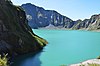
| Bataan National Park | |
|---|---|
 Bataan National Park near Mabayo, Morong | |
 Location in Luzon  Location in the Philippines | |
| Location | Bataan, Philippines |
| Nearest city | Balanga, Bataan, Philippines |
| Coordinates | 14°39′N120°36′E / 14.650°N 120.600°E |
| Area | 23,688 hectares (58,530 acres) |
| Established | December 1, 19455 |
| Governing body | Department of Environment and Natural Resources |
Bataan National Park is a protected area of the Philippines located in the mountainous interior of Bataan province in the Central Luzon Region. Activities in the park include nature viewing, bird watching, and trekking to its several peaks and waterfalls. [1]