Bay County, Michigan

Last updated

Bay County
Bay City Masonic Temple in 2014.jpg
Bay County mi seal.png
Map of Michigan highlighting Bay County.svg
Location within the U.S. state of Michigan
Michigan in United States.svg
Michigan's location within the U.S.
Coordinates: 43°43′N83°56′W / 43.72°N 83.94°W / 43.72; -83.94
CountryFlag of the United States.svg United States
StateFlag of Michigan.svg  Michigan
FoundedFebruary 17, 1857 [1] [2]
Named for Saginaw Bay
Seat Bay City
Largest cityBay City
Area
  Total631 sq mi (1,630 km2)
  Land442 sq mi (1,140 km2)
  Water188 sq mi (490 km2)  30%
Population
 (2020)
  Total103,856
  Density236/sq mi (91/km2)
Time zone UTC−5 (Eastern)
  Summer (DST) UTC−4 (EDT)
Congressional district 8th
Website www.baycounty-mi.gov

Bay County is located in the U.S. state of Michigan. As of the 2020 Census, the population was 103,856. [3] The county seat is Bay City. [4]

Contents

Bay County comprises the Bay City, MI Metropolitan Statistical Area and is included in the Saginaw-Midland-Bay City Combined Statistical Area in the Mid/Central Michigan region.

History

19th century

Bay County was created in 1857 from portions of Midland County, Saginaw County, and Arenac County. [1] Its name references that it "surrounds Saginaw Bay." [1] Being only sparsely populated at that time, Arenac County government was unorganized and was attached to Saginaw County for administrative purposes. There was considerable opposition to the creation of Bay County from elected officials in both Saginaw and Midland counties. In 1854, a bill introduced to the state legislature to create Bay County was defeated by a small majority.

In 1857, a new bill was introduced into the legislature. After initial opposition from the representatives of Saginaw and Midland counties, a compromise revision that would present the matter for ratification to the voters of "in said county" was passed by the legislature on February 17, 1857. The matter was put before all the voters of Saginaw and Midland counties and was soundly defeated. However, the population within the boundaries proposed for Bay County approved the measure. The bill passed by the legislature included phrasing, which was deliberately included by the Bay City lawyer Chester H. Freeman, that allowed Bay County to claim ratification. Under the act, the county was to become effective April 20, 1857.

Residents of Bay County held elections for county officials in June 1857. However, Saginaw County did not recognize the organization of the new county government. In the winter of 1858, Freeman secured passage of a bill in the legislature that would have confirmed the organization of Bay County. But the bill was vetoed by the governor. However, a case that went before the Michigan Supreme Court in its May 1858 term settled the matter. In the case, a defendant was tried in a Saginaw County court, but filed a plea for abatement, claiming that the supposed offense was committed in Bay County and was not in the jurisdiction of the Saginaw County court. Freeman had represented the defendant and prepared arguments, but became incapacitated due to illness. At the request of Freeman's wife, Colonel William M. Fenton argued the case before the Michigan Supreme Court, with the result that Bay County was declared a fully organized county. [5]

20th century

During World War II, shipyards in Bay County were used to produce US Destroyers and missile vessels. [6]

In 1978, Bay County became the second Michigan county (after Oakland County) to adopt a County Executive form of government. Act 139 of 1973 provides for an optional unified form of county government under an appointed County Manager or an elected County Executive. With the County Executive, all departments of the county government that are not headed by a separate elected official (e.g. Treasurer, Clerk, Sheriff, etc.) are under the direction of the County Executive. The County Executive also has veto power over the motions and resolutions passed by the County Commission.

Since the adoption of this form of government, Bay County has had four County Executives: Gary Majeske (R) (1979–1989), Kim Higgs (D) (1989–1993), Thomas Hickner (D) (1993–2016), and James Barcia (D).

Geography

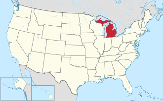
According to the U.S. Census Bureau, the county has a total area of 631 square miles (1,630 km2), of which 442 square miles (1,140 km2) is land and 188 square miles (490 km2) (30%) is water. [7] It is the fifth-smallest county in Michigan by land area.

The Saginaw River flows through Bay City while the Kawkawlin River drains much of the central portion of the county. The Pinconning River and Saganing Creek drain the northern portion. The Saginaw Bay of Lake Huron lies to the east, giving the county its name.

Major highways

Interstate 75 (I-75) and U.S. Highway 23 (US 23), which are concurrent within the county, are the major north–south route. North of Bay City, M-13 follows a parallel route a few miles to the east. US 10 has its eastern terminus in Bay City. M-25, M-15, and M-84 enter Bay City from the east, southeast and southwest respectively and terminate in or near the city. M-20 and Business US 10 end at US 10 as they enter the county.

Adjacent counties

Bay County in 1873; a decade later Arenac County was organized from the northern townships seen in this map. Bay County.jpg
Bay County in 1873; a decade later Arenac County was organized from the northern townships seen in this map.

Demographics

Historical population
CensusPop.Note
1860 3,164
1870 15,900402.5%
1880 38,081139.5%
1890 56,41248.1%
1900 62,37810.6%
1910 68,2389.4%
1920 69,5481.9%
1930 69,474−0.1%
1940 74,9817.9%
1950 88,46118.0%
1960 107,04221.0%
1970 117,3399.6%
1980 119,8812.2%
1990 111,723−6.8%
2000 110,157−1.4%
2010 107,771−2.2%
2020 103,856−3.6%
2023 (est.)102,500 [9] −1.3%
U.S. Decennial Census [10]
1790-1960 [11] 1900-1990 [12]
1990-2000 [13] 2010-2018 [3]

The 2010 United States Census [14] indicates Bay County had a 2010 population of 107,771. This is a decrease of -2,386 people from the 2000 United States Census. Overall, the county had a -2.2% growth rate during this ten-year period. In 2010 there were 44,603 households and 29,116 families in the county. The population density was 243.7 per square mile (94.1 square kilometers). There were 48,220 housing units at an average density of 109.0 per square mile (42.1 square kilometers). The racial and ethnic makeup of the county was 91.2% White, 1.5% Black or African American, 0.4% Native American, 0.5% Asian, 4.7% Hispanic or Latino, 0.1% from other races, and 1.6% from two or more races.

There were 44,603 households, out of which 28.5% had children under the age of 18 living with them, 48.6% were husband and wife families, 11.8% had a female householder with no husband present, 34.7% were non-families, and 29.3% were made up of individuals. The average household size was 2.38 and the average family size was 2.92.

In the county, the population was spread out, with 22.2% under age of 18, 8.5% from 18 to 24, 23.6% from 25 to 44, 29.5% from 45 to 64, and 16.2% who were 65 years of age or older. The median age was 42 years. For every 100 females there were 95.9 males. For every 100 females age 18 and over, there were 93 males.

The 2010 American Community Survey 1-year estimate [14] indicates the median income for a household in the county was $45,451 and the median income for a family was $52,784. Males had a median income of $31,035 versus $18,294 for females. The per capita income for the county was $22,378. About 11.2% of families and 16.2% of the population were below the poverty line, including 23.7% of those under the age 18 and 7.0% of those age 65 or over.

Religion

The Roman Catholic Diocese of Saginaw is the controlling regional body for the Catholic Church. [15]

Economy

According to Bay Future, Inc. [16] the top employers in the county are:

Top Employers in Bay County, Michigan
#Employer# of Employees
1 McLaren - Bay Region2,083
2The Dow Chemical Company 1,160
3 Delta College 957
4 Michigan Sugar 900

Government

From 1932 to 2012, Bay County voted for the Democratic Party candidate in every Presidential election except for five national Republican landslides: 1952, 1956, 1972, 1980 and 1984. However, the county has turned increasingly Republican in recent elections. The November 2022 election resulted in the first majority Republican Board of Commissioners ever sitting in Bay County since the adoption of the Optional Unified Form of County Government (Act 139). Despite this, Bay County had voted Democratic in all 3 statewide races in 2022, and Democrat James Barcia remains as County Executive.

United States presidential election results for Bay County, Michigan [17]
Year Republican Democratic Third party
No.%No.%No.%
2020 33,12554.90%26,15143.34%1,0571.75%
2016 28,32853.17%21,64240.62%3,3046.20%
2012 24,91146.49%27,87752.02%7981.49%
2008 23,79541.32%32,58956.59%1,2042.09%
2004 25,44844.60%31,04954.42%5620.98%
2000 22,15042.90%28,25154.71%1,2352.39%
1996 16,03832.33%27,83556.12%5,73011.55%
1992 16,38330.14%26,49248.74%11,48021.12%
1988 20,71042.13%28,22557.42%2170.44%
1984 26,19853.43%22,59746.09%2350.48%
1980 25,33146.40%24,51744.91%4,7448.69%
1976 23,17446.64%25,95852.24%5571.12%
1972 23,09450.08%21,71247.08%1,3122.84%
1968 18,77944.12%21,41050.30%2,3785.59%
1964 11,89628.52%29,75471.34%560.13%
1960 20,90947.51%22,99852.26%1040.24%
1956 23,51960.39%15,30139.29%1280.33%
1952 20,08758.40%14,11341.03%1960.57%
1948 13,32147.58%14,34951.25%3271.17%
1944 15,45949.54%15,60250.00%1430.46%
1940 14,61849.41%14,90250.37%670.23%
1936 8,72935.08%13,78955.41%2,3679.51%
1932 9,81639.12%14,70858.62%5682.26%
1928 12,46756.88%9,39542.87%550.25%
1924 14,86164.75%5,88125.62%2,2099.62%
1920 13,93364.93%7,01132.67%5162.40%
1916 6,70851.09%5,99645.67%4263.24%
1912 2,62523.43%2,99026.68%5,59049.89%
1908 6,76058.22%4,22336.37%6285.41%
1904 7,60968.25%3,14228.18%3973.56%
1900 6,46254.60%5,08142.93%2932.48%
1896 6,03748.09%6,29650.16%2201.75%
1892 4,58742.96%5,71453.51%3773.53%
1888 4,37843.73%5,38653.80%2482.48%
1884 2,91635.15%4,96359.83%4165.02%

Bay County government is set up under Public Act 139 of 1973. This format provides for an elected County Executive who, as chief administrator, has influence over all departments, except those headed by other elected officials. In that manner, the County Executive appoints and supervises all department heads. It is the duty of the County Executive to coordinate all county activities and unify the management of county affairs, enforce all orders, rules and ordinances passed by the Board of Commissioners and all laws enacted by the state. In addition, the County Executive must submit to the Board of Commissioners a recommended budget each year. The county government operates the jail, maintains rural roads, operates the major local courts, keeps files of deeds and mortgages, maintains vital records, administers public health regulations, and participates with the state in the provision of welfare and other social services. The county Board of Commissioners controls the budget but has only limited authority to make laws or ordinances. Bay County has a Board of Road Commissioners, which consists of three commissioners who are elected and serve six-year staggered terms (one road commissioner elected every two years). The Board is the policy-making body of the Bay County Road Commission and is responsible for establishing budget priorities and managing the annual budget. [18] In Michigan, most local government functions — police and fire, building and zoning, tax assessment, street maintenance, etc. — are the responsibility of individual cities and townships.

Elected officials

Board of Commissioners

7 members, elected from districts (three Democrats, four Republicans) [19]

DistrictCommissionerParty
1Kathy NiemiecRepublican
2Tim BanaszakRepublican
3Vaughn J. Begick, ChairmanRepublican
4Colleen MailletteDemocratic
5Thomas M. Herek,Democratic
6Kaysey Owczarzak RadtkeDemocratic
7Dennis R. PoirierRepublican

Communities

U.S. Census data map showing local municipal boundaries within Bay County. Shaded areas represent incorporated cities. Bay County, MI census map.png
U.S. Census data map showing local municipal boundaries within Bay County. Shaded areas represent incorporated cities.

Cities

Charter townships

Civil townships

Unincorporated communities

Former city

See also

Related Research Articles

<span class="mw-page-title-main">Tuscola County, Michigan</span> County in Michigan, United States

Tuscola County is a county in the Thumb region of the U.S. state of Michigan. As of the 2020 census, the population was 53,323. The county seat is Caro. The county was created by Michigan Law on April 1, 1840, from land in Sanilac County and attached to Saginaw County for administrative purposes. The Michigan Legislature passed an act on March 2, 1850, that empowered the county residents to organize governmental functions.

<span class="mw-page-title-main">Sanilac County, Michigan</span> County in Michigan, United States

Sanilac County is a county located in the Thumb region of the U.S. state of Michigan. As of the 2020 Census, the population was 40,611. The county seat is Sandusky. The county was created on September 10, 1822, and was fully organized on December 31, 1849. Sanilac County is considered to be part of the Thumb of Michigan, a subregion of the Flint/Tri-Cities. Sanilac County enjoys seasonal tourism in towns such as Lexington, Port Sanilac, and Carsonville. Sanilac County is economically attached to St. Clair County and Huron County and is largely composed of nearly flat areas of rich soil.

<span class="mw-page-title-main">Saginaw County, Michigan</span> County in Michigan, United States

Saginaw County, officially the County of Saginaw, is a county located in the U.S. state of Michigan. As of the 2020 Census, the population was 190,124. The county seat is Saginaw. The county was created by September 10, 1822, and was fully organized on February 9, 1835. The etymology of the county's name is uncertain. It may be derived from Sace-nong or Sak-e-nong, as the Sauk tribe is believed by some to have once lived there. A more likely possibility is that it comes from Ojibwe words meaning "place of the outlet" –sag and ong. See List of Michigan county name etymologies.

<span class="mw-page-title-main">Midland County, Michigan</span> County in Michigan, United States

Midland County is a county located in the U.S. state of Michigan. As of the 2020 census, the population was 83,494. The county seat is Midland. The county's name is due to its closeness to the geographical Lower Peninsula's geographical center. It was founded in 1831. However, it was not until 1855 that the county was effectively organized.

<span class="mw-page-title-main">Huron County, Michigan</span> County in Michigan, United States

Huron County is a county in the U.S. state of Michigan. As of the 2020 Census, the population was 31,407. The county seat is Bad Axe. Huron County is at the northern tip of the Thumb, which is a sub region of Mid Michigan. It is a peninsula, bordered by Saginaw Bay to the west and Lake Huron to the north and east, and has over 90 miles (140 km) of shoreline, from White Rock on Lake Huron to Sebewaing on the Saginaw Bay. Huron County's most prominent industry is agriculture, as with most of the other Thumb counties. Huron County enjoys seasonal tourism from large cities such as Detroit, Flint, and Saginaw. Much of the tourism is in the Port Austin and Caseville area.

<span class="mw-page-title-main">Gladwin County, Michigan</span> County in Michigan, United States

Gladwin County is a county located in the U.S. state of Michigan. As of the 2020 Census, the population was 25,386. The county seat is Gladwin.

<span class="mw-page-title-main">Arenac County, Michigan</span> County in Michigan, United States

Arenac County is a county located in the U.S. state of Michigan. As of the 2020 Census, the population was 15,002. The county seat is Standish.

<span class="mw-page-title-main">Standish Township, Michigan</span> Civil township in Michigan, United States

Standish Township is a civil township of Arenac County in the U.S. state of Michigan. The population was 1,701 at the 2020 census. The city of Standish borders the township on the northwest but is administered autonomously.

<span class="mw-page-title-main">Bangor Township, Bay County, Michigan</span> Charter township in Michigan, United States

Bangor Charter Township is a charter township in Bay County in the U.S. state of Michigan. The township's population was 14,045 as of the 2020 Census and is included in the Bay City Metropolitan Statistical Area.

<span class="mw-page-title-main">Bay City, Michigan</span> City in Michigan, United States

Bay City is a city in and the county seat of Bay County, Michigan, United States. The population was 32,661 at the 2020 census. The city is located just upriver from Saginaw Bay on the Saginaw River. It is the principal city of the Bay City metropolitan area, which is coterminous with Bay County as part of the larger Greater Tri-Cities region of Central Michigan. Several historic bridges cross the Saginaw River in Bay City, including Liberty Bridge, Veterans Memorial Bridge, Independence Bridge, and Lafayette Avenue Bridge.

<span class="mw-page-title-main">Fraser Township, Michigan</span> Civil township in Michigan, United States

Fraser Township is a civil township of Bay County in the U.S. state of Michigan. The township's population was 2,994 as of the 2020 census. It is included in the Bay City Metropolitan Statistical Area.

<span class="mw-page-title-main">Kawkawlin Township, Michigan</span> Civil township in Michigan, United States

Kawkawlin Township is a civil township of Bay County in the U.S. state of Michigan. The township's population was 4,419 as of the 2020 census. It is included in the Bay City Metropolitan Statistical Area.

<span class="mw-page-title-main">Monitor Township, Michigan</span> Charter township in Michigan, United States

Monitor Charter Township is a charter township of Bay County in the U.S. state of Michigan, organized in 1869. The township's population was 10,687 as of the 2020 census and is included in the Bay City Metropolitan Statistical Area.

<span class="mw-page-title-main">Pinconning, Michigan</span> City in Michigan, United States

Pinconning is a city in Bay County in the U.S. state of Michigan. The population was 1,204 at the 2020 census. It is included in the Saginaw, Midland, and Bay City metropolitan area. The city is locally noted for its former production of cheese and cheese products, especially Pinconning cheese.

<span class="mw-page-title-main">Pinconning Township, Michigan</span> Civil township in Michigan, United States

Pinconning Township is a civil township of Bay County in the U.S. state of Michigan. The township's population was 2,299 as of the 2020 census. It is included in the Bay City Metropolitan Statistical Area. Pinconning Township was organized on February 28, 1873. The city of Pinconning is surrounded by the township, but is administratively autonomous. The name "Pinconning" is said to come from the Native American word O-pin-nic-con-ing, meaning "potato place".

<span class="mw-page-title-main">Larkin Charter Township, Michigan</span> Charter township in Michigan, United States

Larkin Charter Township is a charter township of Midland County in the U.S. state of Michigan. The population was 5,331 at the 2020 census.

<span class="mw-page-title-main">Saginaw, Michigan</span> City in Michigan, United States

Saginaw is a city in and the seat of Saginaw County, Michigan, United States. The city proper had a population of 44,202 at the 2020 census. Located along the Saginaw River, Saginaw is adjacent to Saginaw Charter Township and considered part of Greater Tri-Cities region of Central Michigan. The Saginaw metropolitan area had a population of 190,124 in 2020. The city is also the largest municipality in the Greater Tri-Cities, with a combined population of 377,474 in the combined statistical area in 2020.

<span class="mw-page-title-main">Saginaw Charter Township, Michigan</span> Charter township in Michigan, United States

Saginaw Charter Township is a charter township of Saginaw County in the U.S. state of Michigan. The population was 41,679 at the 2020 census. The city of Saginaw is adjacent to the township to the southeast, but is administratively autonomous.

<span class="mw-page-title-main">Linwood, Michigan</span> Unincorporated community in Michigan, United States

Linwood is a small unincorporated community in the northern portion of Bay County in the U.S. state of Michigan. The community is on the boundary between Fraser Township on the north and Kawkawlin Township on the south. It is situated with M-13 to the west and the Saginaw Bay of Lake Huron on the east, between Kaiser Tower Road and Elevator Road where Linwood Road becomes Center Street. Bay City is about 12 miles to the south and Linwood is included in the Bay City Metropolitan Statistical Area.

<span class="mw-page-title-main">Mills Township, Midland County, Michigan</span> Civil township in Michigan, United States

Mills Township is a civil township of Midland County in the U.S. state of Michigan, United States. The population was 1,775 at the 2020 census, down from 1,939 in 2010.

References

  1. 1 2 3 "Bibliography on Bay County". Clarke Historical Library, Central Michigan University . Retrieved January 19, 2013.
  2. "History of Bay County". baycounty-mi.gov.
  3. 1 2 "State & County QuickFacts". United States Census Bureau. Retrieved September 15, 2021.
  4. "Find a County". National Association of Counties. Archived from the original on July 4, 2012. Retrieved June 7, 2011.
  5. Butterfield, George Ernest; George N. Fuller (2005) [192?]. "County Organization and Government". History of Bay County. Ann Arbor, Mich.: University of Michigan Library. pp. 42–53. Retrieved March 22, 2008.
  6. "Bay County Michigan MIGenWeb Site". www.mifamilyhistory.org. Retrieved January 31, 2023.
  7. "2010 Census Gazetteer Files". United States Census Bureau. August 22, 2012. Archived from the original on November 13, 2013. Retrieved September 19, 2014.
  8. Kusmierz, Marvin (October 2005). "Michigan Map History Relevant to Bay County, MI". Archived from the original on August 24, 2012. Retrieved August 26, 2012.
  9. "Annual Estimates of the Resident Population for Counties: April 1, 2020 to July 1, 2023". United States Census Bureau. Retrieved April 4, 2024.
  10. "U.S. Decennial Census". United States Census Bureau. Retrieved September 19, 2014.
  11. "Historical Census Browser". University of Virginia Library. Retrieved September 19, 2014.
  12. "Population of Counties by Decennial Census: 1900 to 1990". United States Census Bureau. Retrieved September 19, 2014.
  13. "Census 2000 PHC-T-4. Ranking Tables for Counties: 1990 and 2000" (PDF). United States Census Bureau. Archived (PDF) from the original on March 27, 2010. Retrieved September 19, 2014.
  14. 1 2 "U.S. Census website". United States Census Bureau . Retrieved March 11, 2012.
  15. "Diocese of Saginaw". saginaw.org.
  16. "Bay County by the Numbers". welcometobaycounty. Retrieved December 18, 2018.
  17. Leip, David. "Dave Leip's Atlas of U.S. Presidential Elections". uselectionatlas.org.
  18. "About the Bay County Board of Road Commissioners".
  19. "Summary Results Report - 2020 General Election" (PDF). Bay County, Michigan. November 4, 2020. Archived (PDF) from the original on May 23, 2021.

43°43′N83°56′W / 43.72°N 83.94°W / 43.72; -83.94