Bayard, New Mexico

Last updated

Bayard, New Mexico
Motto: 
"Hub of the Mining District"
Grant County New Mexico Incorporated and Unincorporated areas Bayard Highlighted.svg
Location of Bayard, New Mexico
USA New Mexico location map.svg
Red pog.svg
Bayard
Location in New Mexico
Usa edcp location map.svg
Red pog.svg
Bayard
Bayard (the United States)
North America laea location map.svg
Red pog.svg
Bayard
Bayard (North America)
Coordinates: 32°45′34″N108°07′58″W / 32.75944°N 108.13278°W / 32.75944; -108.13278
Country United States
State New Mexico
County Grant
Government
  Type Mayor–council government
  MayorRodolpho S. Martinez
Area
[1]
  Total0.95 sq mi (2.47 km2)
  Land0.95 sq mi (2.46 km2)
  Water0.00 sq mi (0.01 km2)
Elevation
[2]
5,807 ft (1,770 m)
Population
 (2020) [3]
  Total2,116
  Density2,225.03/sq mi (859.36/km2)
Time zone UTC-7 (Mountain (MST))
  Summer (DST) UTC-6 (MDT)
ZIP code
88023
Area code 575
FIPS code 35-06270
GNIS feature ID2409799 [2]
Website www.cityofbayardnm.com

Bayard is a city in Grant County, New Mexico, United States. It is near Santa Rita, east of Silver City. The population was 2,328 at the 2010 census, [4] down from 2,534 in 2000. This city was incorporated on August 20, 1938.

Contents

Geography

It is located in east-central Grant County. According to the United States Census Bureau, the town has a total area of 0.95 square miles (2.45 km2), all land. [4] The city is in the valley of Whitewater Creek, a seasonal south-flowing tributary of the Mimbres River.

U.S. Route 180 passes through Bayard as Tom Foy Boulevard and Central Avenue, leading northwest 2 miles (3 km) to Santa Clara and 9 miles (14 km) to Silver City, and south 42 miles (68 km) to Deming and Interstate 10. New Mexico State Road 356 leads northeast from Bayard 5 miles (8 km) up the Whitewater Creek valley to Hanover.

Bayard is located in the southern foothills of the Pinos Altos Range and Mogollon Mountains in the southwestern portion of New Mexico and situated east of the Continental Divide at an elevation of approximately 5,800 feet (1,800 m). Gila National Forest lies north from here. A semi-arid desert of predominantly grasses and yucca is in Bayard's southern portion.

Demographics

Historical population
CensusPop.Note
1940 764
1950 2,119177.4%
1960 2,3279.8%
1970 2,90825.0%
1980 3,0364.4%
1990 2,598−14.4%
2000 2,534−2.5%
2010 2,328−8.1%
2020 2,116−9.1%
U.S. Decennial Census [5] [3]

As of the census [6] of 2000, there were 2,534 people, 970 households, and 719 families residing in the town. The population density was 2,916.4 inhabitants per square mile (1,126.0/km2). There were 1,100 housing units at an average density of 1,266.0 per square mile (488.8/km2). The racial makeup of the town was 65.67% White, 0.32% African American, 1.66% Native American, 0.04% Asian, 29.04% from other races, and 3.28% from two or more races. Hispanic or Latino of any race were 84.33% of the population.

There were 970 households, out of which 34.3% had children under the age of 18 living with them, 51.1% were married couples living together, 18.5% had a female householder with no husband present, and 25.8% were non-families. 23.6% of all households were made up of individuals, and 13.4% had someone living alone who was 65 years of age or older. The average household size was 2.61 and the average family size was 3.07.

In the town the population was spread out, with 29.2% under the age of 18, 8.5% from 18 to 24, 22.1% from 25 to 44, 23.3% from 45 to 64, and 16.9% who were 65 years of age or older. The median age was 37 years. For every 100 females, there were 87.4 males. For every 100 females age 18 and over, there were 83.0 males.

The median income for a household in the town was $21,957, and the median income for a family was $27,632. Males had a median income of $30,200 versus $17,132 for females. The per capita income for the town was $11,066. About 19.7% of families and 24.1% of the population were below the poverty line, including 33.8% of those under age 18 and 14.3% of those age 65 or over.

See also

Related Research Articles

<span class="mw-page-title-main">Grant County, New Mexico</span> County in New Mexico, United States

Grant County is a county located in the U.S. state of New Mexico. At the 2020 census, the population was 28,185. Its county seat is Silver City. The county was founded in 1868 and named for Ulysses S. Grant, the 18th President of the United States.

<span class="mw-page-title-main">Central Heights-Midland City, Arizona</span> CDP in Gila County, Arizona

Central Heights-Midland City is an unincorporated community and census-designated place (CDP) in Gila County, Arizona, United States. The area is home to the Pinal Cemetery which serves the community in gereneral but also contains Croatian and Serbian dedicated sections. The Gila County Health and Human Services offices are located within the region. One of the communities few nurseries is located along Golden Hill Road, a notable road in the Central Heights-Midland City area. The population was 2,534 at the 2010 census.

<span class="mw-page-title-main">Whitewater, Indiana</span> Town in Indiana, United States

Whitewater is a town in Franklin Township, Wayne County, in the U.S. state of Indiana. The population was 83 at the 2010 census.

<span class="mw-page-title-main">Bayard, Iowa</span> City in Iowa, United States

Bayard is a city in Guthrie County, Iowa, United States. The population was 405 in the 2020 census, a decline from 536 in 2000 census. It is part of the Des Moines–West Des Moines Metropolitan Statistical Area.
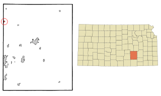
<span class="mw-page-title-main">Whitewater, Kansas</span> City in Butler County, Kansas

Whitewater is a city in Butler County, Kansas, United States. As of the 2020 census, the population of the city was 661.

<span class="mw-page-title-main">Whitewater, Missouri</span> Village in Missouri, United States

Whitewater is a village in Hubble Township in southwestern Cape Girardeau County, Missouri, United States. The population was 88 at the 2020 census. It is part of the Cape Girardeau–Jackson, MO-IL Metropolitan Statistical Area.

<span class="mw-page-title-main">Southwest City, Missouri</span> City in Missouri, United States

Southwest City is a city in McDonald County, Missouri, United States. The population was 922 at the 2020 census. It is located in the southwestern corner of the state of Missouri.
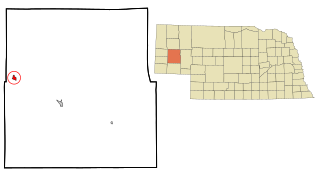
<span class="mw-page-title-main">Bayard, Nebraska</span> City in Nebraska, United States

Bayard is a city in Morrill County, Nebraska, United States. The population was 1,209 at the 2010 census.

<span class="mw-page-title-main">Dexter, New Mexico</span> Town in New Mexico, United States

Dexter is a town in Chaves County, New Mexico, United States. The population was 1,266 at the time of the 2010 census.

<span class="mw-page-title-main">Hurley, New Mexico</span> Town in New Mexico, United States

Hurley is a town in Grant County, New Mexico, United States. The population was 1,297 at the 2010 census, down from 1,464 in 2000.

<span class="mw-page-title-main">Santa Clara, New Mexico</span> Village in New Mexico, United States

Santa Clara is a village in Grant County, New Mexico, United States. The population was 1,686 at the 2010 census, down from 1,944 in 2000. Today it is a bedroom community for nearby Silver City.

<span class="mw-page-title-main">Lovington, New Mexico</span> City in New Mexico, United States

Lovington is a city in, and the county seat of, Lea County, New Mexico, United States. The population was 11,009 at the 2010 census, up from 9,471 in 2000.

<span class="mw-page-title-main">Wilson's Mills, North Carolina</span> Town in North Carolina, United States

Wilson's Mills is a town in Johnston County, North Carolina, United States. In 2010, the population was 2,277, up from 1,291 in 2000. As of 2018, the estimated population was 2,689.

<span class="mw-page-title-main">Harrison, Ohio</span> City in Ohio, United States

Harrison is a city in western Hamilton County, Ohio, United States. The population was 12,563 at the 2020 census. It is part of the Cincinnati metropolitan area.

<span class="mw-page-title-main">Elizabeth, Pennsylvania</span> Borough in Pennsylvania, United States

Elizabeth is a borough in Allegheny County, Pennsylvania, United States, on the east bank of the Monongahela River, where Pennsylvania Route 51 crosses, 15 miles (24 km) upstream (south) of Pittsburgh and close to the county line. The population was 1,398 at the 2020 census. The borough of Elizabeth is entirely contained within the 15037 USPS ZIP code. The local school district is the Elizabeth Forward School District. The borough is home to neighborhoods Walker Heights and Town Hill. Elizabeth Borough is the birthplace of Town Hill Hockey established in 1978.

<span class="mw-page-title-main">Hartford, South Dakota</span> City in South Dakota, United States

Hartford is a suburban American city in Minnehaha County, South Dakota, a few miles northwest of Sioux Falls. Its population was 3,354 at the 2020 census.

<span class="mw-page-title-main">Bayard, West Virginia</span> Town in West Virginia, United States

Bayard is a town in Grant County, West Virginia, United States. The population was 200 at the 2020 census. Bayard was incorporated in 1893 and named in honor of Thomas F. Bayard, Jr., who later became a United States senator from Delaware (1923–1929). Bayard was founded on the West Virginia Central and Pittsburgh Railroad as a coal mining community. Coal mining has remained the town's chief industry.

Whitewater is a town in Walworth County, Wisconsin, United States. The population was 1,433 at the 2020 census.

<span class="mw-page-title-main">Minneiska, Minnesota</span> City in Minnesota, United States

Minneiska is a city in Wabasha and Winona counties in the U.S. state of Minnesota. The population was 97 at the 2020 census.

<span class="mw-page-title-main">Whitewater, Wisconsin</span> City in Wisconsin, United States

Whitewater is a city located in Walworth and Jefferson counties in the U.S. state of Wisconsin. Located near the southern portion of the Kettle Moraine State Forest, Whitewater is the home of the University of Wisconsin–Whitewater. As of the 2020 census, the city's population was 14,889.

References

  1. "ArcGIS REST Services Directory". United States Census Bureau. Retrieved October 12, 2022.
  2. 1 2 U.S. Geological Survey Geographic Names Information System: Bayard, New Mexico
  3. 1 2 "Census Population API". United States Census Bureau. Retrieved October 12, 2022.
  4. 1 2 "Geographic Identifiers: 2010 Demographic Profile Data (G001): Bayard city, New Mexico". American Factfinder. U.S. Census Bureau. Retrieved December 23, 2016.[ dead link ]
  5. "Census of Population and Housing". Census.gov. Retrieved June 4, 2015.
  6. "U.S. Census website". United States Census Bureau . Retrieved January 31, 2008.

Commons-logo.svg Media related to Bayard, New Mexico at Wikimedia Commons