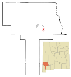
Hurley, New Mexico

Last updated

Hurley, New Mexico
Nickname: 
Brindley Town
Grant County New Mexico Incorporated and Unincorporated areas Hurley Highlighted.svg
Location of Hurley, New Mexico
Usa edcp location map.svg
Red pog.svg
Hurley, New Mexico
Location in the United States
Coordinates: 32°42′05″N108°07′38″W / 32.70139°N 108.12722°W / 32.70139; -108.12722
Country United States
State New Mexico
County Grant
Area
[1]
  Total1.02 sq mi (2.65 km2)
  Land1.02 sq mi (2.64 km2)
  Water0.00 sq mi (0.01 km2)
Elevation
[2]
5,716 ft (1,742 m)
Population
 (2020) [3]
  Total1,256
  Density1,231.37/sq mi (475.35/km2)
Time zone UTC-7 (Mountain (MST))
  Summer (DST) UTC-6 (MDT)
ZIP code
88043
Area code 575
FIPS code 35-33850
GNIS feature ID2412784 [2]
Website www.townofhurley.us

Hurley is a town in Grant County, New Mexico, United States. [2] The population was 1,297 at the 2010 census, [4] down from 1,464 in 2000.

Contents

Geography

Hurley is located in east-central Grant County. U.S. Route 180 passes through the town, leading north 4 miles (6 km) to Bayard, and southeast 38 miles (61 km) to Deming and Interstate 10.

The Grant County Airport and the hamlet and ranch of Apache Tejo are approximately three miles south of Hurley.

The large, open pit Chino Mine and its related facilities lie just to the east of Hurley.

According to the United States Census Bureau, the town has a total area of 1.02 square miles (2.65 km2), of which 0.004 square miles (0.01 km2), or 0.36%, is water. [4]

Demographics

Historical population
CensusPop.Note
1950 2,079
1960 1,851−11.0%
1970 1,796−3.0%
1980 1,616−10.0%
1990 1,534−5.1%
2000 1,464−4.6%
2010 1,297−11.4%
2020 1,256−3.2%
U.S. Decennial Census [5] [3]

As of the census [6] of 2000, there were 1,464 people, 563 households, and 407 families residing in the town. The population density was 1,433.0 inhabitants per square mile (553.3/km2). There were 650 housing units at an average density of 636.2 per square mile (245.6/km2). The racial makeup of the town was 71.79% White, 0.14% African American, 2.05% Native American, 0.07% Asian, 23.43% from other races, and 2.53% from two or more races. Hispanic or Latino of any race were 60.31% of the population.

There were 563 households, out of which 29.5% had children under the age of 18 living with them, 53.1% were married couples living together, 13.9% had a female householder with no husband present, and 27.7% were non-families. 23.8% of all households were made up of individuals, and 13.0% had someone living alone who was 65 years of age or older. The average household size was 2.60 and the average family size was 3.08.

In the town, the population was spread out, with 26.5% under the age of 18, 8.2% from 18 to 24, 22.0% from 25 to 44, 24.2% from 45 to 64, and 19.1% who were 65 years of age or older. The median age was 38 years. For every 100 females, there were 92.1 males. For every 100 females age 18 and over, there were 85.2 males.

The median income for a household in the town was $27,404, and the median income for a family was $31,181. Males had a median income of $29,667 versus $16,528 for females. The per capita income for the town was $11,999. About 14.4% of families and 15.6% of the population were below the poverty line, including 23.4% of those under age 18 and 8.8% of those age 65 or over.

Scenes from the action Western film The Lone Ranger were filmed in locations around Hurley. [7]

See also

Related Research Articles

<span class="mw-page-title-main">Grant County, New Mexico</span> County in New Mexico, United States

Grant County is a county located in the U.S. state of New Mexico. At the 2020 census, the population was 28,185. Its county seat is Silver City. The county was founded in 1868 and named for Ulysses S. Grant, the 18th President of the United States.

<span class="mw-page-title-main">Trinity, Alabama</span> Town in Alabama, United States

Trinity is a town in Morgan County, Alabama, United States. It is included in the Decatur Metropolitan Area and the Huntsville-Decatur Combined Statistical Area. As of the 2020 census, the population of the town was 2,526, up from 2,095 in 2010. It was incorporated in 1901.

<span class="mw-page-title-main">Wahneta, Florida</span> Census-designated place in Florida, United States

Wahneta is a census-designated place (CDP) in central Polk County, Florida, United States. The population was 4,731 at the 2000 census. It is part of the Lakeland–Winter Haven Metropolitan Statistical Area.

<span class="mw-page-title-main">Marshall, Indiana</span> Town in Indiana, United States

Marshall is a town in Washington Township, Parke County, Indiana, United States. As of the 2010 census, the population was 324.

<span class="mw-page-title-main">Brookview, Maryland</span> Town in Maryland, United States

Brookview is a town in Dorchester County, Maryland, United States. The population was 48 at the 2020 census. Brookview was incorporated in 1953. Brookview is governed by a three-person town council. Each member of the town council is elected by voters to a three-year term in office. The now deceased Richard E. Sullivan had previously served as mayor of the town since 1996 and was recognized at the 2017 Annual Maryland Municipal League Summer Conference as a long-serving mayor of over 25 years. The 2018 council consisted of Mayor J.D. Hurley, Commissioner Clint Falduto, Commissioner Shelly Hurley. The present 2021 council consists of Mayor Clint Falduto, Commissioner Mary Falduto, Commissioner Shelly Hurley.

<span class="mw-page-title-main">Kitzmiller, Maryland</span> Town in Maryland, United States

Kitzmiller is a town in Garrett County, Maryland, United States. The population was 321 at the 2010 census.

<span class="mw-page-title-main">Grant, Minnesota</span> City in Minnesota, United States

Grant is a city in Washington County, Minnesota, and a suburb of St. Paul. The population was 4,096 at the time of the 2010 census.

<span class="mw-page-title-main">Hurley, Mississippi</span> Census-designated place in Mississippi

Hurley is an unincorporated community and census-designated place (CDP) in Jackson County, Mississippi, United States. It is part of the Pascagoula Metropolitan Statistical Area. The population was 1,551 at the 2010 census, up from 985 at the 2000 census.

<span class="mw-page-title-main">Martinsburg, Missouri</span> City in Missouri, United States

Martinsburg is a city in Audrain County, Missouri, United States. The population was 304 at the 2010 census.

<span class="mw-page-title-main">Riverside, Suffolk County, New York</span> Hamlet and census-designated place in New York, United States

Riverside is a hamlet and census-designated place (CDP) in Suffolk County, New York, United States. The population was 2,911 at the 2010 census.

<span class="mw-page-title-main">Martinsburg, Pennsylvania</span> Borough in Pennsylvania, United States

Martinsburg is a borough in the Morrisons Cove section of Blair County, Pennsylvania, United States. The population was 1,874 at the 2020 census. It is part of the Altoona, PA Metropolitan Statistical Area.

Loyalhanna is a census-designated place (CDP) in Westmoreland County, Pennsylvania, United States. The population was 3,415 at the 2000 census, at which time it was listed as McChesneytown-Loyalhanna, before just becoming the CDP of Loyalhanna for the 2010 census. As of the 2010 census the population was 3,428 residents.

<span class="mw-page-title-main">Hurley, South Dakota</span> City in South Dakota, United States

Hurley is a city in Turner County, South Dakota, United States. The population was 379 at the 2020 census.

<span class="mw-page-title-main">West Hamlin, West Virginia</span> Town in West Virginia, United States

West Hamlin is a town in Lincoln County, West Virginia, United States, along the Guyandotte River. The population was 519 at the 2020 census, and is now down to 509, according to the 2021 census. West Hamlin is a part of the Huntington-Ashland, WV-KY-OH, Metropolitan Statistical Area (MSA). West Hamlin is west of the county seat at Hamlin, hence the name.

<span class="mw-page-title-main">Winfield, West Virginia</span> City in West Virginia, United States

Winfield is a city in and the county seat of Putnam County, West Virginia, United States, located along the Kanawha River. The population was 2,397 at the 2020 census. It is part of the Huntington–Ashland metropolitan area.

<span class="mw-page-title-main">Mill Creek, West Virginia</span> Town in West Virginia, United States

Mill Creek is a town in Randolph County, West Virginia, United States, along the Tygart Valley River. The population was 563 at the 2020 census.

<span class="mw-page-title-main">Kenova, West Virginia</span> City in West Virginia, United States

Kenova is a city in Wayne County, West Virginia, United States, situated at the confluence of the Ohio and Big Sandy rivers. The city's name is a portmanteau of Kentucky, Ohio, and Virginia (Va), owing to its location where the three states met before the creation of West Virginia. The population was 3,030 at the 2020 census. It is part of the Huntington–Ashland metropolitan area.

<span class="mw-page-title-main">Hampden, Wisconsin</span> Town in Wisconsin, United States

Hampden is a town in Columbia County, Wisconsin, United States. The population was 563 at the 2000 census.

<span class="mw-page-title-main">How, Wisconsin</span> Town in Wisconsin, United States

How is a town in Oconto County, Wisconsin, United States. The population was 563 at the 2000 census. The unincorporated community of Hayes is located in the town. The town is named for Calvin F. How, Jr., an insurance and banking executive.

<span class="mw-page-title-main">Plattekill, New York</span> Place in New York, United States

Plattekill is a town in Ulster County, New York, United States. The population was 10,424 in 2020, a slight decrease from 10,499 at the 2010 census. The name is derived from a stream, the Platte Kill.

References

  1. "ArcGIS REST Services Directory". United States Census Bureau. Retrieved October 12, 2022.
  2. 1 2 3 U.S. Geological Survey Geographic Names Information System: Hurley, New Mexico
  3. 1 2 "Census Population API". United States Census Bureau. Retrieved October 12, 2022.
  4. 1 2 "Geographic Identifiers: 2010 Demographic Profile Data (G001): Hurley town, New Mexico". American Factfinder. U.S. Census Bureau. Retrieved December 23, 2016.[ dead link ]
  5. "Census of Population and Housing". Census.gov. Retrieved June 4, 2015.
  6. "U.S. Census website". United States Census Bureau . Retrieved January 31, 2008.
  7. "The Lone Ranger (2013) - IMDb".

Commons-logo.svg Media related to Hurley, New Mexico at Wikimedia Commons