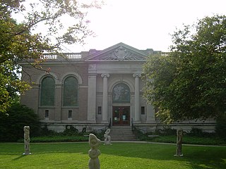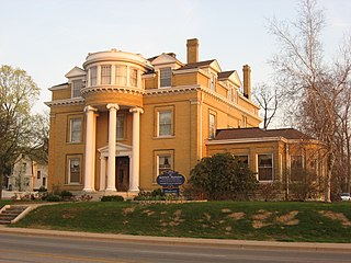
The neighborhood of Irvington, named after Washington Irving, includes Irvington Historic District, a historic district in Indianapolis, Indiana. The historic district is a 545-acre (221 ha) area that was listed on the National Register of Historic Places in 1987. That year, the district included 2,373 contributing buildings, 5 other contributing structures, and 2 contributing sites.

Fletcher Place is a historic district and neighborhood in the city of Indianapolis, Indiana named after Calvin Fletcher, a prominent local banker, farmer and state senator.

Chatham–Arch is a neighborhood located immediately east of Downtown Indianapolis, Indiana, United States. This neighborhood is one of the oldest in Indianapolis, dating back to the mid 19th century. Chatham–Arch contains many of Indianapolis's historic homes.

The Riverside Historic District is a U.S. historic district located in downtown Evansville, Indiana. It was added to the register in 1978 and roughly bounded by Southlane Drive, Walnut, Third, and Parrett Streets. It consists of 1,010 acres (4.1 km2) and 425 buildings. It is also known as the Riverside Neighborhood.

Herron–Morton Place is a historic district in Indianapolis, Indiana, United States. The boundaries of the neighborhood are East 16th Street on the south, East 22nd Street on the north, North Pennsylvania Street on the west, and Central Avenue on the east.

Shelby Place Historic District is a registered historic district in New Albany, Indiana, one mile north of the Ohio River, across from Louisville, Kentucky. It consists of the 1500 and 1600 blocks of the road Shelby Place. It was placed on the National Register of Historic Places due to its historic architectural designs. Immediately to the east Vincennes Street separates the district from New Albany High School.

Cedar Bough Place Historic District is a national historic district located at New Albany, Indiana, ¾ of a mile from the Ohio River, across from Louisville, Kentucky. It consists of the 800-block of the road Cedar Bough Place, between Beeler and Ekin Avenues.

Old Northside is a residential neighborhood near downtown in Indianapolis, Indiana. It is bordered by 16th Street on the north, Pennsylvania Street on the west, Interstate I-65 on the south, and Bellefontaine Street on the east. The Monon Trail runs along the eastern edge of The Frank and Judy O'Bannon Old Northside Soccer Park.

The DePauw Avenue Historic District is a national historic district just northeast of downtown New Albany, Indiana, across the Ohio River from Louisville, Kentucky. The district consists mostly of Depauw Avenue from Vincennes Street in the west to Aebersold Drive to the east, and includes portions of the 1200 block of Beechwood Avenue and two residences on Vance Street. New Albany High School is located on the southern edge of the district.

The East Main Street–Glen Miller Park Historic District is a neighborhood of historic residential buildings and national historic district located at Richmond, Wayne County, Indiana. The district encompasses 84 contributing buildings, 11 contributing structures, and 5 contributing objects along the National Road and sometimes called Millionaire's Row. A portion of the district is recognized by the City of Richmond's Historic Preservation Commission as the Linden Hill conservation district. It developed between about 1830 and 1937 and includes representative examples of Italianate, Queen Anne, Colonial Revival, Tudor Revival, Classical Revival, and Bungalow / American Craftsman style architecture. Located in the district is the separately listed Henry and Alice Gennett House. Other notable contributing resources include elaborate iron bridges and "Madonna of the Trail" statue located in Glen Miller Park, Isham Sedgwick House (1884-1885), John A. Hasecoster House (1895), William H. Campbell House (1905), Howard Campbell House (1909), E.G. Hill House, Crain Sanitarium, and Dr. T. Henry Davis House.

The North Irvington Gardens Historic District is a neighborhood and national historic district in Indianapolis, Indiana. It was placed on the National Register of Historic Places on June 27, 2008. It is immediately to the north of the Irvington Historic District, which has been on the National Register since 1987, sharing the same east and west boundaries of the older district, and extending north to 10th and 11th streets. It is a neighborhood of mostly residential buildings dating primarily from 1910 to 1950, with no one distinctive architectural style, including a house associated with the historic Osborn Farm. Except for one church, the only buildings contributing to the historic nature of the district are 843 houses and 551 garages. Most fences in the district mark the perimeter of the individual properties; very few are along the streets.

Washington Avenue Historic District is a national historic district located at Evansville, Indiana. It was listed on the National Register of Historic Places in 1980. The district, bounded roughly by Madison and Grand Avenues and East Gum and Parrett Streets, sprang up in the late 19th century, during an economic boom when the city's population went from 29,200 in 1880 to more than 59,000 by 1900.

Oliver Johnson's Woods is a historic district and neighborhood on the northern side of Indianapolis, Indiana, United States. Located in southern Washington Township, the district occupies the site of what was once the family farm of Oliver Johnson. Born on the present site of the Indiana State Fairgrounds, Johnson grew up in a pioneer family that lived on the edge of the state capital city. Upon attaining adulthood, he bought property a short distance to the west, to which he moved in 1846. Here, he built a larger farmhouse in 1862, and he tilled the soil for most of the rest of his life. As Indianapolis grew northward, it reached the Johnson farm in the early twentieth century; the aged farmer and his sons saw the city's growth as an opportunity for financial gain, and in 1905 they announced the platting of 0.25 square miles (0.65 km2) of their property into individual lots. They chose an advantageous time to sell their property; as the new residents began to build their homes, an interurban railway was built along College Avenue on the district's western side that connected downtown with Broad Ripple. Many prosperous businessmen were attracted by the development's large lots and wooded streets; the city annexed Oliver Johnson's Woods in 1912, and by the outbreak of World War II, the streets were filled with large houses built in a wide variety of architectural styles. These early residents came from many different ethnicities: European immigrants were becoming more prosperous and leaving their ethnic enclaves, and new neighborhoods such as Oliver Johnson's Woods appealed to them. Among the neighborhood's leading residents was a colony of Jews of German descent.

The Cottage Home Historic District is a historic district and neighborhood located on the near east side of Indianapolis, Indiana. A small portion of Cottage Home is listed on the National Register of Historic Places while a larger area is listed on the state and local levels. Known for its preponderance of "cottage-style" homes built with strong Victorian influences, Cottage Home has historically been a working class neighborhood. Numerous industrial buildings are also scattered throughout the district, providing a base of economic activity. Today, however, many of these buildings are vacant, providing a special challenge to preservation and urban renewal efforts.

The Indianapolis Park and Boulevard System is a group of parks, parkways, and boulevards in Indianapolis, Indiana, that was designed by landscape architect George Edward Kessler in the early part of the twentieth century. Also known as the Kessler System, the district includes 3,474 acres (1,406 ha) and has shaped the city through the present day. This historic district was added to the National Register of Historic Places in 2003.

Independence Historic District, also known as the West Franklin Street-Wabash Avenue Historic District, is a national historic district located in the Lamasco neighborhood of Evansville, Indiana. The district developed after 1880, and encompasses 95 contributing buildings and 1 contributing site. It includes commercial and residential properties and representative examples of Italianate, Queen Anne, Romanesque, and Beaux-Arts style architecture. Notable buildings include the West Branch Carnegie Library (1912), Laval Block, Heldt-Voelker Hardware Store (1890), First Federal Savings, Gerke Building, August Rosenberger House (1894), and St. Boniface Church.

Culver Historic District is a national historic district located at Evansville, Indiana. The neighborhood is all residential, and unlike most of the rest of the city, the lots are not laid out on a grid. Most of the houses are on a lot previously part of the farm owned by Robert Parrett, a native of England who settled in Evansville and built a house near the intersection of Madison Avenue and Parrett Street. Eventually Robert Parrett would become the first Methodist minister in Evansville and helped found Trinity Methodist church, which he served until his death in 1860. His heirs divided up the plat in 1863.

Lincolnshire Historic District is a national historic district located at Evansville, Indiana. The district developed after 1923, and encompasses 95 contributing buildings in a predominantly residential section of Evansville. The district's homes have a mixture of Tudor Revival and Old and new World revival designs, including Colonial Revival. St. Benedict Cathedral and Bosse High School are two landmark buildings from the 1920s and 1930s.

North Anthony Boulevard Historic District is a national historic district located at Fort Wayne, Indiana. The district encompasses 296 contributing buildings in a predominantly residential section of Fort Wayne, extending along North Anthony Boulevard from Lake Avenue in the south to Vance Avenue in the north. An overlapping designation includes all of the rights of way in the district, plus those on the rest of North Anthony south to the Maumee River, as well as on South Anthony Boulevard south of the river.

Indiana and Michigan Avenues Historic District is a national historic district located at LaPorte, LaPorte County, Indiana. The district encompasses 223 contributing buildings and one contributing site in a predominantly residential section of LaPorte. It developed between about 1860 and 1963, and includes examples of Italianate, Queen Anne, Colonial Revival, Prairie School, and Bungalow / American Craftsman style architecture. Located in the district is the separately listed Francis H. Morrison House. Other notable buildings include the Hobart M. Cable, Jr., House, Rear Admiral R. R. Ingersoll Residence (1908), John Secor House, Swan-Anderson House (1870), Carnegie Library (1920), Emmett Scott House (1915), Frank Osborn House, Henry McGill House, First Presbyterian Church (1862), Winn House, First Church of Christ Scientist, and St. Paul's Episcopal Church (1895-1898).


