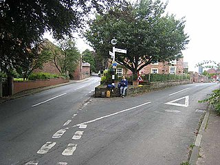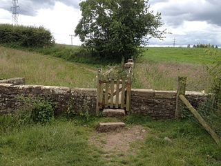
Carlisle is a border city and the county town of Cumbria, as well as the administrative centre of the City of Carlisle district in North West England. Carlisle is located 8 miles (13 km) south of the Scottish border at the confluence of the rivers Eden, Caldew and Petteril. It is the largest settlement in the county of Cumbria and serves as the administrative centre for both Carlisle City Council and Cumbria County Council. Carlisle is also in the historic county of Cumberland. At the time of the 2001 census, the population of Carlisle was 71,773, with 100,734 living in the wider city. Ten years later, at the 2011 census, the city's population had risen to 75,306, with 107,524 in the wider city.

Lanercost Priory was founded by Robert de Vaux between 1165 and 1174, the most likely date being 1169, to house Augustinian canons. The priory is situated at the village of Lanercost, Cumbria, England, within sight of Naworth Castle, with which it had close connections.

Bromfield is a village and civil parish in the Allerdale district of Cumbria, in the north of England.

Burgh by Sands is a village and civil parish in the City of Carlisle district of Cumbria, England, situated near the Solway Firth. The parish includes the village of Burgh by Sands along with Longburgh, Dykesfield, Boustead Hill, Moorhouse and Thurstonfield. It is notable as the site of the first recorded North African (Moorish) military unit in Roman Britain, garrisoning the frontier fort of Aballava on Hadrian's Wall in the 3rd century CE. It is also where Edward I of England died in 1307.

Bowness-on-Solway is a village of fewer than 100 houses in northwest Cumbria, situated to the west of Carlisle on the southern (English) side of the Solway Firth estuary separating England and Scotland. The civil parish had a population of 1,126 at the 2011 census. The western end of Hadrian's Wall is a notable tourist destination, though the Wall itself is no longer to be seen here above ground. The west end of the Hadrian's Wall Path is marked by a pavilion on the small coastal cliff at Bowness. Other attractions are the beaches and wading birds.

Crosscanonby is a village and civil parish in Cumbria, England, historically part of Cumberland, near the Lake District National Park in England. It is situated within the Solway Coast, designated an Area of Outstanding Natural Beauty.

Hadrian's Wall, also known as the Roman Wall, Picts' Wall, or Vallum Hadriani in Latin, is a former defensive fortification of the Roman province of Britannia, begun in AD 122 in the reign of the emperor Hadrian. Running "from Wallsend on the River Tyne in the east to Bowness-on-Solway in the west", the Wall covered the whole width of the island. In addition to the wall's defensive military role, its gates may have been customs posts.

Drumburgh is a small settlement in Cumbria, England. It is 13 kilometres (8 mi) northwest of the city of Carlisle and is on the course of Hadrian's Wall, near to Burgh by Sands. The village is sited on a gentle hill with a good view in all directions over the surrounding lowlands.

St Andrew's Church stands near the village of Aikton, Cumbria, England. It is an active Anglican parish church in the deanery of Carlisle, the archdeaconry of Carlisle, and the diocese of Carlisle. Its benefice is united with those of St Michael, Burgh by Sands, St Mary, Kirkandrews-on-Eden with Beaumont, and St Peter, Kirkbampton. The church is recorded in the National Heritage List for England as a designated Grade I listed building.

St Bridget's Church is in the village of Brigham, Cumbria, England. It is an active Anglican parish church in the deanery of Solway, the archdeaconry of West Cumberland, and the diocese of Carlisle. The church is recorded in the National Heritage List for England as a designated Grade I listed building.

St. Peter's Church is in the village of Kirkbampton, Cumbria, England. It is an active Anglican parish church in the deanery of Carlisle, the archdeaconry of Carlisle, and the diocese of Carlisle. Its benefice is united with those of St Andrew, Aikton, St Mary, Kirkandrews-on-Eden with Beaumont, and St Michael, Burgh by Sands. The church contains Norman architecture and is recorded in the National Heritage List for England as a designated Grade I listed building.

Kirkandrews-on-Eden or Kirkandrews-upon-Eden, in the past known as Kirkanders, is a village and former civil parish, now in the civil parish of Beaumont, in the Carlisle District of the county of Cumbria, England. The village is found 4 miles North-West of Carlisle. Kirkandrews forms part of the Barony of Burgh together with the nearby villages Monkhill, Grinsdale, Rattlingate and Burgh-by-Sands. The civil parish was merged into Beaumont in 1934. In 1931 the civil parish had a population of 145.

Monkhill is a small village in the civil parish of Beaumont, in the City of Carlisle district, in the county of Cumbria, England. Nearby settlements include the small city of Carlisle and the villages of Burgh by Sands and Kirkandrews-on-Eden. Monkhill has a pub called the Drovers Rest Inn and a Methodist Chapel with adjoining School Room which holds local village events. The village is situated on the course of a vallum associated with Hadrian's Wall and is near the narrowest point of the River Eden, the site was a crossing point for Roman troops, Scottish border raiders, and cattle drovers. Monkhill, today, is a quiet little hamlet.

Grinsdale is a village and former civil parish, now in the civil parish of Beaumont, in the Carlisle district, in the English county of Cumbria. Grinsdale has a church called St Kentigern's Church. It is the source of the surname. It is also beside the River Eden. The civil parish was merged into Beaumont in 1934. In 1931 the civil parish had a population of 161.

Cumbria is a county in North West England. It was created in 1974 from the historical counties of Westmorland and Cumberland, together with the Furness area of Lancashire and the Sedbergh Rural District of the West Riding of Yorkshire. Its largest settlement is the county town of Carlisle. Buildings in England are given listed building status by the Secretary of State for Culture, Media and Sport, acting on the recommendation of Historic England. Listed status gives the structure national recognition and protection against alteration or demolition without authorisation. Grade I listed buildings are defined as being of "exceptional interest, sometimes considered to be internationally important"; only 2.5 per cent of listed buildings are included in this grade.

St Michael's Church is in the village of Burgh by Sands, Cumbria, England. It is an active Anglican parish church in the deanery of Carlisle, the archdeaconry of Carlisle, and the diocese of Carlisle. Its benefice is united with those of St Andrew, Aikton, St Mary, Kirkandrews-on-Eden with Beaumont, and St Peter, Kirkbampton. The church is recorded in the National Heritage List for England as a designated Grade I listed building. It is a fortified church standing on the line of Hadrian's Wall, and is unique in having had two fortified towers.

Burgh-by-Sands railway station was originally named Burgh. It opened in 1854 on the Port Carlisle Railway branch and later the Silloth branch, serving the village of Burgh in Cumberland - now Cumbria - England. The line and station closed on 7 September 1964 as part of the Beeching cuts.

Milecastle 70 (Braelees) was one of a series of Milecastles or small fortlets built at intervals of approximately one Roman mile along Hadrian's Wall.

Milecastle 69 was one of a series of Milecastles or small fortlets built at intervals of approximately one Roman mile along Hadrian's Wall.


