
Cumberland is an historic county in Northern England, it mainly corresponds to the district of Cumberland and the part of Westmorland and Furness including Penrith.

Eden was a local government district in Cumbria, England, based at Penrith Town Hall in Penrith. It was named after the River Eden, which flows north through the district toward Carlisle. Its population of 49,777 at the 2001 census, increased to 52,564 at the 2011 Census. A 2019 estimate was 53,253. In July 2021 it was announced that, in April 2023, Cumbria would be divided into two unitary authorities. On 1 April 2023, Eden District Council was abolished and its functions transferred to the new authority Westmorland and Furness, which also covers the former districts of Barrow-in-Furness and South Lakeland.

Penrith is a market town and civil parish in the Westmorland and Furness district of Cumbria, England. It is less than 3 miles (5 km) outside the Lake District National Park and about 17 miles (27 km) south of Carlisle. It is between the Rivers Petteril and Eamont and just north of the River Lowther. The town had a population of 15,181 at the 2011 census. It is part of historic Cumberland.

The Eden Valley Railway (EVR) was a railway in Cumbria, England. It ran between Clifton Junction near Penrith and Kirkby Stephen via Appleby-in-Westmorland.

Kirkby Stephen is a market town and civil parish in Westmorland and Furness, Cumbria, England. Historically part of Westmorland, it lies on the A685, surrounded by sparsely populated hill country, about 25 miles (40 km) from the nearest larger towns: Kendal and Penrith. The River Eden rises 6 miles (9.7 km) away in the peat bogs below Hugh Seat and passes the eastern edge of the town. At the 2001 census the parish had a population of 1,832. In 2011, it had a population of 1,522.
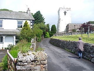
Orton is a village and civil parish in Cumbria, England. It lies 15 miles (24 km) south of Penrith, 8 miles (13 km) from Appleby-in-Westmorland and 1.5 miles (2.4 km) from the M6 motorway. The village is in the upper Lune Valley, at the foot of Orton Scar in the Orton Fells. The Lake District is nearby. The parish includes a wide area outside the village, and had a population of 594 in 2001, decreasing to 588 at the 2011 Census.
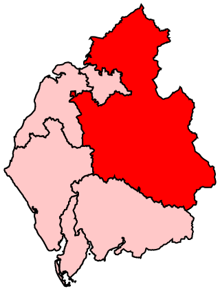
Penrith and The Border is a constituency in Cumbria represented in the House of Commons of the UK Parliament since 2019 by Neil Hudson, a Conservative.
The Vale of Eden is formed by the course of the River Eden, one of the major rivers of Northwest England. It is however of much greater extent than the actual valley of the river, lying between the Cumbrian Mountains, and the northern part of the Pennine Range. It lies entirely within the county of Cumbria. The river has its source in the peat bogs below Hugh Seat, in the dale of Mallerstang. At first it heads off south before turning back north for the rest of its course – except just before its outlet into the sea which it enters from the east.

Knott is a mountain in the northern part of the English Lake District. It is the highest point of the Back o'Skiddaw region, an area of wild and unfrequented moorland to the north of Skiddaw and Blencathra. Other tops in this region include High Pike, Carrock Fell and Great Calva. The fell's slopes are mostly smooth, gentle, and covered in grass, with a few deep ravines. It stands a long way from a road and requires a long walk across the moor top get to it; this, as well as the fact that it is hidden from the rest of the Lake District by the two aforementioned giants, make it one of the most unfrequented tops in the Lakes. When it is climbed it is most often from Mungrisdale or from the north via Great Sca Fell. The word Knott is of Cumbric origin, and means simply "hill".

Aisgill is the southernmost of the hamlets that form the parish of Mallerstang in the English county of Cumbria. It is on the B6259 road, at the head of Mallerstang dale, just before the boundary between Cumbria and North Yorkshire.

Mallerstang is a civil parish in the extreme east of Cumbria, and, geographically, a dale at the head of the upper Eden Valley. Originally part of Westmorland, it lies about 6 miles (9.7 km) south of the nearest town, Kirkby Stephen. Its eastern edge, at Aisgill, borders on North Yorkshire; and since August 2016 it has been within the Yorkshire Dales National Park.
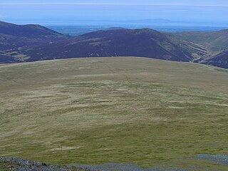
Mungrisdale Common, pronounced mun-grize-dl, with emphasis on grize, is a fell in the English Lake District. Although Alfred Wainwright listed it as one of the 214 featured hills in his influential Pictorial Guide to the Lakeland Fells it was his least favourite. He commented that it "has no more pretension to elegance than a pudding that has been sat on". There is some speculation that Wainwright included the fell in his guide simply as a way to fill space, but that has never been proven. Mungrisdale Common is oddly named, as it is a number of miles from the village of Mungrisdale, which lies in a different river catchment.

Cumbrian toponymy refers to the study of place names in Cumbria, a county in North West England, and as a result of the spread of the ancient Cumbric language, further parts of northern England and the Southern Uplands of Scotland.
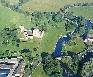
The River Lowther is a small river which flows through limestone rock in Cumbria, England. It is a tributary of the River Eamont which in turn is a tributary of the River Eden which flows into the Solway Firth near Carlisle. The Lowther begins with the confluence of the Keld Gill and the Keld Dub near the village of Keld. It flows north-west until it passes between Bampton and Bampton Grange, before turning north until it flows into the River Eamont close to Penrith.

The Ellen is a river in the English county of Cumbria, flowing from Skiddaw in the Northern Fells to the Solway Firth at Maryport. It was historically in the county of Cumberland. It is approximately 25 miles (40.2 km) in length.

The River Caldew is a river running through Cumbria in England. The river rises high up on the northern flanks of Skiddaw, in the Northern Fells area of the English Lake District, and flows in a northerly direction until it joins the River Eden on the north side of the city of Carlisle.
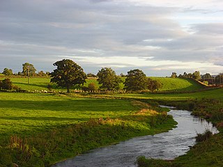
The River Petteril is a river running through the English county of Cumbria.
A gill or ghyll is a ravine or narrow valley in the North of England and parts of Scotland. The word originates from the Old Norse gil. Examples include Dufton Ghyll Wood, Dungeon Ghyll, Troller's Gill and Trow Ghyll. As a related usage, Gaping Gill is the name of a cave, not the associated stream, and Cowgill, Masongill and Halton Gill are derived names of villages.


