Mississippi State, Mississippi is a census-designated place in Oktibbeha County, Mississippi, United States. It is the official designated name for the area encompassing Mississippi State University, which lies partly in the nearby incorporated municipality of Starkville. The population at the 2020 census was 4,968.

Deep Creek is a census-designated place (CDP) in Accomack County, Virginia, United States. Per the 2020 census, the population was 94.

Gargatha is a census-designated place (CDP) in Accomack County, Virginia, United States. Per the 2020 census, the population was 415.

Harborton is a census-designated place (CDP) in Accomack County, Virginia, United States. Per the 2020 census, the population was 130.

Lee Mont is a census-designated place (CDP) in Accomack County, Virginia, United States. Per the 2020 census, the population was 102.

Mappsburg is a census-designated place (CDP) in Accomack County, Virginia, United States. Per the 2020 census, the population was 51.

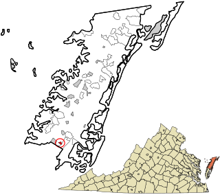
Quinby is a census-designated place (CDP) in Accomack County, Virginia, United States. It was first listed as a CDP in 2010. Per the 2020 census, the population was 285.

Chase Crossing is a census-designated place (CDP) in Accomack County, Virginia, United States. Per the 2020 census, the population was 335.

Metompkin is a census-designated place (CDP) in Accomack County, Virginia, United States. Per the 2020 census, the population was 490.
Savage Town is a census-designated place (CDP) in Accomack County, Virginia, United States. It was first listed as a CDP in 2010. Per the 2020 census, the population was 72.
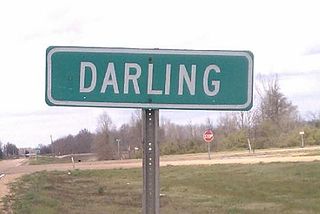
Darling is a census-designated place in Quitman County, Mississippi. Darling is located on Mississippi Highway 3, north of Marks. Per the 2020 Census, the population was 154.
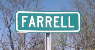
Farrell is an unincorporated community and census-designated place in Coahoma County, Mississippi, United States. Per the 2020 census, the population was 200. Farrell is located approximately 4 miles (6 km) south of Stovall and 4 miles (6 km) north of Sherard on Mississippi Highway 1. It is approximately 9 miles (14 km) northwest of Clarksdale, the county seat.

White Oak is a census-designated place located on Mississippi Highway 4 in Tunica County, Mississippi. White Oak is approximately 2 miles (3.2 km) east of Evansville and approximately 8 miles (13 km) west of Savage. The population at the 2020 census was 692.
Lemannville is an unincorporated community and census-designated place in Ascension and St. James parishes, Louisiana, United States. Per the 2020 census, the population was 695.
Morgantown is a census-designated place (CDP) in Adams County, Mississippi, United States, located to the northeast of the city of Natchez. As of the 2020 census, it had a population of 1,334.
Cloverdale is a census-designated place (CDP) in Adams County, Mississippi, United States, located to the south of the city of Natchez. As of the 2020 census, it had a population of 557.
Mississippi Valley State University is a census-designated place in Leflore County, Mississippi, United States. The population at the 2020 census was 805. It is the location of Mississippi Valley State University and is adjacent to Itta Bena.
Arnold Line is an unincorporated area and census-designated place (CDP) in Lamar County, Mississippi, United States. As of the 2020 census it had a population of 2,333. It is part of the Hattiesburg Metropolitan Statistical Area.
Cleary is an unincorporated community and census-designated place in Rankin County, Mississippi, United States. Per the 2020 census, the population was 1,688.
Robinhood is an unincorporated community and census-designated place in Rankin County, Mississippi, United States. Per the 2020 census, the population was 1,491.

