
Batley is a market town in the Metropolitan Borough of Kirklees, West Yorkshire, England, south-west of Leeds, north-west of Wakefield and Dewsbury, south-east of Bradford and north-east of Huddersfield, in the Heavy Woollen District. In 2011, the population was 48,730.

Ossett is a market town in West Yorkshire, England. It is in the City of Wakefield district. Historically part of the West Riding of Yorkshire, it is situated between Dewsbury, Horbury and Wakefield. At the 2021 census, the town had a population of 21,861. Ossett forms part of the Heavy Woollen District.

Tingley is a suburban village in the City of Leeds in West Yorkshire, Northern England, forming part of the parish of West Ardsley. Tingley forms part of the Heavy Woollen District. It is situated between the cities of Leeds and Wakefield.
The Heavy Woollen District is a region of textile-focused industrial development in West Yorkshire, England. It acquired the name because of the heavyweight cloth manufactured there from the early 19th century.

Oldfield is a small hamlet within the county of West Yorkshire, England, situated north of Stanbury and near to Oakworth. It is approximately 6 miles (9.2 km) west of the town of Keighley. It mainly consists of farmland and has panoramic views across the Worth Valley towards Brontë Country. Top Withens, the house featured in the novel Wuthering Heights, is clearly visible.

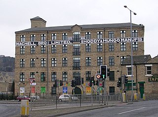
Healey is a small village and industrial district on the east bank of the River Calder in the southwestern outskirts of Ossett, near Wakefield in West Yorkshire, England. It developed during the industrial revolution when three cloth and fulling mills were built.
Lawns is a district of Wakefield in West Yorkshire, England.

Oakes is a district of Huddersfield, West Yorkshire, England. It is situated 2 miles (3 km) to the west of the town centre off the A640 New Hey Road towards the M62 motorway, between Marsh, Lindley, Quarmby and Salendine Nook.

Arthursdale is an area within the village of Scholes in West Yorkshire, England. It is a small area immediately to the north of Rakehill Road in Scholes, near the former Scholes station on the closed Cross Gates–Wetherby line. It was established around 1900 on glebe land bought by farmer, property developer and brick works manager Arthur Chippindale and included Whinmoor Farm. A cricket club named after the settlement was formed in 1929.

Brandy Carr is a hamlet in Kirkhamgate in the City of Wakefield in West Yorkshire, England, north of the eponymous Brandy Carr Hill between the Balne Beck and Carr Gate Beck. Brandy Carr was part of Kirkhamgate civil parish. The nearest settlements are Carr Gate to the north and Wrenthorpe to the southeast. Rhubarb is grown at Brandy Carr Nurseries, and liquorice since its reintroduction in the early 1990s.

Brown Moor is an area in the metropolitan borough of the City of Leeds in West Yorkshire, England, east of Austhorpe and north of Colton. The M1 motorway and the A63 road pass it on its eastern flank and the A6120 road in the south. The area is named after a nearby hill. A colliery operated here in the 19th century and was accessed by a spur off the Leeds and Selby Railway, but was already disused in the early 20th century. At that time, some cottages had been erected nearby. Those had been sold by 2002 when Thorpe Park was established in the area.
Alverthorpe railway station served the village of Alverthorpe near Wakefield in the English county of West Yorkshire.

Painthorpe is a residential area in the Wakefield district, in the English county of West Yorkshire. It is situated southwest of Crigglestone.

Beggarington, also known as Beggerington and Begerington is a hamlet consisting of a few houses about 0.4 miles (0.6 km) north of Hartshead in Kirklees, West Yorkshire. It is situated in a bend of the B6119 road at the junction with the road from Roberttown. Beggerington has traditionally been considered a part of Hartshead. The place name means either "where the berries grow" or is related to beggar.

Stanley railway station on the Methley Joint Railway served the village of Stanley east of Outwood, Wakefield, West Yorkshire.
Earlsheaton was a railway station serving Earlsheaton in West Yorkshire. The station was on the Bradford, Wakefield and Leeds Railway. The station was opened in 1875 on the Great Northern's–– Dewsbury Loop. The line was extended to Batley by 1880.

Egypt is a hamlet near Thornton, in the City of Bradford, West Yorkshire, England.

The Bradford, Wakefield and Leeds Railway was an independent railway company that built a line between Wakefield and a junction close to Leeds, in Yorkshire, England. It opened its main line in 1857, and was worked by the Great Northern Railway. The line shortened the GNR route to Leeds.

