
Everest is a city in Brown County, Kansas, United States. As of the 2020 census, the population of the city was 265.
Morrill is a city in Brown County, Kansas, United States. As of the 2020 census, the population of the city was 218.
Glasco is a city in Cloud County, Kansas, United States. As of the 2020 census, the population of the city was 441.

Protection is a city in Comanche County, Kansas, United States. As of the 2020 census, the population of the city was 498.

Burden is a city in Cowley County, Kansas, United States. As of the 2020 census, the population of the city was 512.

Longton is a city in Elk County, Kansas, United States, along the Elk River. As of the 2020 census, the population of the city was 288.

Ensign is a city in Gray County, Kansas, United States. As of the 2020 census, the population of the city was 166. It is located along U.S. Route 56 highway.

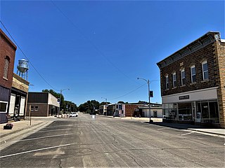
Jetmore is a city in and the county seat of Hodgeman County, Kansas, United States. As of the 2020 census, the population of the city was 770.

Formoso is a city in Jewell County, Kansas, United States. As of the 2020 census, the population of the city was 94.
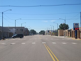
Lakin is a city in and the county seat of Kearny County, Kansas, United States. As of the 2020 census, the population of the city was 2,205. It is located along Highway 50.
Oketo is a city in Marshall County, Kansas, United States. As of the 2020 census, the population of the city was 64.

Bern is a city in Nemaha County, Kansas, United States. As of the 2020 census, the population of the city was 161.

Lyndon is a city in and the county seat of Osage County, Kansas, United States. As of the 2020 census, the population of the city was 1,037.
Delphos is a city in Ottawa County, Kansas, United States. As of the 2020 census, the population of the city was 302. The community was named after Delphos, Ohio.

Atwood is a city in and the county seat of Rawlins County, Kansas, United States. As of the 2020 census, the population of the city was 1,290.

Belleville is a city in and the county seat of Republic County, Kansas, United States. As of the 2020 census, the population of the city was 2,007.

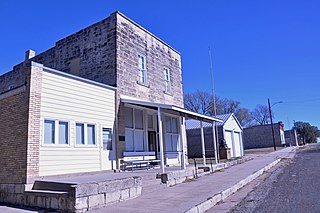
Narka is a city in Republic County, Kansas, United States. As of the 2020 census, the population of the city was 81.

Andale is a city in Sedgwick County, Kansas, United States. As of the 2020 census, the population of the city was 941.
Mount Hope is a city in Sedgwick County, Kansas, United States. As of the 2020 census, the population of the city was 806.

Argonia is a city in Sumner County, Kansas, United States. As of the 2020 census, the population of the city was 456.


