St. George, Kansas

Last updated
St. George, Kansas
St. George, Kansas.jpg
First Street in St. George (2012)
Pottawatomie County Kansas Incorporated and Unincorporated areas St. George Highlighted.svg
Location within Pottawatomie County and Kansas
Map of Pottawatomie Co, Ks, USA.png
Coordinates: 39°11′28″N96°25′13″W / 39.19111°N 96.42028°W / 39.19111; -96.42028 Coordinates: 39°11′28″N96°25′13″W / 39.19111°N 96.42028°W / 39.19111; -96.42028 [1]
Country United States
State Kansas
County Pottawatomie
Founded1857
Incorporated 1919
Government
  Type Mayor–Council
   Mayor Tim Pralle [2]
Area
[3]
  Total0.65 sq mi (1.67 km2)
  Land0.65 sq mi (1.67 km2)
  Water0.00 sq mi (0.00 km2)
Elevation
[1]
1,027 ft (313 m)
Population
 (2020) [4]
  Total1,054
  Density1,600/sq mi (630/km2)
Time zone UTC-6 (CST)
  Summer (DST) UTC-5 (CDT)
ZIP code
66535
Area code 785
FIPS code 20-62200 [1]
GNIS ID 476409 [1]
Website stgeorgeks.gov

St. George is a city in Pottawatomie County, Kansas, United States. [1] As of the 2020 census, the population of the city was 1,054. [4] The name might have been intended to honor several pioneer settlers named George. [5]

Contents

History

St. George was platted in 1857. [6] The town was moved about a mile in 1879 in order to be on the new railroad. [7]

Geography

St. George is located at 39°11′24″N96°25′3″W / 39.19000°N 96.41750°W / 39.19000; -96.41750 (39.190085, -96.417532). [8] According to the United States Census Bureau, the city has a total area of 0.69 square miles (1.79 km2), of which, 0.68 square miles (1.76 km2) is land and 0.01 square miles (0.03 km2) is water. [9]

Demographics

Historical population
CensusPop.
1860 78
1870 11851.3%
1880 20674.6%
1920 211
1930 2162.4%
1940 203−6.0%
1950 25123.6%
1960 2593.2%
1970 241−6.9%
1980 30928.2%
1990 39728.5%
2000 4349.3%
2010 63947.2%
2020 1,05464.9%
U.S. Decennial Census

St. George is part of the Manhattan, Kansas Metropolitan Statistical Area.

2010 census

As of the census [10] of 2010, there were 639 people, 228 households, and 161 families residing in the city. The population density was 939.7 inhabitants per square mile (362.8/km2). There were 255 housing units at an average density of 375.0 per square mile (144.8/km2). The racial makeup of the city was 90.9% White, 0.3% African American, 1.4% Native American, 0.9% Asian, 1.4% from other races, and 5.0% from two or more races. Hispanic or Latino of any race were 5.8% of the population.

There were 228 households, of which 46.5% had children under the age of 18 living with them, 55.3% were married couples living together, 10.5% had a female householder with no husband present, 4.8% had a male householder with no wife present, and 29.4% were non-families. 24.6% of all households were made up of individuals, and 6.1% had someone living alone who was 65 years of age or older. The average household size was 2.80 and the average family size was 3.39.

The median age in the city was 30.2 years. 33.2% of residents were under the age of 18; 6.9% were between the ages of 18 and 24; 34.1% were from 25 to 44; 18% were from 45 to 64; and 7.7% were 65 years of age or older. The gender makeup of the city was 49.0% male and 51.0% female.

2000 census

As of the census of 2000, [11] there were 434 people, 173 households, and 106 families residing in the city. The population density was 987.3 inhabitants per square mile (381.2/km2). There were 198 housing units at an average density of 450.4 per square mile (173.9/km2). The racial makeup of the city was 97.47% White, 0.69% African American, 1.38% from other races, and 0.46% from two or more races. Hispanic or Latino of any race were 3.92% of the population.

There were 173 households, out of which 34.7% had children under the age of 18 living with them, 52.0% were married couples living together, 5.2% had a female householder with no husband present, and 38.2% were non-families. 28.3% of all households were made up of individuals, and 5.8% had someone living alone who was 65 years of age or older. The average household size was 2.51 and the average family size was 3.20.

In the city, the population was spread out, with 29.5% under the age of 18, 9.0% from 18 to 24, 33.2% from 25 to 44, 20.7% from 45 to 64, and 7.6% who were 65 years of age or older. The median age was 31 years. For every 100 females, there were 88.7 males. For every 100 females age 18 and over, there were 100.0 males.

The median income for a household in the city was $29,306, and the median income for a family was $34,250. Males had a median income of $22,159 versus $21,125 for females. The per capita income for the city was $15,544. About 14.4% of families and 23.6% of the population were below the poverty line, including 31.3% of those under age 18 and 20.0% of those age 65 or over.

Government

The St. George government consists of a mayor and five council members. The council meets the 1st Thursday of each month at 7PM. [2]

Education

The community is served by Rock Creek USD 323 public school district, which was formed through school unification by consolidating St. George and Westmoreland schools. Rock Creek High School is located approximately halfway between the two communities, and its mascot is Rock Creek Mustangs. St. George Elementary is located in St. George. [12]

St. George High School was closed through school unification in 1991. The St. George High School mascot was St. George Trojans. [13]

Notable people

Related Research Articles

<span class="mw-page-title-main">Powhattan, Kansas</span> City in Brown County, Kansas

Powhattan is a city in Brown County, Kansas, United States. As of the 2020 census, the population of the city was 69.

<span class="mw-page-title-main">St. Francis, Kansas</span> City in Cheyenne County, Kansas

St. Francis is a city in and the county seat of Cheyenne County, Kansas, United States. As of the 2020 census, the population of the city was 1,263.

<span class="mw-page-title-main">Waverly, Kansas</span> City in Coffey County, Kansas

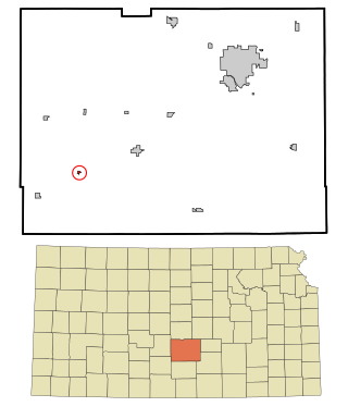
Waverly is a city in Coffey County, Kansas, United States. As of the 2020 census, the population of the city was 574.

<span class="mw-page-title-main">Hepler, Kansas</span> City in Crawford County, Kansas

Hepler is a city in Crawford County, Kansas, United States. As of the 2020 census, the population of the city was 90.

<span class="mw-page-title-main">Norcatur, Kansas</span> City in Decatur County, Kansas

Norcatur is a city in Decatur County, Kansas, United States. As of the 2020 census, the population of the city was 159.

<span class="mw-page-title-main">Elk Falls, Kansas</span> City in Elk County, Kansas

Elk Falls is a city in Elk County, Kansas, United States, along the Elk River. As of the 2020 census, the population of the city was 113.

<span class="mw-page-title-main">Park, Kansas</span> City in Gove County, Kansas

Park is a city in Gove County, Kansas, United States. As of the 2020 census, the population of the city was 112.

<span class="mw-page-title-main">Hoyt, Kansas</span> City in Jackson County, Kansas

Hoyt is a city in Jackson County, Kansas, United States. As of the 2020 census, the population of the city was 593.

<span class="mw-page-title-main">Nortonville, Kansas</span> City in Kansas, United States

Nortonville is a city in Jefferson County, Kansas, United States. As of the 2020 census, the population of the city was 601.

<span class="mw-page-title-main">Westwood Hills, Kansas</span> City in Kansas, United States

Westwood Hills is a city in Johnson County, Kansas, United States. As of the 2020 census, the population of the city was 400. It is the most densely populated city in the Kansas City Metropolitan Area at 6,240 people per square mile. It borders Kansas City, Missouri.

<span class="mw-page-title-main">Kingman, Kansas</span> City in Kingman County, Kansas

Kingman is a city in and the county seat of Kingman County, Kansas, United States. As of the 2020 census, the population of the city was 3,105.

<span class="mw-page-title-main">Parker, Kansas</span> City in Kansas, United States

Parker is a city in Linn County, Kansas, United States. As of the 2020 census, the population of the city was 241.

<span class="mw-page-title-main">Lenora, Kansas</span> City in Norton County, Kansas

Lenora is a city in Norton County, Kansas, United States. As of the 2020 census, the population of the city was 207.

<span class="mw-page-title-main">Minneapolis, Kansas</span> City in Ottawa County, Kansas

Minneapolis is a city in and the county seat of Ottawa County, Kansas, United States. As of the 2020 census, the population of the city was 1,946.

<span class="mw-page-title-main">Langdon, Kansas</span> City in Reno County, Kansas

Langdon is a city in Reno County, Kansas, United States. As of the 2020 census, the population of the city was 39.

<span class="mw-page-title-main">Bel Aire, Kansas</span> City in Sedgwick County, Kansas

Bel Aire is a city in Sedgwick County, Kansas, United States, and a suburb of Wichita. As of the 2020 census, the population of the city was 8,262.

<span class="mw-page-title-main">Marietta, Minnesota</span> City in Minnesota, United States

Marietta is a city in Lac qui Parle County, Minnesota, United States on Minnesota State Highway 40 near the South Dakota border. The population was 162 at the 2010 census.

<span class="mw-page-title-main">Long Beach, Minnesota</span> City in Minnesota, United States

Long Beach is a city in Pope County, Minnesota, United States. The population was 335 at the 2010 census.

<span class="mw-page-title-main">Echo, Minnesota</span> City in Minnesota, United States

Echo is a city in Yellow Medicine County, Minnesota, United States. The population was 278 at the 2010 census.

<span class="mw-page-title-main">Appleton City, Missouri</span> City in Missouri, United States

Appleton City is a city in St. Clair County, Missouri, United States. The population was 1,032 as of the 2020 census. It is the largest city in St. Clair County.

References

  1. 1 2 3 4 5 "St. George, Kansas", Geographic Names Information System , United States Geological Survey, United States Department of the Interior
  2. 1 2 St. George - List of Public Officials
  3. "2019 U.S. Gazetteer Files". United States Census Bureau. Retrieved July 24, 2020.
  4. 1 2 "Profile of St. George, Kansas in 2020". United States Census Bureau. Archived from the original on May 26, 2022. Retrieved May 26, 2022.
  5. "Profile for Saint George, Kansas". ePodunk . Retrieved 22 June 2014.
  6. Kansas State Historical Society (1916). Biennial Report of the Board of Directors of the Kansas State Historical Society. Kansas State Printing Plant. pp.  263.
  7. Blackmar, Frank Wilson (1912). Kansas: A Cyclopedia of State History, Volume 2. Standard Publishing Company. pp.  620.
  8. "US Gazetteer files: 2010, 2000, and 1990". United States Census Bureau. 2011-02-12. Retrieved 2011-04-23.
  9. "US Gazetteer files 2010". United States Census Bureau. Archived from the original on 2012-01-25. Retrieved 2012-07-06.
  10. "U.S. Census website". United States Census Bureau . Retrieved 2012-07-06.
  11. "U.S. Census website". United States Census Bureau . Retrieved 2008-01-31.
  12. "Rock Creek USD 323". USD 323. Retrieved 4 January 2017.
  13. "St George Is Easy Winner Over Bears", The Manhattan Mercury, 21 January 1962, p.9.

Further reading