Havensville, Kansas

Last updated

Havensville, Kansas
Old Havensville School.JPG
Historic Havensville School (2009)
Pottawatomie County Kansas Incorporated and Unincorporated areas Havensville Highlighted.svg
Location within Pottawatomie County and Kansas
Map of Pottawatomie Co, Ks, USA.png
Coordinates: 39°30′40″N96°04′35″W / 39.51111°N 96.07639°W / 39.51111; -96.07639 [1]
Country United States
State Kansas
County Pottawatomie
Founded1878
Incorporated 1892
Named for Paul Havens
Area
[2]
  Total0.14 sq mi (0.38 km2)
  Land0.14 sq mi (0.38 km2)
  Water0.00 sq mi (0.00 km2)
Elevation
[1]
1,204 ft (367 m)
Population
 (2020) [3]
  Total119
  Density850/sq mi (310/km2)
Time zone UTC-6 (CST)
  Summer (DST) UTC-5 (CDT)
ZIP code
66432
Area code 785
FIPS code 20-30775
GNIS ID 2394327 [1]

Havensville is a city in Pottawatomie County, Kansas, United States. [1] As of the 2020 census, the population of the city was 119. [3]

Contents

History

Havensville had its start in the year 1878 by the building of the railroad through that territory. [4] It was named for Paul E. Havens, a railroad employee. [5] [6] [7]

The first post office in Havensville was established in March 1878. [8]

Geography

According to the United States Census Bureau, the city has a total area of 0.15 square miles (0.39 km2), all of it land. [9]

Climate

This climatic region is typified by large seasonal temperature differences, with warm to hot (and often humid) summers and cold (sometimes severely cold) winters. According to the Köppen Climate Classification system, Havensville has a humid continental climate, abbreviated "Dfa" on climate maps. [10]

Demographics

Historical population
CensusPop.Note
1880 180
1900 437
1910 412−5.7%
1920 333−19.2%
1930 263−21.0%
1940 232−11.8%
1950 208−10.3%
1960 166−20.2%
1970 163−1.8%
1980 18312.3%
1990 135−26.2%
2000 1468.1%
2010 133−8.9%
2020 119−10.5%
U.S. Decennial Census

Havensville is part of the Manhattan, Kansas Metropolitan Statistical Area.

2020 census

The 2020 United States census counted 119 people, 51 households, and 34 families in Havensville. [11] [12] The population density was 820.7 per square mile (316.9/km2). There were 59 housing units at an average density of 406.9 per square mile (157.1/km2). [12] [13] The racial makeup was 93.28% (111) white or European American (89.92% non-Hispanic white), 0.0% (0) black or African-American, 1.68% (2) Native American or Alaska Native, 0.84% (1) Asian, 0.0% (0) Pacific Islander or Native Hawaiian, 1.68% (2) from other races, and 2.52% (3) from two or more races. [14] Hispanic or Latino of any race was 3.36% (4) of the population. [15]

Of the 51 households, 19.6% had children under the age of 18; 49.0% were married couples living together; 25.5% had a female householder with no spouse or partner present. 27.5% of households consisted of individuals and 5.9% had someone living alone who was 65 years of age or older. [12] The average household size was 3.3 and the average family size was 3.5. [16] The percent of those with a bachelor’s degree or higher was estimated to be 19.3% of the population. [17]

18.5% of the population was under the age of 18, 6.7% from 18 to 24, 21.8% from 25 to 44, 31.9% from 45 to 64, and 21.0% who were 65 years of age or older. The median age was 47.3 years. For every 100 females, there were 85.9 males. [12] For every 100 females ages 18 and older, there were 90.2 males. [12]

The 2016-2020 5-year American Community Survey estimates show that the median household income was $101,250 (with a margin of error of +/- $53,413) and the median family income was $104,375 (+/- $45,295). [18] Males had a median income of $71,667 (+/- $58,927) versus $17,031 (+/- $8,488) for females. [19] Approximately, 8.6% of families and 15.0% of the population were below the poverty line, including 53.8% of those under the age of 18 and 4.8% of those ages 65 or over. [20] [21]

2010 census

As of the census [22] of 2010, there were 133 people, 58 households, and 41 families residing in the city. The population density was 886.7 inhabitants per square mile (342.4/km2). There were 73 housing units at an average density of 486.7 per square mile (187.9/km2). The racial makeup of the city was 98.5% White, 0.8% from other races, and 0.8% from two or more races. Hispanic or Latino of any race were 3.8% of the population.

There were 58 households, of which 22.4% had children under the age of 18 living with them, 58.6% were married couples living together, 8.6% had a female householder with no husband present, 3.4% had a male householder with no wife present, and 29.3% were non-families. 25.9% of all households were made up of individuals, and 6.9% had someone living alone who was 65 years of age or older. The average household size was 2.29 and the average family size was 2.73.

The median age in the city was 45.8 years. 20.3% of residents were under the age of 18; 3.9% were between the ages of 18 and 24; 24.8% were from 25 to 44; 38.3% were from 45 to 64; and 12.8% were 65 years of age or older. The gender makeup of the city was 55.6% male and 44.4% female.

2000 census

As of the census [23] of 2000, there were 146 people, 64 households, and 41 families residing in the city. The population density was 1,116.0 inhabitants per square mile (430.9/km2). There were 74 housing units at an average density of 565.6 per square mile (218.4/km2). The racial makeup of the city was 95.21% White, 0.68% African American, 0.68% Native American, 0.68% from other races, and 2.74% from two or more races. Hispanic or Latino of any race were 2.74% of the population.

There were 64 households, out of which 29.7% had children under the age of 18 living with them, 60.9% were married couples living together, 4.7% had a female householder with no husband present, and 34.4% were non-families. 32.8% of all households were made up of individuals, and 12.5% had someone living alone who was 65 years of age or older. The average household size was 2.28 and the average family size was 2.90.

In the city, the population was spread out, with 24.7% under the age of 18, 6.2% from 18 to 24, 31.5% from 25 to 44, 20.5% from 45 to 64, and 17.1% who were 65 years of age or older. The median age was 39 years. For every 100 females, there were 117.9 males. For every 100 females age 18 and over, there were 100.0 males.

The median income for a household in the city was $26,875, and the median income for a family was $43,125. Males had a median income of $31,250 versus $17,000 for females. The per capita income for the city was $18,043. There were 7.9% of families and 10.9% of the population living below the poverty line, including 22.6% of under eighteens and 6.9% of those over 64.

Education

The community is served by Onaga USD 322 public school district.

Related Research Articles

<span class="mw-page-title-main">Glasco, Kansas</span> City in Cloud County, Kansas

Glasco is a city in Cloud County, Kansas, United States. As of the 2020 census, the population of the city was 441.

<span class="mw-page-title-main">Gridley, Kansas</span> City in Coffey County, Kansas

Gridley is a city in Coffey County, Kansas, United States. As of the 2020 census, the population of the city was 313.

<span class="mw-page-title-main">Mulberry, Kansas</span> City in Crawford County, Kansas

Mulberry is a city in Crawford County, Kansas, United States. As of the 2020 census, the population of the city was 409.

<span class="mw-page-title-main">Jennings, Kansas</span> City in Decatur County, Kansas

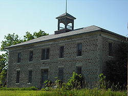
Jennings is a city in Decatur County, Kansas, United States. As of the 2020 census, the population of the city was 81.

<span class="mw-page-title-main">Kinsley, Kansas</span> City in Edwards County, Kansas

Kinsley is a city in and the county seat of Edwards County, Kansas, United States. As of the 2020 census, the population of the city was 1,456. It is located along Highway 50.

<span class="mw-page-title-main">Howard, Kansas</span> City in Elk County, Kansas

Howard is a city in and the county seat of Elk County, Kansas, United States. As of the 2020 census, the population of the city was 570.

<span class="mw-page-title-main">Longton, Kansas</span> City in Elk County, Kansas

Longton is a city in Elk County, Kansas, United States, along the Elk River. As of the 2020 census, the population of the city was 288.

<span class="mw-page-title-main">Gove City, Kansas</span> City in Gove County, Kansas

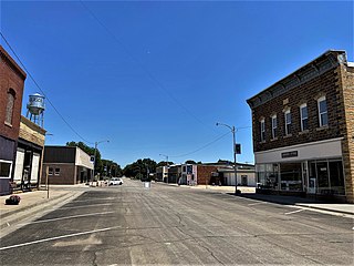
Gove City, more commonly known as Gove, is a city in and the county seat of Gove County, Kansas, United States. As of the 2020 census, the population of the city was 80.

<span class="mw-page-title-main">Hamilton, Kansas</span> City in Greenwood County, Kansas

Hamilton is a city in Greenwood County, Kansas, United States. As of the 2020 census, the population of the city was 182.

<span class="mw-page-title-main">Kingman, Kansas</span> City in Kingman County, Kansas

Kingman is a city in and the county seat of Kingman County, Kansas, United States. As of the 2020 census, the population of the city was 3,105.

<span class="mw-page-title-main">Meade, Kansas</span> City in Meade County, Kansas

Meade is a city in and the county seat of Meade County, Kansas, United States. As of the 2020 census, the population of the city was 1,505.

<span class="mw-page-title-main">Ness City, Kansas</span> City in Ness County, Kansas

Ness City is a city in and the county seat of Ness County, Kansas, United States. As of the 2020 census, the population of the city was 1,329. Ness City is famous for its four-story Old Ness County Bank Building located downtown, and nicknamed Skyscraper of the Plains.

<span class="mw-page-title-main">Lyndon, Kansas</span> City in Osage County, Kansas

Lyndon is a city in, and the county seat of Osage County, Kansas, United States. As of the 2020 census, the population of the city was 1,037.

<span class="mw-page-title-main">Onaga, Kansas</span> City in Pottawatomie County, Kansas

Onaga is a city in Pottawatomie County, Kansas, United States. As of the 2020 census, the population of the city was 679.

<span class="mw-page-title-main">Belleville, Kansas</span> City in Republic County, Kansas

Belleville is a city in and the county seat of Republic County, Kansas, United States. As of the 2020 census, the population of the city was 2,007.

<span class="mw-page-title-main">Clearwater, Kansas</span> City in Sedgwick County, Kansas

Clearwater is a city in Sedgwick County, Kansas, United States. As of the 2020 census, the population of the city was 2,653.

<span class="mw-page-title-main">Mayfield, Kansas</span> City in Sumner County, Kansas

Mayfield is a city in Sumner County, Kansas, United States. As of the 2020 census, the population of the city was 75.

<span class="mw-page-title-main">Linn, Kansas</span> City in Washington County, Kansas

Linn is a city in Washington County, Kansas, United States. As of the 2020 census, the population of the city was 387.

<span class="mw-page-title-main">Palmer, Kansas</span> City in Washington County, Kansas

Palmer is a city in Washington County, Kansas, United States. As of the 2020 census, the population of the city was 125.

<span class="mw-page-title-main">Lake Quivira, Kansas</span> City in Kansas, United States

Lake Quivira is a city in Johnson and Wyandotte counties in the State of Kansas, and part of the Kansas City Metropolitan Area. As of the 2020 census, the population of the city was 1,014.

References

  1. 1 2 3 4 U.S. Geological Survey Geographic Names Information System: Havensville, Kansas
  2. "2019 U.S. Gazetteer Files". United States Census Bureau. Retrieved July 24, 2020.
  3. 1 2 "Profile of Havensville, Kansas in 2020". United States Census Bureau. Archived from the original on May 26, 2022. Retrieved May 26, 2022.
  4. Blackmar, Frank Wilson (1912). Kansas: A Cyclopedia of State History, Embracing Events, Institutions, Industries, Counties, Cities, Towns, Prominent Persons, Etc. Standard Publishing Company. p. 830. ISBN   9780722249055.
  5. Gannett, Henry (1905). The Origin of Certain Place Names in the United States. Govt. Print. Off. p. 152.
  6. Kansas State Historical Society (1916). Biennial Report of the Board of Directors of the Kansas State Historical Society. Kansas State Printing Plant. p. 263.
  7. "Profile for Havensville, Kansas". ePodunk . Retrieved June 22, 2014.
  8. "Kansas Post Offices, 1828-1961". Kansas Historical Society. Archived from the original on October 9, 2013. Retrieved June 22, 2014.
  9. "US Gazetteer files 2010". United States Census Bureau . Retrieved July 6, 2012.
  10. Climate Summary for Havensville, Kansas
  11. "US Census Bureau, Table P16: HOUSEHOLD TYPE". data.census.gov. Retrieved January 3, 2024.
  12. 1 2 3 4 5 "US Census Bureau, Table DP1: PROFILE OF GENERAL POPULATION AND HOUSING CHARACTERISTICS". data.census.gov. Retrieved January 3, 2024.
  13. Bureau, US Census. "Gazetteer Files". Census.gov. Retrieved December 30, 2023.
  14. "US Census Bureau, Table P1: RACE". data.census.gov. Retrieved January 3, 2024.
  15. "US Census Bureau, Table P2: HISPANIC OR LATINO, AND NOT HISPANIC OR LATINO BY RACE". data.census.gov. Retrieved January 3, 2024.
  16. "US Census Bureau, Table S1101: HOUSEHOLDS AND FAMILIES". data.census.gov. Retrieved January 3, 2024.
  17. "US Census Bureau, Table S1501: EDUCATIONAL ATTAINMENT". data.census.gov. Retrieved January 3, 2024.
  18. "US Census Bureau, Table S1903: MEDIAN INCOME IN THE PAST 12 MONTHS (IN 2020 INFLATION-ADJUSTED DOLLARS)". data.census.gov. Retrieved January 3, 2024.
  19. "US Census Bureau, Table S2001: EARNINGS IN THE PAST 12 MONTHS (IN 2020 INFLATION-ADJUSTED DOLLARS)". data.census.gov. Retrieved January 3, 2024.
  20. "US Census Bureau, Table S1701: POVERTY STATUS IN THE PAST 12 MONTHS". data.census.gov. Retrieved January 3, 2024.
  21. "US Census Bureau, Table S1702: POVERTY STATUS IN THE PAST 12 MONTHS OF FAMILIES". data.census.gov. Retrieved January 3, 2024.
  22. "U.S. Census website". United States Census Bureau . Retrieved July 6, 2012.
  23. "U.S. Census website". United States Census Bureau . Retrieved January 31, 2008.

Further reading