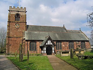
Tattenhall is a village and former civil parish, now in the parish of Tattenhall and District, 8 miles (13 km) south-east of Chester, in the unitary authority area of Cheshire West and Chester and the ceremonial county of Cheshire, England. In the 2001 census, the population was recorded as 1,986, increasing to 2,079 by the 2011 census.

Gedling is a local government district with borough status in Nottinghamshire, England. The council is based in Arnold. The borough also includes Carlton along with villages and rural areas to the north-east of Nottingham. The main built-up part of the borough around Arnold and Carlton forms part of the Nottingham Urban Area.
Arnold is a market town in the Borough of Gedling in the county of Nottinghamshire in the East Midlands of England. It is situated to the north-east of Nottingham's city boundary. Arnold has the largest town centre in the Borough of Gedling and the most important town centre in the northeastern part of the conurbation of Greater Nottingham. Gedling Borough Council is headquartered in Arnold. Since 1968 Arnold has had a market, and the town used to have numerous factories associated with the hosiery industry. Nottinghamshire Police have been headquartered in Arnold since 1979. At the time of the 2011 United Kingdom census, Arnold had a population of 37,768.

Gamston is a village, civil parish and suburb of West Bridgford, in the Rushcliffe district of Nottinghamshire, England. It is situated approximately 3 miles (5 km) south-east of Nottingham, and the same distance east of West Bridgford. The population as of 2021 census was 2,173.

Sherwood is a constituency represented in the House of Commons of the UK Parliament since 2010 by Mark Spencer, a Conservative. The constituency's name is common with Sherwood Forest which is in the area.
Gedling is a constituency in Nottinghamshire created in 1983 represented in the House of Commons of the UK Parliament since 2019 by Tom Randall of the Conservative Party. The seat was a safely Conservative until the Labour Party's landslide victory in 1997, when it was won for Labour by Vernon Coaker. Labour held Gedling until 2019, when it was regained by the Conservative Party.
The Dukeries is an area of the county of Nottinghamshire so called because it contained four ducal seats. It is south of Worksop, which has been called its "gateway". The area was included within the ancient Sherwood Forest. The ducal seats were:

Colwick is a village and civil parish, in the Borough of Gedling of Nottinghamshire, England. It is situated to the east of Nottingham's city boundary, and forms the Colwick ward. At the time of the 2011 census, the village had a population of 2,829, falling to 2,778 at the 2021 census.

Stoke Bardolph is a village and civil parish in the Gedling district of Nottinghamshire. The population of the civil parish taken at the 2011 census was 170, increasing to 598 residents at the 2021 census. It is to the east of Nottingham, and on the west bank of the River Trent. Nearby places include Burton Joyce and Radcliffe on Trent.
Lowdham is a village and civil parish in the Newark and Sherwood district of Nottinghamshire between Nottingham and Southwell. At the 2001 census it had a population of 2,832, increasing to 3,334 at the 2011 census, and falling to 3,247 at the 2021 census. Two main roads slicing through the village are the A6097 south-east to north-west and the A612 between Nottingham and Southwell.
Bestwood Village is an village and civil parish in the Gedling district of Nottinghamshire.

Linby is a small village and civil parish in Nottinghamshire, England. The nearest town is Hucknall which is immediately to the south-west. The village grew up around the mills on the River Leen, from which Linby's name is derived. Small streams known as Linby Docks run on both sides of the main street. The population of the civil parish at the 2011 census was 232, increasing to 676 at the 2021 census.

Papplewick is a village and civil parish in Nottinghamshire, England, 7.5 miles (12.1 km) north of Nottingham and 6 miles (9.7 km) south of Mansfield. It had a population of 756 at the 2011 census, and 651 at the 2021 census. In the Middle Ages, the village marked the southern gateway to Sherwood Forest.

Gedling is a village and former civil parish which gives its name to the larger Borough of Gedling in Nottinghamshire, England. It lies 4 miles (6.4 km) north-east of Nottingham city centre. The parish was abolished in 1935 and absorbed into the urban district of Carlton, which in turn was abolished in 1974 on the creation of borough of Gedling. The population of the Gedling ward at the 2011 census was 6,817 and 111,787 for the district. Gedling was recorded in the Domesday Book and is still a distinct settlement, although residential, commercial and industrial growth in the wider borough of Gedling and the neighbouring city of Nottingham, boroughs of Broxtowe and Rushcliffe and district of Ashfield means it can be difficult to distinguish the village of Gedling from the nearby town of Carlton, with which it has become contiguous.

Newstead is a village and civil parish in Nottinghamshire, England in the borough of Gedling. It is situated between the city of Nottingham and the towns of Kirkby-in-Ashfield, Sutton-in-Ashfield and Hucknall.

Lambley is an English village and civil parish near Nottingham, England, hardly touched by urbanisation, as it lies in a green belt. The population recorded in the 2011 census was 1,247, marginally falling to 1,231 at the 2021 census. Its proximity to Nottingham has tended to raise the price of its real estate.

Mapperley is a residential and commercial area of north-eastern Nottingham, England. The area is bounded by Sherwood to the north-west, Thorneywood to the south and Gedling to the east.

Woodborough is a village and civil parish in the Gedling district, in the county of Nottinghamshire, England. It is located 7 miles (11 km) north-east of Nottingham. According to the 2001 census it had a population of 1,852, rising slightly to 1,872 at the 2011 census, and 1,909 at the 2021 census.

Warren Hill is an area within the market town of Arnold in the English ceremonial county of Nottinghamshire. Located in the civil parish of St. Albans, it is in the local government district of Gedling. The area is roughly 1.5 miles (2.4 km) from Arnold town centre and about 4 miles (6 km) from Nottingham. The surrounding areas include Top Valley to the south, Rise Park to the west, Arnold and the suburb of Redhill to the east and Bestwood Country Park and Bestwood Village to the north. Most of the area consists of newly built housing estates with mainly 3-4 bedroom semi-detached houses as well as some newly built terraced housing and bungalows.

St. Albans is a civil parish in the Gedling borough of Nottinghamshire, England.

