Related Research Articles
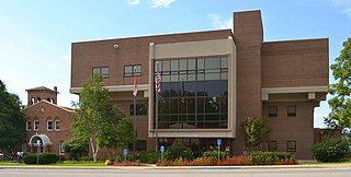
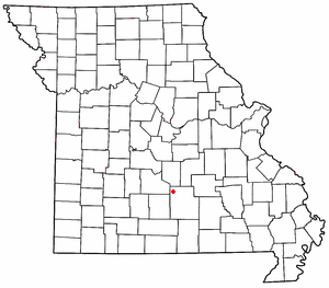
Pulaski County is a county located in the U.S. state of Missouri. As of the 2020 census, the population was 53,955. Its county seat is Waynesville. The county was organized in 1833 and named for Kazimierz Pułaski, a Polish patriot who died fighting in the American Revolution.

Devils Elbow is an unincorporated community in Pulaski County, Missouri, United States on historic U.S. Highway 66. It is situated on the Big Piney River and is named for a tight incised meander in the river known as a "devil of an elbow". The community is approximately five miles (8 km) east of St. Robert.

The Gasconade River is about 280 miles (450 km) long and is located in central and south-central Missouri.
Plato is an incorporated village in northwestern Texas County, Missouri, United States. It is located approximately 20 miles northwest of Houston and 10 miles south of Fort Leonard Wood on Route 32. The population was 82 at the 2020 census.
Duke is an unincorporated community in southwest Phelps County, Missouri, United States. It is located approximately thirteen miles northwest of Licking and five miles east of Fort Leonard Wood. The community is on Missouri Route K and two miles east of a meander in the Big Piney River in the Mark Twain National Forest.

Laquey is an unincorporated community in Pulaski County, Missouri, United States. It has Zip Code: 65534 and Area Code: 573.
Clara is an unincorporated community in central Texas County, Missouri, United States. The community is located on a hilltop, approximately one-half mile northwest of the Big Piney River. It is about three miles southwest of Houston on Missouri Route Z.
Fort Leonard Wood is a U.S. Army training installation located in the Missouri Ozarks. The main gate is located on the southern boundary of The City of St. Robert. The post was created in December 1940 and named in honor of General Leonard Wood in January 1941. Originally intended to train infantry troops, in 1941 it became an engineer training post with the creation of the Engineer Replacement Training Center. During World War II Italian and German POWs were interned at the fort. In 1984, as part of the Base Realignment and Closure process, most of the U.S. Army Engineer School's operations were consolidated at Fort Leonard Wood. Before that, officer training was conducted at Fort Belvoir, Virginia.
Bloodland is a former community in southern Pulaski County, Missouri, United States. The community lies within Ft. Leonard Wood. The location is about 3.5 miles west-northwest of the community of Big Piney which sits adjacent to the east boundary of the Fort Leonard Wood and 4.5 miles north of the community of Palace, which is just outside the southern boundary of Fort Leonard Wood.
Simmons is a community in Texas County, in the U.S. state of Missouri. The community is located at the intersection of US Route 63 and Missouri Route Z, approximately seven miles south of Houston. The Big Piney River flows past the east side of the community.
Relfe is an extinct town in western Phelps County, in the U.S. state of Missouri. The GNIS classifies it as a populated place.
Spring Creek is an extinct town in Phelps County, in the U.S. state of Missouri. The GNIS classifies it as a populated place. The community is on the southwest side of the confluence of Spring Creek and the Big Piney River. The site is on the Phelps-Pulaski county line. The Wayman/Pillman cemetery is west of the county line in Pulaski County. The boundary of Fort Leonard Wood is two miles to the west, along Missouri Route J, which passes through the community.
Dry Creek is a stream in Pulaski County, Missouri. It is a tributary of the Big Piney River.
Hanna is a former community in southwestern Pulaski County, in the U.S. state of Missouri.
Piney Township is an inactive township in Pulaski County, in the U.S. state of Missouri.
Edanville is an extinct town in northern Texas County, in the U.S. state of Missouri. The GNIS classifies it as a populated place.
Gravel Point is an extinct town in southwestern Texas County, in the U.S. state of Missouri. The community and Gravel Point School is on Gravel Point Road and adjacent to a small tributary of West Piney Creek. It was approximately eight miles north-northwest of Cabool.
Ladd is an unincorporated community in northwestern Texas County, in the U.S. state of Missouri.
West Piney Creek also known as the Little Piney River is a stream in Texas County in the Ozarks of south central Missouri. It is a tributary to the Big Piney River.
Spring Creek is a stream in Texas and Phelps counties in the Ozarks of southern Missouri. It is a tributary to the Big Piney River.
References
- ↑ U.S. Geological Survey Geographic Names Information System: Big Piney
- ↑ Big Piney, MO, 7.5 Minute Topographic Quadrangle, USGS, 1954 (1991 rev.)
- ↑ Missouri Atlas & Gazetteer, DeLorme, 1998, First edition, p. 54, ISBN 0-89933-224-2
- ↑ "Home of the Eagles". www.plato.k12.mo.us.
- ↑ "Post Offices". Jim Forte Postal History. Retrieved December 10, 2016.
- ↑ "Pulaski County Place Names, 1928–1945". The State Historical Society of Missouri. Archived from the original on June 24, 2016. Retrieved November 27, 2016.
- ↑ Hewett, J. (1994). Supplement to the Official records of the Union and Confederate Armies. Wilmington, NC: Broadfoot Pub. Co. , Volume 35, p. 136
Municipalities and communities of Pulaski County, Missouri, United States | ||
|---|---|---|
| Cities |  | |
| Townships | ||
| CDP | ||
| Unincorporated communities | ||
| Ghost towns | ||
| Footnotes | ‡This populated place also has portions in an adjacent county or counties | |