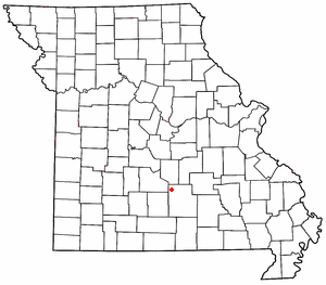
Pulaski County is a county located in the U.S. state of Missouri. As of the 2020 census, the population was 53,955. Its county seat is Waynesville. The county was organized in 1833 and named for Kazimierz Pułaski, a Polish patriot who died fighting in the American Revolution.

Laclede County is a county located in the U.S. state of Missouri. As of the 2020 census, the population was 36,039. Its county seat is Lebanon. The county was organized February 24, 1849, and was named after Pierre Laclède, founder of St. Louis.

Crocker is a city in Pulaski County, Missouri, United States. The population was 1,110 at the 2010 census.

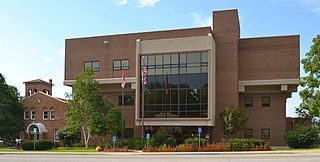
Waynesville is a city in and the county seat of Pulaski County, Missouri, United States. Its population was 5,406 at the 2020 census. Located in the heart of the Missouri Ozarks, it was one of the communities served by historic Route 66.

Devils Elbow is an unincorporated community in Pulaski County, Missouri, United States on historic U.S. Highway 66. It is situated on the Big Piney River and is named for a tight incised meander in the river known as a "devil of an elbow". The community is approximately five miles (8 km) east of St. Robert.

Hazelgreen is an unincorporated community in eastern Laclede County, Missouri, United States. It lies along historic U.S. Route 66, now an outer road of Interstate 44. The town is split by I-44, one mile west of the I-44 - Missouri Route 133 junction in adjacent Pulaski County. The Gasconade River is just north and west of the site.

Buckhorn is a community in Pulaski County, Missouri, United States. It is on Route 17 just south of its junction with Interstate 44 It is also on historic U.S. Route 66. The community is within the Mark Twain National Forest and the northwest corner of Fort Leonard Wood is three miles to the east. Waynesville is six miles to the northeast along Route 44 and Laquey is two miles to the southwest off of Route 17.
Plato is an incorporated village in northwestern Texas County, Missouri, United States. It is located approximately 20 miles northwest of Houston and 10 miles south of Fort Leonard Wood on Route 32. The population was 82 at the 2020 census.
Big Piney is an unincorporated community in Pulaski County, Missouri, United States on the southeastern edge of Fort Leonard Wood and one mile west of a bend in the Big Piney River. The community is on Missouri Route TT four miles northeast of Palace. Licking is seventeen miles to the southeast. Its former K-8 school has closed; students attend the Plato R-V School District.

Swedeborg is an unincorporated community in northwestern Pulaski County, Missouri, United States. It is located approximately five miles northeast of Richland on Route 133.

Beaver Township is one of twelve townships in Pulaski County, Indiana, United States. As of the 2010 census, its population was 516 and it contained 216 housing units.
Indian Creek Township is one of twelve townships in Pulaski County, Indiana, United States. As of the 2010 census, its population was 691 and it contained 422 housing units.
Fort Leonard Wood is a U.S. Army training installation located in the Missouri Ozarks. The main gate is located on the southern boundary of The City of St. Robert. The post was created in December 1940 and named in honor of General Leonard Wood in January 1941. Originally intended to train infantry troops, in 1941 it became an engineer training post with the creation of the Engineer Replacement Training Center. During World War II Italian and German POWs were interned at the fort. In 1984, as part of the Base Realignment and Closure process, most of the U.S. Army Engineer School's operations were consolidated at Fort Leonard Wood. Before that, officer training was conducted at Fort Belvoir, Virginia.
Pulaskifield is an unincorporated community located in Capps Creek Township, Barry County, Missouri, United States. The area was originally known as Bricefield ; archaically misspelled Brassfield or Brycefield. The area was locally known under the community name of Pulaskifield, but officially changed to that name in 1930 by request of the large group of Polish immigrants who bought land and began farming, beginning in the late 1870s, in an approximate two-mile radius of the crossing point of Missouri Route 97 and Barry County Farm Road 2040. The community was renamed to honor Casimir Pulaski, a Polish nobleman and Revolutionary Continental Army Brigadier General remembered as a hero who fought for independence and freedom both in Poland and in the United States.
Cookville is an extinct town in southwestern Pulaski County, in the U.S. state of Missouri. The GNIS classifies it as a populated place. The town site is along Roubidoux Creek within the southern part of Fort Leonard Wood. The community of Greenview is located two miles to the west on Missouri Route 17 along the western boundary of the military reservation and adjacent to the Pulaski-Laclede county line.
Spring Creek is an extinct town in Phelps County, in the U.S. state of Missouri. The GNIS classifies it as a populated place. The community is on the southwest side of the confluence of Spring Creek and the Big Piney River. The site is on the Phelps-Pulaski county line. The Wayman/Pillman cemetery is west of the county line in Pulaski County. The boundary of Fort Leonard Wood is two miles to the west, along Missouri Route J, which passes through the community.
Hanna is a former community in southwestern Pulaski County, in the U.S. state of Missouri.
Palace is an unincorporated community in southern Pulaski County, in the U.S. state of Missouri. The community is located on Missouri Route AW, just southeast of the Fort Leonard Wood boundary. The community of Evening Shade lies approximately three miles south on Route AW in Texas County.
Liberty Township is an inactive township in Pulaski County, in the U.S. state of Missouri.
Bado is an unincorporated community in southwest Texas County, in the U.S. state of Missouri. Bado is located on Missouri Route M, along the banks of Little Piney Creek. The community is approximately nine miles west-southwest of Houston and nine miles north of Cabool. The store, post office, a rock house and White House are still standing.

